
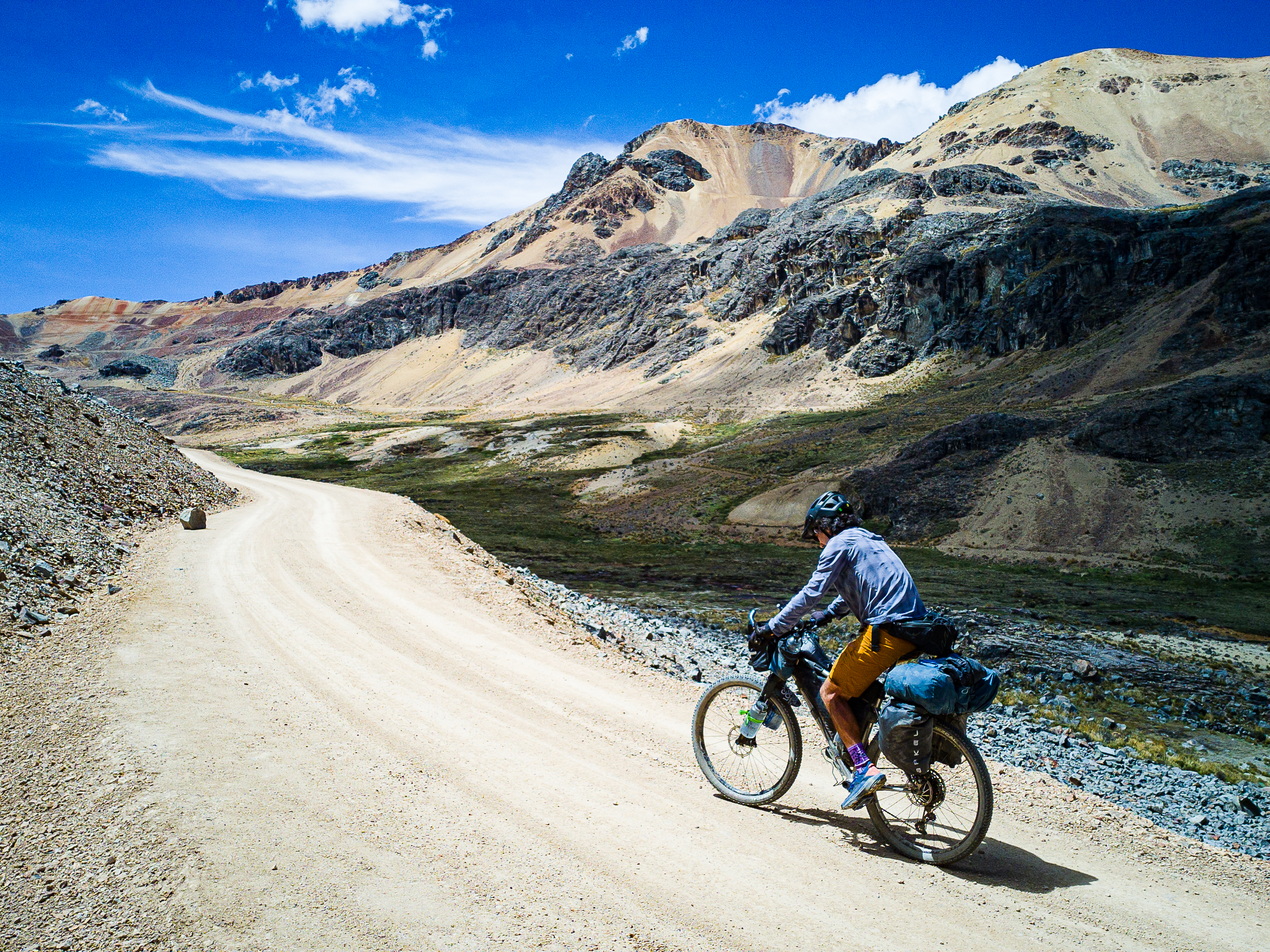
AKA, the Ayacucho Adventure Route
The Peruvian Andes is arguably the greatest bikepacking destination in the world. A sprawling network of dirt roads connects together the vast folds of the Andes Mountains. It is home to some of the highest mountains and deepest canyons in the Americas. The views are consistently spectacular, Quechua culture is rich in history and tradition, wild camping opportunities are abundant, and frequent small villages make resupply fairly simple. It is a country where you can point your bike in any direction and enjoy an incredible ride.
Most bikepackers in Peru follow a few established routes: The Huascaran Circuit through the Cordillera Blanca, and the Peru Great Divide, which connects the Cordillera Blanca with the Incan heartland near Cusco. From there, most travellers head to Cusco, while others follow the Cones & Canyons route to Arequipa.
This route provides an alternative way through the southern part of the country, linking the historic city of Ayacucho with the colonial gem of Arequipa. This is a spectacular part of the country, where a broad plateau is broken up by numerous canyons, including the two deepest in the Americas. The complete route is about 1,400 kilometres, with 31,000 m of elevation gain. I broke it into two parts for the purpose of this guide.
Part one starts in Ayacucho and ends in large town of Challuanca, where you can easily veer off to Cusco if that’s your destination. Part 2 continues onward to Arequipa through Cotahuasi Canyon, Valle de los Volcanes, and Colca Canyon.
Highlights:
- Enjoying the local atmosphere in the city of Ayacucho (also known as Huamanga)
- Cycling through colourful quinoa fields outside Ayacucho.
- The views from El Abismo Puncu Pata (the abyss)
- The historic Incan town of Vilcashuaman
- The stunning Aguas Turqueseas Millpu
- Enjoying the hot springs surrounding the extinct geyser of Pachapupum
- The rugged valley leading to the village of Luren
- The historic villages, ancient ruins, and condor viewing in the Sondondo Valley
- Partially circumnavigating the colourful massif of Nevado Ccarhuarazo
- Hiking the stone forest of Pampachiri
Background
I rode this route in October and November of 2025. This is the start of the rainy season in Peru and I chose this route because the rain generally starts a bit later on the western side of the Andes, compared to the Cusco area. I chose Ayacucho as my starting point because it had an airport and was near where I finished my 2018 trip. I wanted a trip that would take about a month and would finish in Arequipa, while passing through Cotahuasi and Colca canyons. I mapped out a few options to get to Cotahuasi and ultimately settled on a route that linked together local tourist attractions and small villages through Ayacucho District.
The route is broken into two parts for the purpose of this guide. Part 1 is an alternative to the Peru Divide, for those looking to get off the standard bikepacking routes and explore seldom-visited parts of Ayacucho District. Part 2 follows parts of Cones & Canyons, but has a different start and branches off to ride through Colca Canyon, which only became possible when a bridge was installed at the bottom of the canyon in 2019.
Route Map
WordPress won’t let me embed the route map from Ride With GPS, so click on the image instead.

Key stats:
- Distance: 645 km
- Elevation: 14,575 m
- Suggested riding time: 12-16 days, including rest days
- Road surfaces: 75% unpaved
Note that I did not ride the section from KM 91 to Vilcashuaman. I followed a trail down through Titancayocc, but I discovered partway down that this trail crossed into a protected vicuna reserve, so I can’t recommend anyone else ride it. The alternative presented here does connect to Vilcashuaman.
Route Guide
This route begins in Ayacucho, a splendid colonial city rich in history and culture. Nearby, you’ll find the remains of the capital city of the Wari empire, an Andean civilization that pre-dated the Incas by several hundred years; as well as the Pampa de Quinua, where the final battle of independence for Peruvian independence was fought. Ayacucho’s colonial centre is home to beautiful Spanish buildings and a vibrant town square where you’re likely to encounter a parade if you hang around long enough. There’s lots of good restaurants and cafes, a lively market, shops, many hotels, several interesting museums, and even a Warmshowers host at Casa Samaykuy. It is a great place to acclimatize if you’re coming to Peru to ride this route, or to relax if you’ve been riding the Peru Divide.
Getting to Ayacucho is easy thanks to regular flights and buses from Lima. If you’re riding the Peru Divide and don’t want to detour to Ayacucho, you can join this route in Cangallo, but you’ll miss a few highlights from the start of the route if you do.


Section 1: Ayacucho to Vilcashuaman
The route leaves Ayacucho through a rough area of the city. After a short descent, you’ll find yourself climbing on a smooth dirt road through colourful fields of quinoa. A long climb brings you through the Quechua agriculture zone, where you’ll pass through a few small villages, and into the puna, where grazing reigns supreme and wild herds of vicuna scamper about. The final stretch of the climb is the steepest, but it eventually flattens out before joining the highway for 20 km. If you’re not already acclimatized, you’ll want to find a place to camp before you get too high. Otherwise, you’ll find yourself facing a 70 km stretch above 4,000m, which can wreak havoc on the body if you’re not prepared.
The route leaves the highway and follows a dirt road through the alpine to a spot known as El Abismo Puncupata. “The abyss” offers amazing views over the valleys and mountains to the east. You can camp here and enjoy a morning sunrise if it’s not clouded over. From Puncupata, the route continues along the ridge, with consistently great views to the east. Eventually, you’ll enter the outskirts of Titancayocc, the world’s largest forest of puya raimondii, a fascinating plant related to the pineapple that’s found only in parts of the Andes. Unfortunately, the road through Titancayocc is fenced off, so duck under at your own risk. If you stick to the road, you’ll pass by numerous puya raimondii before dropping down to Vilcashuaman, the former regional capital of the Inca. If you risk ducking the fence, you’ll enjoy a steep descent to the village of Vischongo, where an easy paved climb brings you to Vilcashuaman. It’s worth spending a bit of time here to resupply and enjoy the mix of Incan and Spanish architecture.


Section 2: Vilcashuaman to Huancasancos
From Vilcashuaman, the route descends to the Vischongo River. A short but tough climb and rough descent brings you to the Rio Pampas, which you’ll follow to Cangallo, which lies on the Peru Divide route. Here, you’ll cross the river and follow it south until a long climb takes you back to the puna. It starts off paved but eventually turns into dirt at the turnoff to Huancaraylla. The highlight of this stretch is Aguas Turquesas Millpu, one of the most photogenic sites in Peru. I went in with low expectations but the bright turquoise pools, towering limestone cliffs, and tumbling waterfalls above took my breath away.
Above Millpu, the route takes you back across the puna, crossing a 4,400m pass before dropping down to the village of Carapo. From there, a quiet highway takes you through a dusty canyon until a punchy climb brings you to the village of Huancasancos, which has a few basic hotels, restaurants, and shops.


Section 3: Huancasancos to Andamarca
Climbing above Huancasancos, you may be fortunate to see condors soaring through the canyon below you. You’ll drop into the canyon, then climb back to the puna, first passing through the village of Sacsamarca. The destination is an extinct geyser called Pachapupum, which is Quechua for “navel of the earth.” The geyser is surrounded by warm pools (they aren’t quite hot enough to be called hot springs) and you can camp here.
Continuing along the plateau, you’ll pass through the llama-herding village of Putacasa, where there’s a surprising number of restaurants, most serving trout. Soon after, you’ll find the turnoff to the Luren Valley (I’m not sure the actual name, so I went with the name of largest town), a rugged canyon with dramatic rock formations and a few scattered villages that seem nearly cut-off from the world. The town of Luren is at the bottom of the valley, and there’s a few shops and a very basic guesthouse here.
From Luren, a paved 900m climb takes you to a pass above the Sondondo Valley. A long descent takes you to Aucara, but first you should stop the Mirador Capillo, which offers incredible views of Laguna Jochalpampa, and is looked over by a giant statue of Jesus. Aucara is a clean village with a orderly square and red brick church off the plaza. The route continues through more pastoral villages to Andamarca, the biggest town in the region. It’s a good spot for a rest day to check out the pre-Incan ruins of Caniche and ancient Incan terraces.


Section 4: Andamarca to Challuanca
Above Andamarca, you’ll pass by two interesting sites. First is the Zona Maquetas Mayobamba, where a local artisan has carved figures into the rocks. Next is the Mirador de Condores Mayobamba, which is reputedly the best condor viewing spot in Peru. After dropping down into the village of Mayobamba, you’ll begin a 1,200m climb back to the puna. The town of Chipao is your last opportunity to resupply for the next few days.
Once in the puna, you’ll start circling the highlight of the route – Nevado Ccarhuarazo. This colourful mountain sprawls like an octopus in all directions and you’ll climb over several ridges before rounding the northmost tentacle and beginning the climb to the pass. Ccarhuazo is a striped mountain much like the far more famous Rainbow Mountain near Peru, but with no tourists to share it with.
From Ccarhuazo, you’ll begin a long descent (broken up by a couple of short climbs) to Pampachiri, where you’ll cross the Peru Divide route once more. The Divide bypasses the most interesting natural attractions in the area – the Bosque de Piedras de Pampachiri, a sprawling forest of conical rock formations stretching across the horizon. This route takes you passed the stone forest and then along a series of rough paths down to a river crossing that may not be possible in rainy season; you may want to look for a detour around this section if it’s been raining. The ultimate reward is an 1,100m descent down to Highway 30A, which will take you to Challuanca and the end of Part 1. Rest up, because the next stretch to Cotahuasi Canyon is the most challenging of the route.


Camping, lodging, food, and water
This route passes through numerous towns and small villages where you’ll find everything from bare-bones guesthouses to half-decent hotels. Accommodation ranges in price from 25-80 soles. All but the smallest villages will have a store and restaurant, while bigger towns will present a few options for a sit down meal and resupply.
Camping is easy in the puna (generally above 3,800m), but make sure to ask the local herders if it’s OK first before you set up your tent. I had an encounter with an elderly Quechua woman who didn’t speak Spanish when I pitched my tent in the alpine above Millpu. I thought I was in an isolated spot, but I was spotted. While I was allowed to stay, it made for an awkward situation.
Water is generally abundant, but you must carry a filter. The only stretch where I had trouble was on the climb out of Ayacucho, where the only sources were in small villages. Once we hit the puna, the only water we found was from a pair of ponds just off the highway.
For cooking, I used an alcohol stove and never had trouble finding 96% alcohol in larger towns like Vilcashuaman, Cangallo, Huancasancos, Andamarca, and Challuanca. It’s easiest to find in a dedicated farmacia, but can be bought in general stores elsewhere.
Which Bike?
Given some of the rough roads, a rigid mountain bike with 2.25″ tires is recommended at minimum. Front suspension is a bonus, but only for a few short sections.
Must Know
When to ride & weather
The rainy season in Peru is said to run from October to April, with the worst months generally being January through March. I rode this route from Oct. 21 to Nov. 23, 2025, and had generally fantastic weather throughout, but also probably got a little lucky with the unexpected dry spell. One thing that was consistent was the winds, which would pick up in the afternoon and inevitably died off at sunset. I never had to deal with a windy campsite. It can get below freezing at night above 4,000m, especially if you’re riding in the dry season.
Where to start?
I rode the route from north to south, but there’s no real reason you couldn’t go the other way and start in Arequipa. The benefit to finishing your ride in Arequipa is that it’s a fantastic city to unwind in after some tough stretches on the bike.
Part 1 of this route ends in Challuanca, which is on the main highway that links Cusco to the coast. Regular buses will take you from here to Cusco or Lima.
Time and suggested itinerary
I rode this section in 14 days, including rest days in Vilcashuaman and Andamarca. I wouldn’t want to have gone any faster, but definitely could have gone a little slower. Expect to do at least 1,000m of climbing every day, and to have some days with over 1,500m.


Leave a Reply