Should I stay or should I go?
I don’t even really like the Clash, but I couldn’t think of another song lyric or cliche to encapsulate my mentality the last week of my trip.
I was lying in a hotel room in Tarma, a touristy city in the eastern Andes of Peru, battling a nasty case of travelers diarrhea and debating whether or not to keep riding towards Cusco or head down to the coast and go home a little earlier than planned.

The good ceviche. Not pictured – the sketchy market ceviche that I suspect caused my problems.

Tarma is pleasant enough, but lacks the food options for six days in the city.
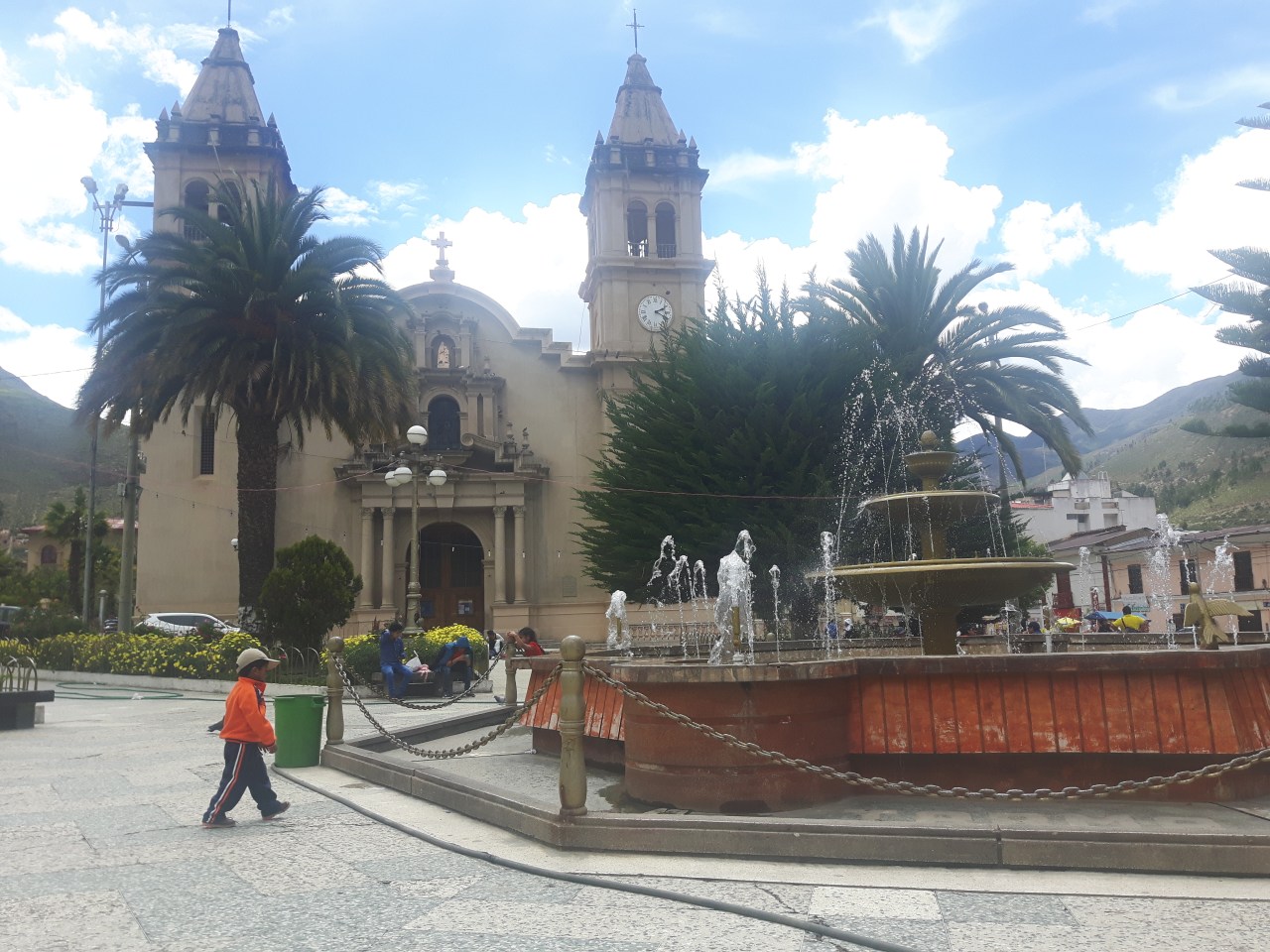
The central square.
I was in Tarma mainly because I needed to be in a city with decent internet for a job interview. It’s a tourist town but it’s completely off the Gringo trail and I had only heard of it a few days earlier when a few mining engineers stopped while driving past and one of them (who spoke English) suggested I go to Tarma – saying it blooms with flowers and it’s one of Peru’s most beautiful cities. When I looked at the map to see where the nearest city was for my interview, Tarma was the ideal choice – it was the right distance, the right size, and it was a tourist destination for Limanos, meaning it likely had decent hotels, restaurants and good Internet.
I planned a two day stay in Tarma to relax and rejuvenate, but then I ate some sketchy ceviche at the local market and two days turned into six. I knew I shouldn’t have ordered from that tub of raw seafood that’s just been sitting there, but for five months my stomach had been rock solid and I got cocky. And I paid the price. I hoped the break would be rejuvenating, but instead it left me weaker. I spent most of four days in bed, not straying too far from the bathroom. Generally I’d start feeling better by the end of the day, but in the morning, Montezuma would be back with a vengeance, my stomach churning like a whirpool.

My Tarma home – a decent bed, hot water and good wifi for 35 soles ($14 CDN) per night.
Finally, on the day I was planning on seeking medical attention, I woke up and my stomach was feeling fine. I was still a little feverish and probably should have taken another day of rest, but after six days I really wanted to get the hell out of my prison cell and hit the road. I loaded up my bike, headed to the bus station and hopped on a bus up to La Oroya – saving myself an 1,100 metre climb that I thought I should avoid given my weakened physical state. La Oroya was once considered one of the most polluted places in the world thanks to a smelter in the city, so I didn’t linger. Granted, I don’t know if things have improved in the last decade, but I didn’t want to find out, and there wasn’t much to keep me there. Instead, I enjoyed a 40 kilometre cruise down the highway before turning off into Nor Yauyos-Cochas Reserve and a night at the guest house in the village of Chancayllo. My stomach was feeling pretty good, but I still wanted to have access to a toilet just in case and didn’t want to risk camping. The local restaurant was closed, so I cooked up some food in my room before hitting the hay.

La Oroya’s dirty smelter.

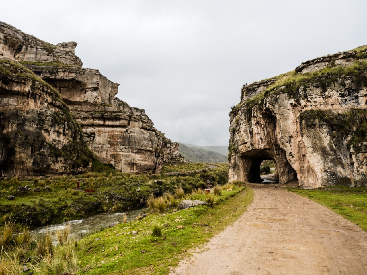
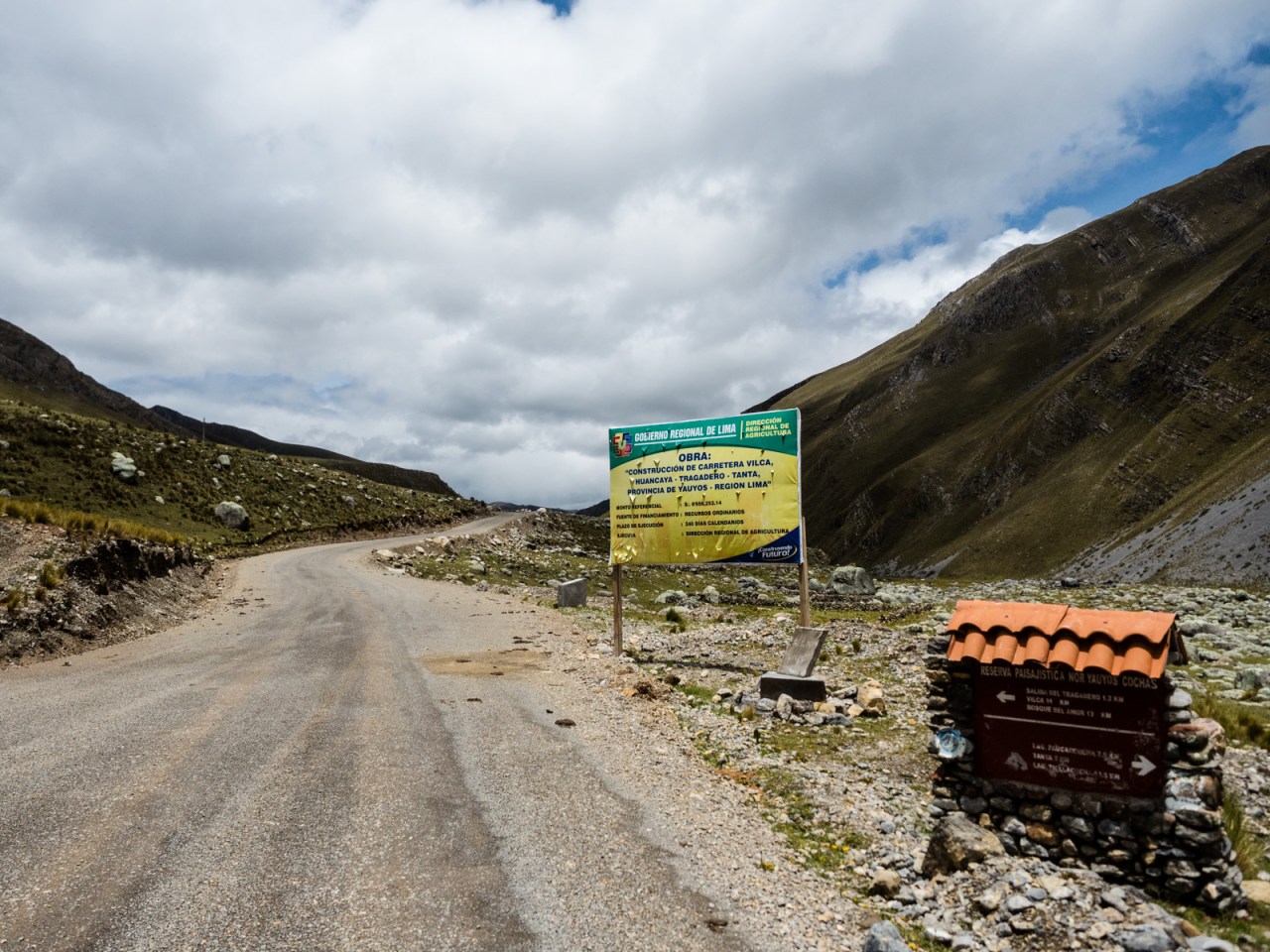
Entering Nor Yauyos-Cocha Reserve.
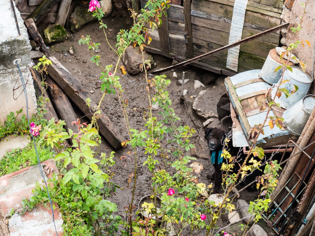
My neighbour in Chancayllo.

The roofs of Chancayllo.
On day two I woke up feeling even better, but despite that, I had a slow start, not leaving the hospedaje until 9 a.m. I had in front of me a long, gradual climb up to 4,400 metres, where my planned route would pass some lakes that appeared to be surrounded by glacier-capped mountains. And if all went well, I would camp there and enjoy a beautiful view of a range of 5,000 metre high peaks. I had a hunch this would be my last day in the high Andes, and I wanted to take it slow and soak it in as much as possible.
The ride was pretty easy as the road climbed almost unnoticeably up a wide valley, past sheep and alpaca farms and towards the height Peruvian divide. Pretty soon I would leave the Atlantic watershed behind, and enter the Pacific. Despite the ease of the ride, I knew I was reaching the end of the line for my adventure. In a day or so I would reach a fork in the road, with one way heading back to the mountains and over another 4,800 metre pass that’s said to be the toughest along the Peru Divide route, and the other heading to the coast. While my plan was to decide when I reached it, my mind was already tempted by the coastal route. My body was tired, my bike was weary and in need of repairs, and I was lonely – a sensation I hadn’t experienced on this trip, despite going days at a time without having a proper conversation.


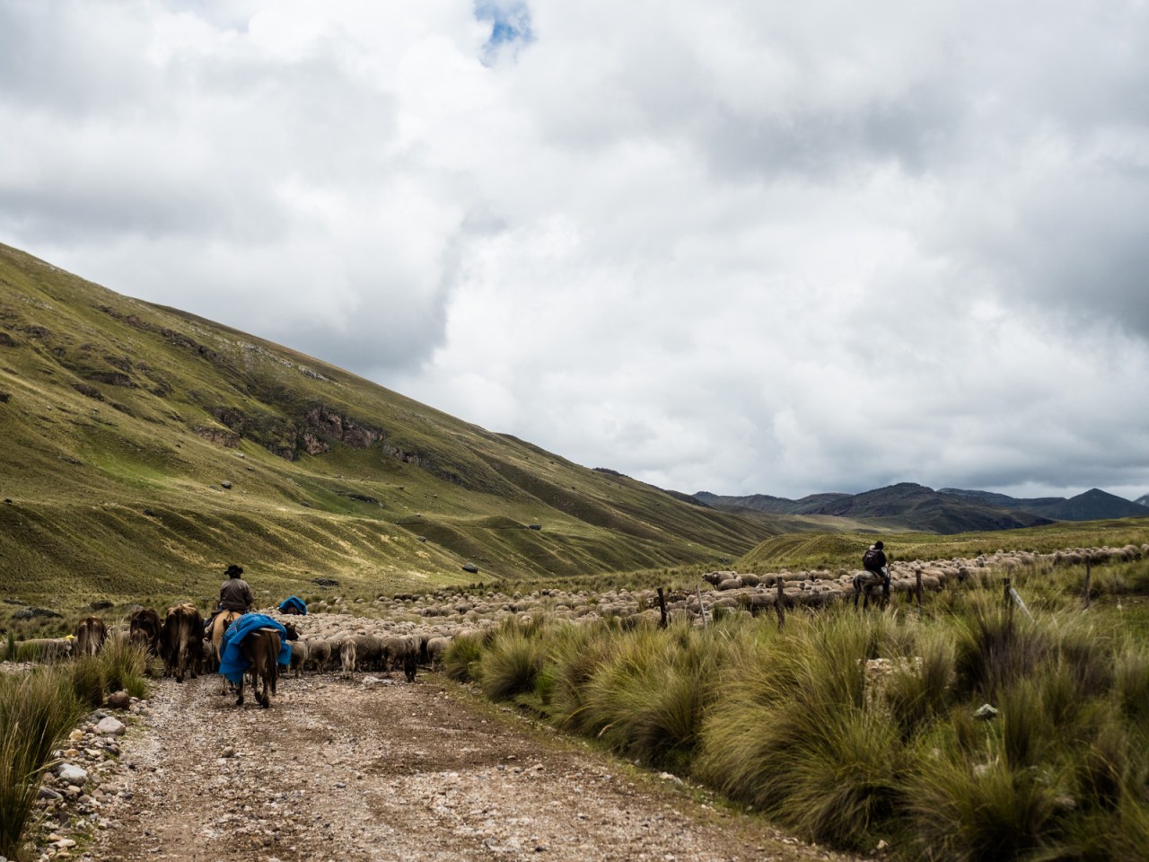
This is the biggest herd of anything I’ve seen on this trip.
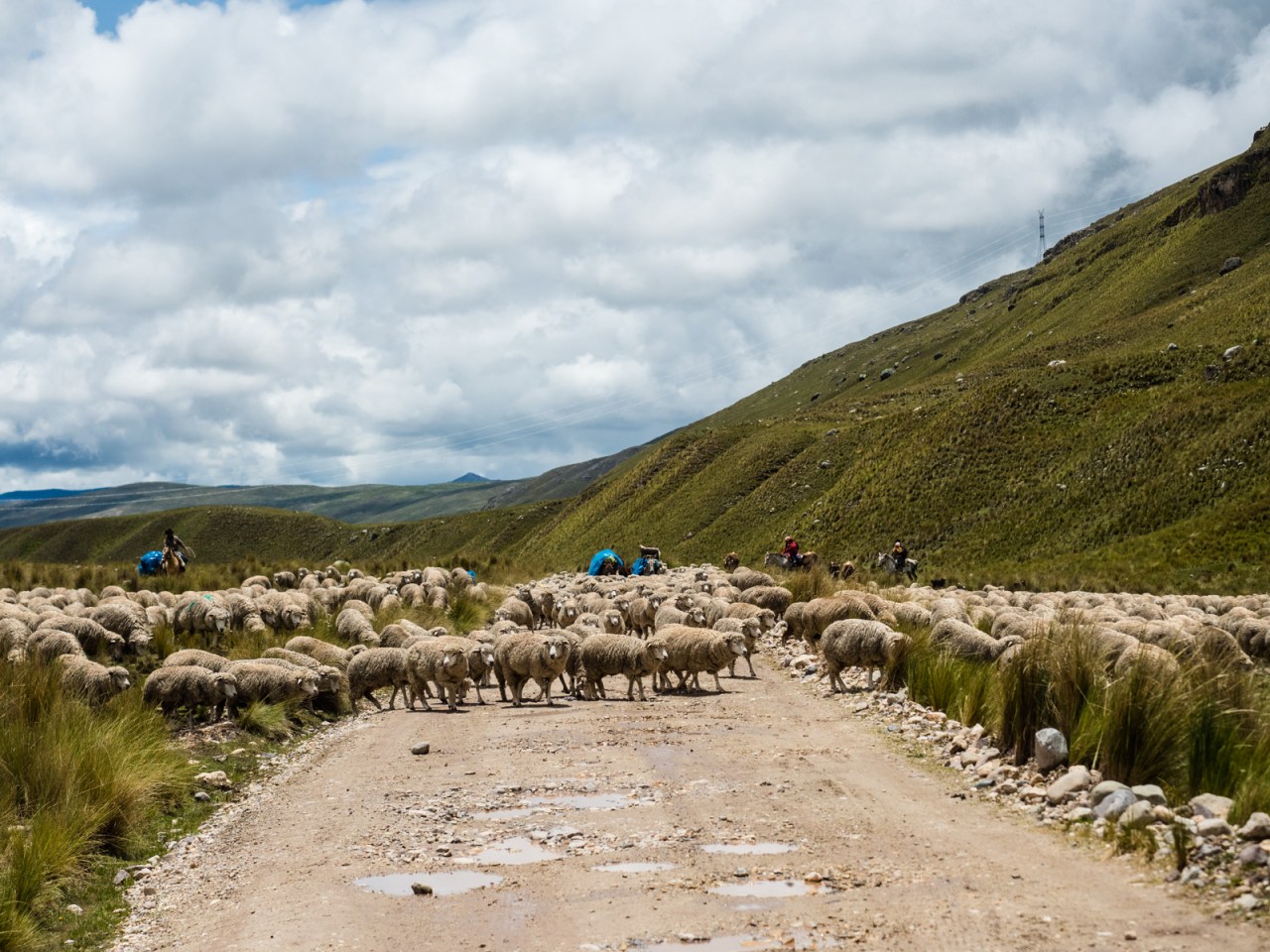
It took a few minutes, but eventually I edged my way through.

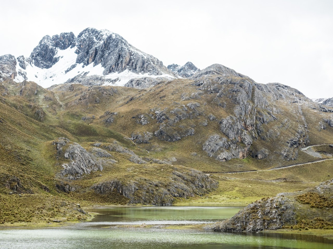
I reached Laguna Huayllacancha in the late afternoon, then took a detour above the lakeshore until I found a flat spot with an amazing view of huge snow-capped mountains to pitch my tent. It was exactly the spot I was looking for and I deliberately set up my tent so I could lie in bed and stare out at the view. I set up camp and cooked dinner, then lay down and enjoyed the scene that unfurled outside my door. As darkness fell the rain came so I closed up my tent and fell asleep to the sound of the drops hitting my tent. At some point I woke up and the patter of the rain had stopped – replaced by the quiet of snow drifting downwards. I knocked the snow off my tent and went back to sleep. When I woke up in the morning, it was raining again, but the ground was covered in snow and it was overcast. I lay in bed, hoping the sun would come out and dry off my tent before I got going.

You know things are good when snow’s in sight.
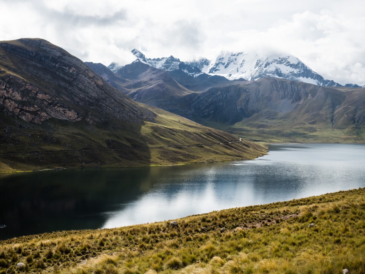
Big mountains over Laguna Huayllacancha
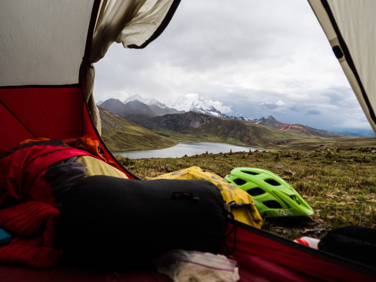
The view from my tent.
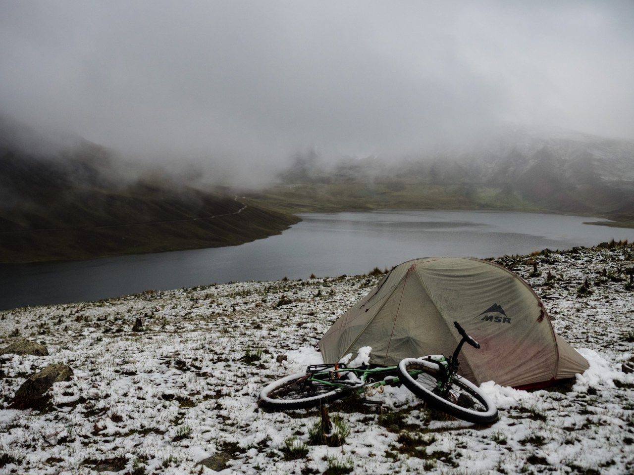
What I woke up to.
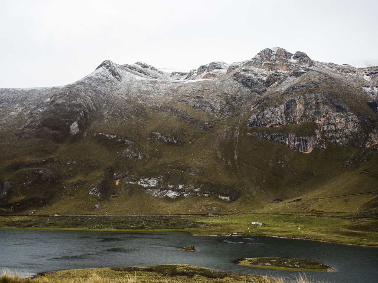
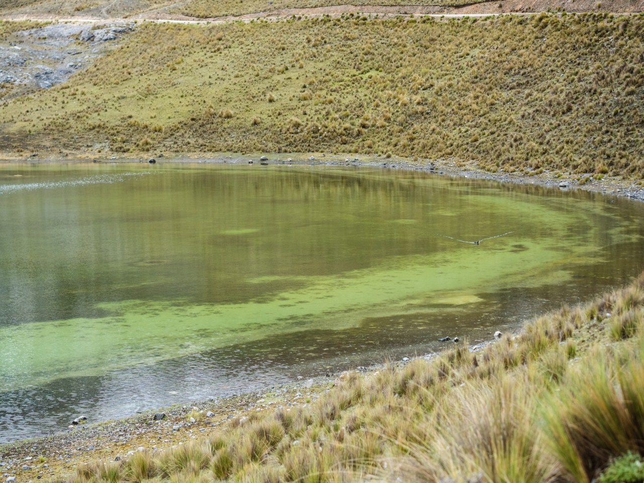
A trout farm lies in the lake beneath snowy peaks.
The day started with a short downhill back to the lake, then a brutally steep climb for about two kilometres as I approached my final high pass of the trip. I rode through a snowy landscape surrounded by big mountains and small tarns. It was incredibly peaceful and serene and once I finished the steep bit, the road leveled out and I ascended easily to the 4,769-metre high pass – my final high point of the trip. By now, gaining these heights wasn’t as much of an achievement, but it was never easy. I place a rock on one of the many cairns at the top of the pass and then enjoyed a wild 1,000-metre descent to the Rio Canete valley.

Looking down at Laguna Huayllacancha partway up the steep climb.
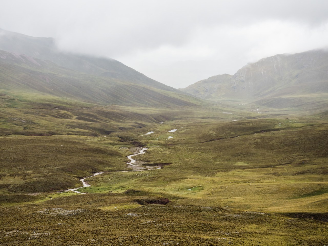
And looking back on the river valley I rode up the day before.

Approaching the snow line.
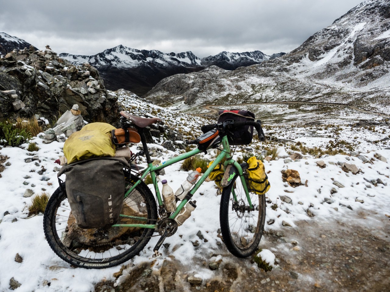
An unnamed pass at 4,769 metres. My last high one of the trip.

Locals left these cairns at the pass.

Descending into the snow.
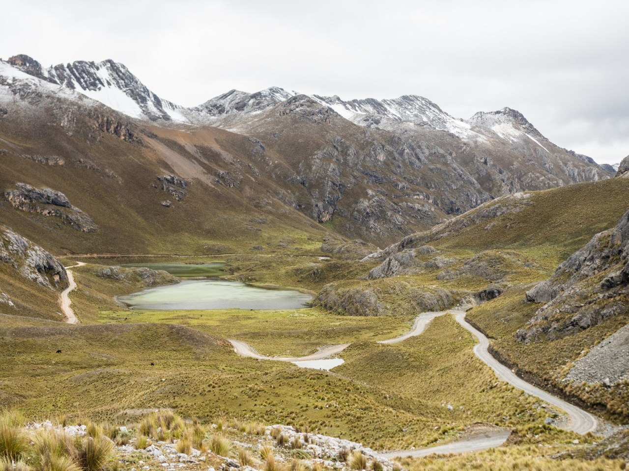
And towards a land of small lakes.

.
.

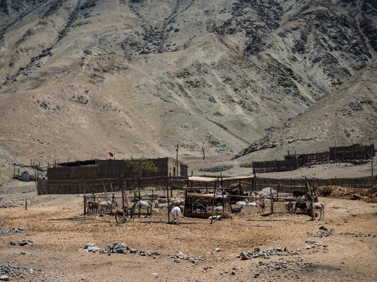
I stopped for lunch near these basic farmers huts.
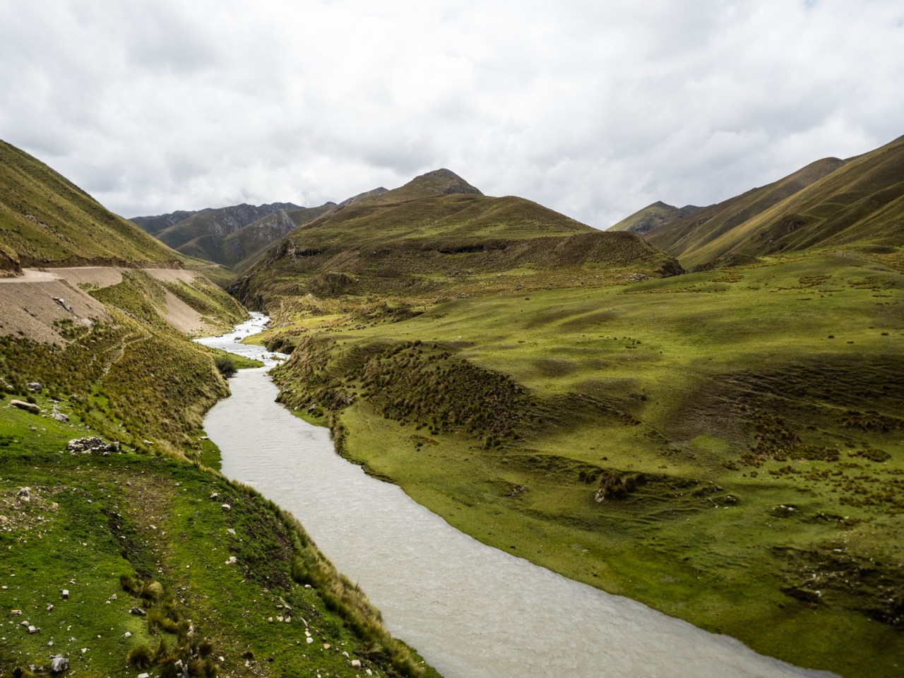
And eventually I reached the road along the Rio Canete.
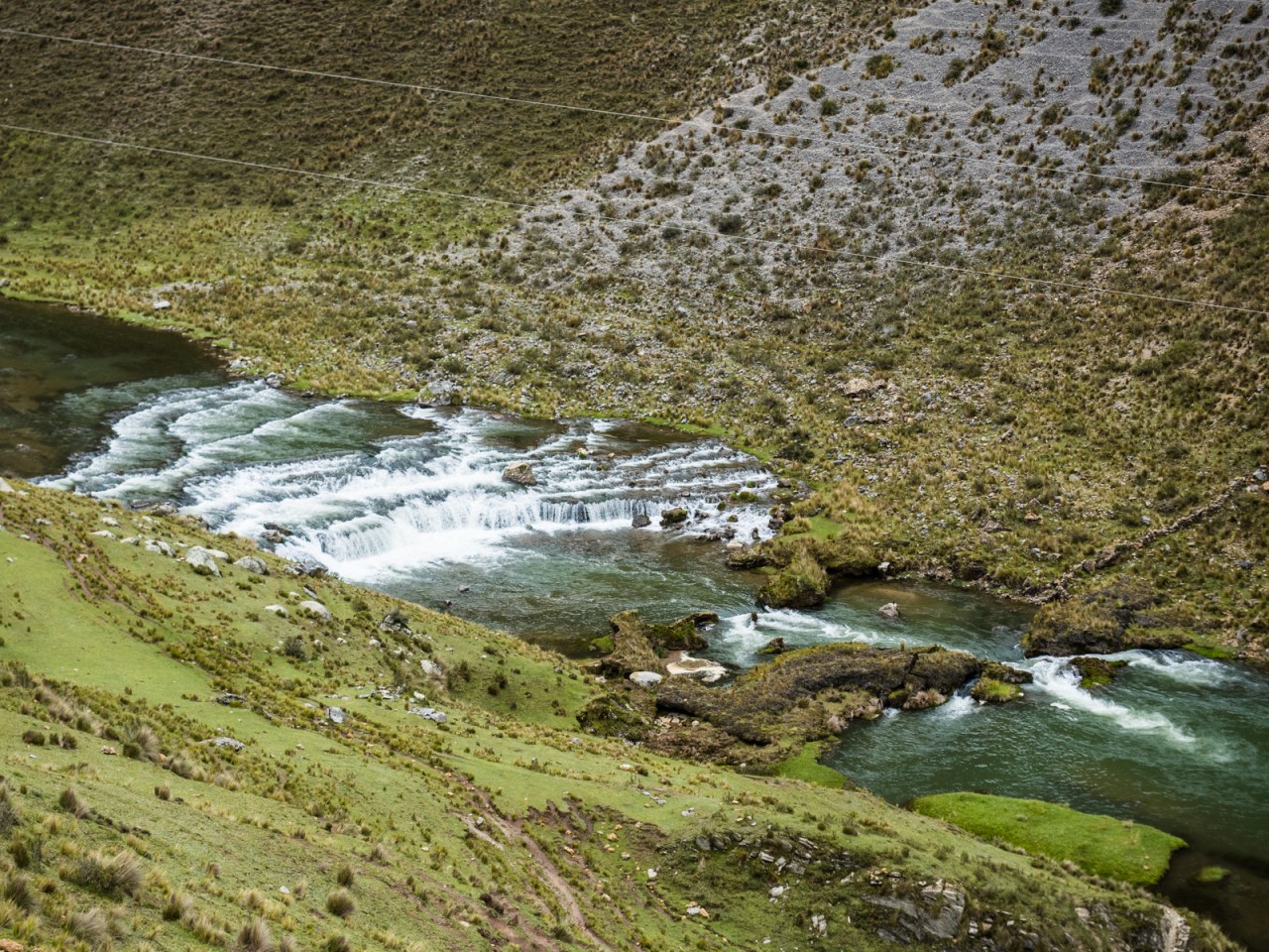
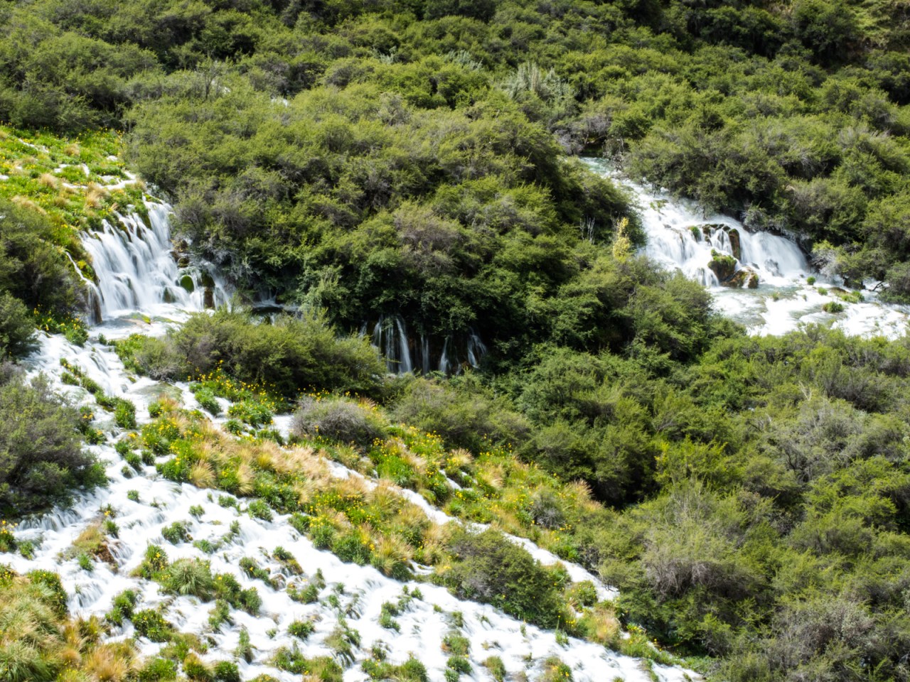
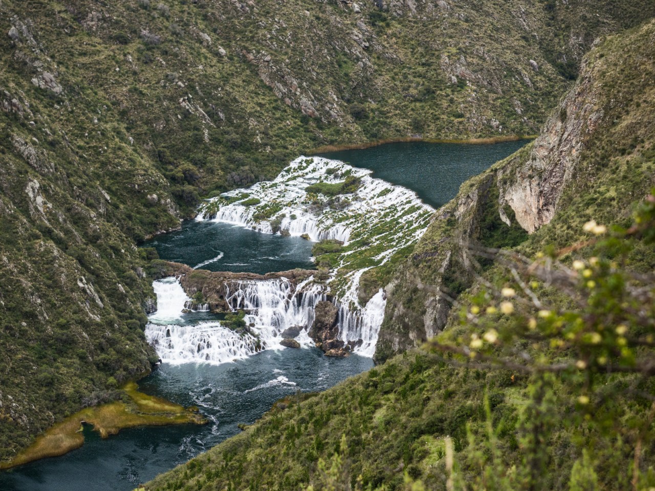
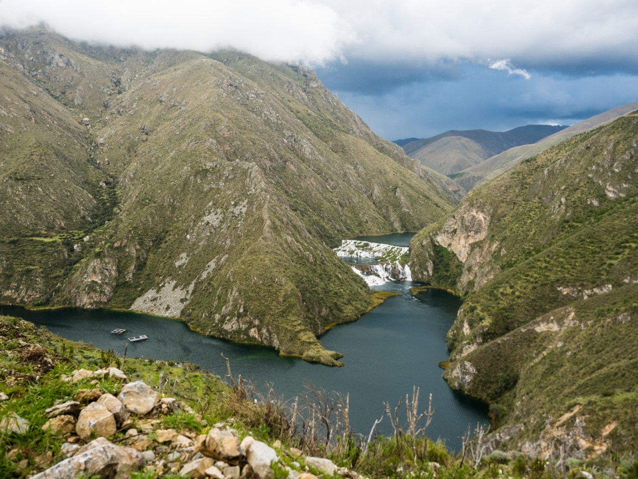
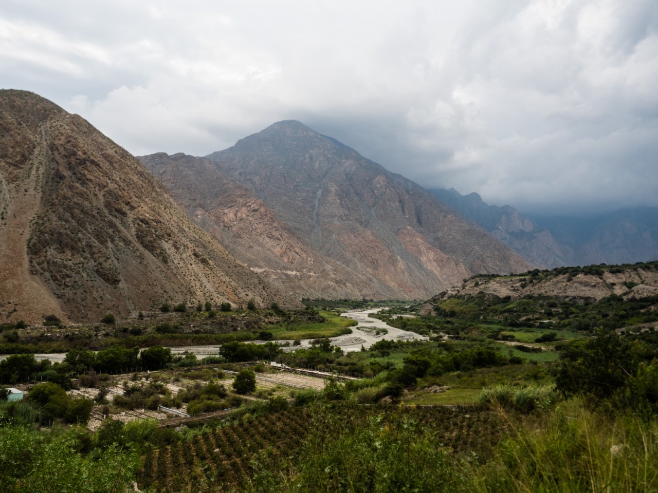
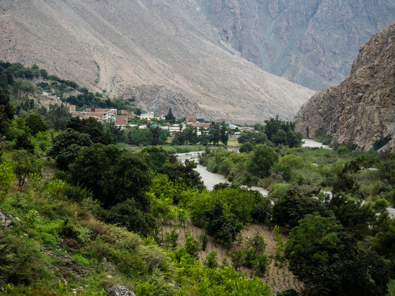
The Rio Canete has been on my list of places to witness since I started researching my trip. As I delved into the Peruvian bike touring blogosphere, I saw incredible pictures of the river, with its cascading series of waterfalls and lagoons, and knew I wanted to experience it myself. The Pikes, the first people to ride this route, had to contend with an extended section of single-track along the river, but when I reached it the road was finished and so I had an easy pedal along the green and blue waters until I reached the village of Vilca. Before reaching the village, I stopped at a lookout where the river descended in a series of cascades through a forest that crossed the valley. It was an awesome sight, in the most literal sense of the word. I suspect the new road will make trips here from Lima more accessible, and this spectacular place will become more popular.

The ride started in a narrow canyon.

With peasant farmers tending to their herds by the river.

After a few kilometres I encountered the first set of waterfalls.
Mostly this stretch of river was calm.
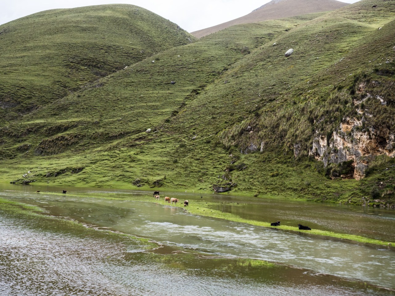
The water was high, leaving these cows almost stranded.

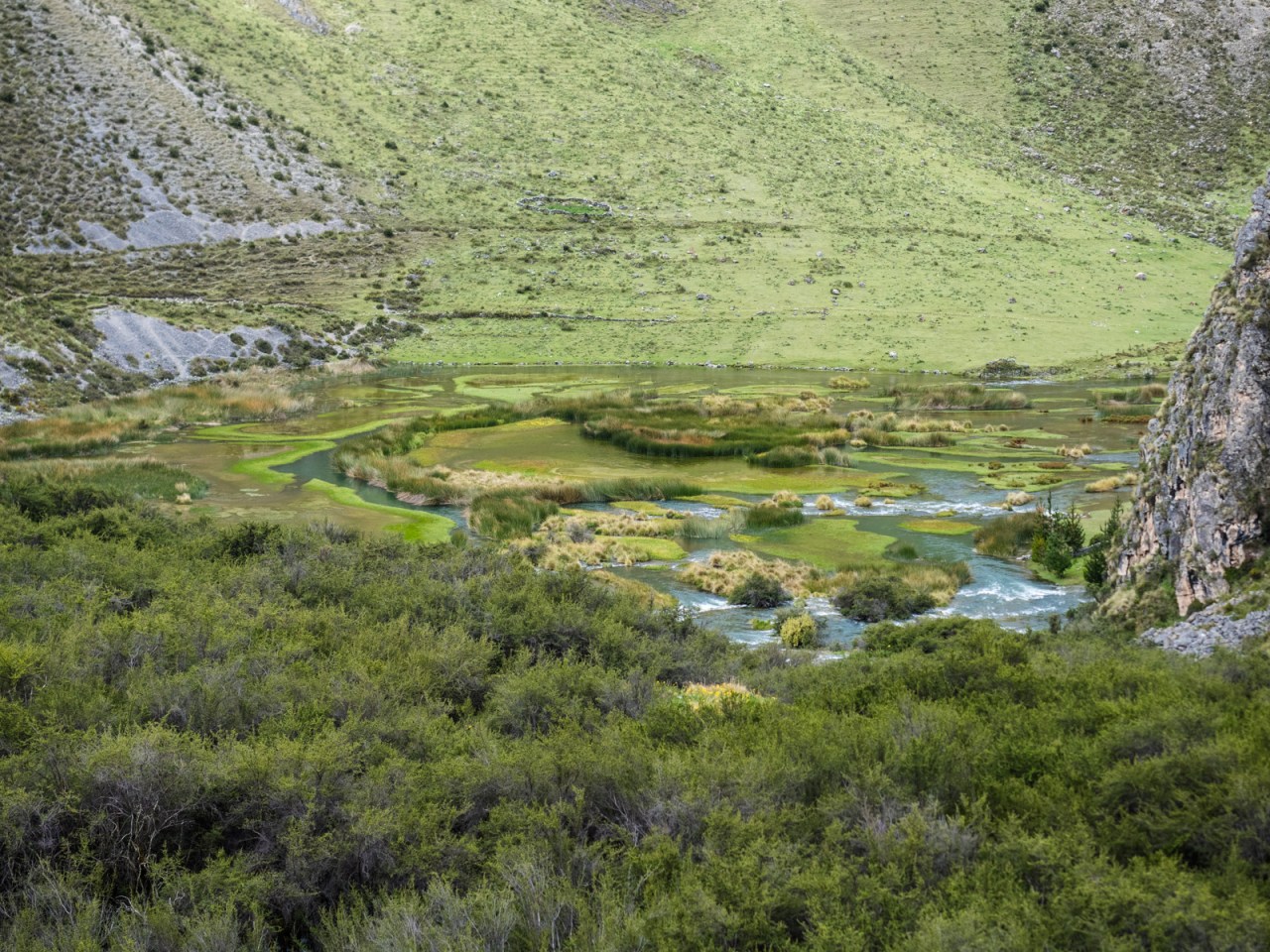
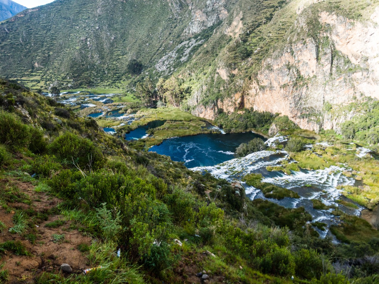
Eventually the river entered a series of marshes.
Then it got really scenic.
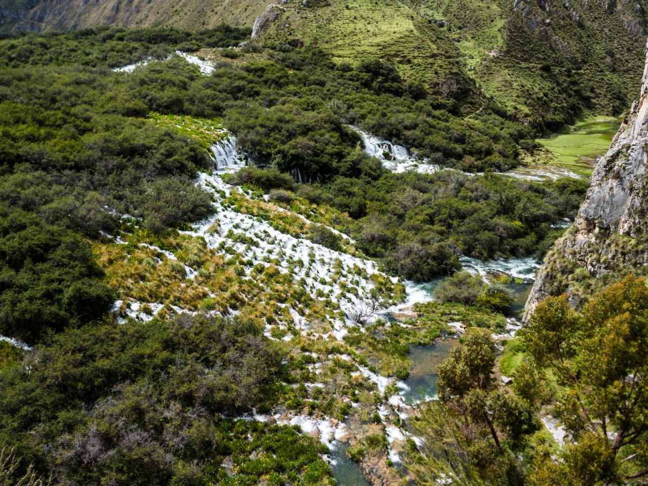
This series of cascades outside Vilca was truly incredible.

Vilca was a cute little town with stone buildings and a charming square. I planned to stock up on food for dinner here but all the stores were closed since I guess the owners were out in the fields. Fortunately, there was a couple selling fruits, vegetables and bread out of a van, so I bought some potatoes, tomatoes, carrots, onions and bread for two soles (about 80 cents in Canada) so I could make a curry that night.

Vilca’s church…

and Vilca’s square.
I left town over an ancient stone bridge and followed the dirt road along the river, stopping to take frequent photos of the lagoons, marshes and waterfalls that line the route. It was a tougher section than expected, with several short but tough climbs along the way. As I pedaled along I decided this was a great way to end my trip. I found a place to camp on a clifftop overlooking a particularly scenic section of river and had a very relaxing evening enjoying the view. Unfortunately, I couldn’t get my alcohol fuel to light (I think I bought a bad batch), so instead of a veggie curry, I ate tuna and tomato sandwiches for dinner. The next morning, I went for a little walk by the river before hopping on my bike and riding to the nearby town of Huancaya for some fresh trout for breakfast.

Vilca and it’s stone bridge.

More incredible views of the Rio Canete.
Leaving Huancaya, I entered the final stretch of my ride. My hope was to make it to Paracas, an ambitious 300 kilometres away in two days. Piece of cake! Up first was 20 kilometres of dirt, mostly downhill, then 120 kilometres of pavement – also downhill, but with a headwind and a pretty gradual grade, meaning I had to pedal most of it. On top of that, I must have banged my crank at some point, because it came loose and my chain kept jumping out of the big ring unless I pedaled at the perfect cadence. I considered stopping to get it fixed, but instead I opted to power through. Despite the technical difficulties, I made it 140 kilometres that day, reaching the tourist town of Lunahuana, with its rafting agencies and vineyards, just before nightfall. After checking into a hotel (I was done with camping), I met some Venezuelans while looking for dinner. They invited me to their place for pasta, so I joined them and had some broken conversations about the situation in their home country; I’ve encountered many Venezuelans who’ve fled their country along the way. Unfortunately a memory card issue caused me to lose many pictures from this day.
Barren mountains rise above the fertile lower Canete valley.


I saw thousands of political signs all over Peru, so it was fitting that as I was leaving, people were painting new ones for the 2019 elections.
And so it came it to the final day, where I’d hit the coast and then follow the Pan-American for 120 kilometres to Paracas. It was an ambitious goal, but I was determined to make it. Unfortunately, it got off to a bad start when my GPS sent me through some vineyards and avocado plantations on a dirt track that ended on a sketchy trail that hung to a cliff over the Canete River. Not knowing if the trail connected to another road further on, and with no locals around to ask, I backtracked to the highway and rode it to the coast.

Despite being a busy highway, there were still signs of traditional rural life.

I though the woman was pushing a cart. Turns out it was a donkey.

This was wine country, and the road was lined with pisco and wine sellers.

My route took me through a vineyard.


And ended in a bit of techy singletrack.
I’d ridden along the coast of northern Peru on my way to Mancora a few months earlier and found it completely miserable. This section was quite a bit better (though still not as pleasant as the dirt roads of the Andes.) The highway was busier, but there was a wide shoulder so I could stay away from the traffic. It also wasn’t as dirty and, the desert scenery was a little more interesting despite its barrenness. I passed by dusty towns, chicken farms and little settlements where shacks were built right on the sand, with no infrastructure to be seen. I don’t know if the poverty is worse in this area than in the Andes, but the lack of water and arable land makes it feel more desperate.
Despite the near-complete lack of rain, there’s still some semblance of agriculture along the Peruvian coast.

I couldn’t tell if these shacks were inhabited, or if they were simply a way of someone staking a claim to the land in case it becomes worth something in the future.

There was several chicken farms along the highway. And here I was naive enough to think all the chicken for sale in Peru was free-range.

I’m not sure what the cows eat around here.
With my crank causing me all sorts of problems and preventing me from riding as hard as I wanted – not to mention my general fatigue – it took me longer than expected to reach Paracas. I was still a ways away when the sun set and I seriously questioned if I would make it. I thought I had 40 kilometres to go when my phone told me I had 55, a pronouncement that seriously deflated me. As I climbed a short hill, I pulled it out to check if there were any towns coming up I could stay in. When I did, I noticed my GPS wanted to send me on a solid 20 kilometre detour. Realizing I only less than 35 kilometres to go, I felt rejuvenated and got a second wind. I crushed the next 15K, reaching the turnoff to Pisco, where I exited the Pan-American and rode to the coastal road. There, I turned south again, the sign saying 12 kilometres to Paracas. It was 7:45 p.m. and I figured I would be there in 30 minutes. But the wind had other ideas and fought me the rest of the way. I struggled on, reaching my breaking point several times, but I pushed through until I finally reached the gateway to Paracas, and a bed and shower. I didn’t make any grand proclamations about the end of the trip to the backpackers at the hostel. Instead, I had a quiet night to myself, enjoying a late dinner of ceviche, fried fish and a beer.
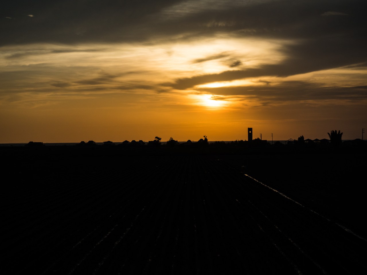
That day I rode past sunset…
…
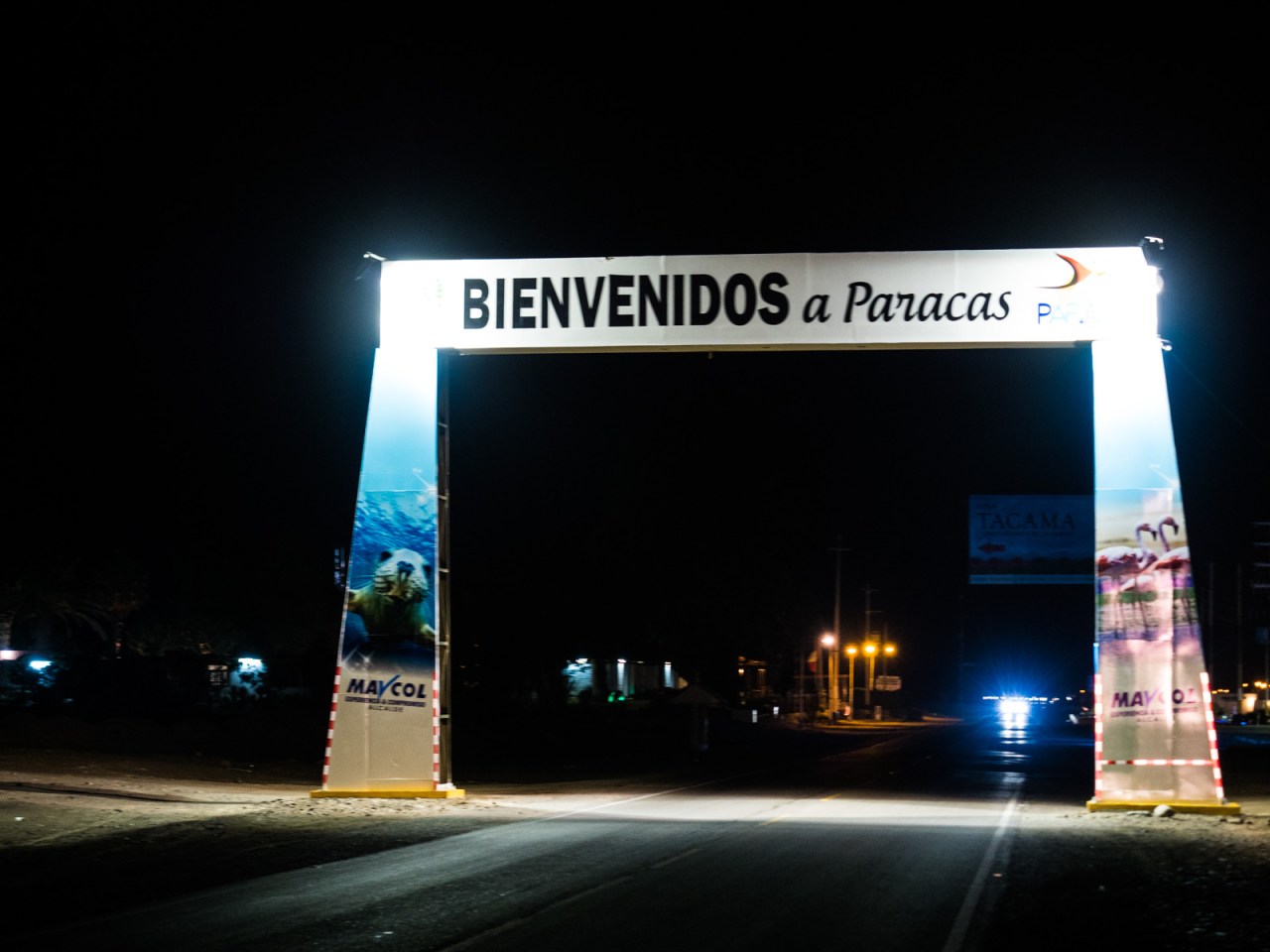
… And arrived in Paracas at night.
Paracas is a small beach town known as the poor-man’s Galapagos. The national park next door is surreal patch of desert and the coastal waters are home to hundreds of thousands of birds of all kinds, and a variety of marine mammals. Of course, the order of business on my first day there was to find a seat by the pool and stay there – only rising for lunch and to get drunk for the first time in ages that night.


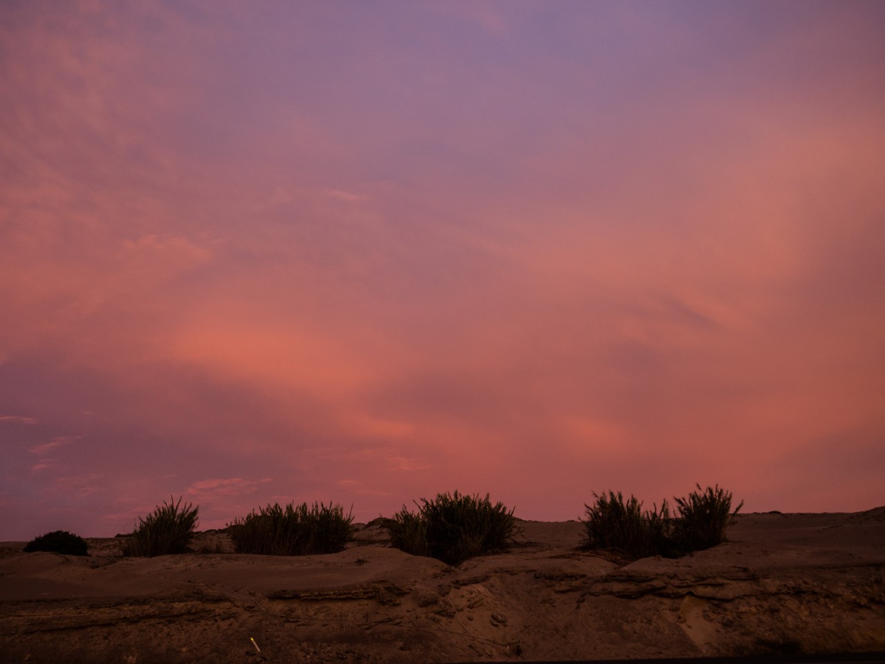
I also enjoyed an incredible sunset.
Day two was similar, but late in the day, I decided to take my bike out for one last spin and ride out to the national park. That headwind I battled the other day seemed like a mild breeze compared to what I experience today, and I thought about turning back. But I’m stubborn and the sign said 10 kilometres to the viewpoint, and after riding through the Andes for six months, what’s a little wind? I struggled down the highway to El Catedral – a rocky prominence jutting out of the ocean that’s home to countless birds, then had a fun time freeriding through the desert on the way back. I watched the sunset, then re-joined the highway and let the wind blow me back to Paracas.

Riding aganst the wind into Paracas National Reserve

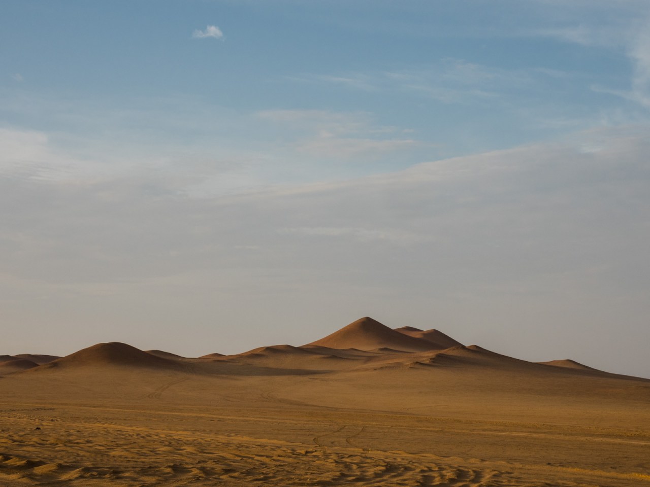
Huge dunes rose above the road.

Eventually I hit the coast.

This is La Catedral – home to many birds and crashing waves.

The road was really rough, so I just went where I wanted.

The evening glow in the desert.

I stayed out until sunset…

… and took a cheesy parting shot of myself riding off into the sunset.
The next morning I took a boat tour to the Islas Ballestas, which must feature one of the greatest concentrations of birds in the world. They covered every inch of the rocky islands and soared overhead and dove into the water. Everywhere you looked, a flock of birds would go whizzing through the air or dive into the sea. Sea lions basked on the rocky beaches, occasionally flopping into the water to go for a swim. We even saw a few penguins!
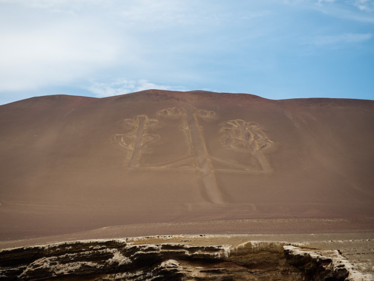
The Candelabra of Paracas, who’s origin is unknown.

Those are all birds.

More birds…


What can I say? There was lots of birds.
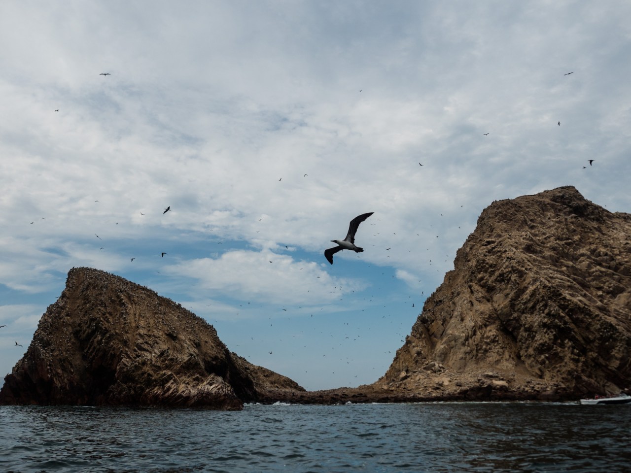

And a few posing sea lions…


And after two hours we were back to shore where the locals keep their fishing boats.
It was a short tour (about 2.5 hours) and then I got back to the hostel, packed my bags and got on a bus to Lima. It was Monday and I had a flight booked for Thursday, but I needed to find a bike box in that time. Turns out, that was easier than expected and I found one at the second shop I visited (a few weeks earlier, when I was in Lima looking for a new wheel, it took me about a dozen shops and a full day of walking to find one).
Tomorrow I fly back to to the northern hemisphere. I’m stopping in San Francisco to go skiing with my brother this weekend, and on Tuesday and I finish the trip back to Revelstoke. While I’m ready to go back and see friends and enjoy some spring skiing, I’m already thinking about my next trip – whether it’s to ride through the rest of South America or go somewhere else.
To be continued?
Click here for a GPS track of this route.


1 comment ›