
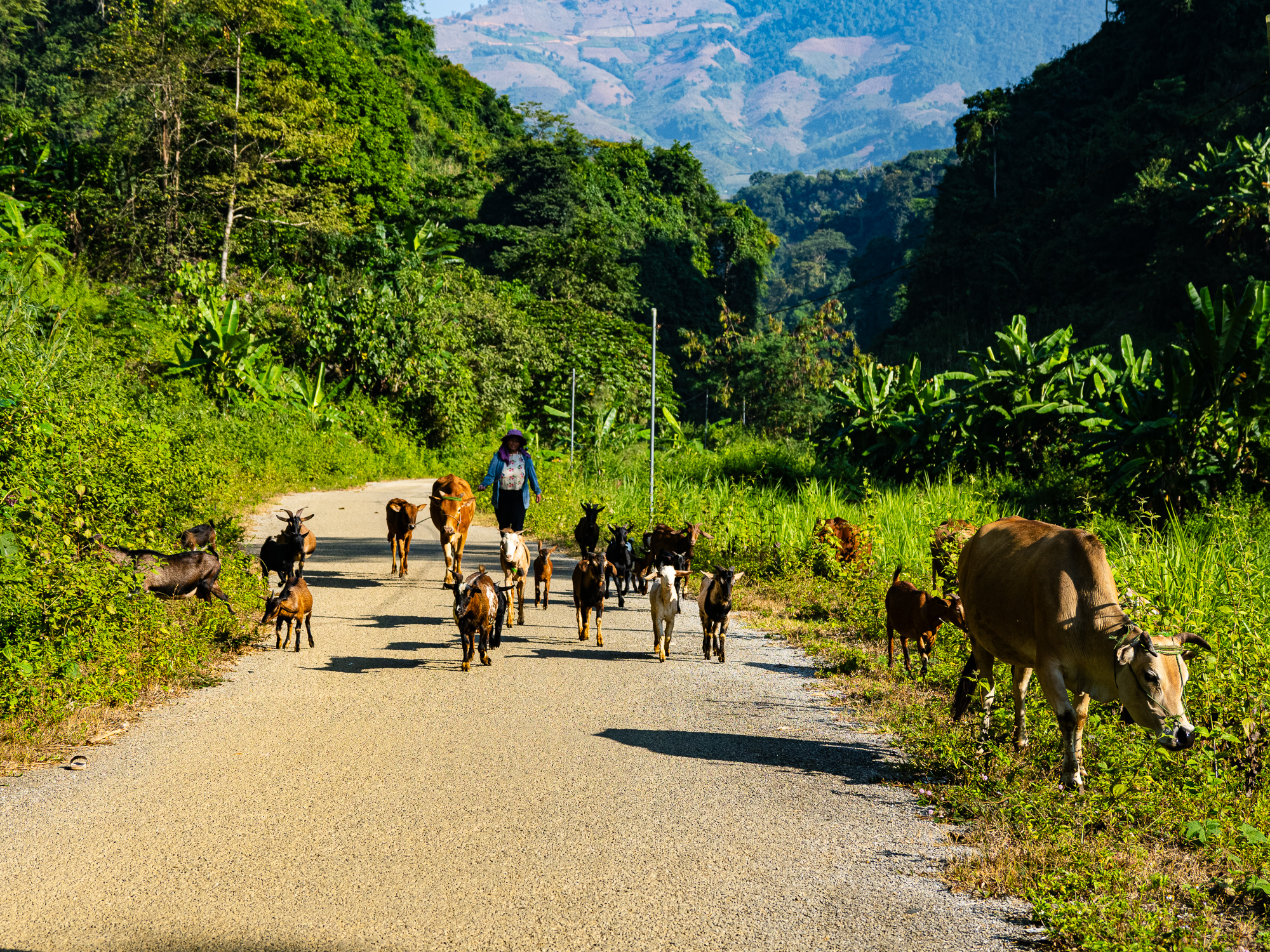
Tua Chua is a remote, seldom-visited region of Dien Bien Phu Province in northwest Vietnam. The region is situated on a plateau located between a bend in the Da River. It features beautiful rice terraces flanked by high mountains that rise out of the Da River (which is now a reservoir) and is home to several ethnic minority groups. There are a only a few basic homestays in the region and it sees very few foreign tourists, most of whom come on guided motorcycle tours from Sapa or Dien Bien Phu.
This route begins in Dien Bien Phu (DBP), the provincial capital, and finishes in Qyun Nhai, where you can either head east to Mu Cang Chai or south to Son La. It is a very challenging route, with over 8,000m of climbing in only 335 km, but the quiet roads and incredible scenery makes it all worth it. It makes for a great detour from the main highway for those heading to and from Laos, or if you’re simply exploring northwest Vietnam.
Read my blog post about this route here.
Highlights:
- Riding along the peaceful shores of Ho Pa Khoang outside DBP.
- The serene Song Nam Co valley.
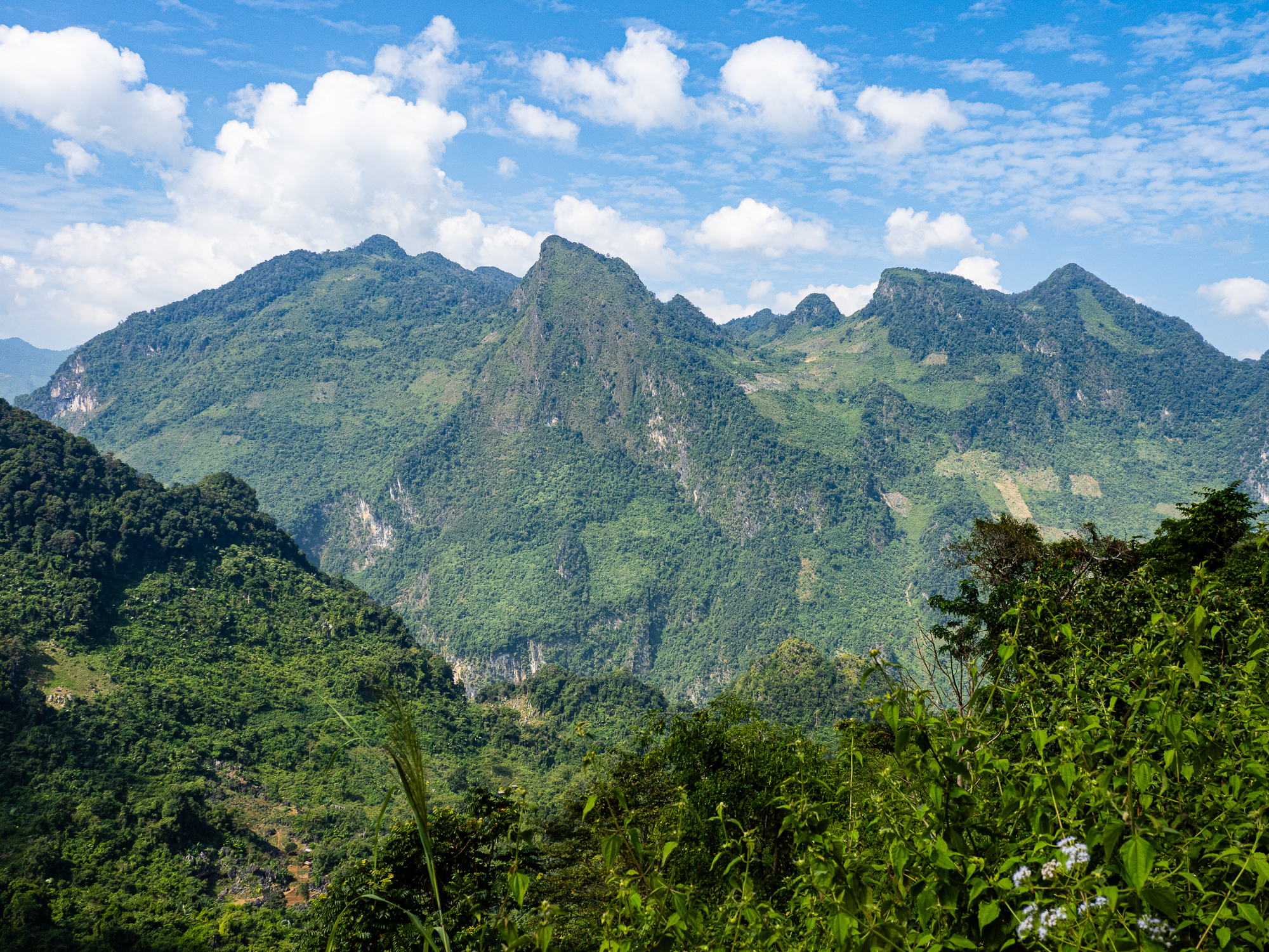
- The towering limestone cliffs that rise above the highway near Ban Bo.
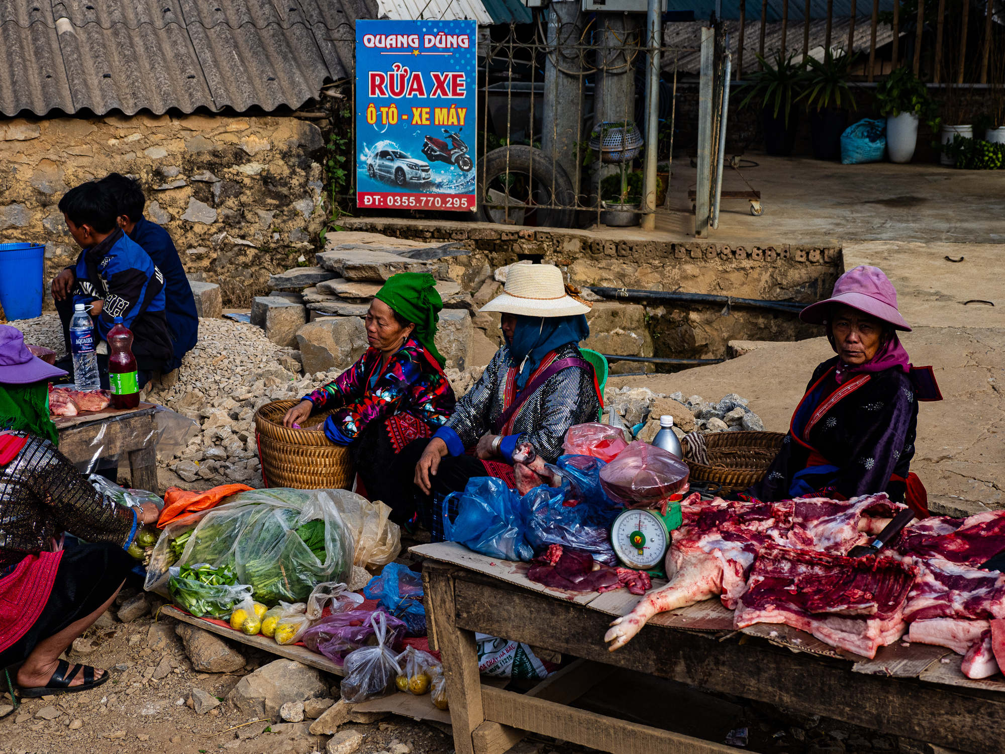
- The weekly market in Tua Chua town.
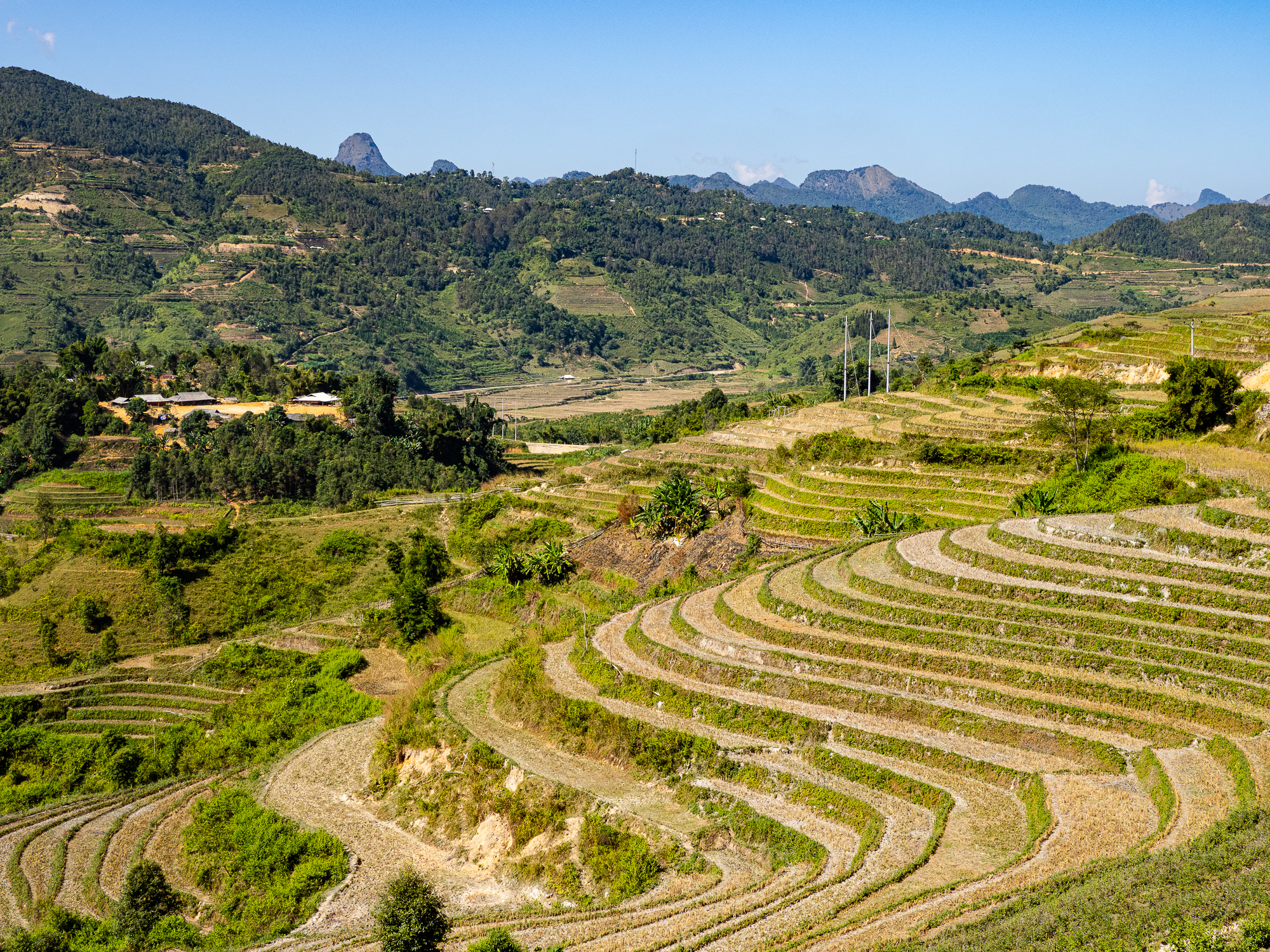
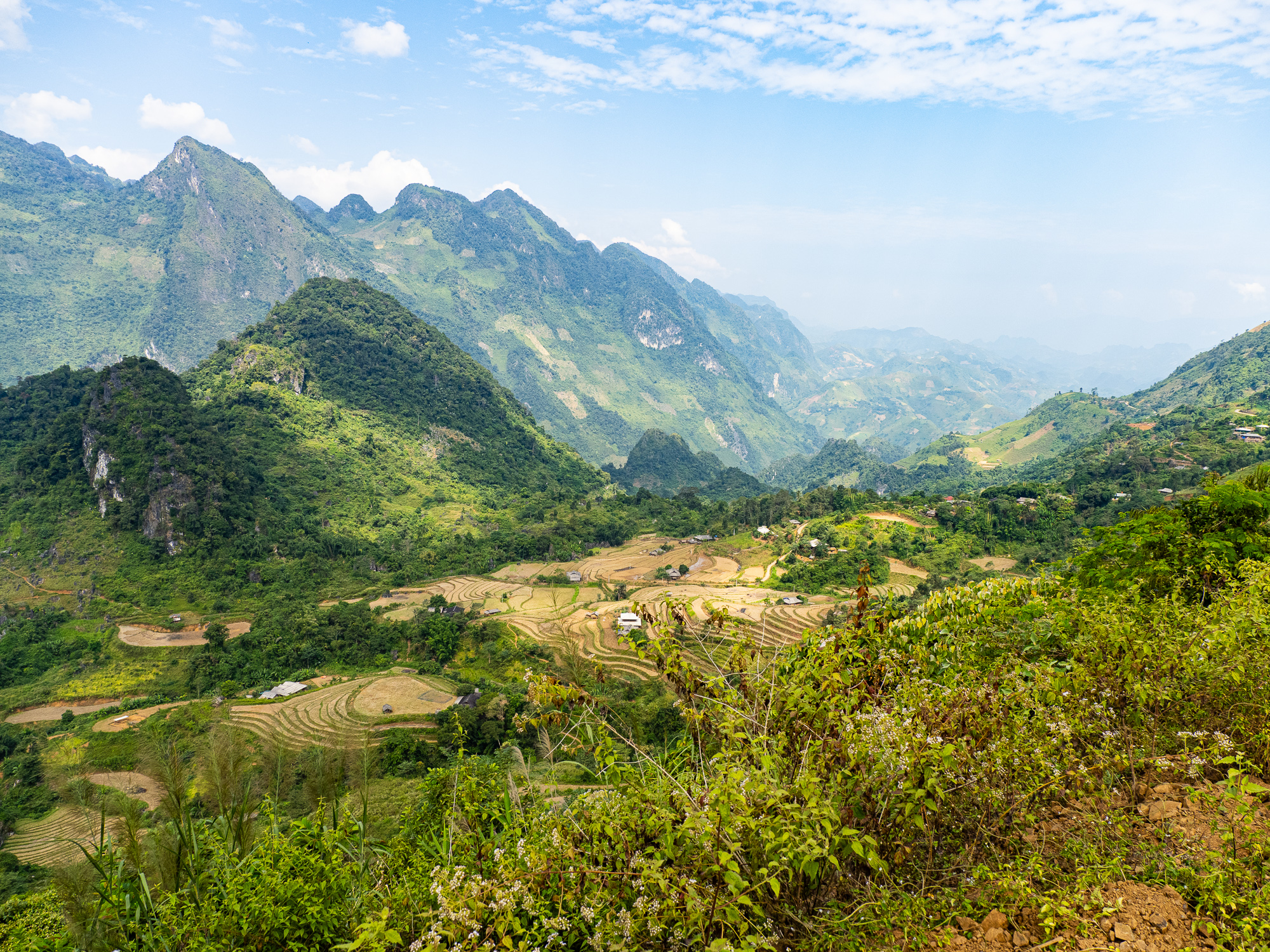
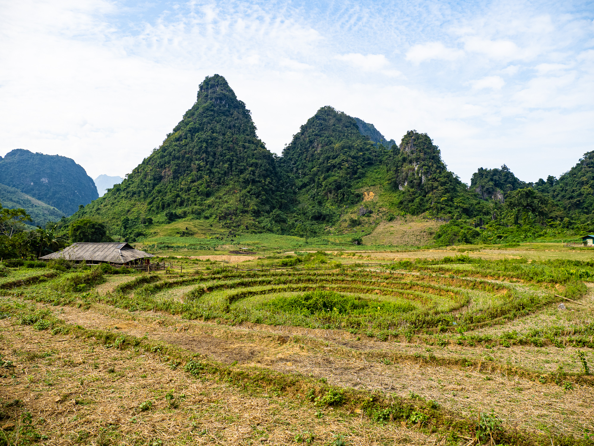
- The layered rice terraces and jungle-clad peaks of the Tua Chua Plateau.
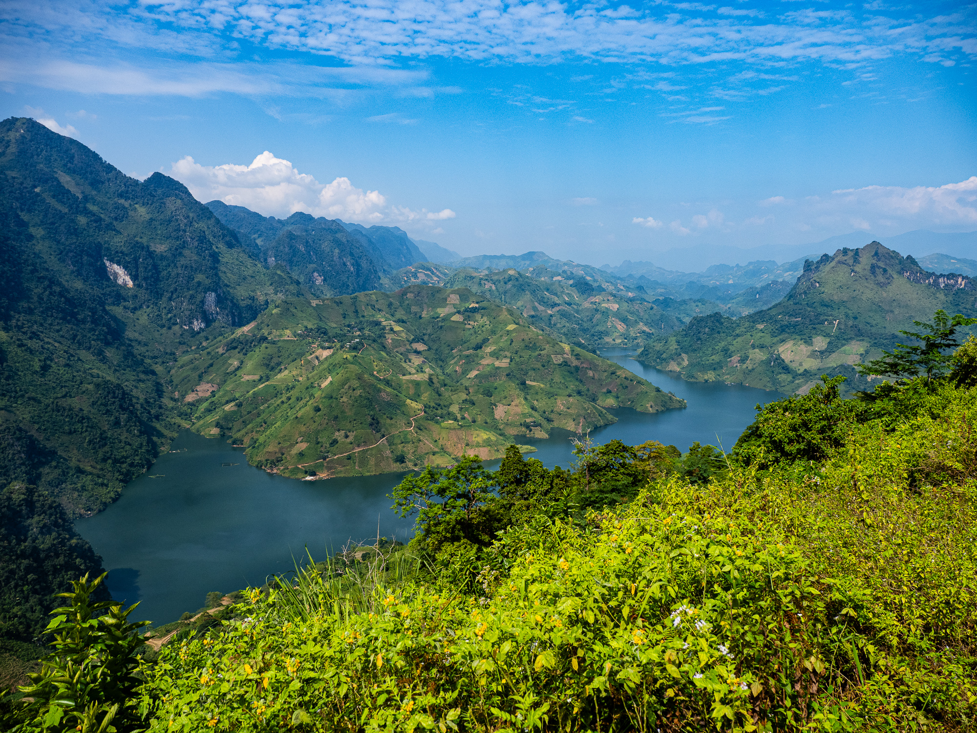
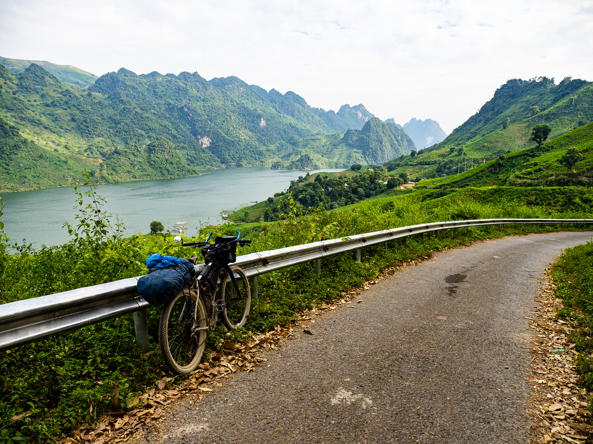
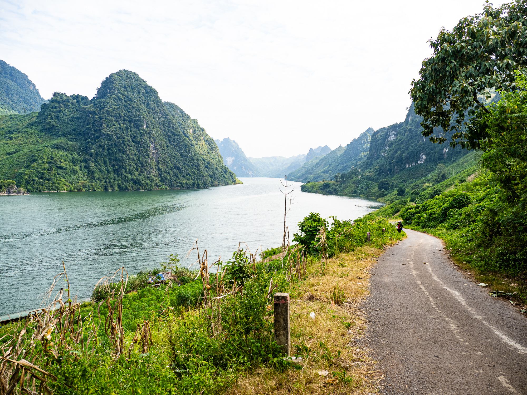
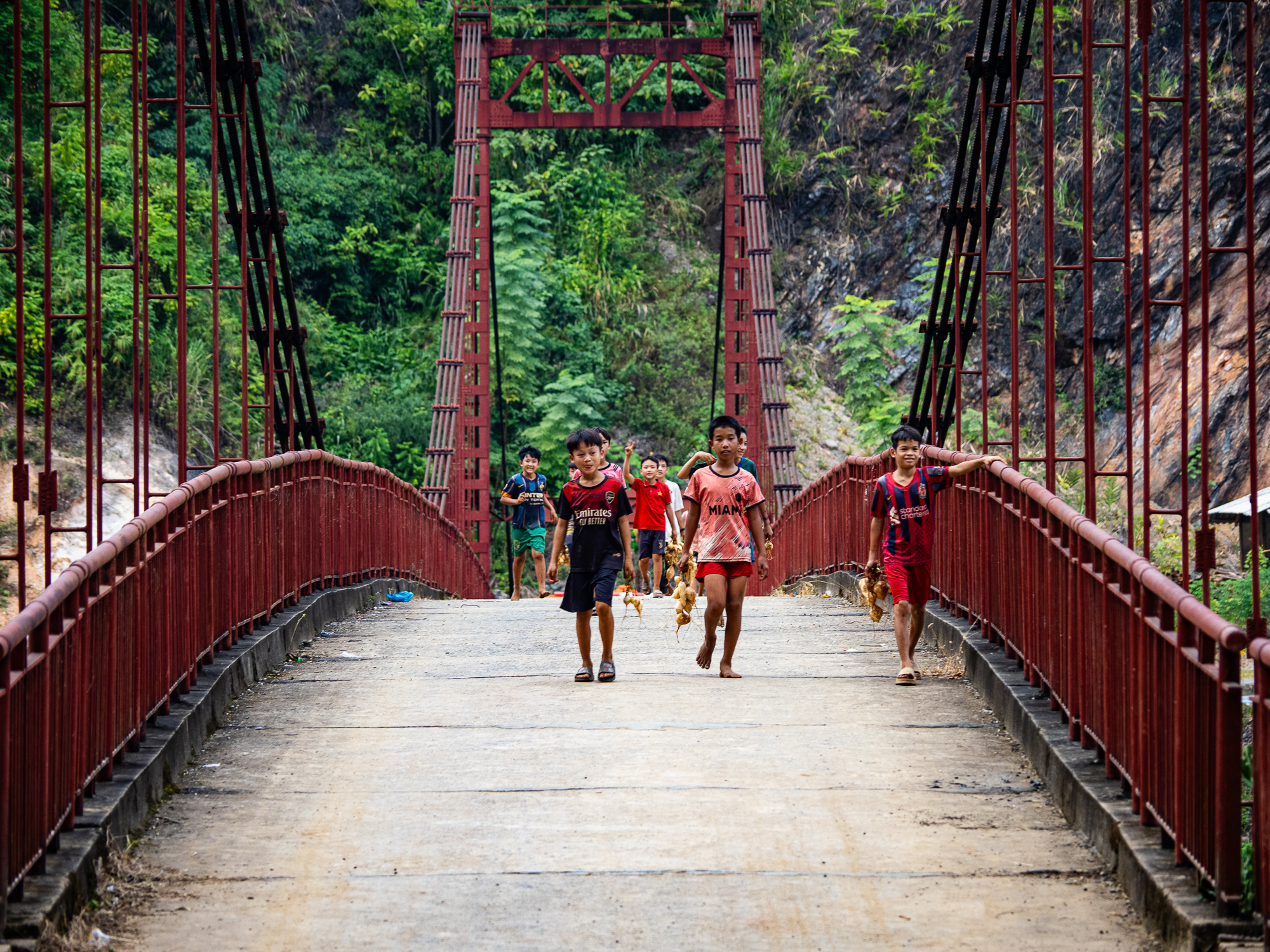
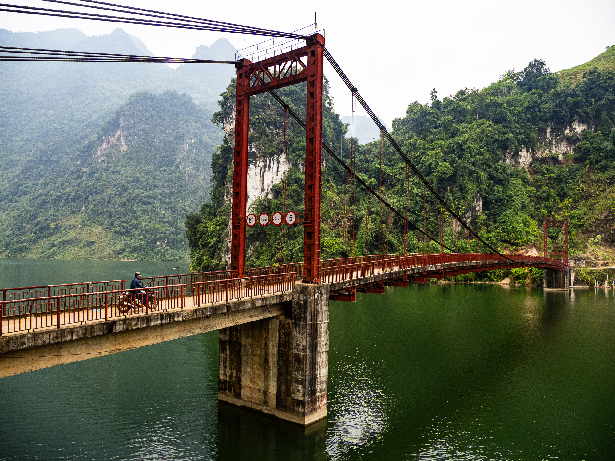
- Riding along the Da Reservoir and over the Pa Phong Bridge
- Staying at the two traditional homestays in the region – one high on the plateau and the other by the Pa Phong Bridge.
- Exploring Kho Chu La Cave
Background
I rode this route in November 2024 as part of a three week ride in northwest Vietnam. I decided to explore the NW instead of the more popular Ha Giang area because the latter seemed over-touristed and I didn’t want to share the road with hordes of backpackers on motorcycle tours. Tua Chua looked like an interesting region when I was planning the route, but I was unsure about the availability of accommodation. In DBP, a tour guide said the region was like Ha Giang, but without the crowds. He also confirmed the presence of two homestays that were marked on Google maps, which made the ride feasible.
Route Guide
This route begins in the city of DBP, the capital of the province of the same name. DBP is most famous as the site of the final battle where Vietnamese independence forces defeated the colonial French army in 1954. You can visit several battle sites in the city, including the bunker where the French army formally surrendered. There’s a decent selection of hotels and restaurants, and it’s a good place to stock up on food for your trip, though you won’t need much since food is pretty easy to come by on this trip.

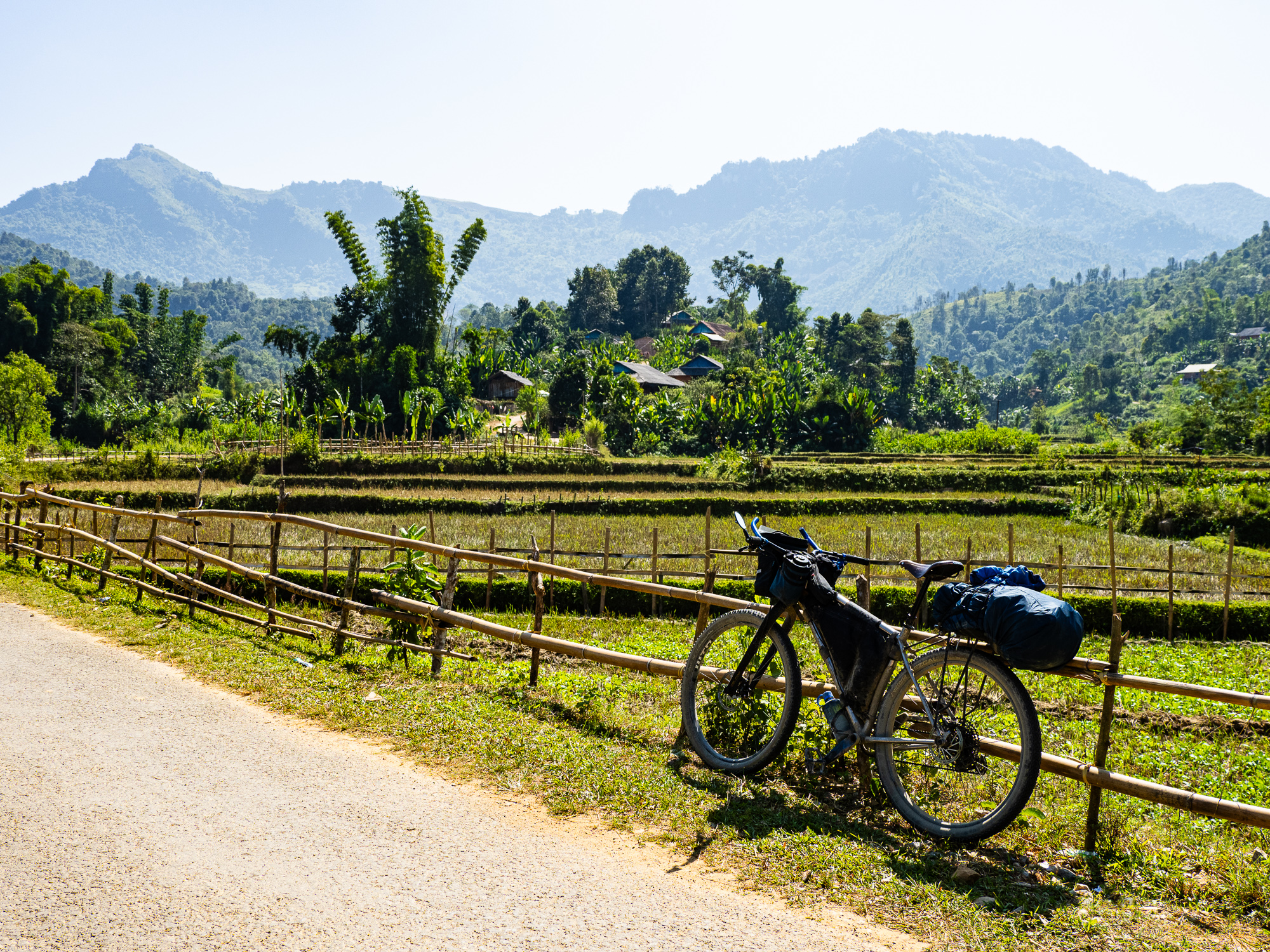
The route begins by climbing out of DBP to the shores of Ho Pa Khoang, a quiet lake not far from the city. The water looked serene, though I didn’t go for a swim. There were a few spots that looked suitable for camping along its shores – a rarity in Vietnam.


After the lake, the route joins highway AH13, which is the main thoroughfare across north Vietnam. After a short stretch of busy highway, the route turns onto a peaceful side road just above the Nam Co River. Enjoy the idyllic agricultural backdrop as you cruise mostly downhill through this remote valley.
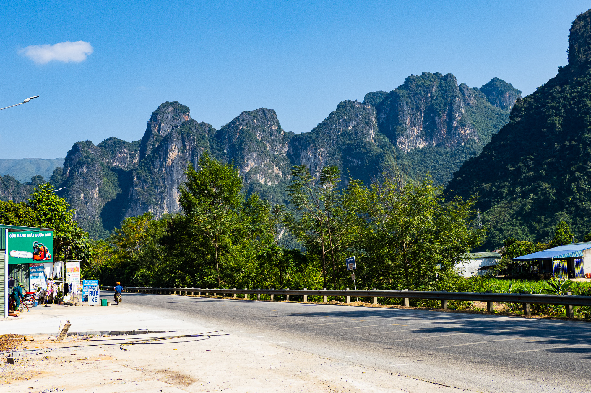
Back on AH13, you’ll be greeted by incredible views of towering limestone cliffs as you pass through the villages of Ban Bung and Ban Bo. If you want, you can take a short detour south along the Nam Hua River to enjoy the scenery. Eventually, the route reaches Tuan Giao, which is home to several decent hotels and a smattering of restaurants. This is where I stayed the first night. It is a long day from DBP, but there aren’t many options before Tuan Giao unless you have a tent, which I didn’t bring on this trip.


From Tuan Giao, the route heads north on QL279 before turning off onto some narrow side roads into Tua Chua province. After a short punchy climb and steep descent, you’ll rejoin the highway, but don’t worry, there is very little traffic on the 600m climb to TuaChua town. The town is the capital of the district and home to several basic hotels and home stays. There’s a weekly market, though we were not there for it.
The route leaves town on a paved side road and climbs higher onto the plateau. Upon rejoining the main road, you’re greeted by incredible views of sprawling rice terraces backed by forested mountains. The road navigates above a terraced valley before climbing to the Ta Phin karst forest, where you’ll find a village of the same name. I stayed at a homestay here in 2024, but it is no longer marked on Google Maps and I’m not sure it still exists. If it doesn’t, you’ll probably want to spend the night in Tua Chua town.


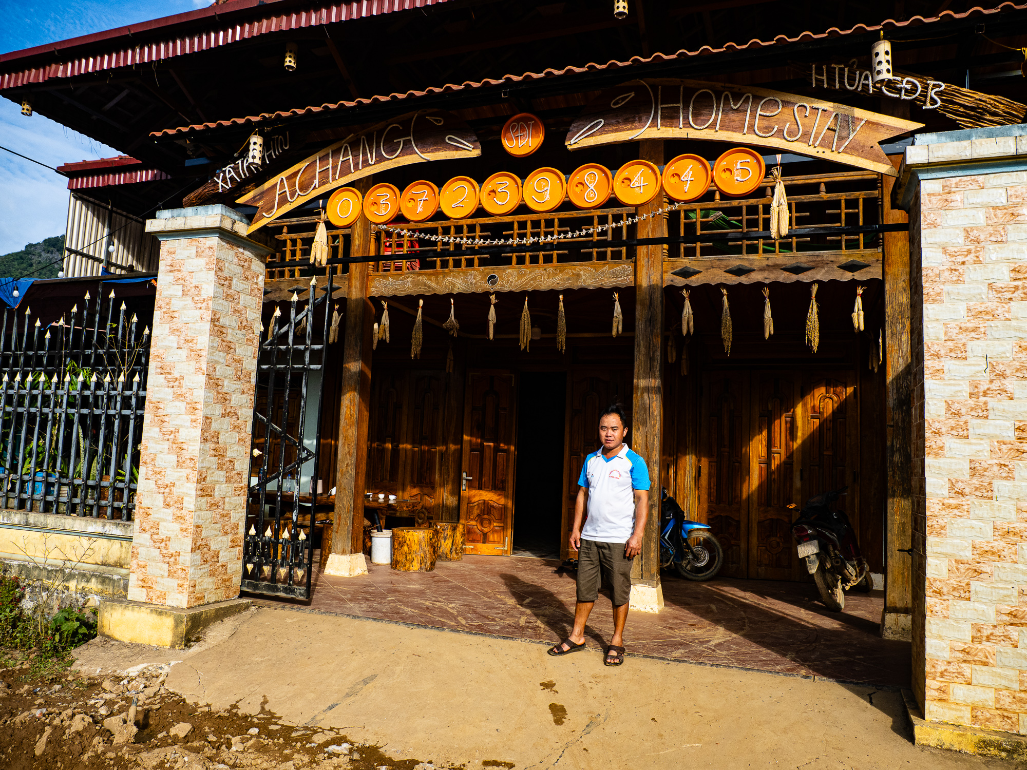
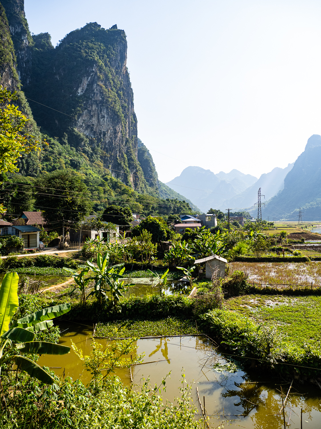
From Ta Phin, the route continues north along the plateau, circling around numerous karst mountains before it begins plummeting down toward the Da Reservoir. The views above the reservoir are incredible and among the best in Vietnam. Eventually, you’ll reach the lakeshore and cross the Pa Phong Bridge, where you’ll find a rustic homestay on the south side. The facilities were very basic when I visited in Nov. 2024, but the location can’t be beat and the food was plentiful. If you’re lucky, you may be able to take a boat tour on the reservoir.


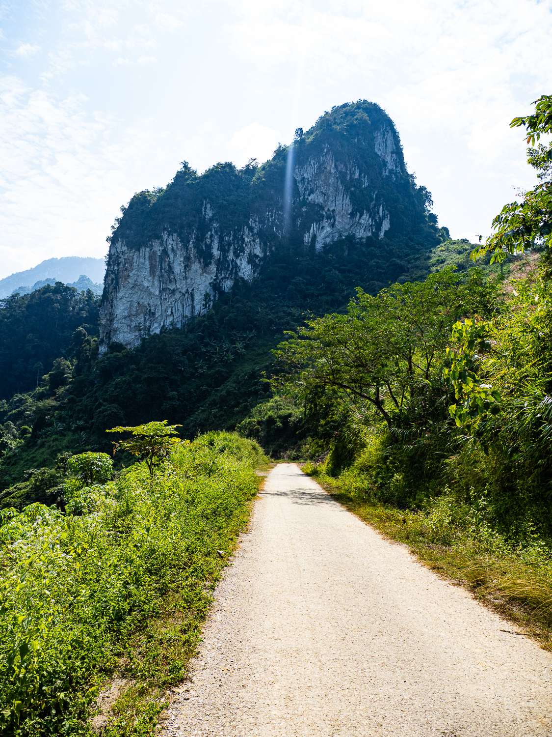


From Pa Phong, it’s a very tough climb back to the plateau. Expect lots of steep hills that may have you pushing your bike. The views continue to be remarkable and you’ll pass by several villages along the way back to Tua Chua town. A highlight of this section is Kho Chu La cave, one of many limestone caverns in north Vietnam. The route loops back to Tua Chua and then backtracks along highway DT129 to the village of Huoi Long. From Huoi Long, you’ll follow a backroad through a wide valley before climbing to a small plateau. Finally, one last climb bring you to a pass, where the final descent to Quynh Nhai begins.
In Quynh Nhai, you can chose to head east to famous rice terraces of Mu Cang Chai, or go south to Son La. It really depends on how much time you have, and how much climbing you have the tolerance for. I went south as I didn’t have the time to ride through Mu Cang Chai.


Camping, lodging, food, and water
Accommodation can be found in Tuan Giao, Tua Chua, Pa Phong, and Quyn Nhai. There was a homestay in Ta Phin village on the Tua Chua plateau, but it is no longer marked on Google Maps and may be closed. I didn’t bring camping equipment, but I did note few spots on Ho Pa Khoang and in Tua Chua district.
Food is generally easy to come by, except in the loop north of Tua Chua. You’ll want to stock up on extra snacks and lunches for that stretch.
Water wasn’t too much of an issue, but you’ll definitely want a filter. I filled up my bladder from local taps and filtered it into my bottles from there.
Which Bike?
95% of this route is on paved roads, but I recommend a gravel bike with at least 40mm tires because they can get pretty rough. The climbs are steep, so appropriate gearing is a must.
Must Know
When to ride & weather
This route is best ridden from October to April, which is outside the rainy season and when temperatures are coolest in north Vietnam. I rode it in early-November and had pretty much perfect weather. The temps were ideal on the plateau, but it was pretty hot, though bearable, down by the river.
Where to start?
If you’re coming from Laos, start in DBP. If coming from Hanoi, you can pick up the route in Quynh Nhai.
Time and suggested itinerary
This is a challenging route with tons of climbing. I rode it in 4.5 days, continuing all the way to Son La on Day 5. This is my suggested itinerary, which is based on availability of accommodation as I didn’t bring camping equipment:
Day 1 – DBP to Tuan Giao (92 km with 1,800m of climbing)
Day 2 – Tuan Giao to Tua Chua or Ta Phin (if the homestay still exists), (50km/1,300m climbing to Tua Chua, or 80km, 2,000m climbing to Ta Phin)
Day 3 – Tua Chua/Ta Phin to Pa Phong homestay (82km/2,300m climbing from Tua Chua, 54km, 1,400 climbing from Ta Phin)
Day 4 – Pa Phong to Tua Chua (50km, 1700m climbing)
Day 5 – Tua Chua to Quynh Nhai (60km, 1,279m climbing)
Route Map

WordPress won’t let me embed the route map from Ride With GPS, so click on the image instead.


Leave a comment