What is it about the mountains that make me feel so at home? I didn’t grow up in the mountains, though I did spend many winter days skiing as a kid. I spent a summer in Banff when I was 21, but I spent more time then getting drunk than scaling mountains. It wasn’t until I was 29 that I exchanged city living for life in the Columbia Mountains, surrounded by some of the best ski touring, hiking and mountain biking in the world. What is it about the mountains that I find so majestic and so inviting? I know other people who feel this way about oceans or forests or deserts or the great plains. I’ve often wondered what it is that makes people consider certain things beautiful.
For me it’s mountains, but I’ve never entirely been able to define their appeal. They’re immense, powerful places that make me feel small and take huge efforts to explore and overcome. They present an endless variety of landscapes, from towering glaciers and startling cliffs to colourful alpine meadows and roaring creeks.
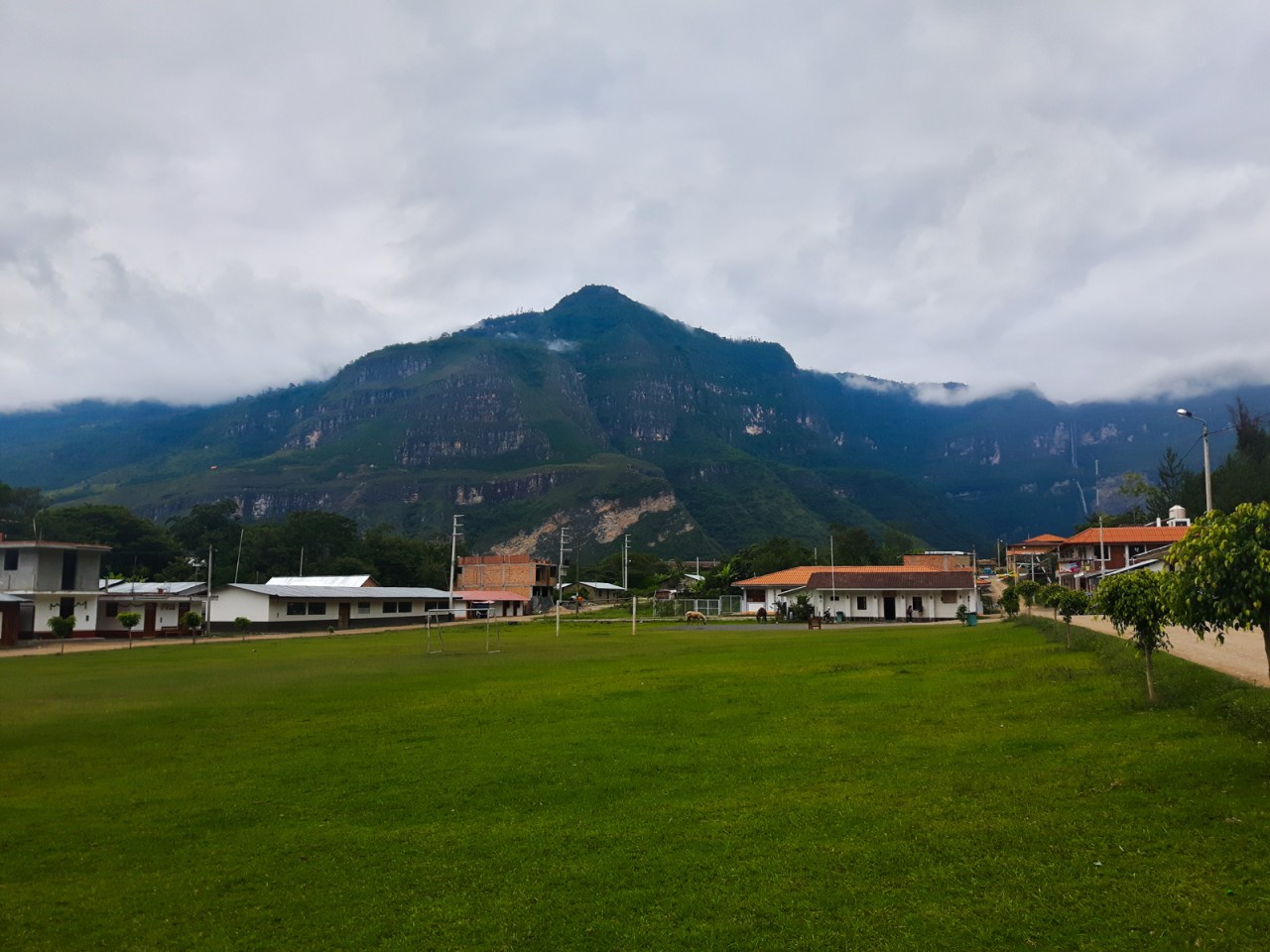
Whatever it may be, I was definitely very happy to find myself in the small Andean city of Chachapoyas in northern Peru for Christmas. A few lazy beach days in Mancora was nice (and I was with some great people there) but I didn’t feel nearly as relaxed lazing back in a hammock there as I did strolling the colonial centre of Chachopoyas and gazing out at the green surroundings that plunged into incredible river canyons.

Chachapoyas’ pleasant pedestrian shopping street.

Looking out over the city of Chachapoyas.
Compared to hectic Mancora, Chachapoyas was calm, orderly and traffic-free. The main square was under renovations and torn up, but there was a nice pedestrian street running through town, a typical South American market filled with amazing fruits and vegetables, and a good variety of restaurants. After two long bus rides to get there, I settled in at the Chachapoyas Backpackers Hostel and spent my first day recovering from the overnight journey, lazing about, and walking the city streets. There’s not much to do in Chachapoyas itself, but it is an excellent base for the many attractions surrounding it, which include ancient ruins and some of the tallest waterfalls in the world.

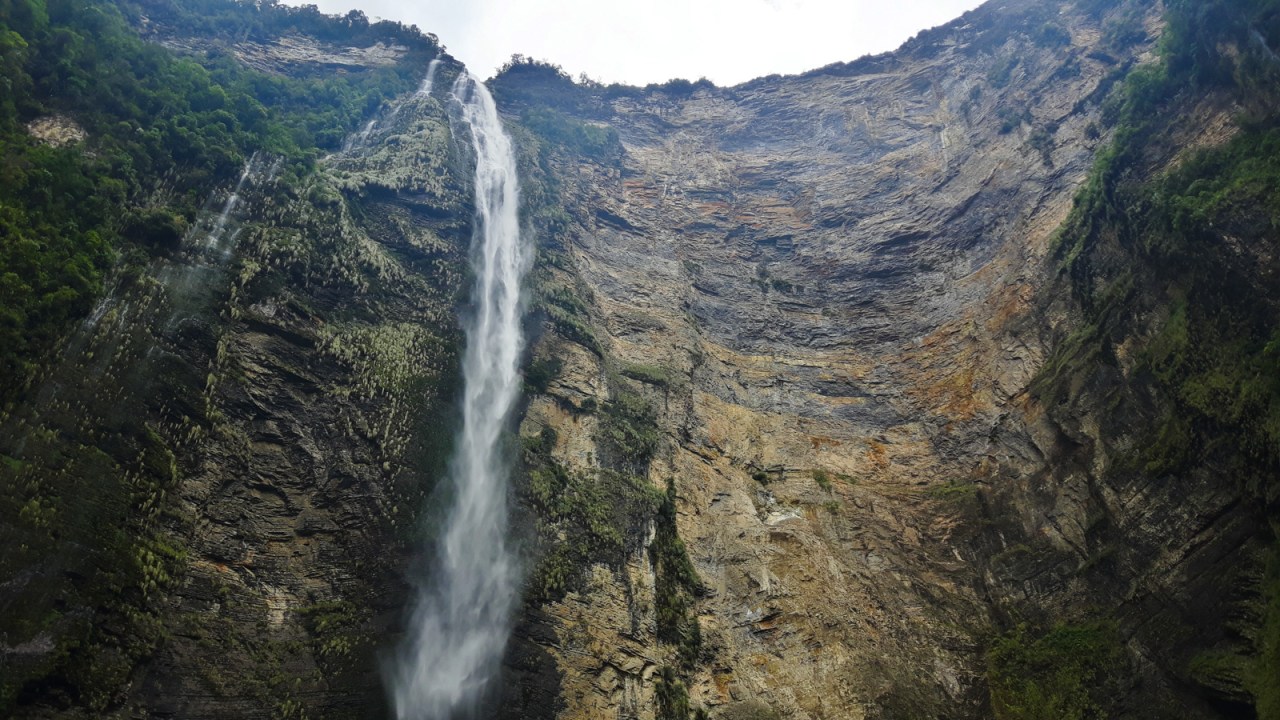
On Christmas Eve, I set out to go see one of the main attractions – Gocta Falls. Depending on who you ask, it’s either the third or 16th highest waterfall in the world. Regardless, at 771 metres high, it is truly impressive. Almost as amazing is the fact is it was only discovered by outsiders 15 years ago, though considering Chachapoyas’ remoteness and that it’s only recently been serviced by a paved road, maybe I shouldn’t be surprised. It makes me wonder how many other wonders there are to discover in the world today.
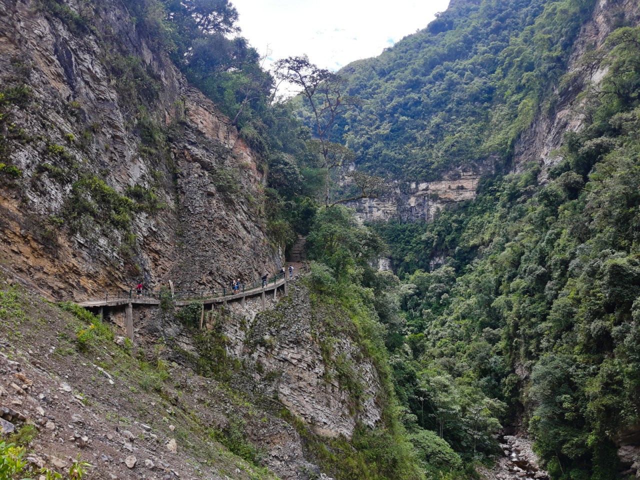
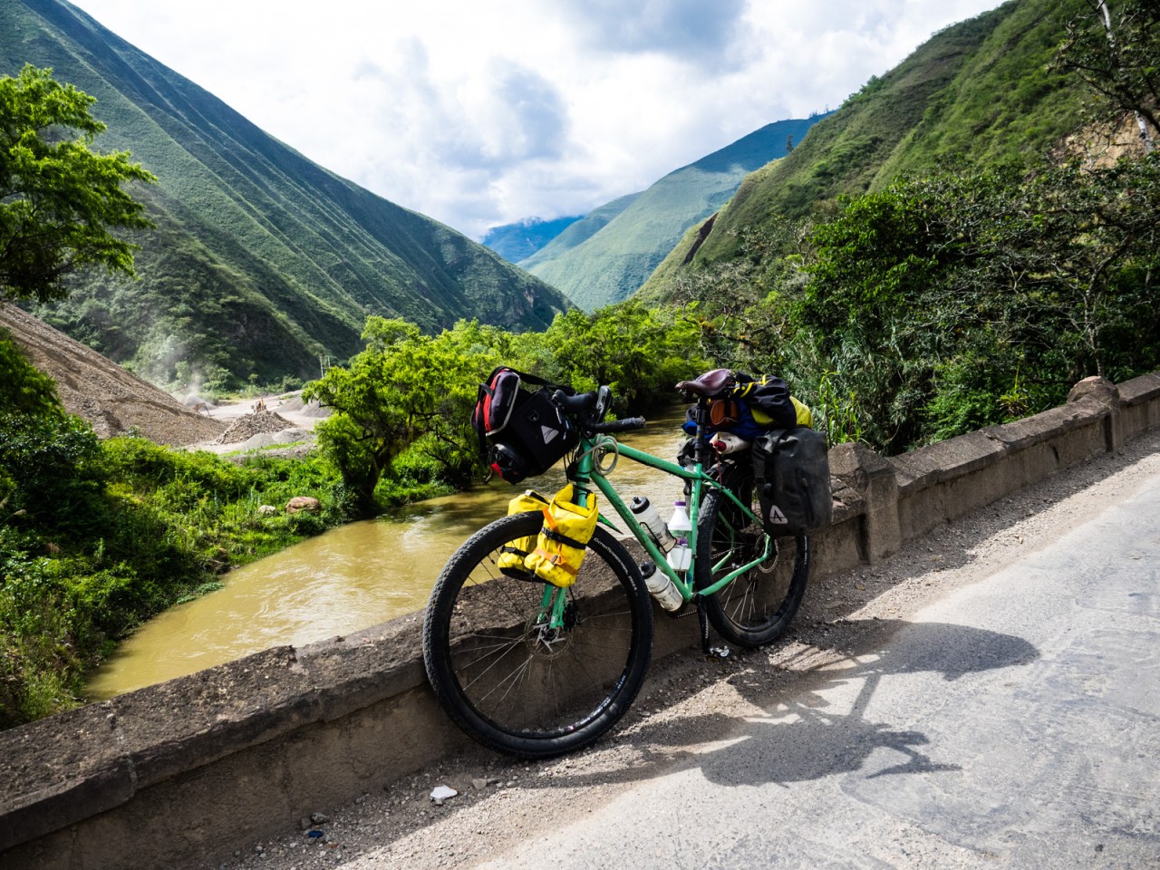
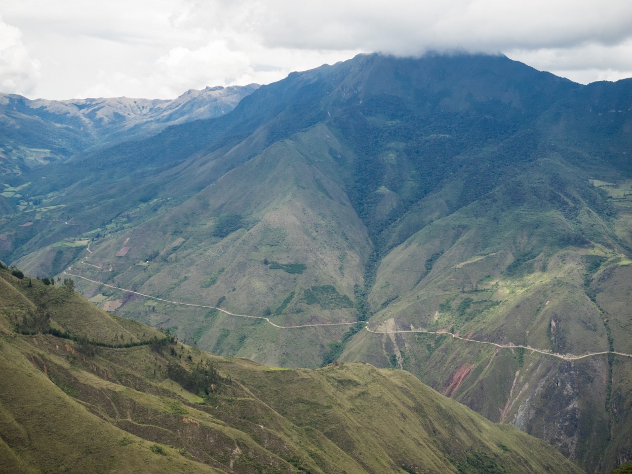
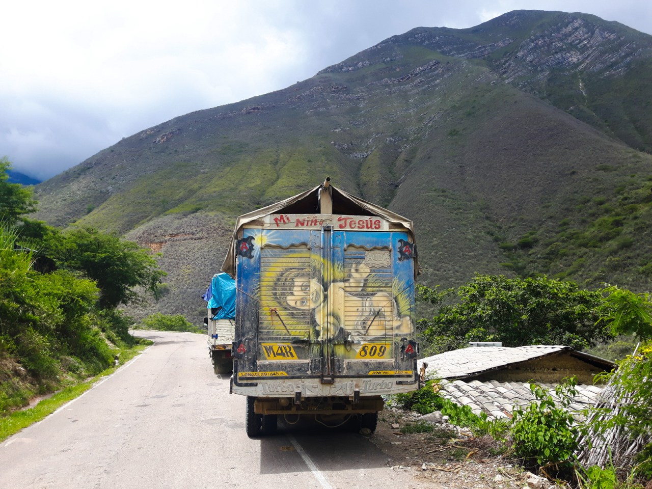
To get to the falls I booked a tour through the hostel and was joined on the hike by an American family and a Spanish/Peruvian couple. The drive to the start of the hike followed the single-lane highway where at times the canyon walls loomed over the road while the Utcubamba River flowed alongside. Eventually we turned onto a dirt track to the village of Cocachimba and we got our first glimpses of the falls on the way there.
We started the five kilometre walk in Cocachimba, and we enjoyed periodic views of the towering falls as we got closer. What began as a distant cascade of water dividing the forest loomed consistently larger as we approached. As we neared the base of the waterfall, only the lower (and bigger) of the two drops was visible. The water floated down in a thick mist, crashing apart when it hit the rocks near the trail’s end. It was fairly dry at the time, so the waterfall wasn’t at its most powerful, but the spectacle was just as impressive as the water tumbled in ever-changing curtains of water, a constantly changing curtain plunging more than five hundred metres. The upper drop, which itself is a massive 240 metres high, was out of view of our craning necks.
The hike to Gocta Falls begins in Cocachimba

Fossils were visible in the rocks along the trail.
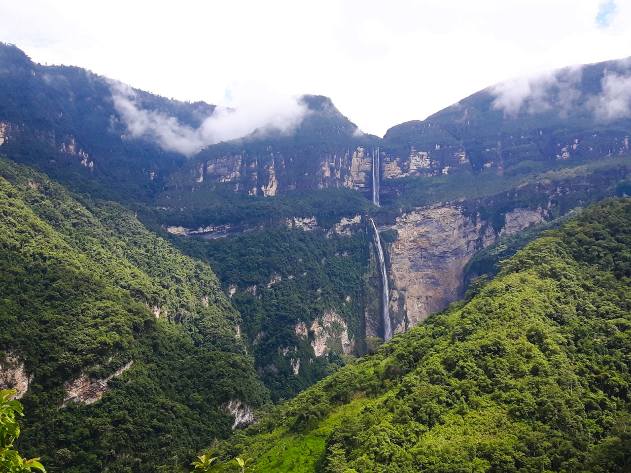
The two stages of Gocta Falls.
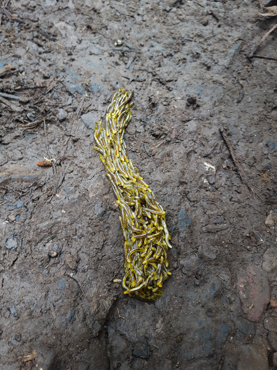
A seething mass of worms.
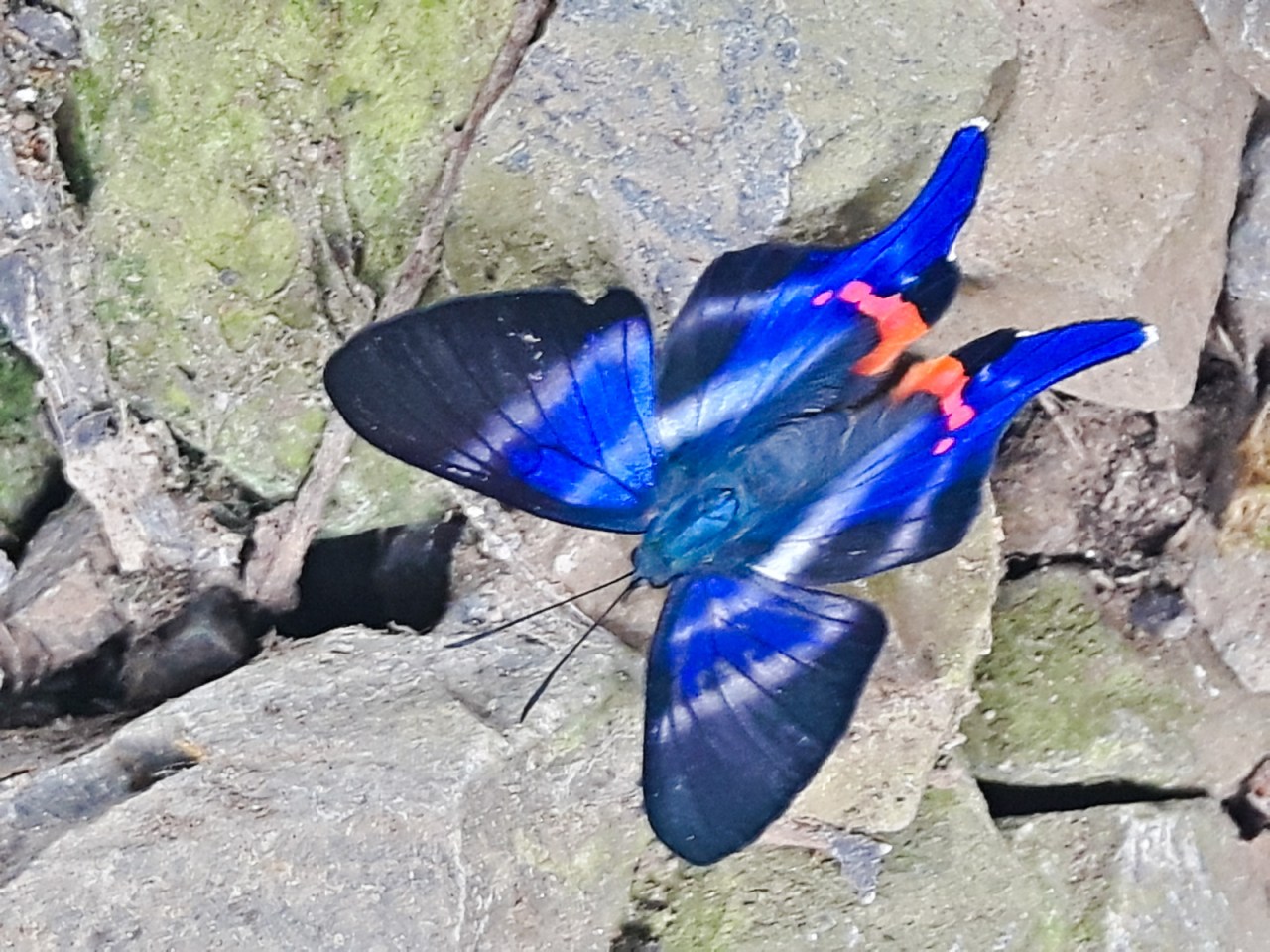
A beautiful blue butterfly.
The hike to Gocta Falls.
The lower drop of Gocta Falls.
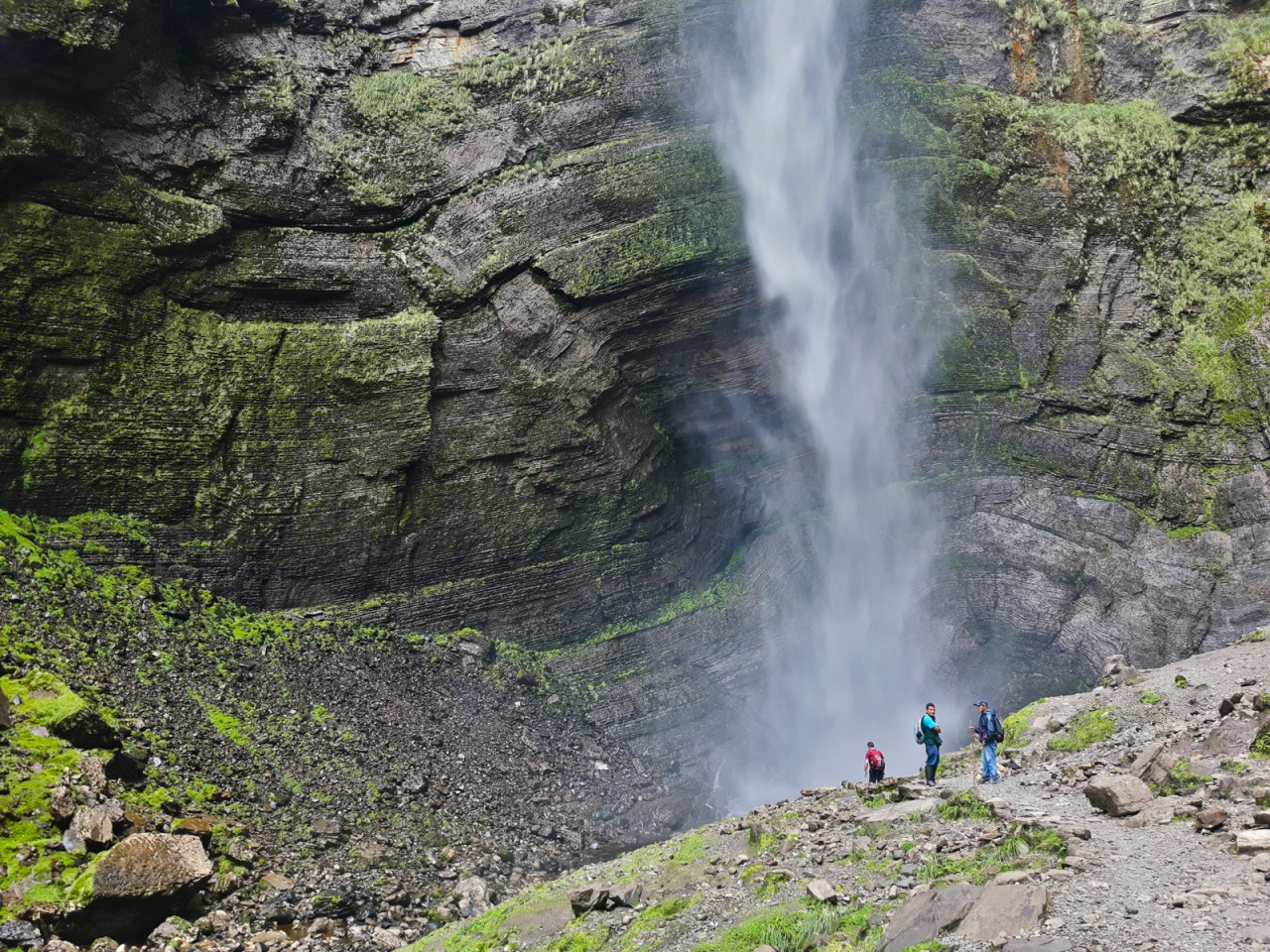
At the base of Gotca Falls.
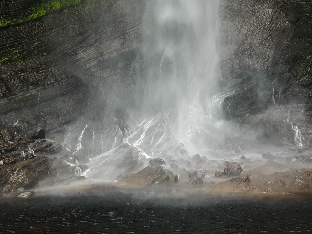
Gocta Falls drops in a thick mist.

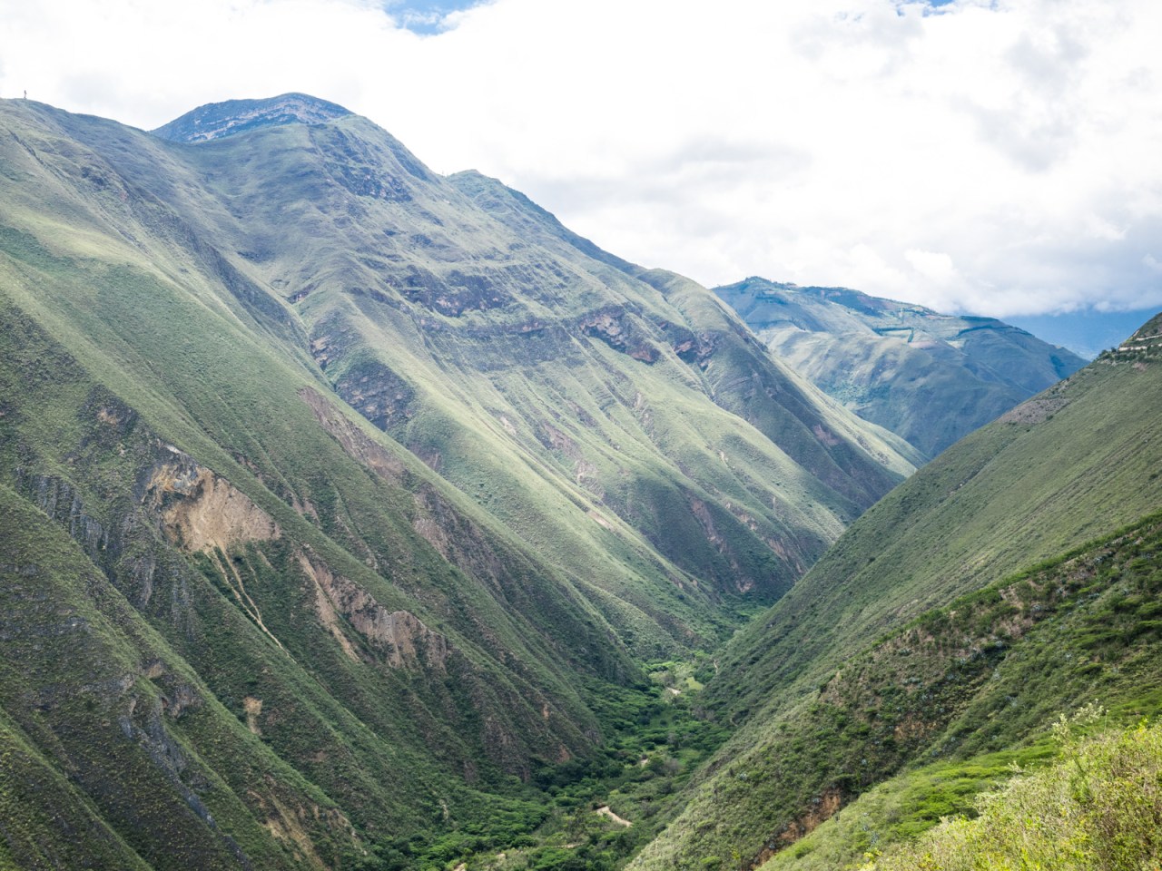
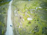
The area around Chachapoyas is home to huge canyons.
That night was Christmas Eve, when Peruvians celebrate Christmas. As I rested following the hike, I heard music coming from the street. I ran outside while a group of children accompanied by a band ran paraded up and down the main street. Meanwhile, parents and children were out shopping for Christmas presents.
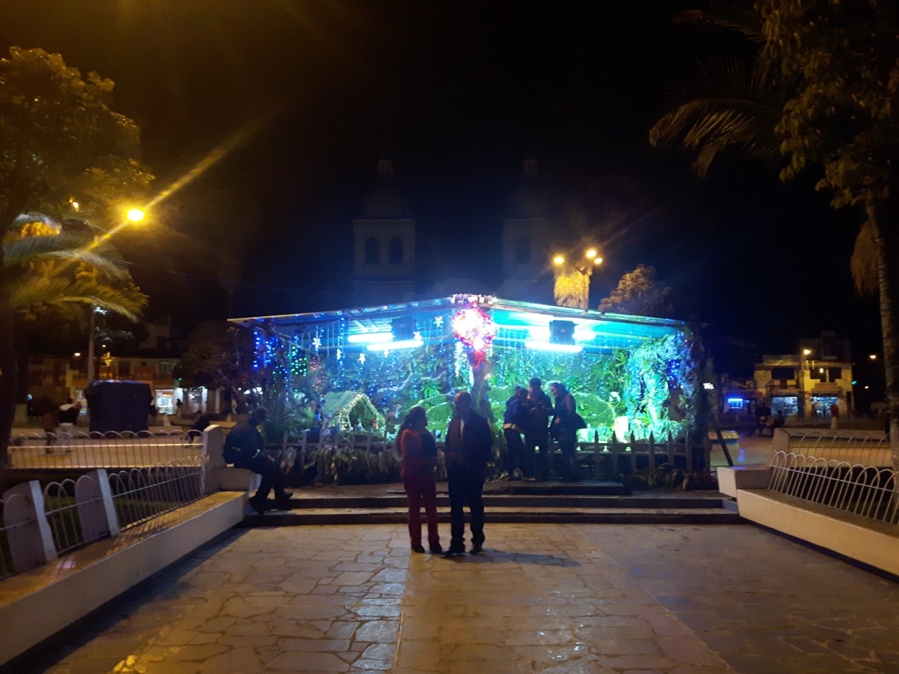
The owners of the hostel organized a group dinner consisting of barbecue chicken, fries and salad. It wasn’t fancy, but it was a nice way to spend the holiday. This was actually the first time I’d spend Christmas away from family, so it was nice to have company. After, we went to the church of the main square, but it was surprisingly quiet in the lead up to midnight mass. I had to hold back my laughter at the nativity display – not because of the scene, but because of the Christmas lights that each played a different song of high-pitched digital midi music. These lights were everywhere, and were just as annoying as you could imagine, especially when there was several sets of lights playing different songs at the same time. In the church, they seemed completely out of place.
I went back to the hostel and was drifting off to sleep when the city erupted in a massive display of fireworks – a Christmas Eve tradition in Peru. I walked up to the hostel roof to take it in and watch the colourful display light up the night sky in all directions. The partying continued late into the night as I slept.
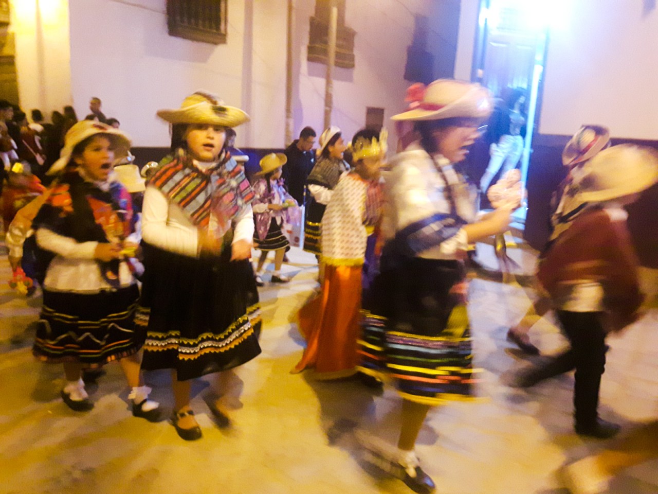
Kids dance in the street on Christmas Eve.

Christmas dinner at Chachapoyas Backpackers.
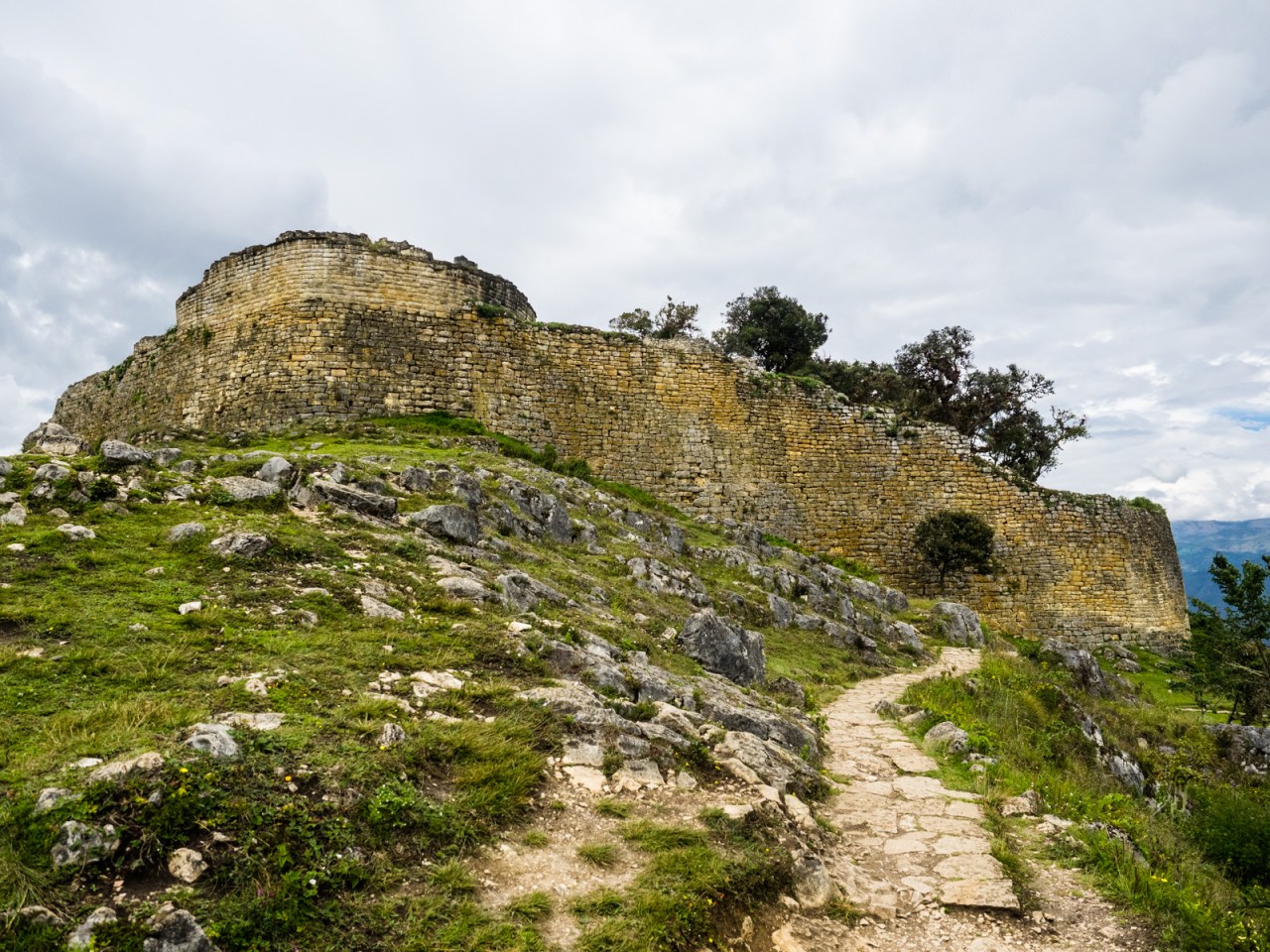
Christmas Day was a lazy one as I got ready for the next stage of my trip. After calling home in the morning to wish my family a merry Christmas, I pretty much did nothing except pack. The following day I set out on my bike with the aim of making it to Nuevo Tingo 30 kilometres south, where I hoped to visit the ruins of Kuelap that were left behind by the ancient Chachapoyan culture. The gondola taking you up to the ruins had been down for a few weeks but fortunately it was up and running when I got there, allowing me to avoid a 30 kilometre, 1,000 metre climb to the site, that in all honesty I probably would have skipped.
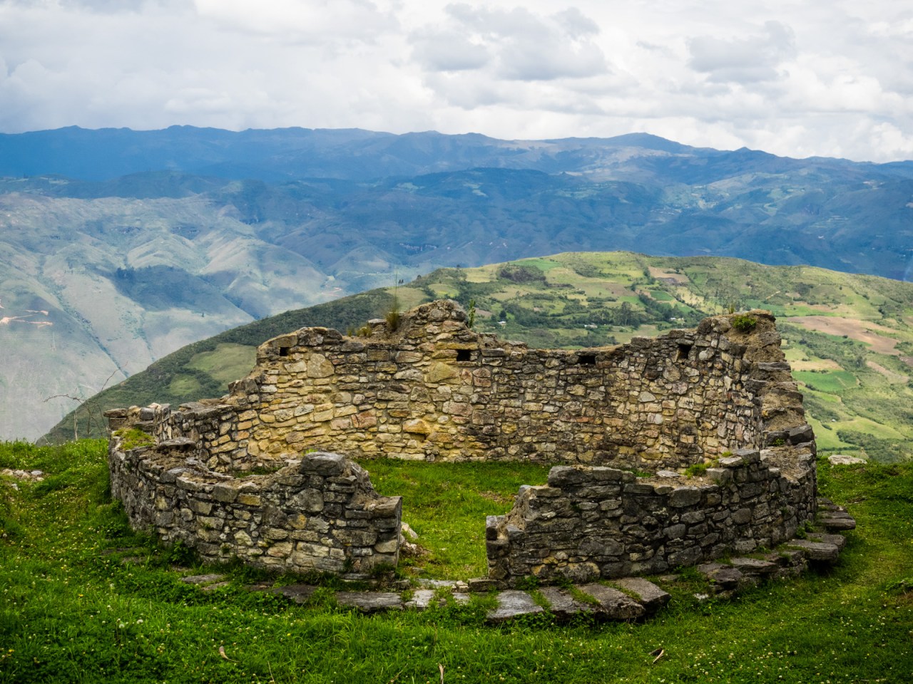
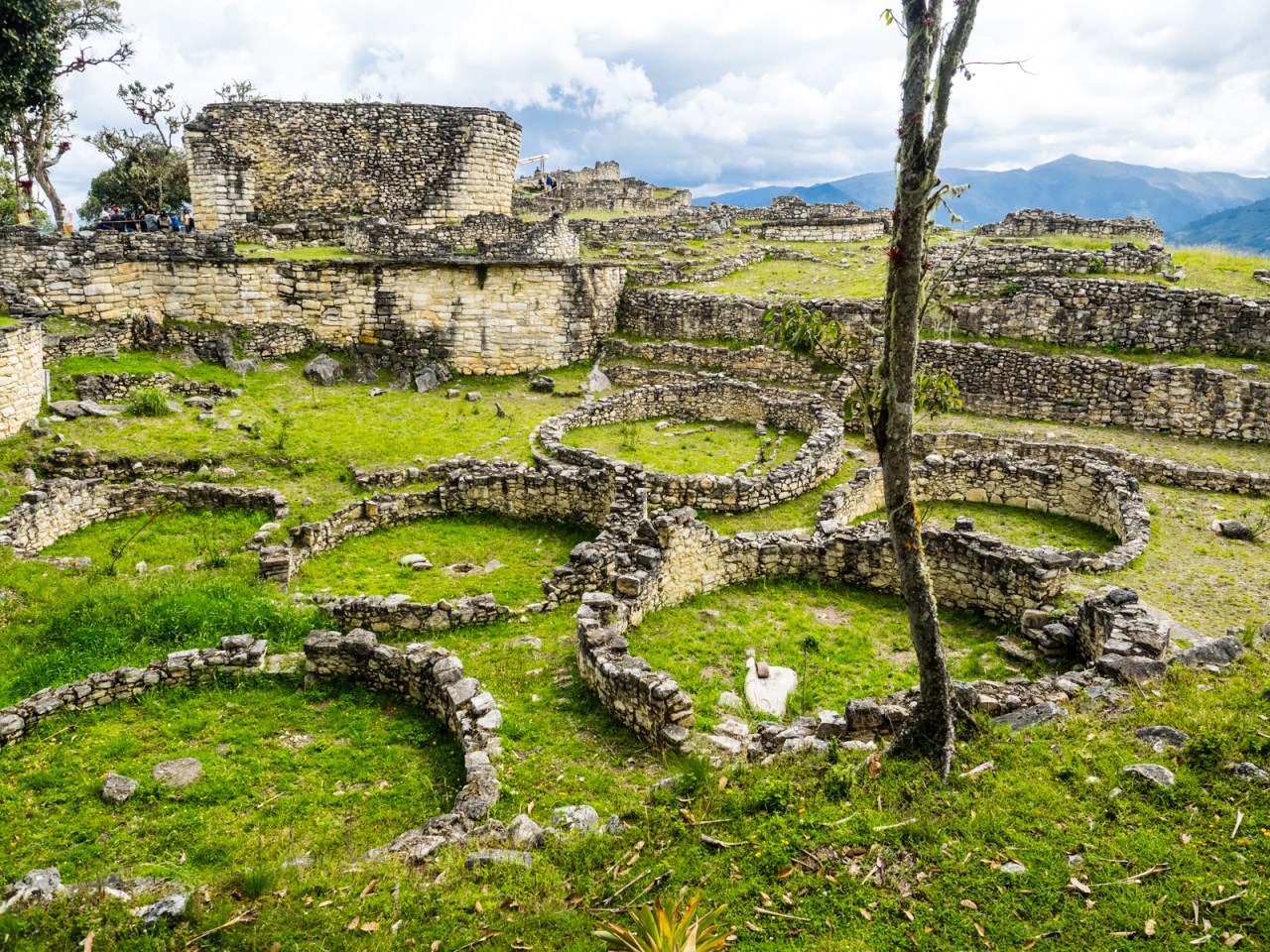
Kuelap is perched on top of a mountain, providing amazing views of the surrounding area, though I imagine for the Chachapoyan’s the draw of the site was more strategic than scenic. The tourist brochures for Kuelap call it the Macchu Pichu of northern Peru, and I guess I’ll see how they compare in a few months. After hopping on the gondola, I strolled around the site for a few hours, taking in the great walls, circular houses and temple structures left behind by the Chachapoyan people, while trying to stay away from the tour groups the improved infrastructure has enabled. Kuelap is a huge site, but only a small part has been excavated and I suspect it will continue to grow in popularity.
Fred and the Utcubamba River.
The view from the gondola to Kuelap.
Before they built the gondola to Kuelap, the only way up was a 35 kilometre dirt road
The walls of Kuelap.

The entrance to Kuelap.

One of the major structures of Kuelap.
The people of Kuelap lived in circular homes.

A few llama live amongst the ruins.
Kuelap was a major centre before it fell due to infighting prior to the rival of the Inca.
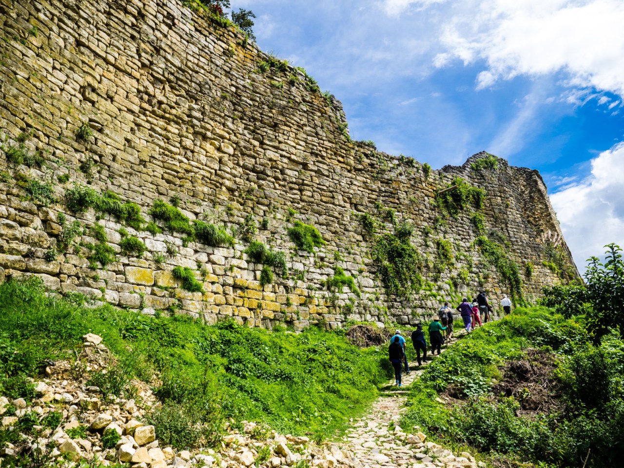
The walls of Kuelap.
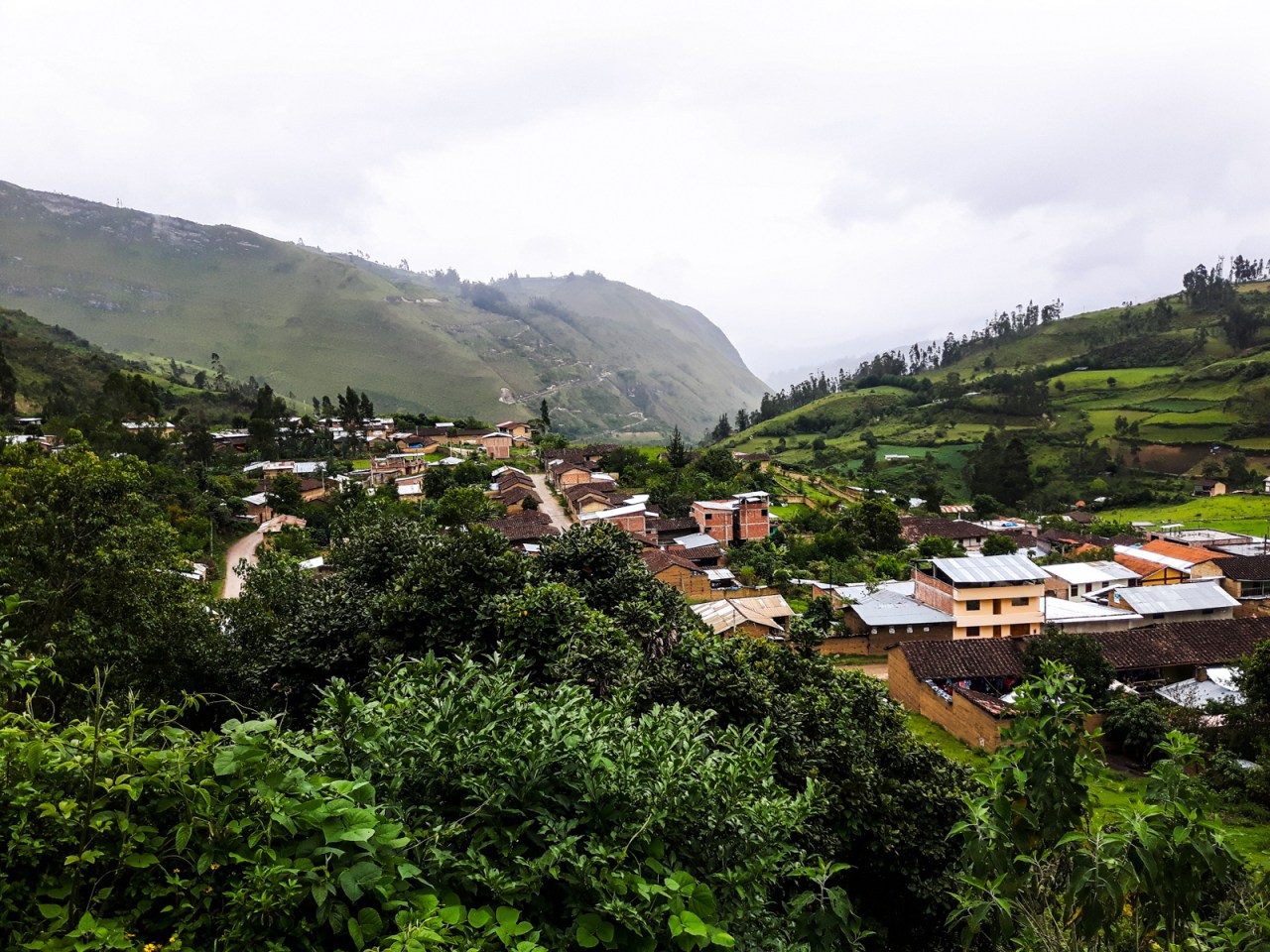
I stayed in a cheap hostel in Nuevo Tingo that night and the following morning I set off for my first big day of riding in a while, heading south towards a 3,600 metre pass. The narrow road followed the Utcubamba River south to Leymebamba before beginning the long climb to Calla Calla Pass, where I hoped to sleep in an abandoned building I’d read about in another bike tourers blog. I had a great cheap breakfast about an hour into the day, and an overpriced but tasty lunch at a cafe outside the Leymebamba Museum. Unfortunately, the museum, which is home to a collection of mummies and other curios found nearby, was closed for the holidays, so I pedaled on, eager to tackle the long climb ahead of me before dark. Light was quickly fading when the concrete shack I was looking for appeared around a bend in the road, and I happily bunked down for the night.
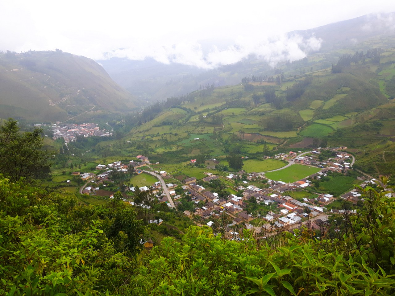
Looking down on Tingo from Nuevo Tingo. Tingo was mostly destroyed in a flood in 1993, prompting the construction of the new village up the hill.
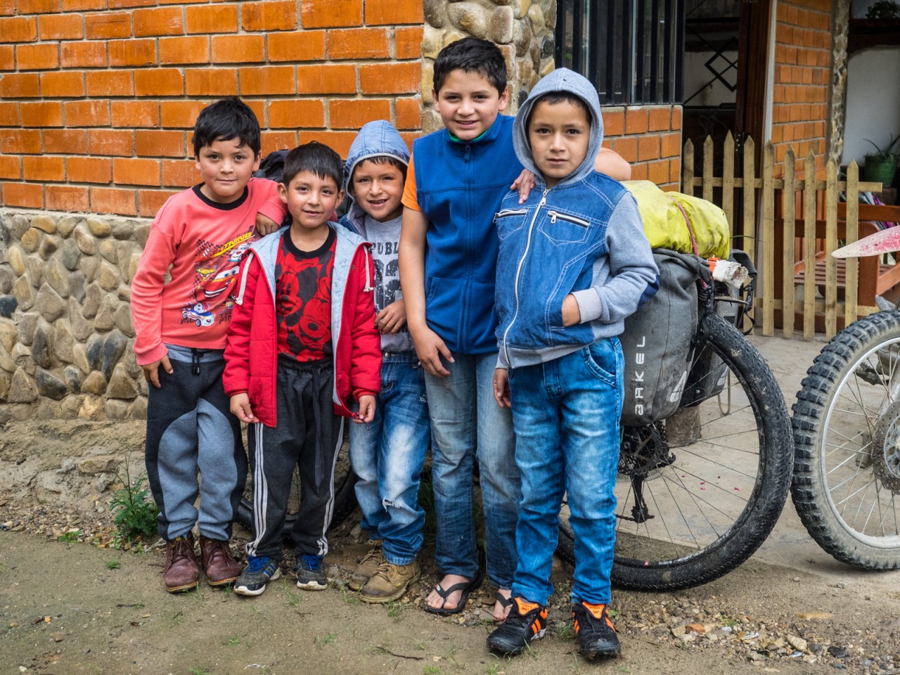
Kids gather around my bike during a breakfast stop on the way to Leymebamba.
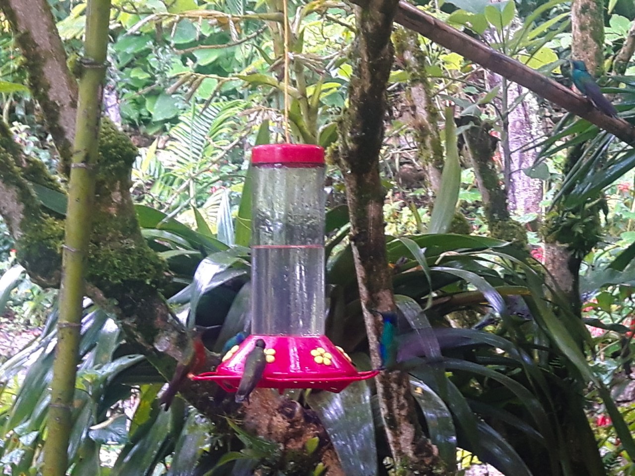
Hummingbirds at lunch.
Leymebamba.

Pedaling up from Leymebamba.

A dry place to spend the night at 3,600 metres is always welcome.
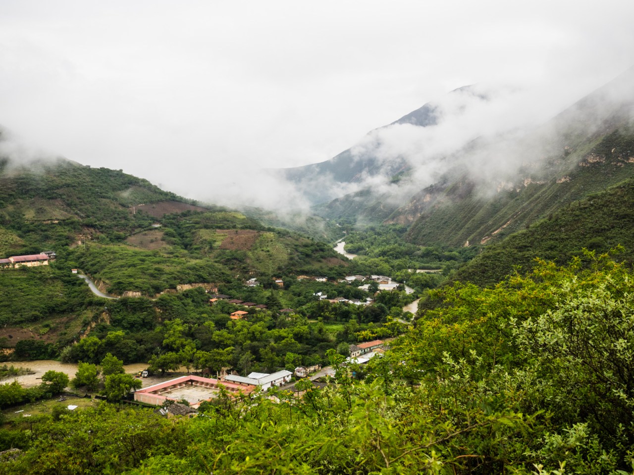
I set off the next morning and right away saw a sign saying Celendin – 115 kilometres. Sounds like a challenge, I thought, and right away I set a goal to make it. It was definitely ambitious, but I knew my day would start with a 60 kilometre descent into the Maranon River valley, so it seemed possible, though afterwards I would have to climb for 45 kilometres, so maybe not.
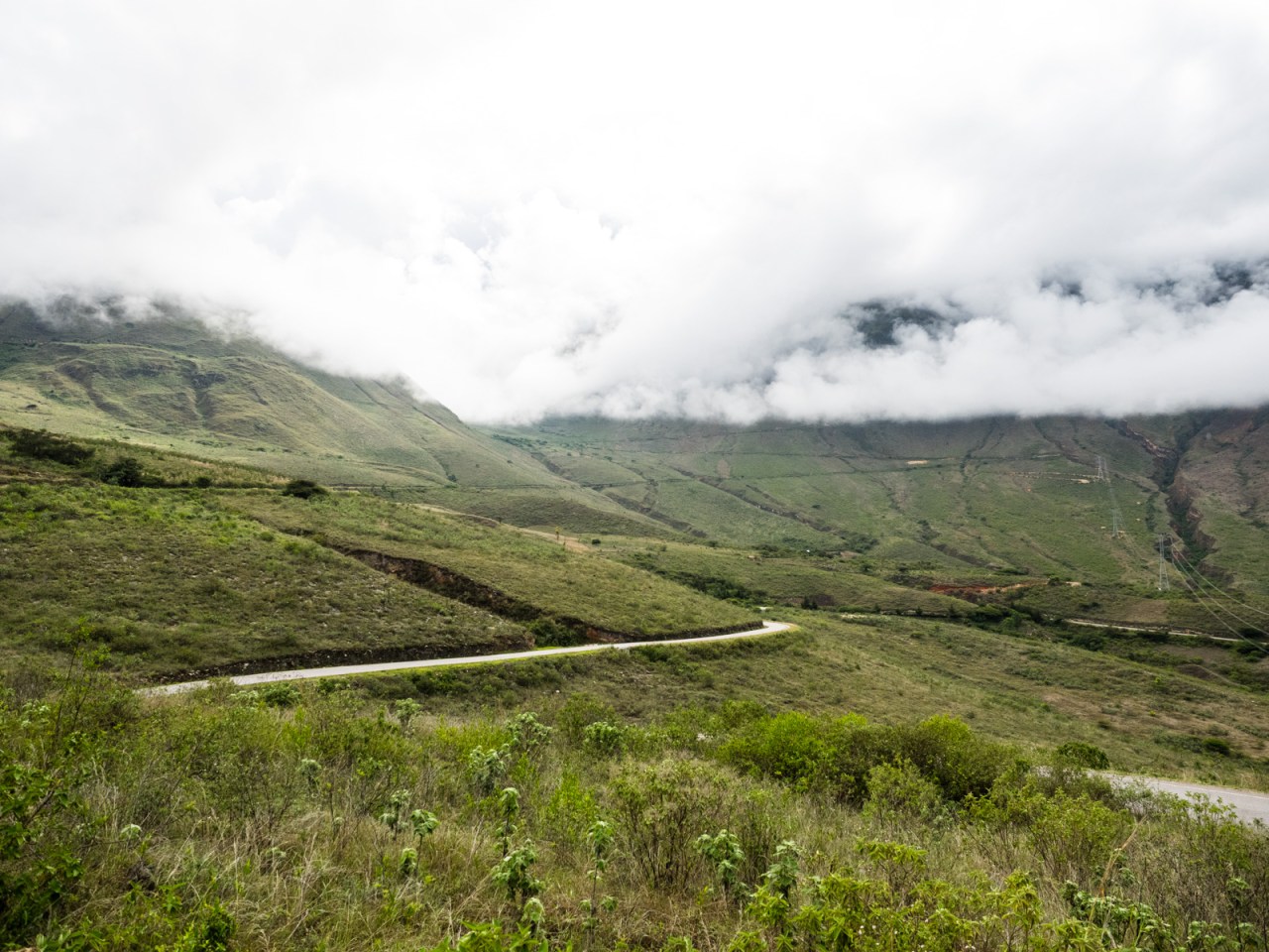
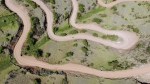
The descent was incredible – 60 kilometre and 2,800 metres of downhill from the alpine pass to the desert valley below. The road seemed impossible as it curved along the steep mountainsides, swerving and switchbacking forever downward. There was almost no traffic and the grade was just low enough that you could lay off the brakes and still maintain a fast but comfortable speed. Down and down I went, through the occasional tiny settlement, but mostly it was just me, the road, and the towering cliffs above and below. After 2.5 hours (I was slowed down by taking picture taking) I reached the town of Balsas in the valley bottom, where I loaded up on food and prepared myself mentally for what was to come – a 45 kilometre climb back up to 3,100 metres above sea level.

Calla Calla Pass – what a place to start a day.
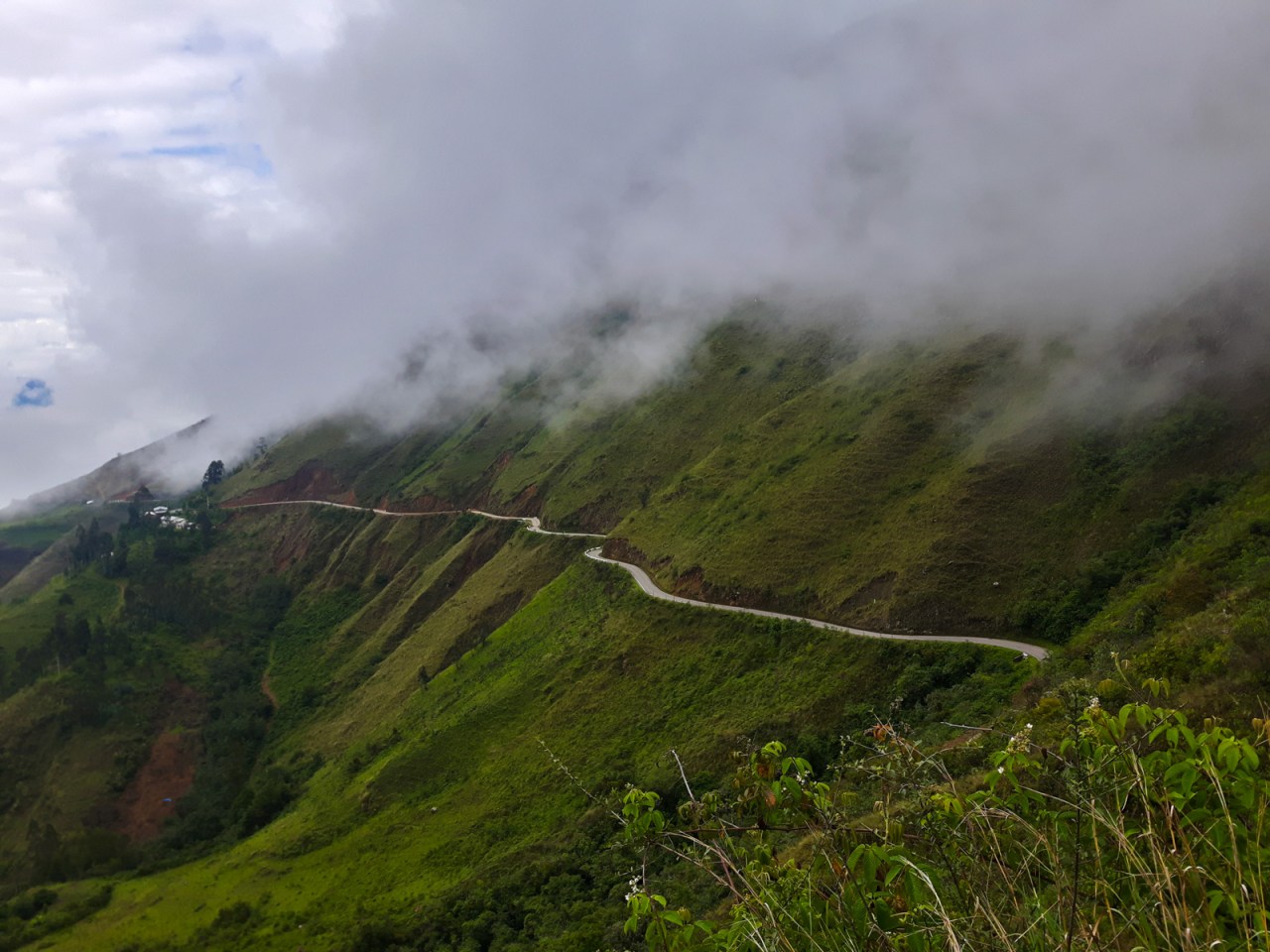
Peruvian Roads go through the most amazing places.
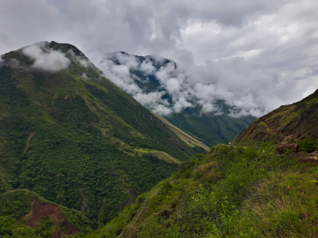
The views down from Calla Calla were amazing.

At 2,800 metres, the descent to the Maranon River was my longest of the trip.
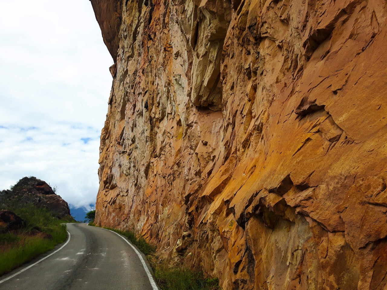
The road was built into the canyon walls, and was only paved a few years ago, making a multi-day journey much shorter.
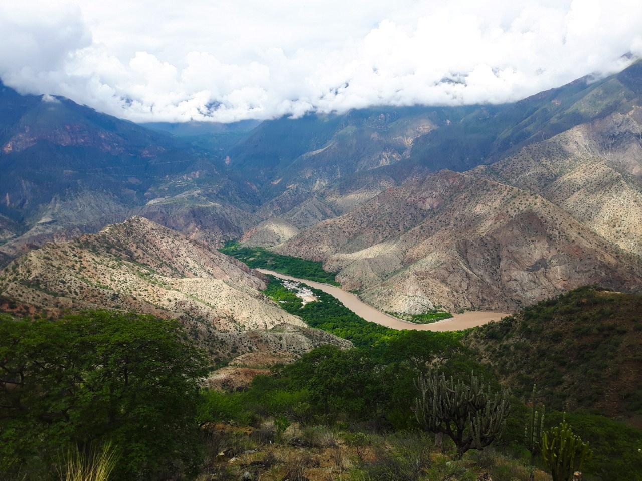
The Maranon River is considered the source of the Amazon.
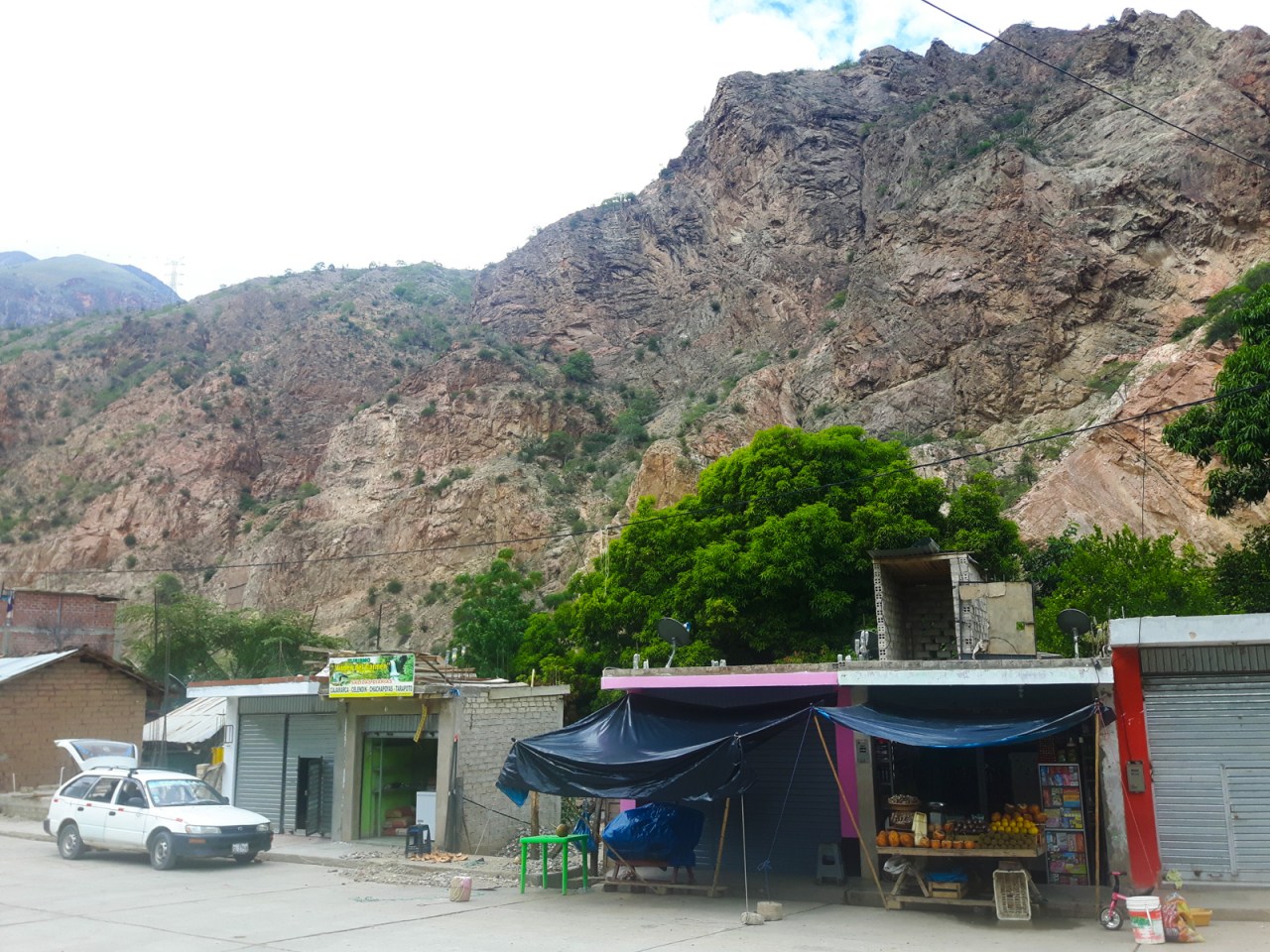
The dusty down of Balsas sits at 800 metres.
The climb seemed endless as I transitioned from low-lying desert to productive farmland. The road wasn’t as dramatic as the one I’d come down earlier, but the views certainly were, as I could constantly look back across the valley at what I had just come down, and look up at the never ending switchbacks to come. I pedaled forever upwards and it took much longer than I though to get to the top. Camping spots were rare and the lure of a good meal and a hotel bed in Celendin propelled me onwards. As the clock ticked past six, and with five kilometres left to climb, I knew I was running short of time. I stepped up the pace, pushing as hard as I could to reach the top. Finally, at about 6:30, with the light fading, Celendin came into view below me. I raced darkness down the hill as fast I could, worrying about my cold hands and keeping an eye out for any traffic. I reached the outskirts of Celendin just as it got dark and made my way to the main square, where I settled into the Mi Posada hostel before going out for two meal – a burger, followed by Chinese food, because I was so hungry after such a big day and the burger wasn’t enough.

The climb out of Balsa started in cactus country.
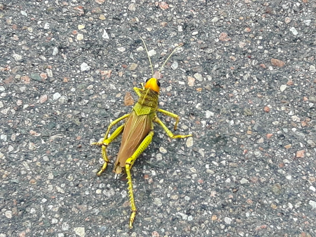
I passed this huge grasshopper on the way up.
These roads aren’t easy to drive. Even the best need a little help.

Eventually the climb emerged from the desert into typical South American farmland.
Looking forward, I could see the road switchbacking up the mountain.

Looking back, the views were amazing…
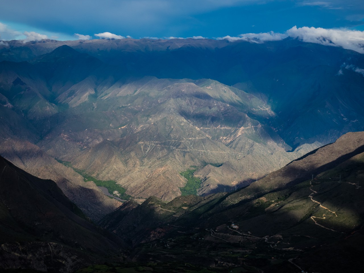
I could see the road I had come down that morning across the Maranon River valley.
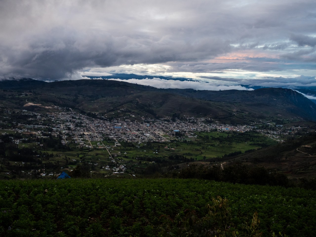
Celendin came into view after a long, long climb.
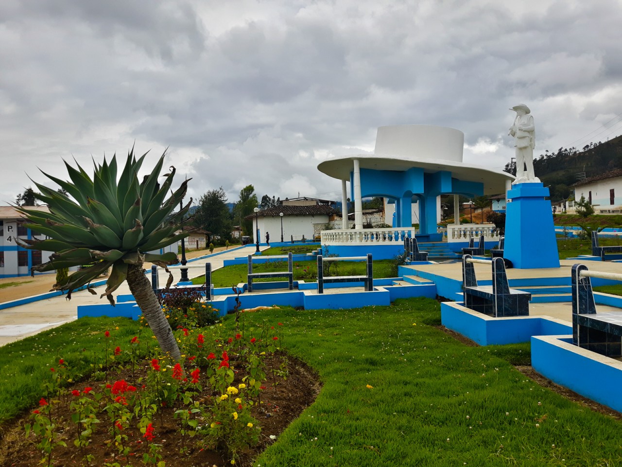
Christmas celebrations were in full swing in Celendin.
Normally I’d take a day off after such a big effort, but I was keen to make it to Cajamarca before New Years Eve, so I prepared for another day in the saddle. I had a lazy start and didn’t leave Celendin until noon. Cajamarca was 115 kilometres away, and my only goal was to eat into some of that before finding a place to pitch my tent. Of course, the day started with a long climb and I grinded my way slowly upwards. I was no longer on a single-lane highway, but there still wasn’t much traffic. I had very little energy, both physically and mentally, and the going was slow. And then the rain started – first a light drizzle, and then a torrential downpour. At about 3:30, some 30 kilometres out of Celendin, I found shelter under the awning of a school. With the rain showing no signs of stopping, I settled in for the night, laying out my air mattress and sleeping bag on the dry concrete pad. A water spout and a shed that blocked the view from the road made this a particularly great place to sleep.
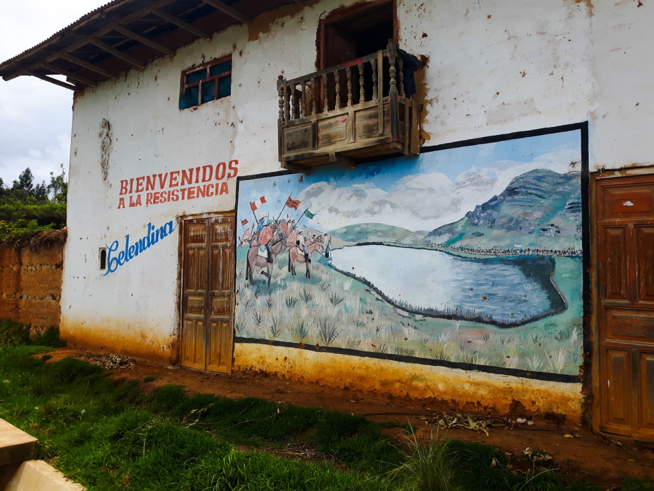
A mural on the way out of Celendin.
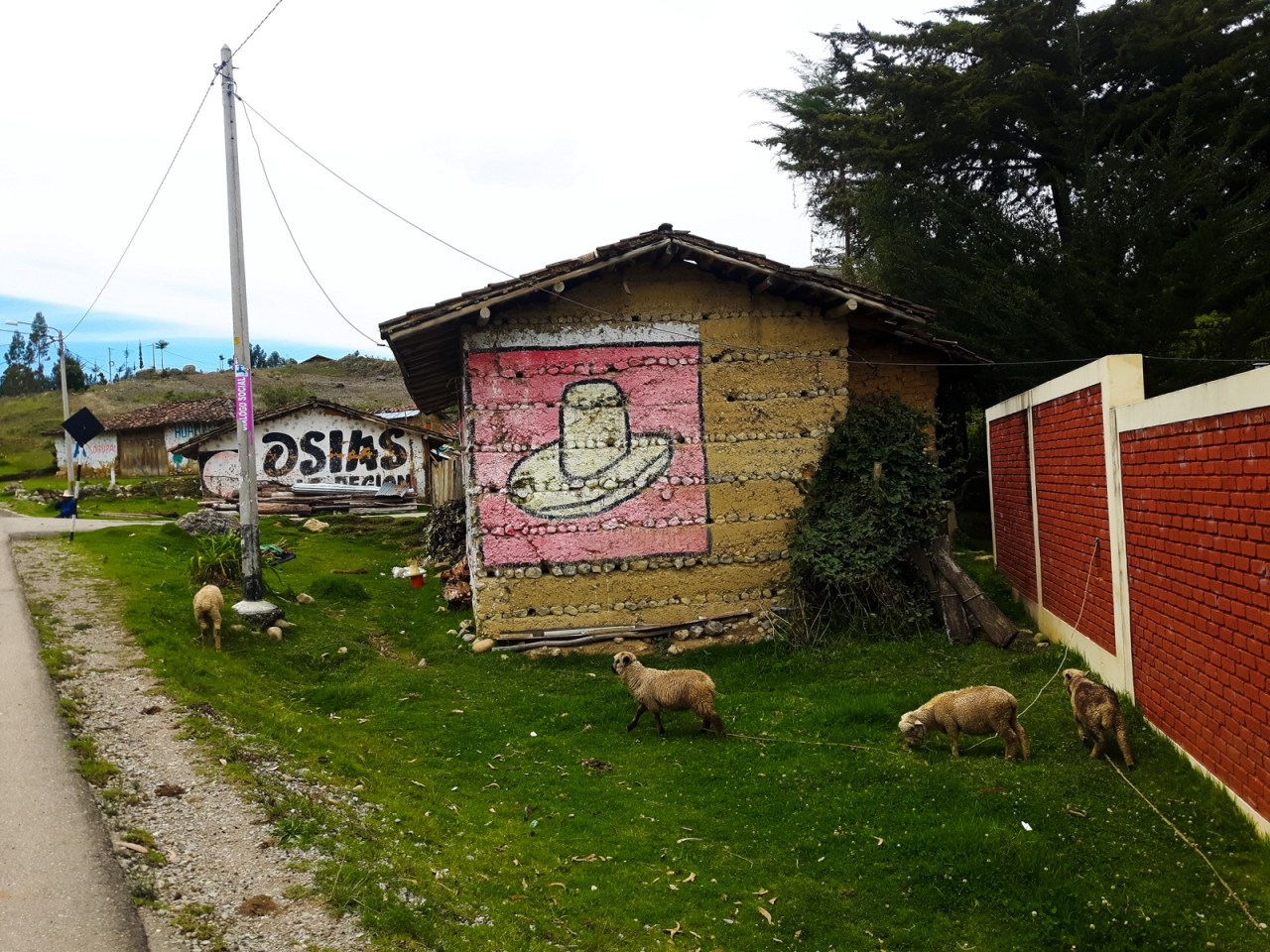
White hats are part of traditional wear in northern Peru, and nowhere is it more prominent than in Celendin.
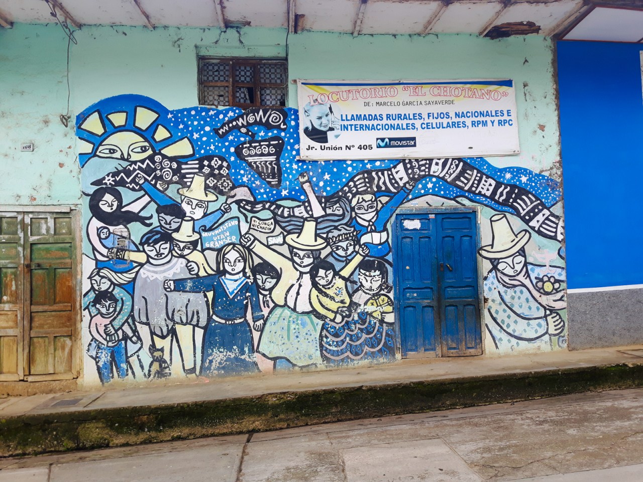
More political graffiti near Celendin.
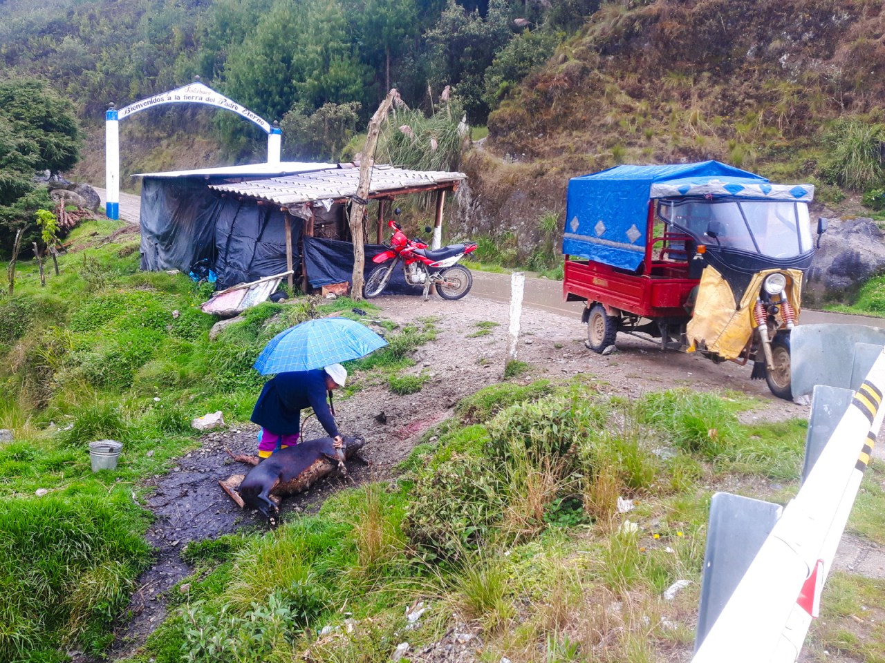
Yes, that is a woman blowtorching a pig at the side of the road.

When the rain came, I found refuge at this rural school.

The next morning I was treated to a beautiful sunrise without even having to get up.
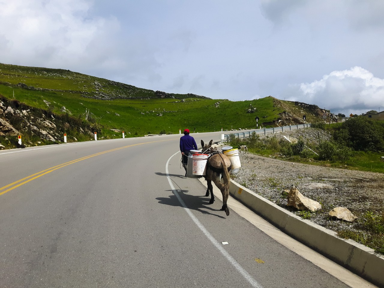
This highway was only paved recently, and donkeys are just as common as cars on it.
One of the many, many political signs adorning local homes.
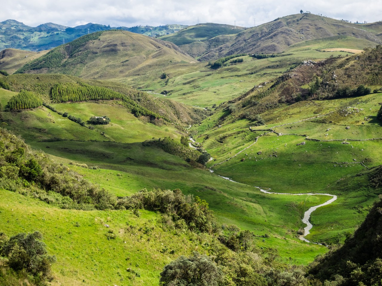
The lush farmland on the way to Cajamarca.
I woke up the next morning to a glorious sunrise. I got on my bike early and found out I was just outside a small village, which was hosting a regional market that morning. I felt well rested and had a bit more jump in my legs today. The ride was relatively easy, with more down than up, and a long flat stretch, and cruised through to Cajamarca, reaching the city by mid-afternoon. After five days in the saddle, I was ready for a few days off, and I was eager to explore Cajamarca, which my parents had visited during their trip to Peru in 1972.
You can view the GPS track for this route here: https://ridewithgps.com/routes/26717130


Hi Alex,
Your Mom just sent these beautiful pictures to me. What an awesome undertaking!
With admiration,
Bonnie
LikeLike
Hi. A really nice post. I am thinking of driving Chachapoyas to Cajamarca in my Kia Roi (I live in Trujillo) However, I was always told that the road was not good other than for a 4 x 4. Your posts seems to indicate it is a new road that is fine. Is that correct. Many thanks.
LikeLike
Hi Kevin, sorry for the late response. The road is completely paved and at a gentle grade so you will be fine. Just take it slow because it’s a narrow, winding road with some steep drop offs. The views are incredible.
LikeLike