Mount Cartier is a bucket list bike ride for many in Revelstoke. Towering more than 2,000 metres above the Columbia River, many years ago the BC Forest Service established a fire lookout right near the top.
And to get there, they built a trail.
I don’t know when the first people rode a bike down the Mount Cartier trail, but I know it’s a popular heli-drop for people with money, and a grueling push for masochists.
The trail itself is a mix of flowy singletrack, technical roots and rocks, and narrow, exposed sections in the alpine not much wider than your bike. It’s been improved in recent years as commercial operations started offering trips up there and needed to make the trail friendlier to the public (and more sustainable), but when I rode it in 2013, it was still very rough and wild. The top sections where it switchbacks across the massive Greenslide avalanche path were especially intimidating. One misstep and it’s easy to imagine trundling right down to the river, following the path created by many monstrous avalanche.
I did the hike-a-bike in July 2013. I was a last-minute invite to a big group of very fit people and I was not prepared. I didn’t pack the right food, I didn’t sleep well the night before, and I’m held up as an example of bike ride lack-of-preparation because I neglected to change my rear brake pad the night before and instead found myself scrambling to replace it at the summit. I suffered on the climb and struggled massively on the descent.
Of course, I brought my camera with me to document the ride. It was a great excuse to catch a breath while my fitter friends did the heavy work of clearing away more than 50 trees.
Here it is – 20 photos from Mount Cartier.

Starting out. Only 15 kilometres and 2,000+ metres of climbing to go.

At the bridge over McKay Creek, where the real climbing begins.

We ran into a lot of downed trees on the way up, which we cut away as we went. The work gave me a chance to catch up. I helped out when I could, but mostly I was happy to take it easy.
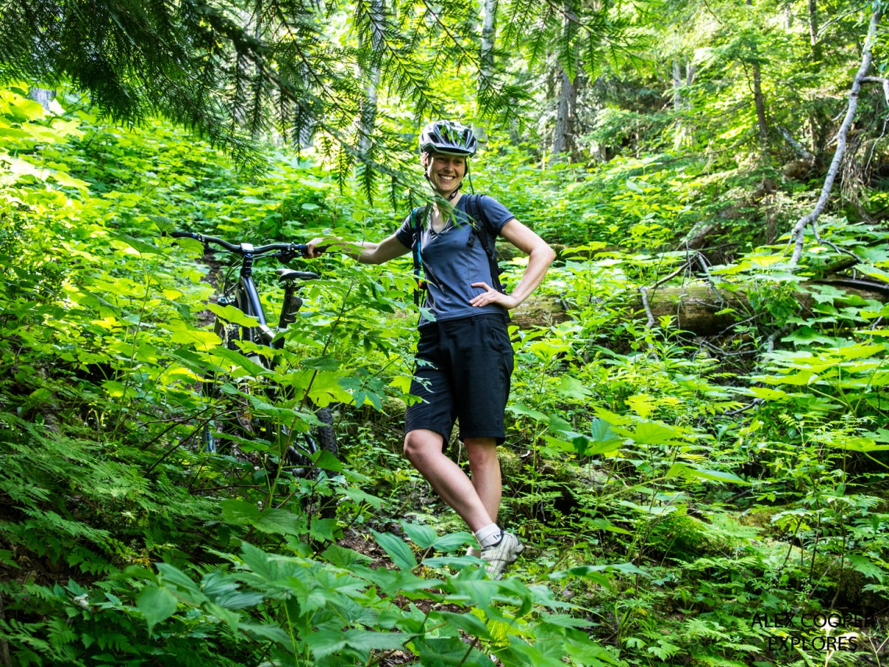
Carol supervises as the boys work the saws.

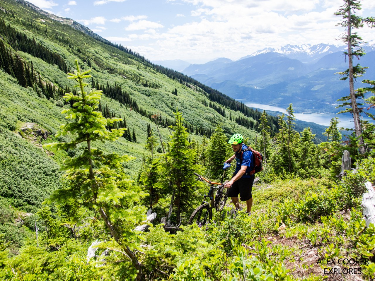
When a trail is this long and climbs this much, sometimes it’s easier to just carry your bike, as Nash Masson demonstrates.

Others, like Mark Bender, choose to push.
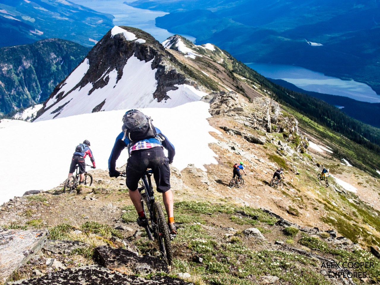
About 10 kilometres up the trail skirts the edge of the Greenslide path. It’s the biggest avalanche path over a road in B.C. When it goes, it goes huge!

The higher you get, the better the views get. This is looking over at Mount Begbie (on the right) and the Mulvehill range.
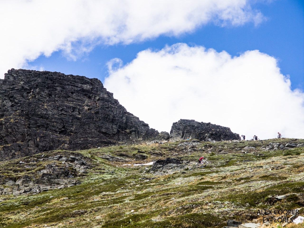
After a whole lot of pushing, and not much pedaling, we near the top.
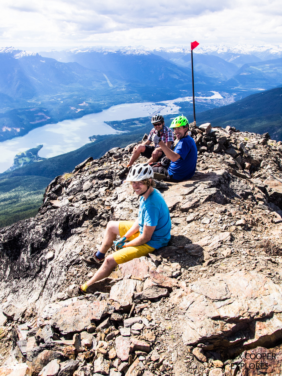
And hear we are, on the summit, at 2,610 metres above sea level. Matt brought a beer to celebrate.

The old fire lookout has been restored and maintained and is now the site of a radio repeater. Did I mention the views down the Upper Arrow Lake are incredible from up here?

Looking into the fire lookout, with crazy cloud reflections.
And the fun begins. This was one of those “pick up the camera and shoot” photos that turned out pretty great.

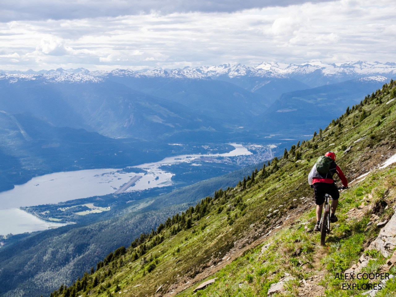
Nash, one of the best bikers I know, leads the way down the mountain. It’s a long way down.

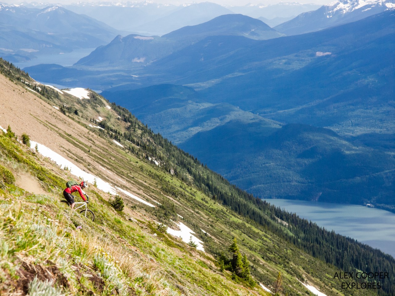
Henning Schipper indulged me by waiting as I took photos while everyone else sped on ahead. Eventually he sped off too, but he did wait lower down while I struggled.
The trail through the Greenslide is very narrow at points. That’s Revelstoke off in the distance.
More beautiful views of the Upper Arrow Lake and the Monashee Mountains.

Nash rides the north ridge, with the summit looming above.

From there down, no one wanted to wait for me to take photos. I struggled the whole way down, but eventually made it back to the truck and beer in one piece.


Just curious if you were able to go inside the hut (saw your pic of the outside so I’m wondering if it was locked/closed)
LikeLike