They say it’s the rainy season in Colombia and I believe it, though until a few days ago, it hadn’t affected my trip. I only got stuck riding in a torrential downpour once, and that was on pavement and was mostly downhill. Plus it was pretty hot that day, I was on my way to a hostel and had laundry in my sights, so it wasn’t too bad. Other than that, I experienced some light drizzle and it rained frequently at night, but I somehow always managed to camp under a shelter when it did.
That changed the morning I started on the infamous Trampolin de la Muerte in southern Colombia, aka the Trampoline of Death, a road reputed as one of the wildest in a country full of them. Finally, I bore the full brunt of a tropical mountain rain fall, in a part of a country where more than 300 people died in a tragic landslide earlier this year.
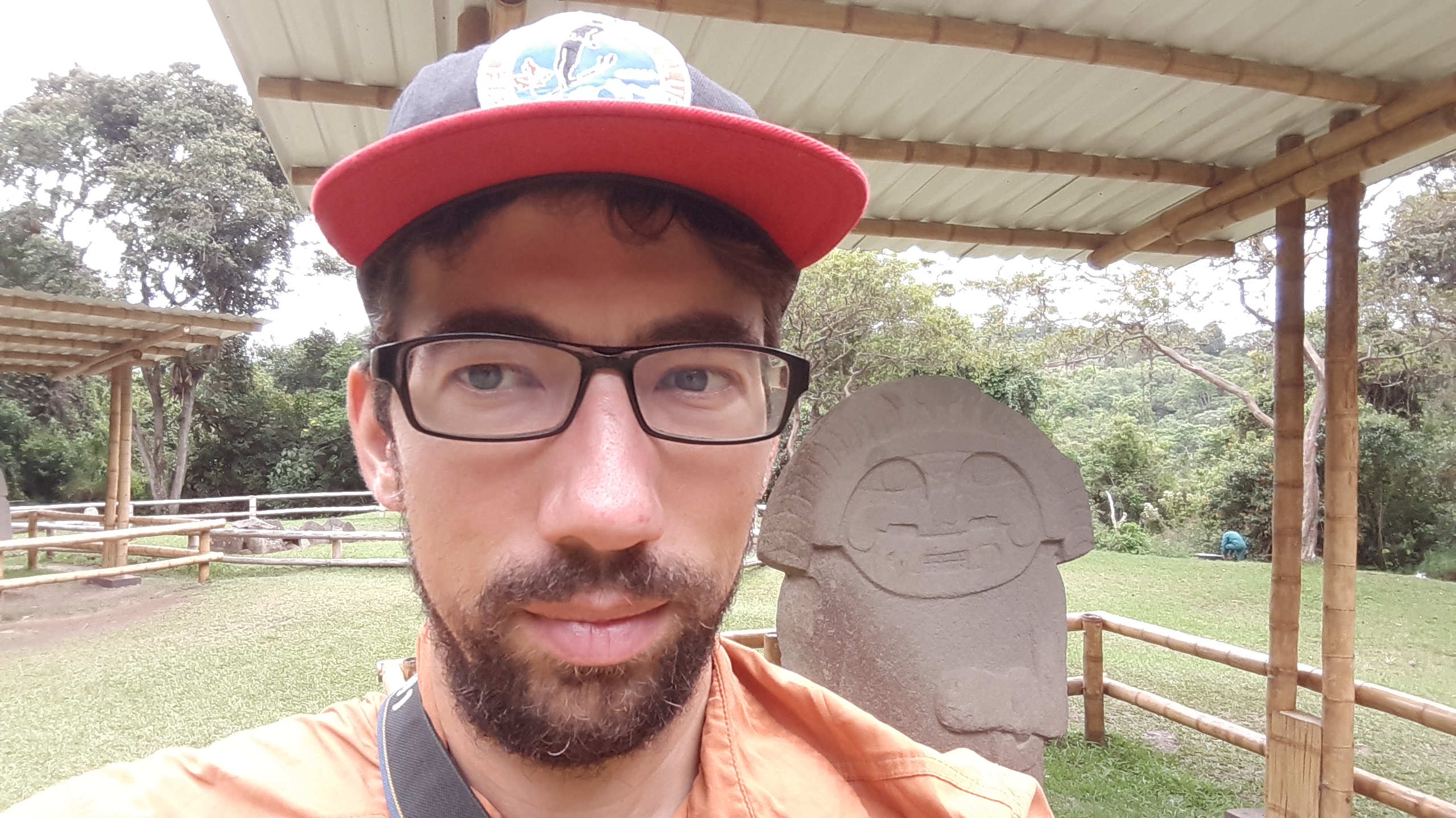
First, let’s backtrack to the night I left Ibague. The night bus to Pitallito was as expected – there wasn’t enough leg room and I slept poorly as the bus sped down the winding highway. I did doze off for a bit, but mostly I swayed in my seat while the bus carromed down the road. My destination was San Agustin, which was formerly home to a society that became famous for its giant stone carvings. Getting there meant climbing off the bus and pedaling 30 kilometres, mostly uphill, before checking into a hostel and promptly setting off to the archaeological park where the statues are located.
I’m torn on whether the detour was worth it. The carvings were interesting and the park museum had a good display on the cultures that created them. At the same time, I got caught exploring the area with a school group and I was exhausted from the lack of sleep the previous night. That and the next two days riding to Mocoa were the least inspiring of the trip and I wondered if I should take the bus the whole way. Or maybe I should have just slowed down a little and spent more time in San Agustin?


The one upside to the stop is I met another bike tourer at the hostel in San Augustin – William, a Bogotan who’s cycling to southern Brazil along a similar route to me, though he said he loved pavement, whereas I prefer dirt. He was leaving for Mocoa at seven the next morning but I wasn’t up for an early start after my overnight bus journey so I said I would try to catch him on the road, not expecting that to actually happen. He was gone when I woke up so I cooked myself a nice omelet for breakfast and had a leisurely 9:30 a.m. departure.
The road to Mocoa was a matter of grinding out the kilometres. It started flat (!!!), then climbed for 25 kilometres and 900 metres before beginning a long, periodically interrupted 25 kilometre descent. The highway was pretty quiet but the views weren’t as great as I’d grown used to in Colombia. I progressed slowly but surely up the climb, then flew down the descent. I couldn’t believe it when I saw William just ahead of me as we rode into the roadside village of San Juan de Villalobos.
 It was a chance encounter because William speaks Spanish, whereas I can barely get by, and he’s familiar with the local customs. I hung out as he tried to convince the police to let us camp on their lawn for free. When that failed, we ended up at a hospedaje where he negotiated us a rate of 9,000 pesos for the night for a private room each. That’s about $4 CDN. I would not have done so well on my own.
 We set off together the next morning for Mocoa and I quickly found out why I was able to catch up. We climbed at a similar speed but I was much faster on the downs. He also took more and longer photo breaks. After one long wait I opted to ride ahead. I told him where I planned on camping in Mocoa and to look for me there. The remaining 50 kilometres to Mocoa were a series of uninspiring ups and downs as I descended to the edge of the Amazon jungle.

I reached the Posasda Dantayaco around three, set up my tent, and quickly settled into a hammock. I shared the place with a tourism film crew and two others backpackers, and that night we were treated to a performance, though I really just wanted it to stop so I could sleep.
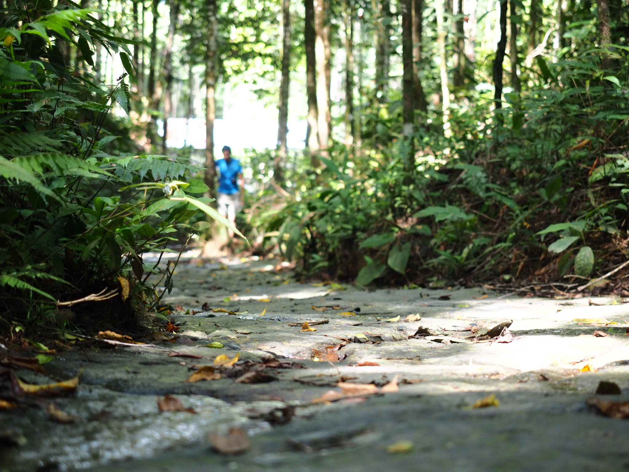
William showed up at the hostel the next morning and we set off with the film crew to hike to the Cascada Fin del Mundo. My plan was to do the walk in the morning and ride in the afternoon but the hike turned out far more beautiful than expected, so that plan went out the window quickly as I heeded my advice to slow down a little.
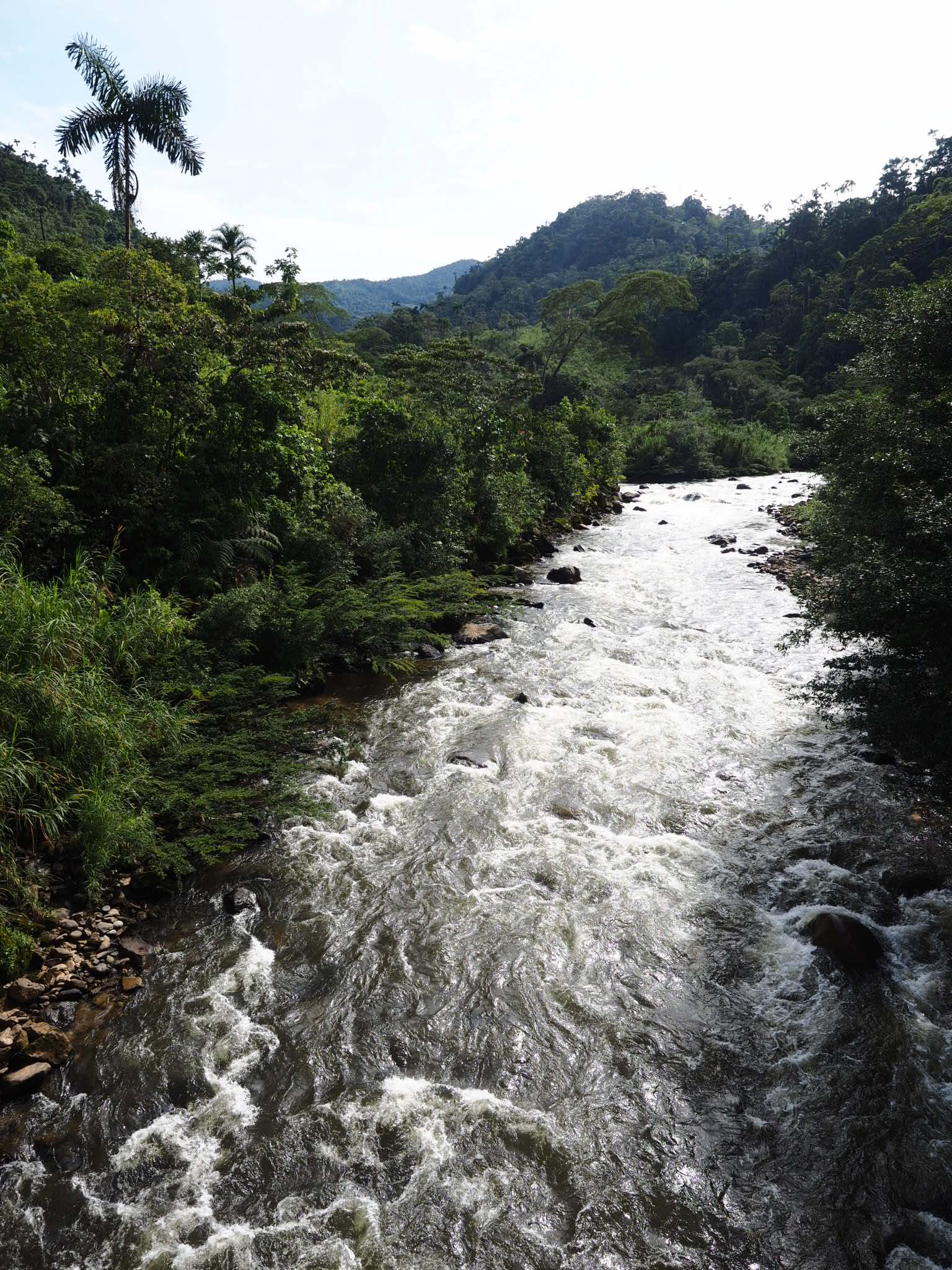
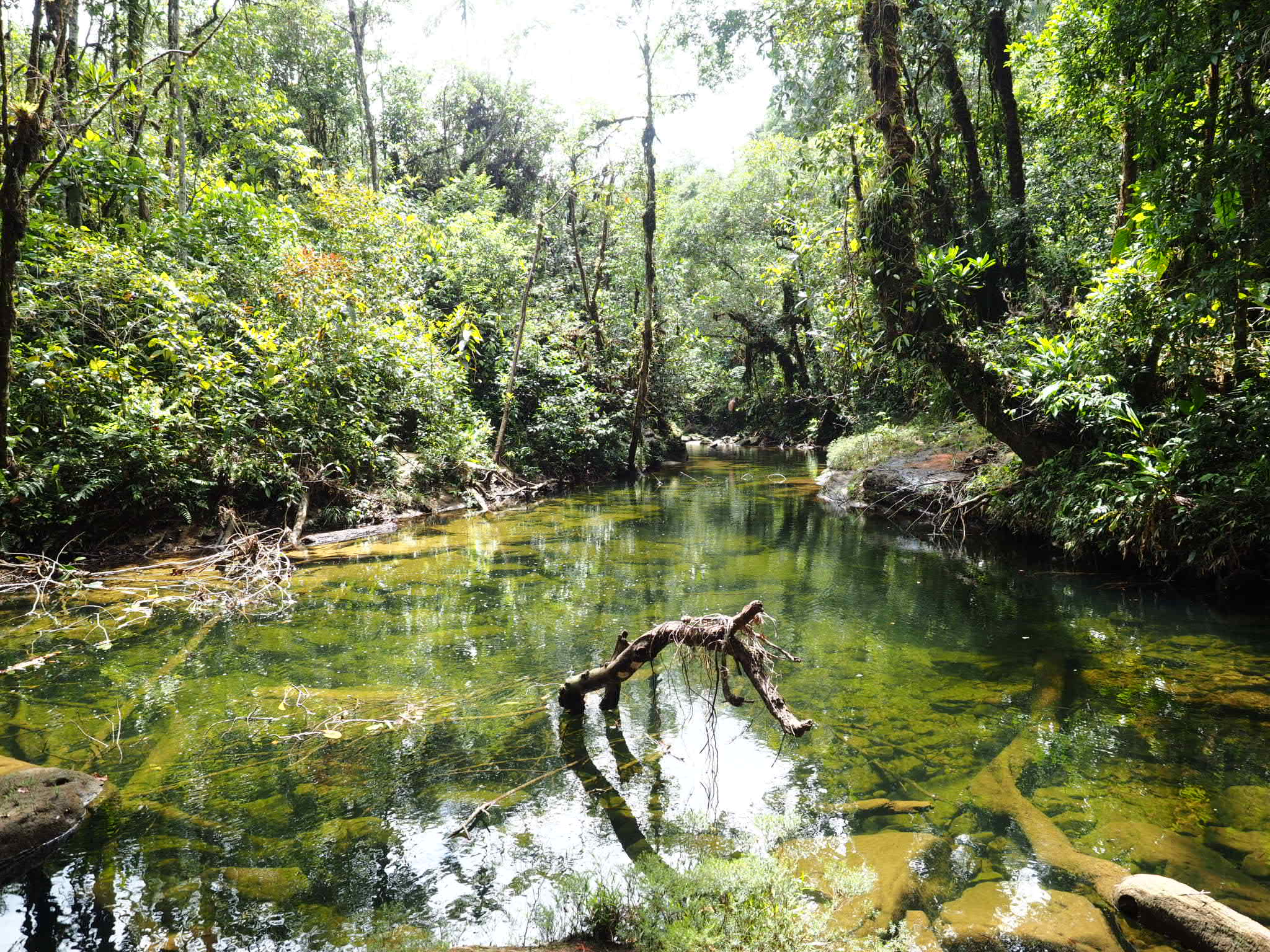
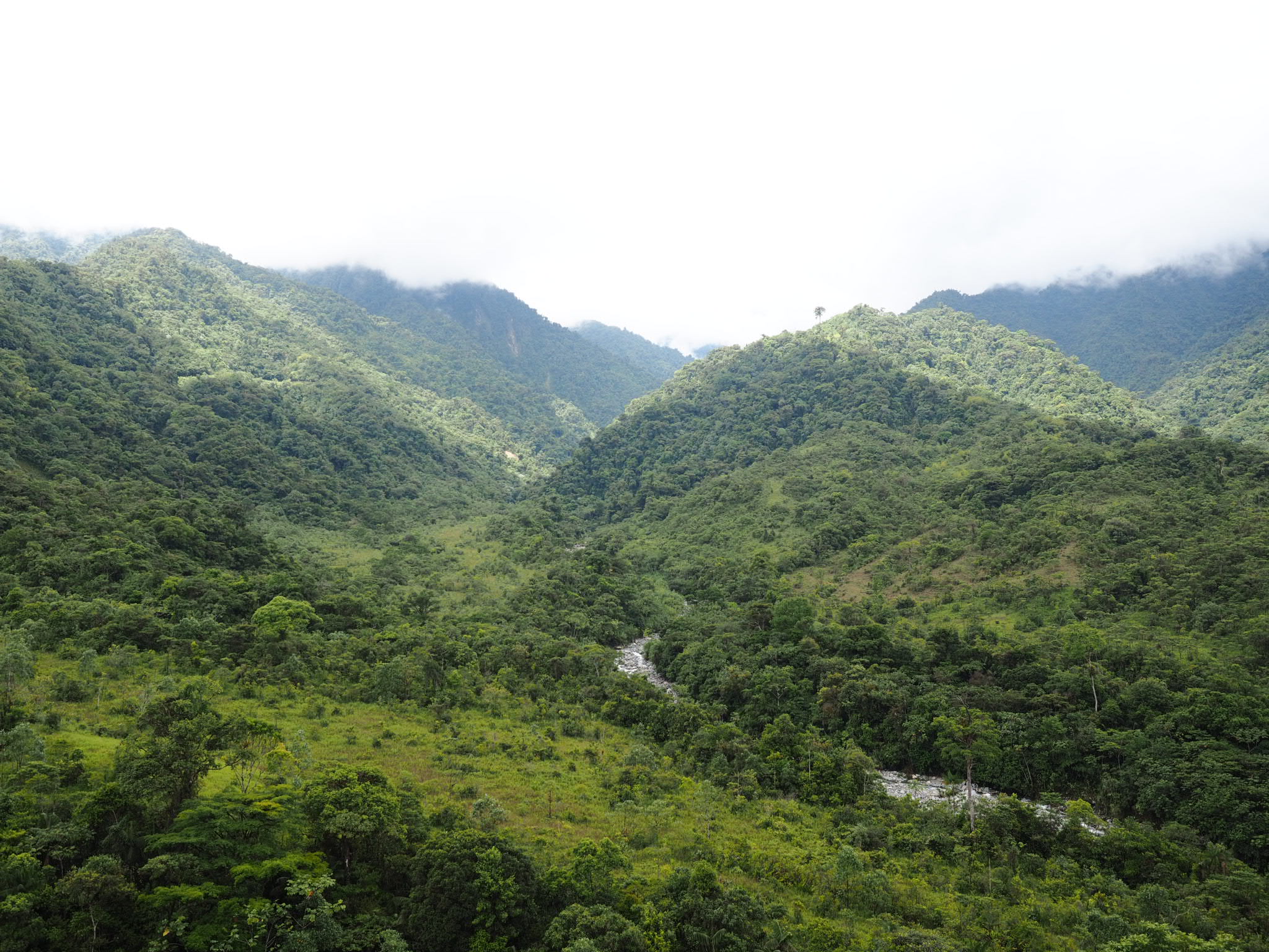
We quickly ditched the film crew as the trail climbed through the jungle before reaching the river. The river tumbled along a series of waterfalls in a narrow valley, culminating in the Fin del Mundo – a 75 metre plunge off an overhanging cliff into the jungle below. From the top, you could look over the jungle to Mocoa in the distance. There was a great swim hole, a few cliff-jumping spots, and a nice but sketchy little restaurant where they served extremely well-cooked meat that had been sitting in the open. I took my chances and didn’t live to regret it. I spent most of the day by the falls. When I got back to the hostel, I unpacked my bags and pitched my tent for a second night there.


 I woke up early the next morning with the dream of tackling the Trampolin de la Muerte in a day. It was only 79 kilometres with 2,300 metres of climbing. No big deal, right? Mother Nature (and my body) had other ideas.
Not more than 10 minutes after leaving the hostel it suddenly started pouring. There was no warning; it went from a drizzle to a monsoon in seconds. I scrambled to get on my rain jacket and by the time I did the rest of me was soaked. I figured I would shelter at the next restaurant or hostel but I didn’t pass any for more than an hour. I kept pedaling until I reached the start of the Trampolin. There, I hunkered down at a restaurant and ate a second breakfast while waiting for the rain to stop. It was after 10 when I finally felt confident enough to get on my bike again.
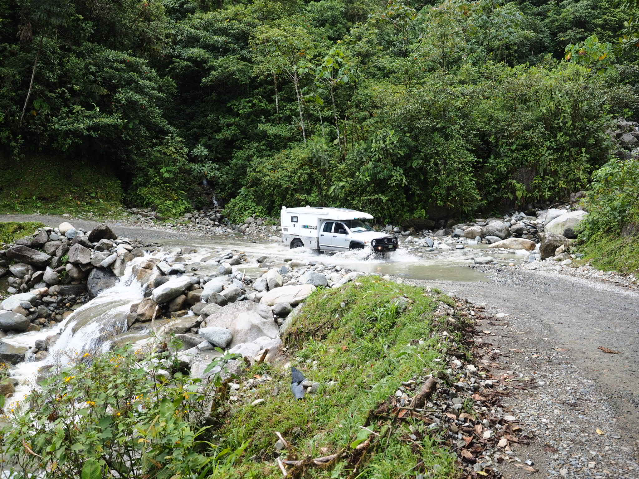
 The Trampolin started off like most Colombian roads, passing through a few settlements, where dogs inevitable gave chase. William, who I’d planned to meet up with on the road, waved at me from a passing collectivo. The first sign the road was a little different was when I had to ford a creek that was raging over the road. My shoes were already soaked from the morning so I just waded right in. Then i watched while a few vehicles made the questionable crossing.
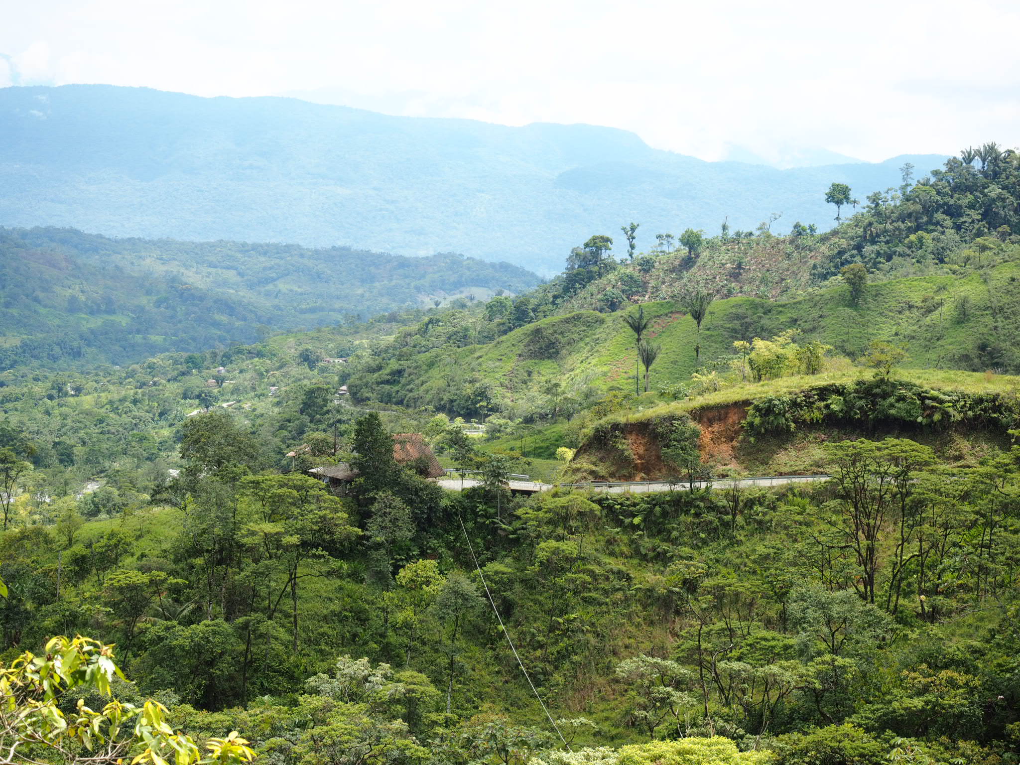

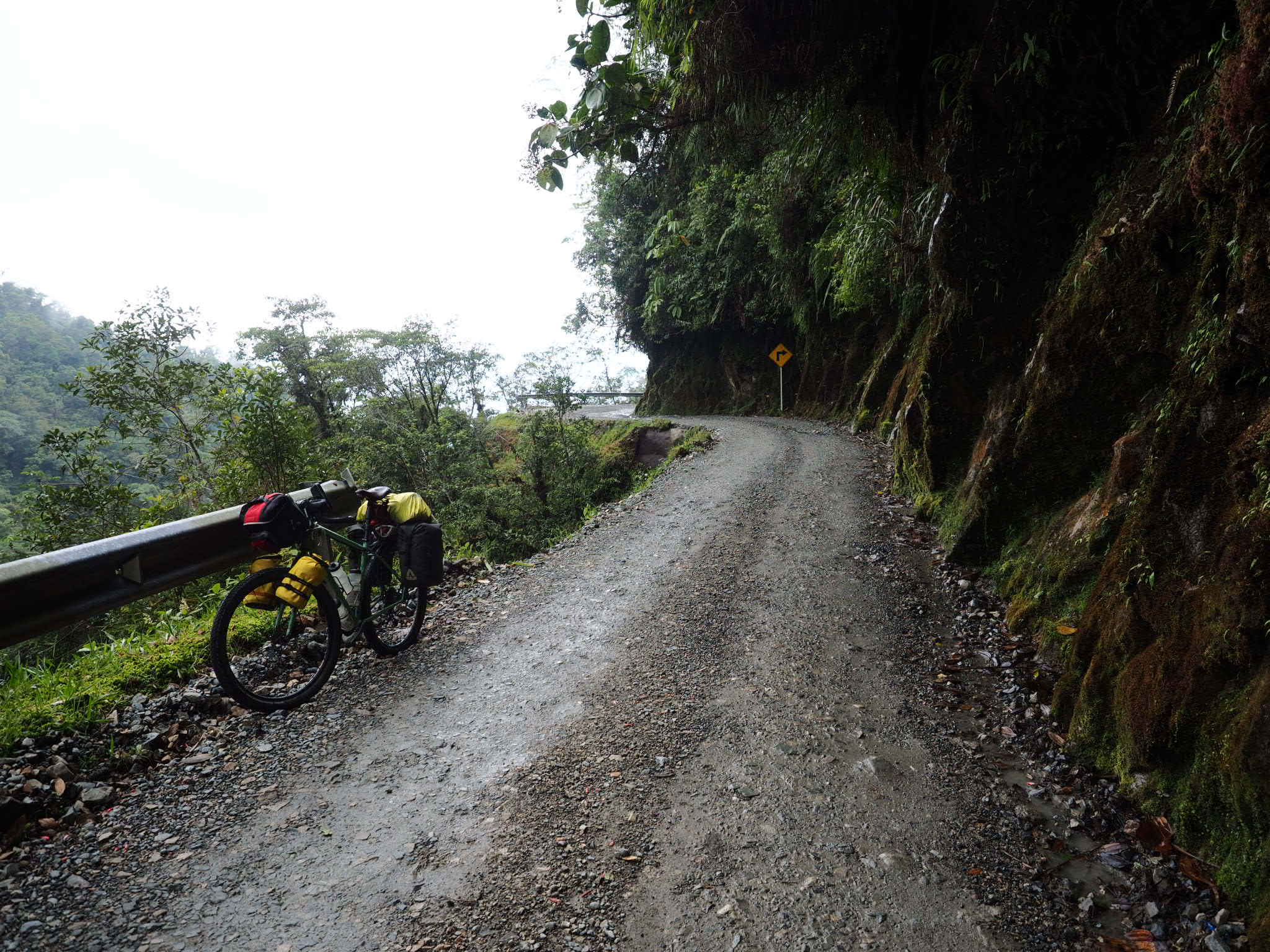
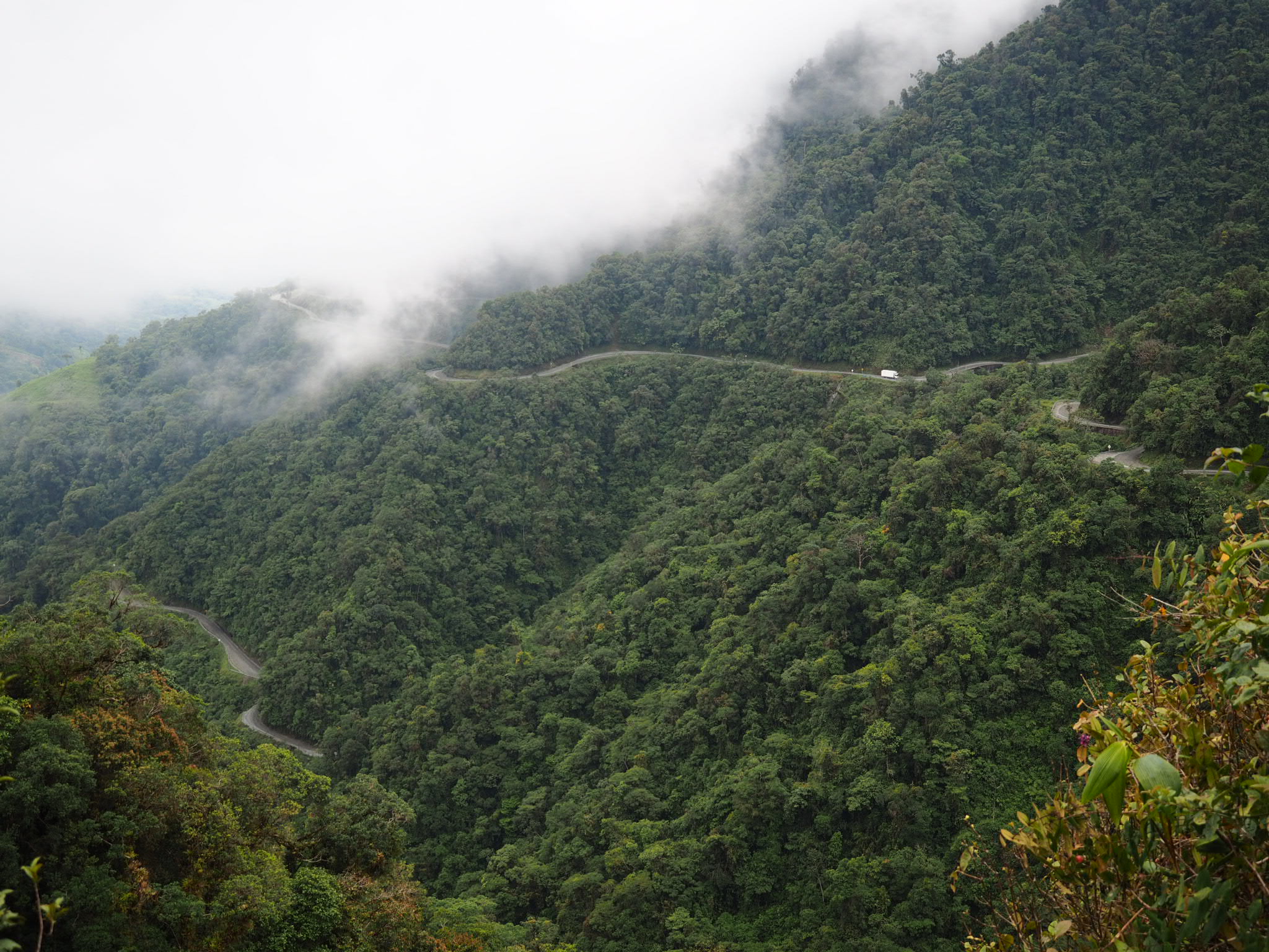
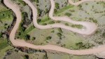
As I pedaled higher, I could see the road switchbacking up the mountain above me, disappearing into the ominous clouds. The road wasn’t particularly steep or rough, but it was a long and consistent climb. It was reasonably wide but at times there was barely enough room for me and a vehicle. The worst were the pickup trucks that shuttled people and goods along the road, and couldn’t be bothered to slow down while they passed, even at the narrowest sections. I would hug the inside and they would somehow squeeze by on the outside; I kept expecting one to go over.
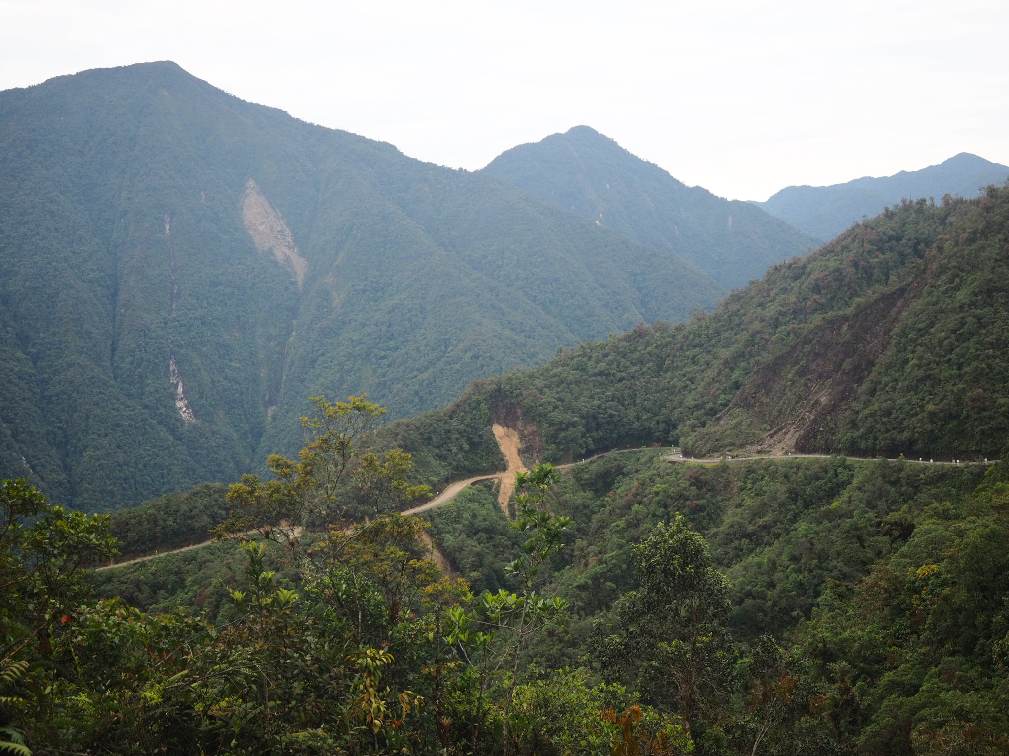
There was a few perilous drop offs and places where guard rails were non-existent, replaced by flimsy yellow tape that flapped in the wind. Numerous roadside shrines memorialized the hundreds of people who didn’t survive the journey over the years. It’s amazing to think this is the only road through the mountains in this part of Colombia.


It took a good four hours until I reached a military check point and the small restaurant that also fed the troops stationed at this remote outpost 1,400 metres above where I started. No sooner did I stop for lunch then did the skies open up again. A light drizzle turned into a monsoon in a matter of minutes. It didn’t last as long as in the morning, but I was so glad to have shelter, as were the local dogs and chickens. At the same time, it was only 3 p.m. and I wasn’t ready to stop. I hoped to make it to another restaurant 12 kilometres down the road, but I also didn’t want to get caught in another storm, especially at this elevation.

The rain stopped around four and I contemplated moving on. I waited because the people at the restaurant said there was nowhere to sleep past there. I listened to them, even though I’d read otherwise online. Thankfully I did because not long after it rained heavily some more. I was provided a shed to sleep in because the usual spot for bike tourers was taken up by a litter of puppies. It was pretty bleak sleeping quarters but after a bit of cleaning it was adequate. I ended up having a great night sleep.


The next day was grey and drizzly but fortunately the heavy rains held off. The road had turned to mud overnight and if it wasn’t muddy, it was rocky. I quickly reached the first pass and then coasted down to small restaurant for breakfast. I then rode up and down past numerous old landslides before plodding my way up the final 600 metre climb, stopping frequently. My legs were toast and I struggled mightily to make it to the top. The kilometre signs were both a blessing and a curse – a sign of my slow progress, and all that remained to climb.


When I finally reached the top, at a lofty 2,700 metres, I was treated to a fantastic panorama of the verdant Sibundoy Valley. The road down to the town of San Francisco was fast and relatively smooth and next thing I knew I was enjoying lunch while the locals geared up for a parade. I watched as they danced and marched around the main plaza, then got back on the bike and battled a headwind for 20 kilometres to the other end of the valley, while a road race took place around me. I got to Santiago, the last village before the next climb, found a cheap hotel room (crucially, with hot water), went to the gas station to clean my bike, ate some fresh trout, and passed out knowing I was only two days from the border with Ecuador.
You can view the GPS track for this route here: https://ridewithgps.com/trips/20079646


Nice
LikeLike
Best view.
LikeLike