After six weeks in Colombia, I was eager to move on to Ecuador. Not that there’s anything wrong with Colombia – it had exceeded my expectations – but I was eager to experience something different. Every day in Colombia was starting to feel the same, riding up and down endless mountains covered in farms and lush greenery. It was beautiful and the people were friendly, but I was ready for something new. I knew Ecuador would be similar, but it’s also a little higher and still has a thriving indigenous culture, something Colombia is lacking and one of the things I’ve loved about past travels on Latin America.
First I had at least two days riding ahead of me to reach the border. I got a late start on my second to last day in Colombia, lazily packing my bags and searching for a decent breakfast before leaving Santiago. I only planned to ride 75 kilometres that day, all on pavement, so I wasn’t in a big rush. I completely underestimated the three climbs ahead of me and my general level of fatigue.
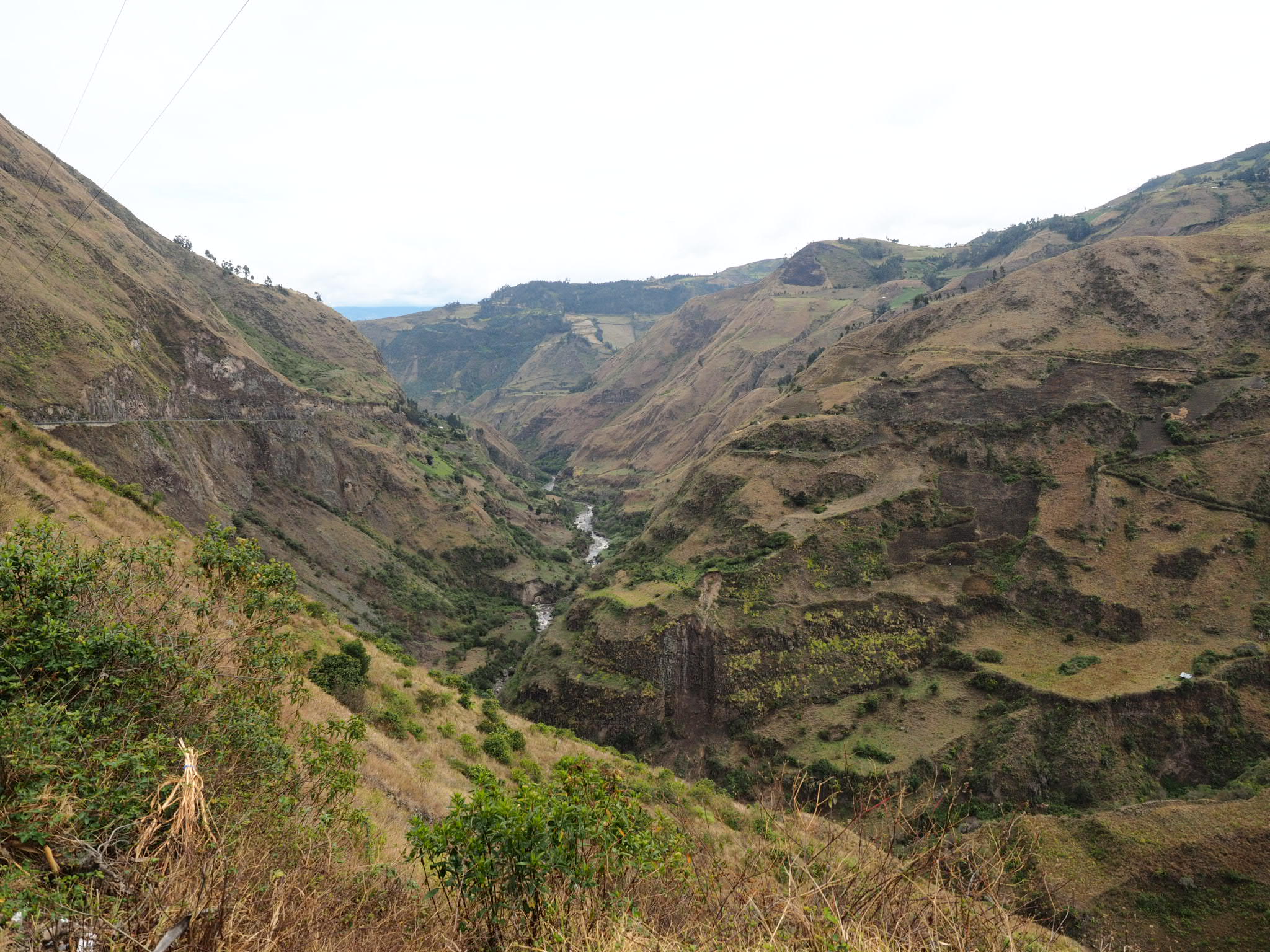
I left Santiago as the townfolk headed to church and began the first of three climbs of the day almost right away. It was a 1,000 metre vertical monster that was never steep but just kept going and going and going. There was no big mountain to overcome, just an endlessly unfolding range that layered upward after every bend in the road.
It took several hours to get to the top and I started immediately on the steep winding descent to Laguna Cocha. I pulled off the highway for lunch hoping to find a nice spot with a view, but instead was greeted with a road lined with restaurants all selling trout, and none with a view of the lake.

Lunch over, I started on climb number two, which mercifully was much shorter than the first. On the way down the other side I ran into two bike tourers on their way up and we shared some advice about out respective roads ahead. They were impressed I rode the Trampolin de la Muerte – every other cyclist they met said they’d given up and hitched a ride part way. I thought about that but I’m stubborn, I replied.
“It’s all downhill from here,” one of them told me. “No it isn’t,” the other corrected. The latter was right.
I said bye to the cyclists and cruised down to the Pan- American and began the third climb of the day. I had marked a roadside hotel on my map as my destination for the night but now I questioned if I would make it. I kept any eye out for other options as I climbed but saw nothing. I crested the top of the hill just as it got dark, with a 10 kilometre descent between me and the hotel. I’d ridden down in the dark on my way into Medellin, but that was on a well lit highway. This time, the only lights were from traffic, and to make matters worse, a thick fog blanketed the road.
It was the most terrifying ride of my life as cars whizzed past me, my headlamp not nearly bright enough. I rode slowly, hugging the shoulder as best I could, praying my lights didn’t burn out. Down and down I went until I finally reached the hotel and its neighboring restaurant. Thankfully that was over.
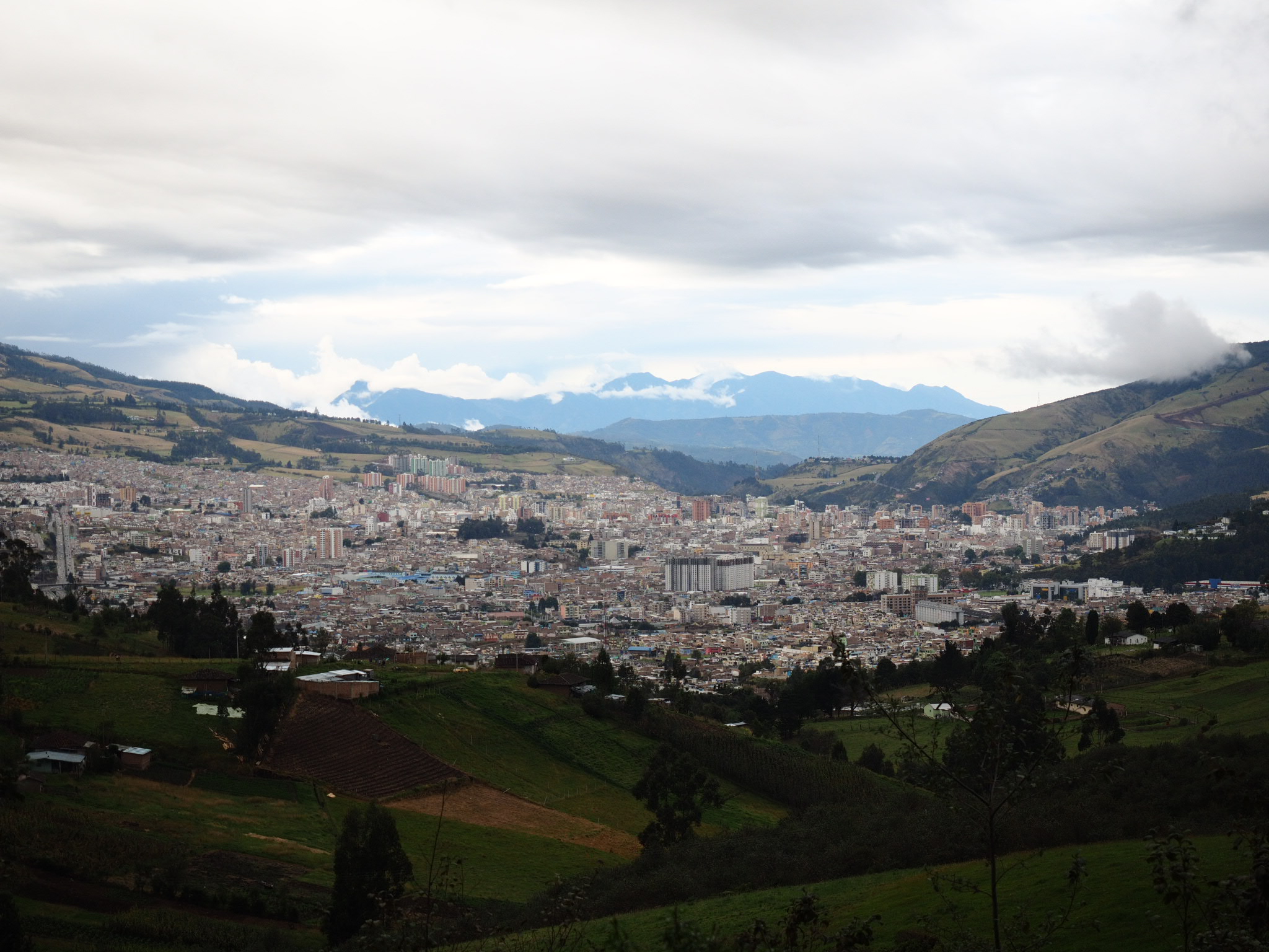
The next morning I finished the long descent, then went back up the inevitable response. The partly sunny skies gave way to rain and I entered the border city of Ipiales in a downpour. I tracked down a pizza joint and devoured lunch as I waited for the rain to stop before making a dash for the border.
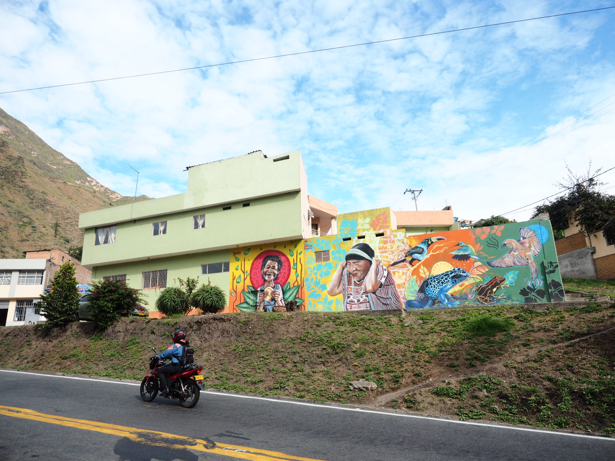
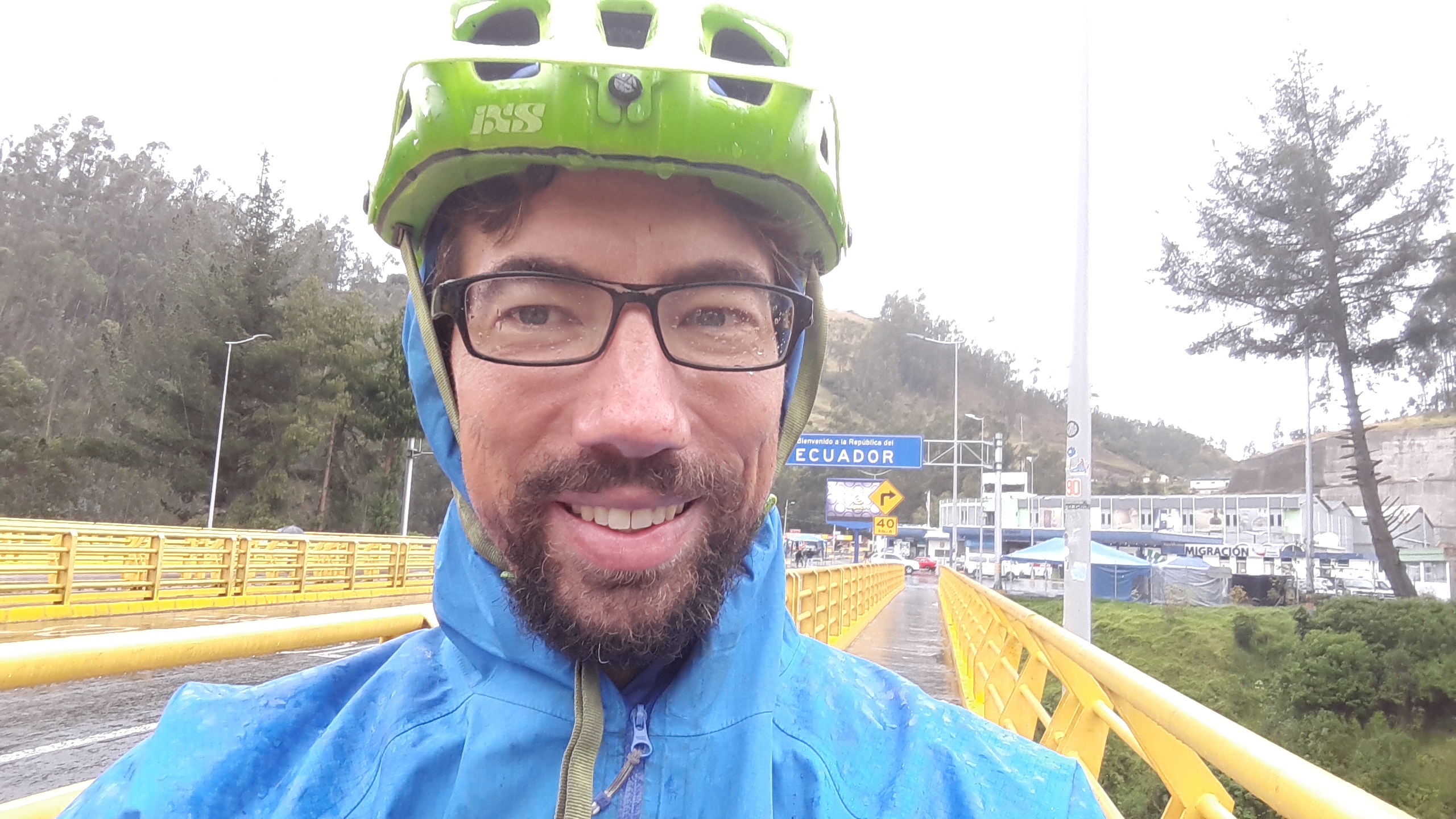
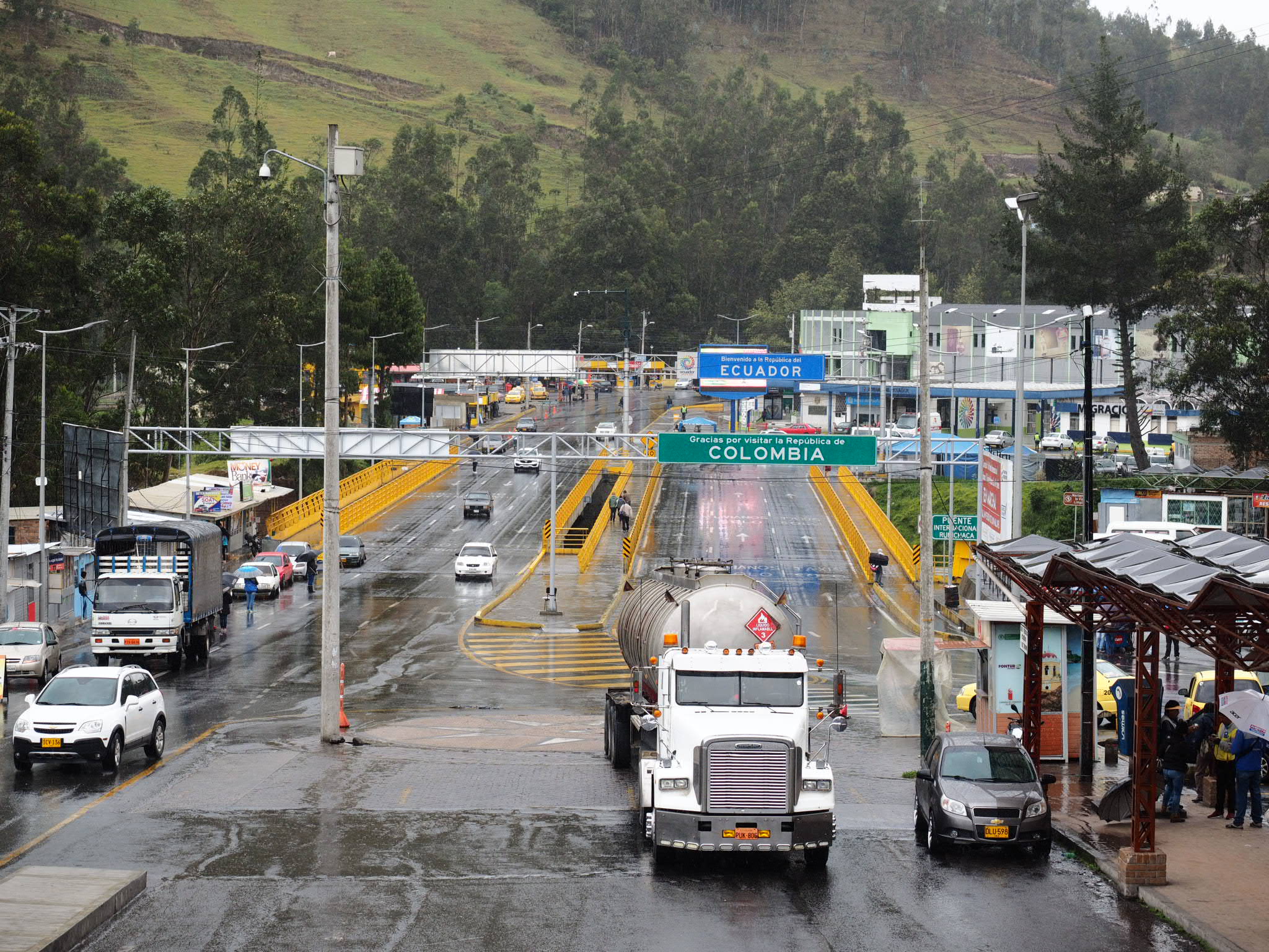
With the rain showing no signs of giving up, I decided to embrace the wet and cruised through Ipiales to the border. I nearly went through Colombian immigration but fortunately someone turned me around before I went too far. It took a few minutes to get my exit stamp and then I rode across the bridge separating the two countries and had an even easier time getting into Ecuador. Right on cue, the rain stopped and from there it was a short climb into Tulcan where I found a hotel with a real hot water shower – the first I can remember having in ages.
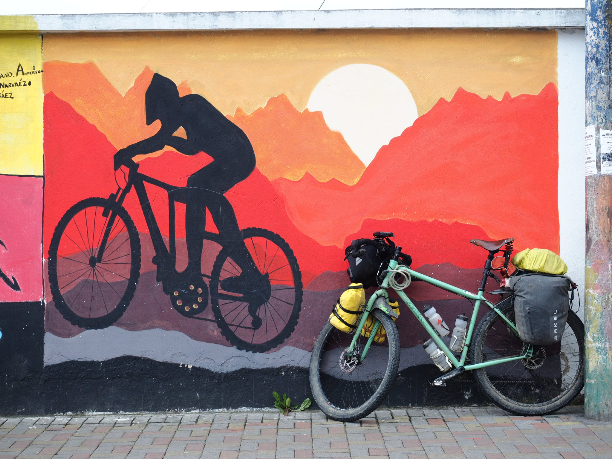
Somewhat refreshed, I set out the next morning on the start of the Trans Ecuador Mountain Bike Route – a collection of mostly dirt roads that links the country’s major Andean destinations almost all the way to Peru. Up first was the El Angel Ecological Reserve.
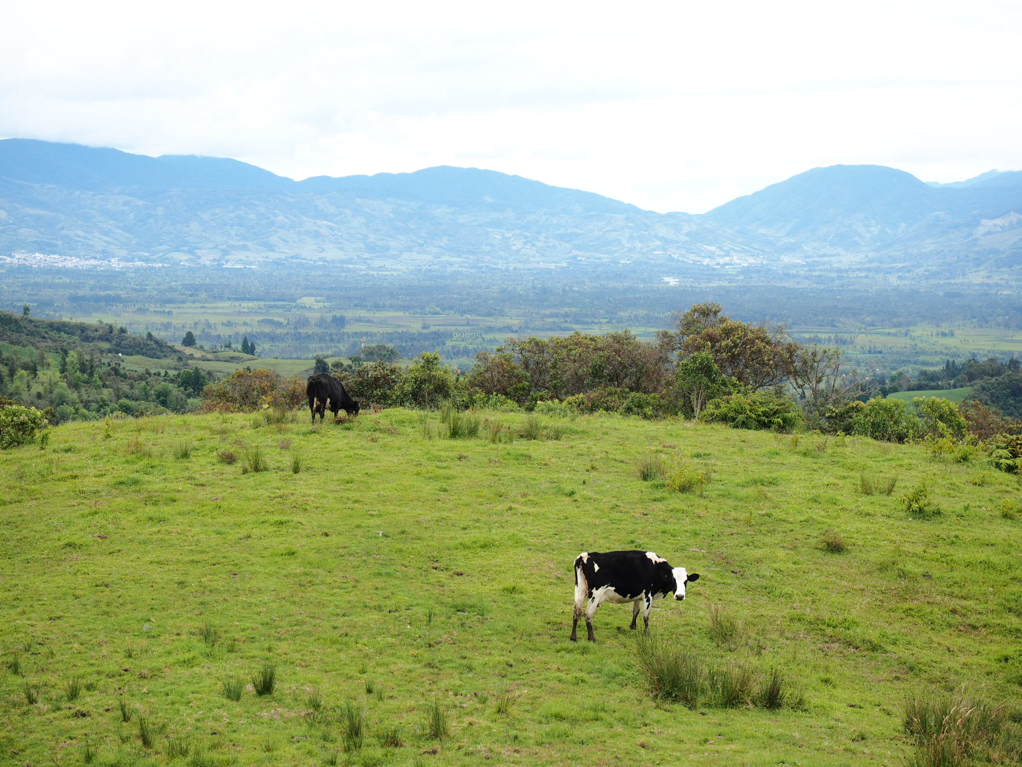
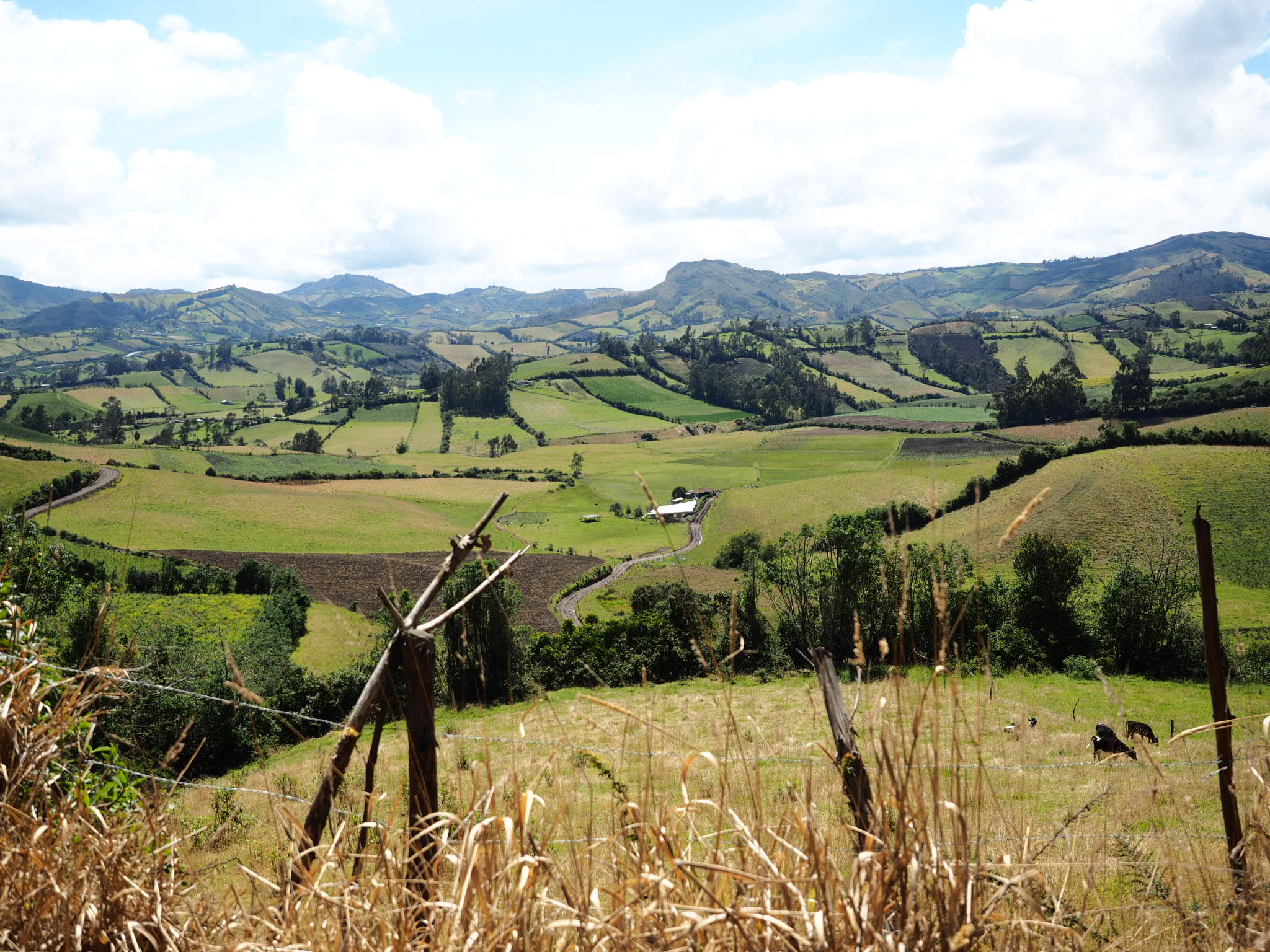
The dirt road left Tulcan into rolling farmland reminiscent of the start of tour in Boyaca. Only here the road wasn’t as steep, or it was and my perception of steepness had changed, or I was stronger. Either way, I climbed under sunny skies out of the city and into farm land that eventually gave way to open paramo landscapes. At the same time, the glorious sunshine was being replaced by ominous clouds.
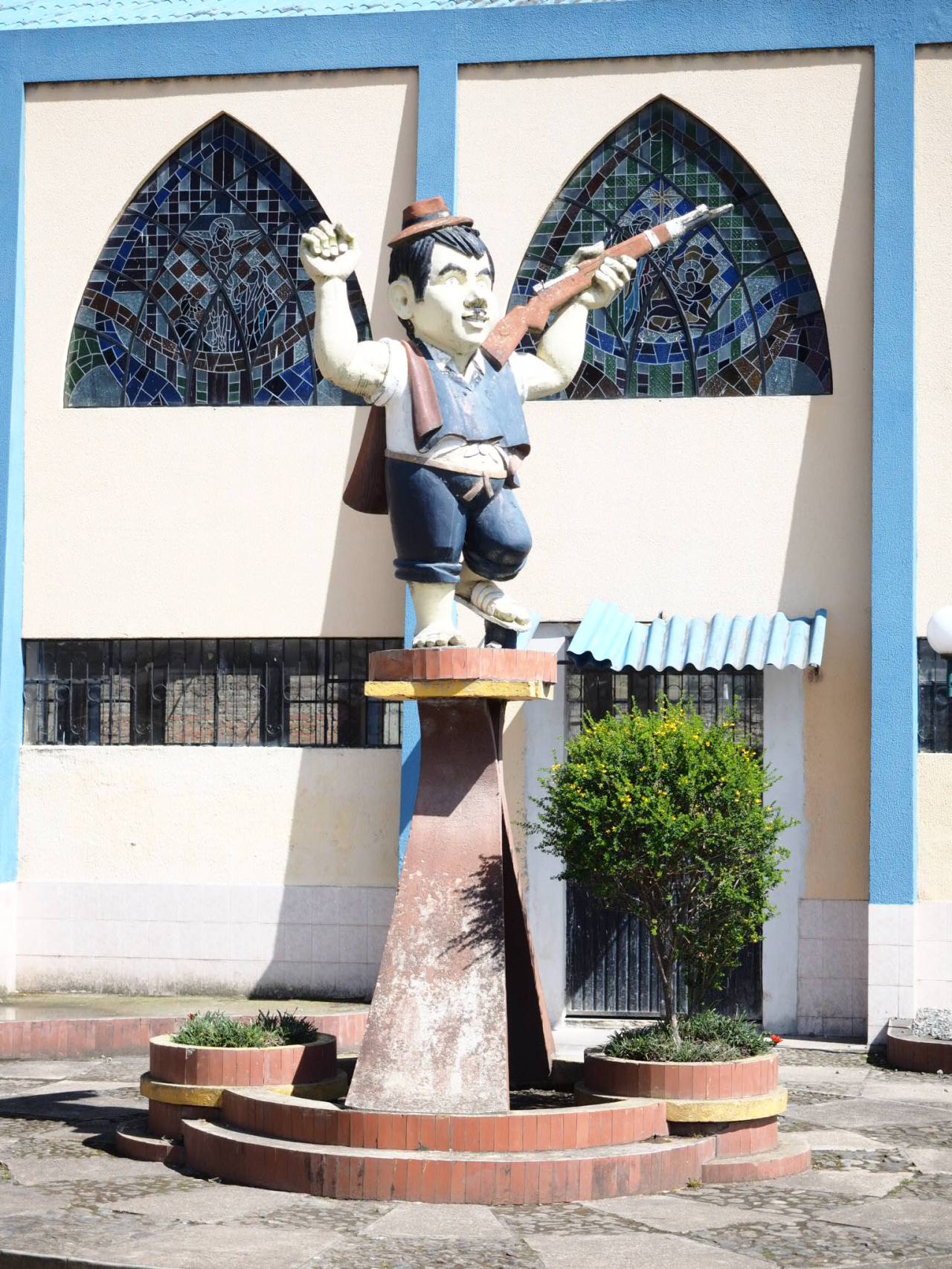
The directions for the start of the TEMBR say to look for the statue with the Hitler moustache. Here it is!
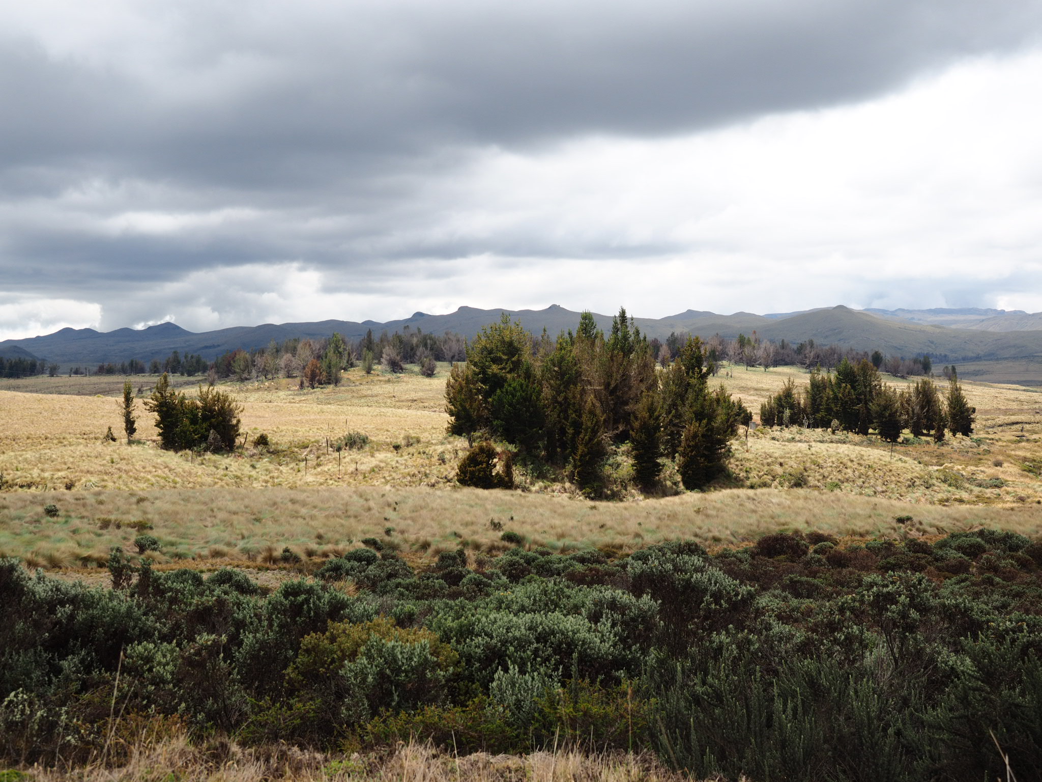
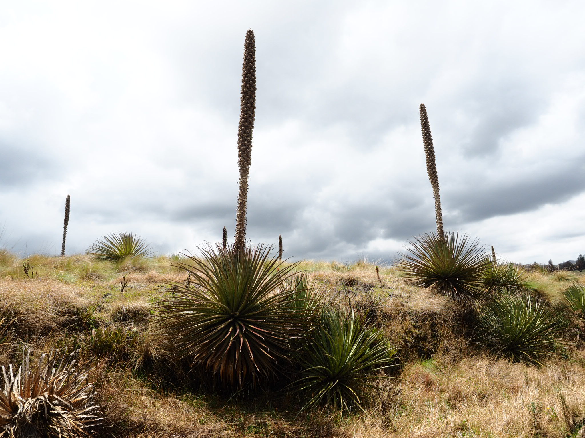
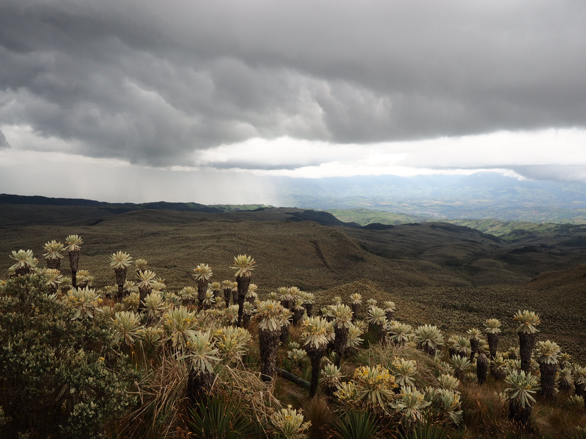
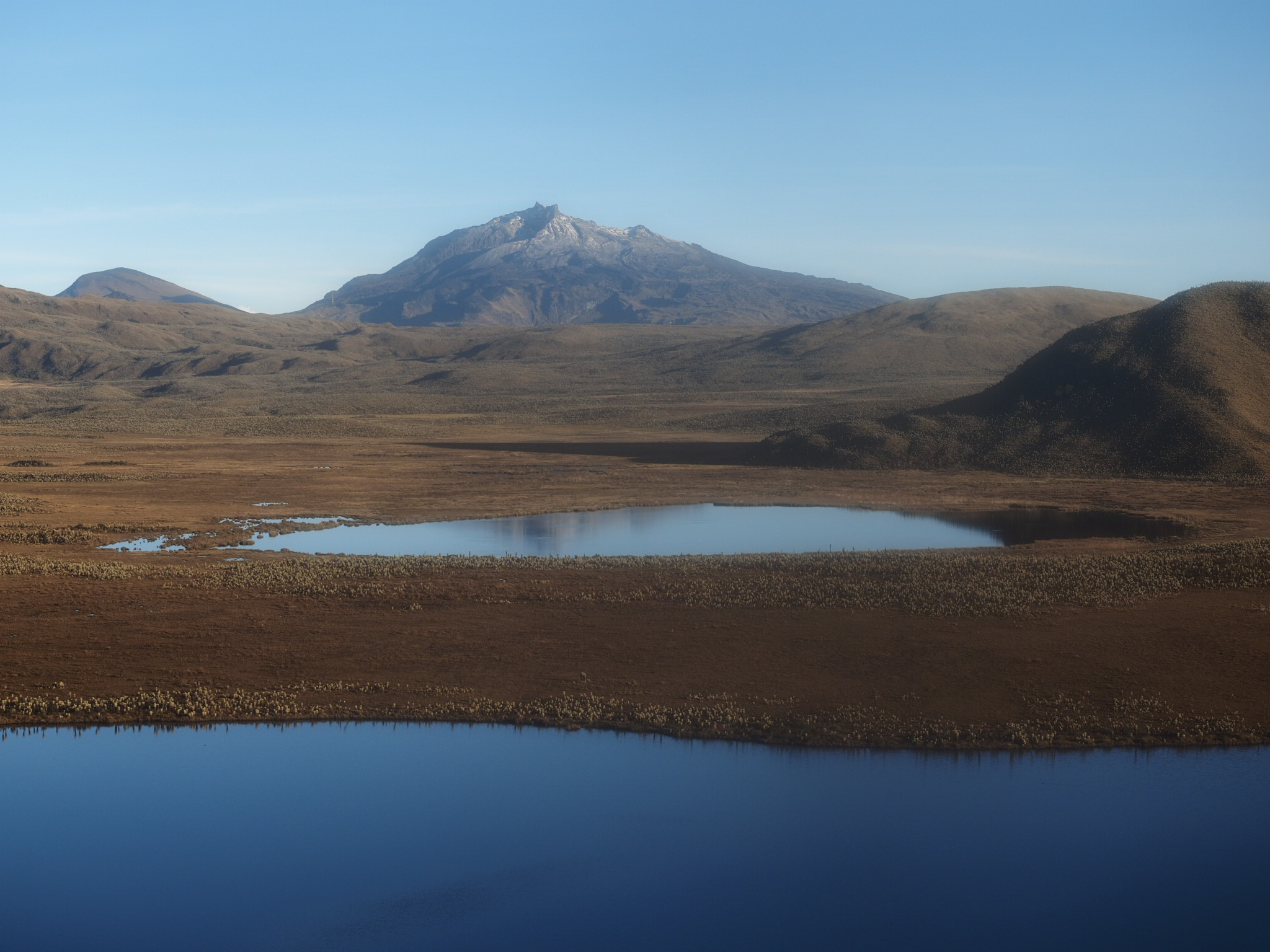
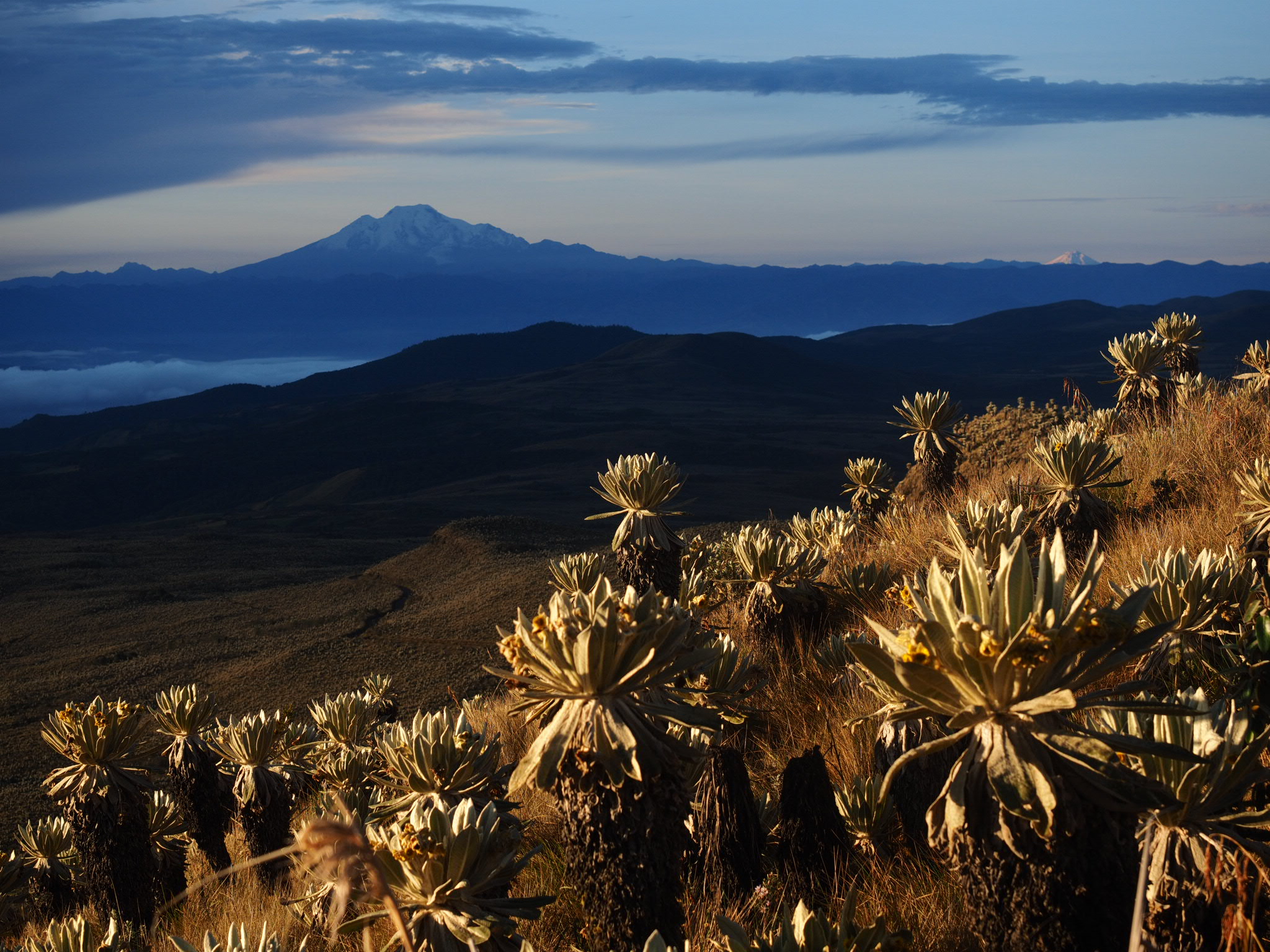
The road got worse as I pedaled on but I didn’t mind because the views were outstanding. Open fields dotted with puya stretched towards far off mountains. Soon, the land was covered in frailejones – a veritable forest of these unique plants that grow only a few centimetres per year but can be up to seven metres tall.
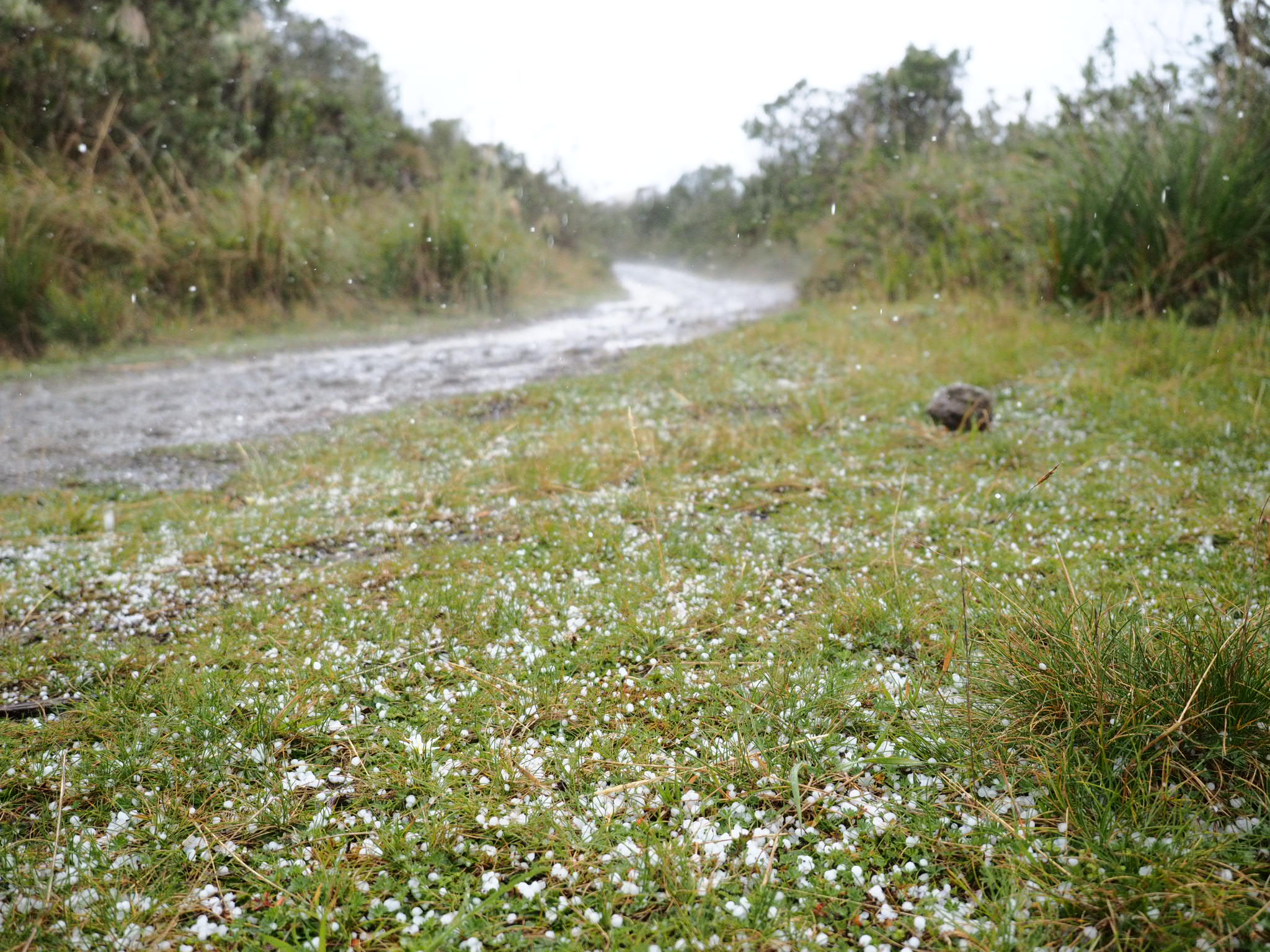
 The weather continued to worsen, as did the road. A few drops of rain turned into a hard splatter and I soon found myself riding through a hail storm. I quickened my pace but I could only go so fast over the rough road that was covered in puddles of uncertain depth.

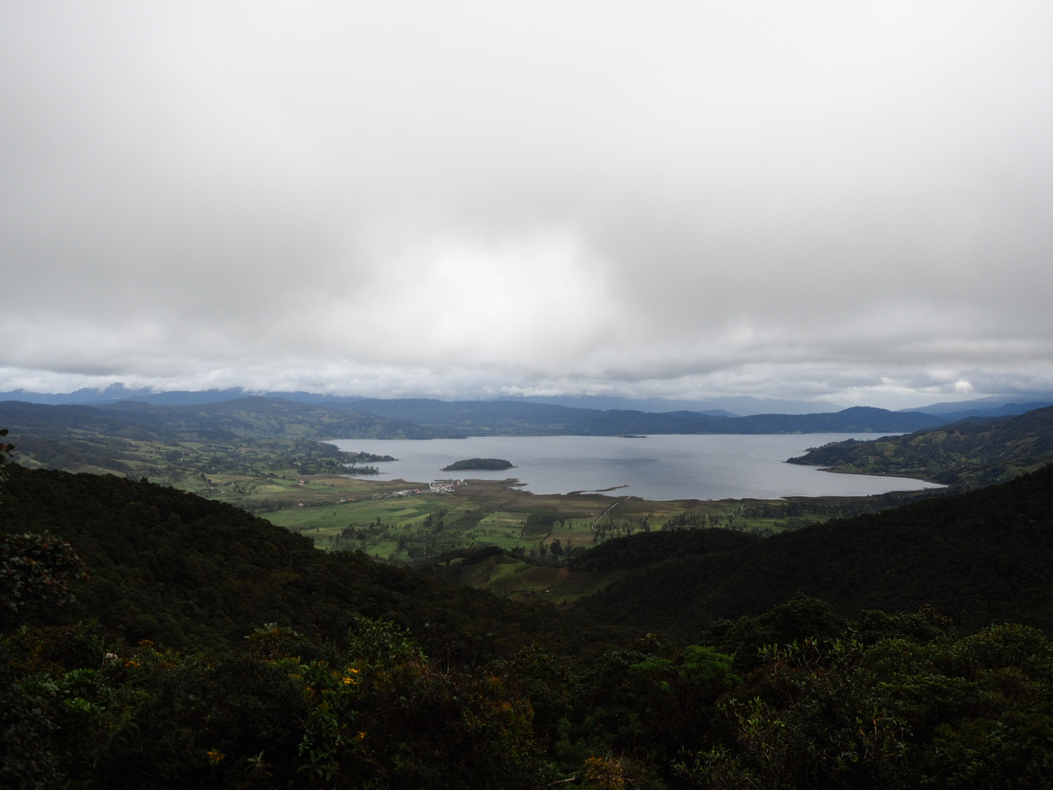
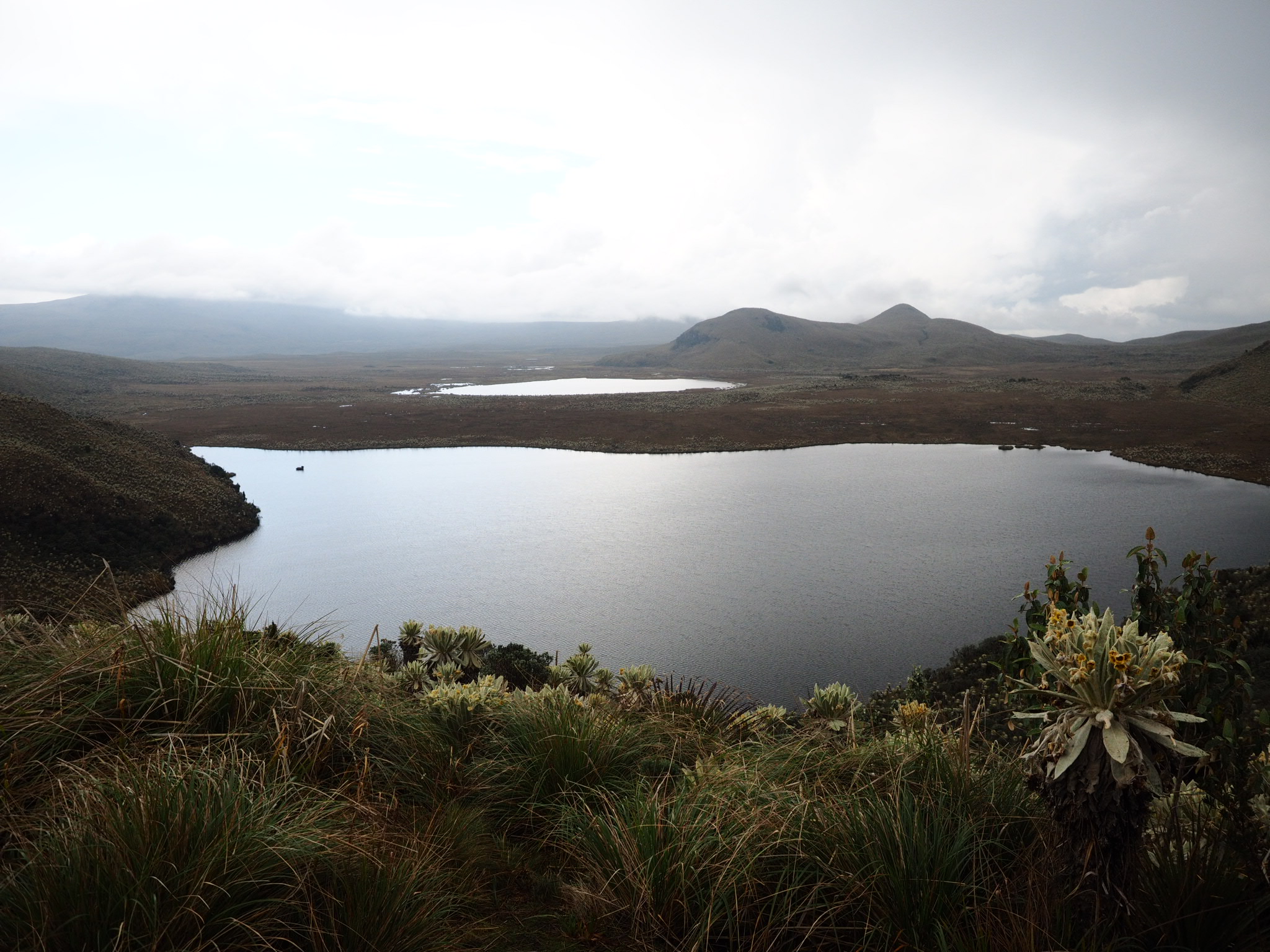
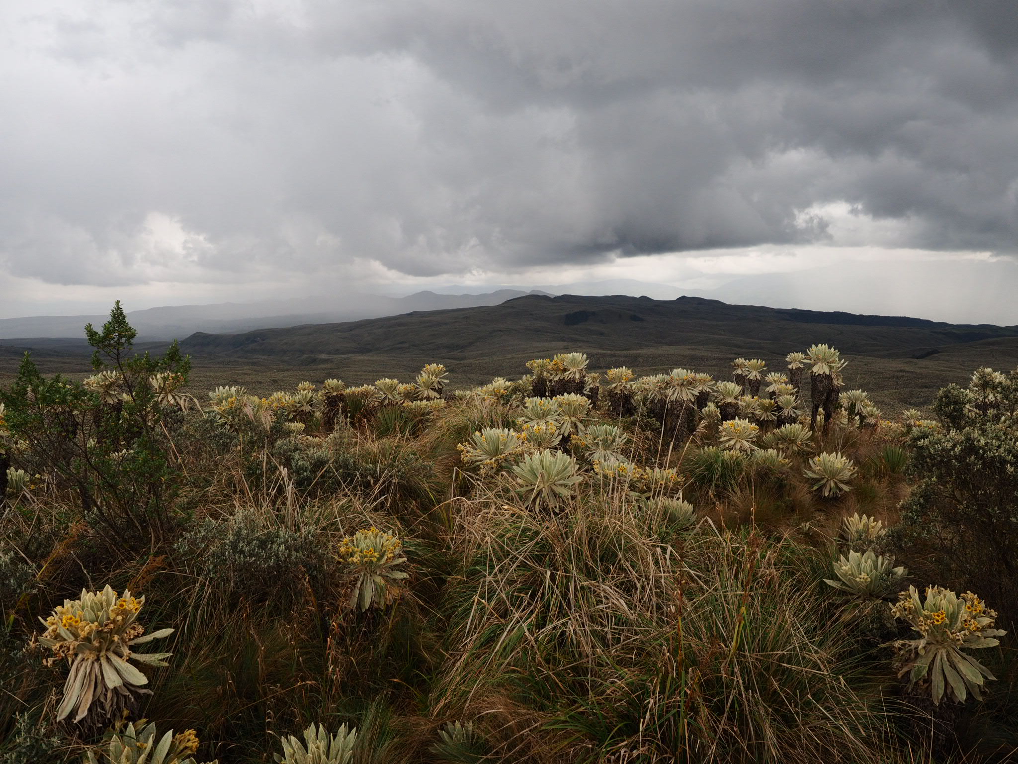
 I made it to the ranger station and the wardens shared their lunch with me and offered me a bed to sleep in. I contemplated riding on, but after a short walk through the incredible paramo to a lake and a lookout, I took them up on their offer.

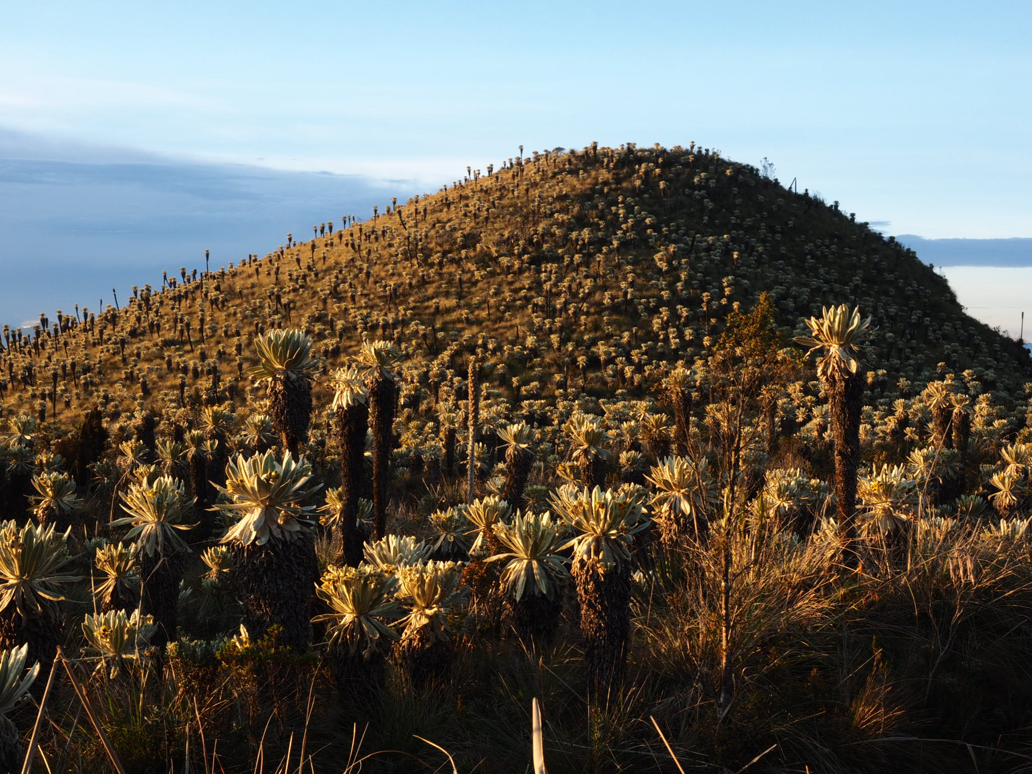
The next morning I woke up to a glorious sunrise. The skies above had cleared and the sun cast a golden glow on the fields of frailejones. I grabbed my camera and scampered up to the lookout as fast as I could, which wasn’t very fast considering I was up at 3,800 metres elevation.
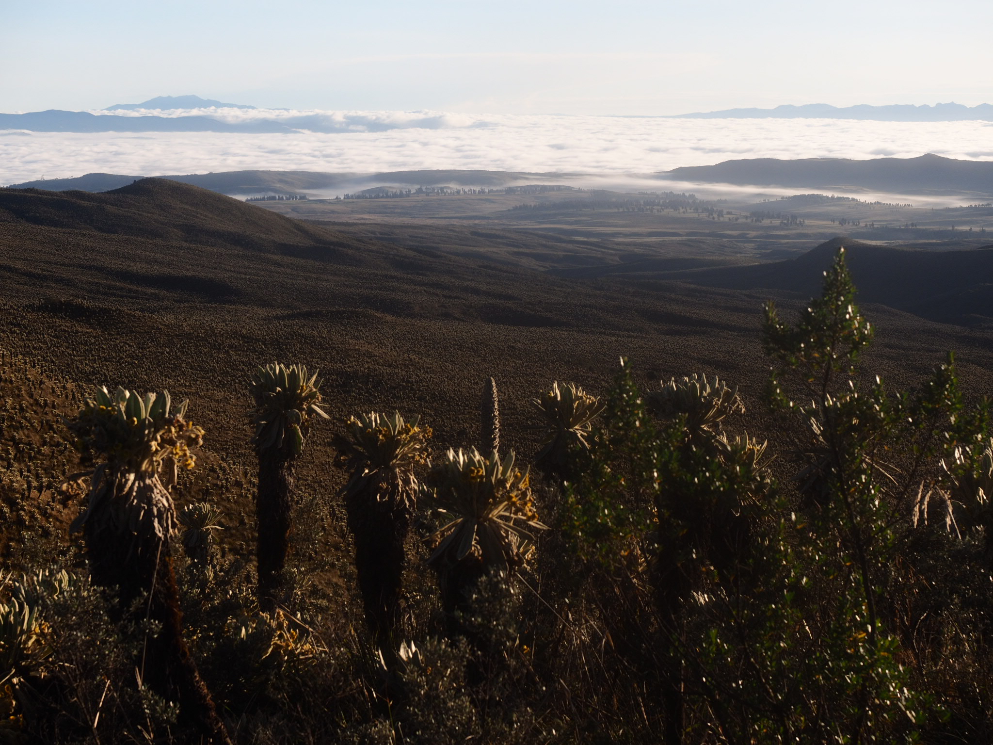
The views were astonishing and I could see patches of fresh snow on nearby mountains. Cayambe, the third highest mountain in Ecuador, loomed, while Cotopaxi (the second highest) could be seen poking it’s cone above a distant ridge. Rejuvenated, I returned to the ranger station for breakfast and set off on the long but mostly downhill ride to Ibarra.
Ecuador – you sure give quite the welcome.
You can find the GPS track for this route here: https://ridewithgps.com/routes/26716117


1 comment ›