“Why aren’t you smiling? Why aren’t you happy?”
I had just collapsed after cresting a 4,750 metre high pass in Peru’s Cordillera Blanca following a day of pushing my bike up through sopping wet meadows, fast-flowing creeks, and steep rocky slopes in a mix of rain and snow. I was very tired and very wet, and there was Iohan already at the top, already eager to start the descent, with his camera out taking my picture.

Sylvain and Iohan at the top of Portachuelo Honda.
Iohan, a Bulgarian-Canadian is one of those people in South American dirt road touring circles whose legend precedes him. Four years ago, he started riding his bike from the Canadian Arctic and he’s been slowly making his way south through the Americas ever since, with detours to Morocco and Oman. Along the way, he’s self-produced videos of his adventures that have taken him down paths even some of the most adventurous bikepackers haven’t attempted.
I’d read his blog, Bike Wanderer, but I hadn’t watched his videos; at an hour each, I just never took the time, though I had started on his first one which documents his winter adventure in the Canadian Arctic. Anyways, when I was in Cuenca, Ecuador, in mid-December, I emailed him after reading one of his posts about a route he took out of Cajamarca, Peru. I asked for a GPS track and he said he would send it to me when he reached Huaraz. I didn’t hear back from him before I got to Cajamarca and after looking at his photos I decided I’d stick to the road slightly more traveled out of there.
I left Cajamarca several weeks after him, so I was pretty surprised to show up in Caraz with a reply from Iohan in my inbox, and even more surprised that he’d been hanging out in Caraz for the past 10 days, working on a new video. We met up and made plans to ride through the Cordillera Blanca together, just as soon as his friend Sylvain arrived from Quebec in two days.
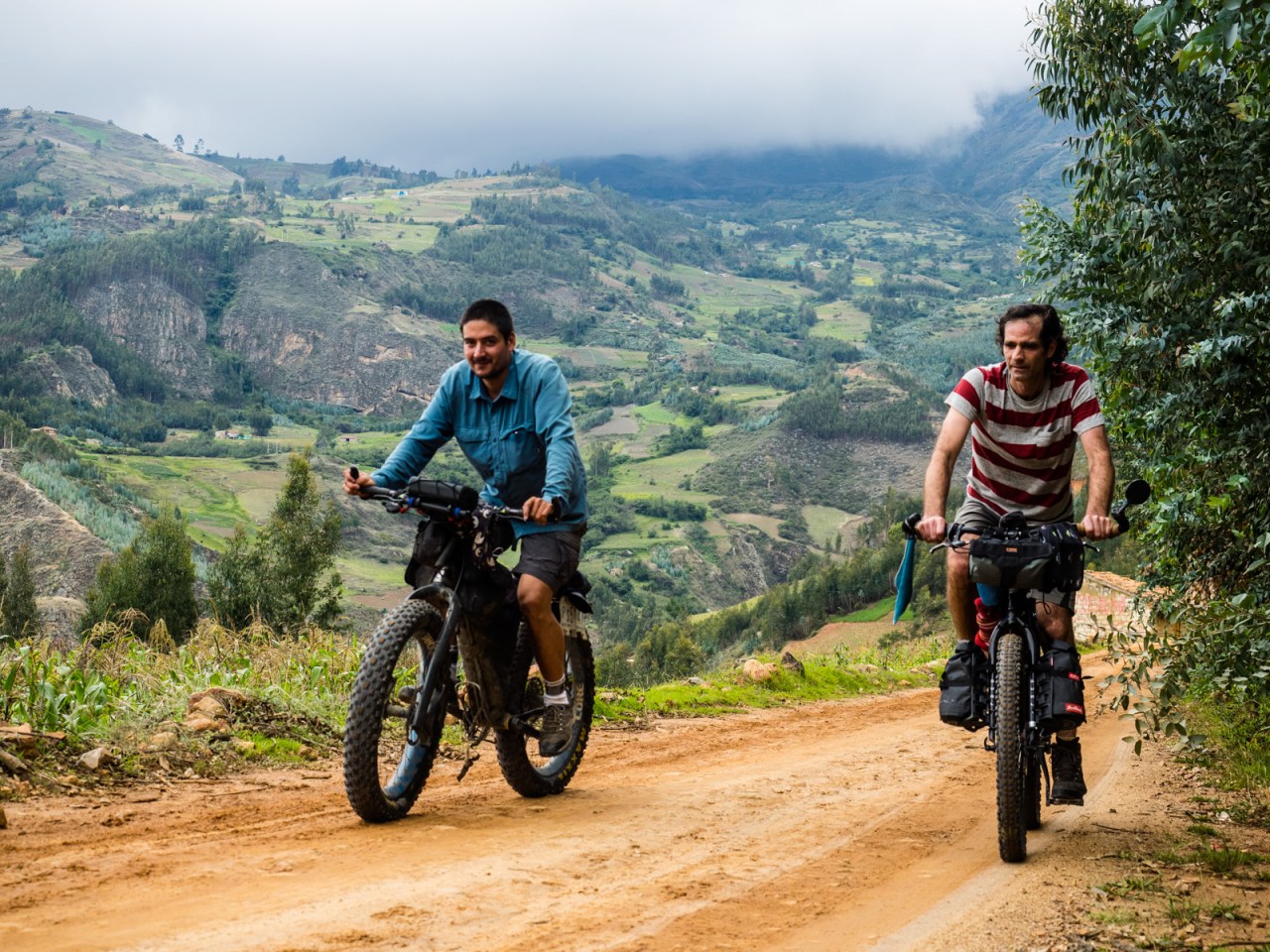
I spent those two days taking it easy and enjoying Caraz’s many bakeries, which all sold the same things – including my favorite borrachitos (chocolate fudge balls). Sylvain showed up on Jan. 14 and we set out the next morning on a day ride to Laguna Paron – a beautiful alpine lake surrounded by huge, glacier-capped mountains. For Sylvain the ride was to get acclimatized as quickly as possible (he want from sea level to 4,200 metres in a little more than a day), while for Iohan it was to get his legs back. For me, I was just along for the views and the company.
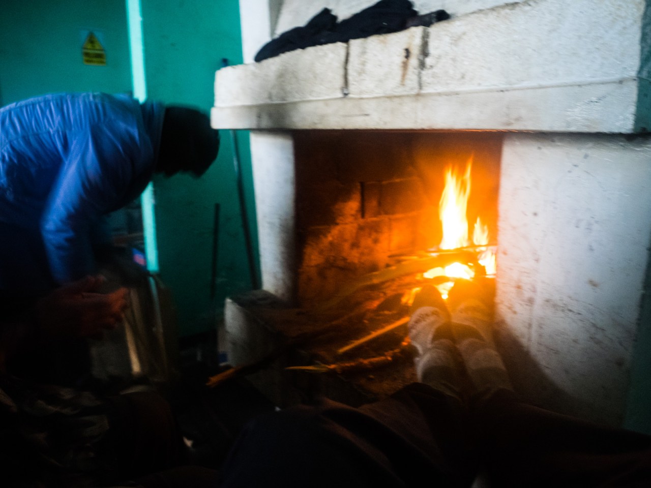
The ride to the lake started off through fairly typical Andean scenery of rolling farms and small villages until the road was swallowed up by a canyon that led to the lake. Along the way the weather was also typical, going from warm and sunny to cold and rainy. It was also a much slower ride than anticipated, where I, only two days removed from my last ride, led the way while Iohan and Sylvain alternated between pushing and riding. I thought we’d be up and down by four at the latest but it was almost five when we all reached the top. The rain was pelting down at this point and it was cold. The mountains were covered in a thick cloud and the views were almost non-existent. When the caretaker of the refugio offered us each a bed, food and fire for only 15 soles ($6 CDN) each, we quickly agreed and huddled inside, drying out of feet by the fire.

A rusted out mototaxi on the road to Laguna Paron.

Iohan loves dogs.
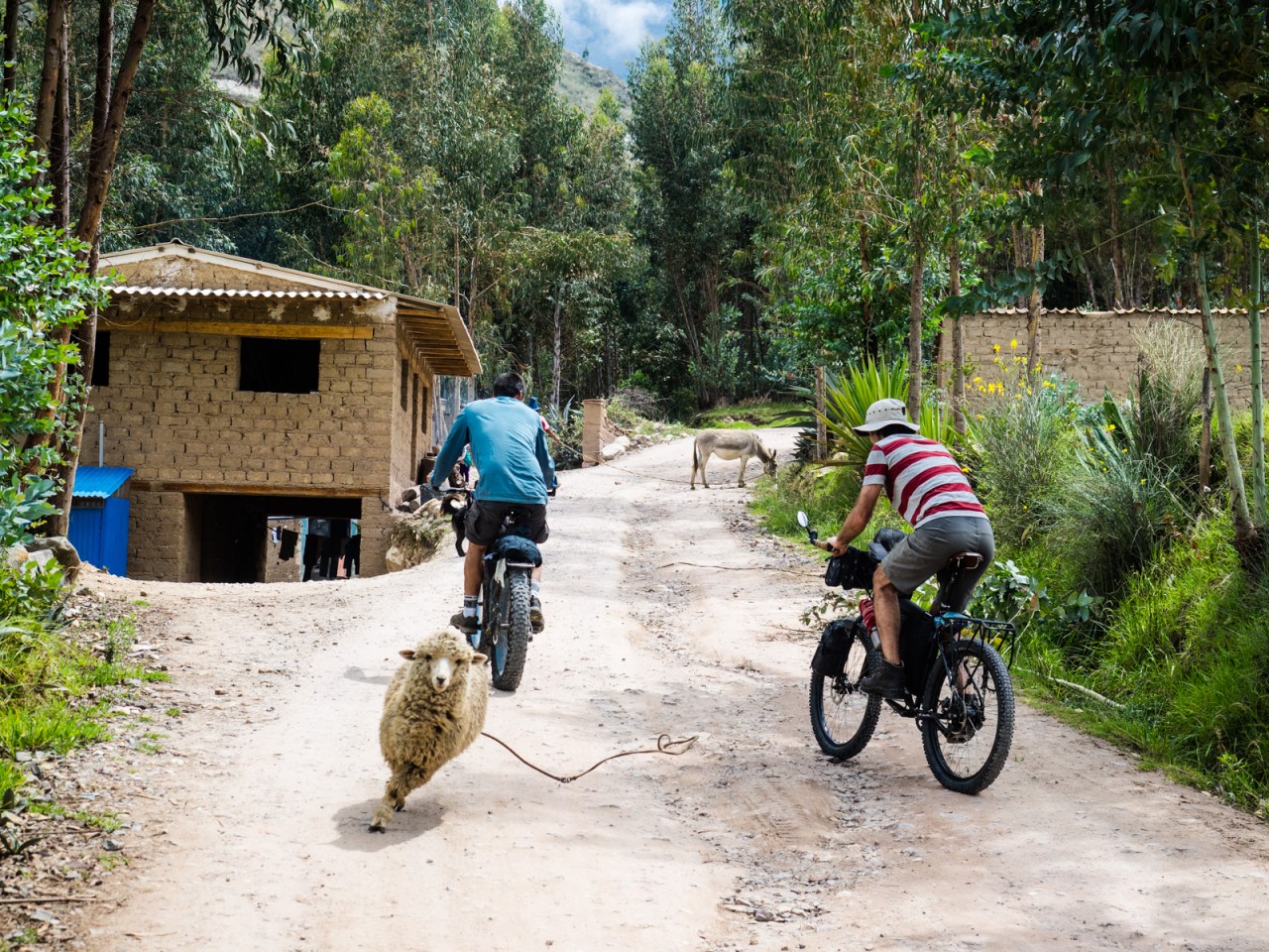
A sheep blitzes down the road between Iohan and Sylvain.
Typical South American landscapes on the way to Laguna Paron.
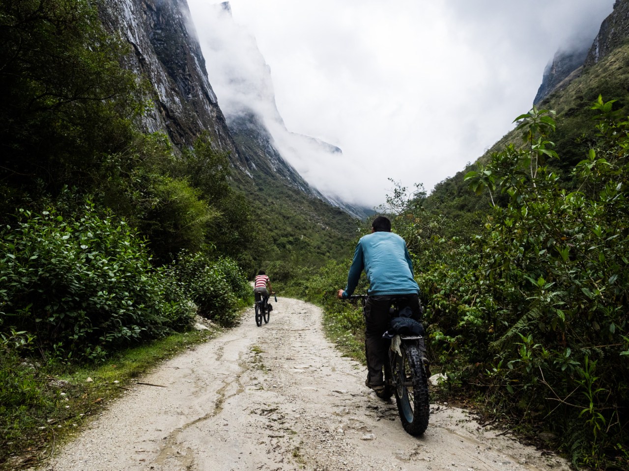
And then we entered the canyon.

The skies grew moody in the canyon.

Row, row, row your boat in Laguna Paron.
Iohan arrives at the lake. It was very rainy.
So we happily dried out by the fire.
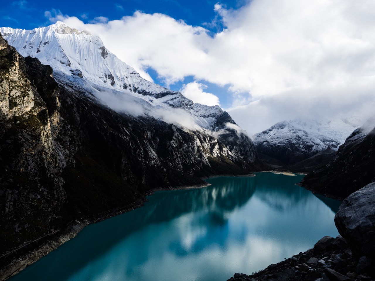
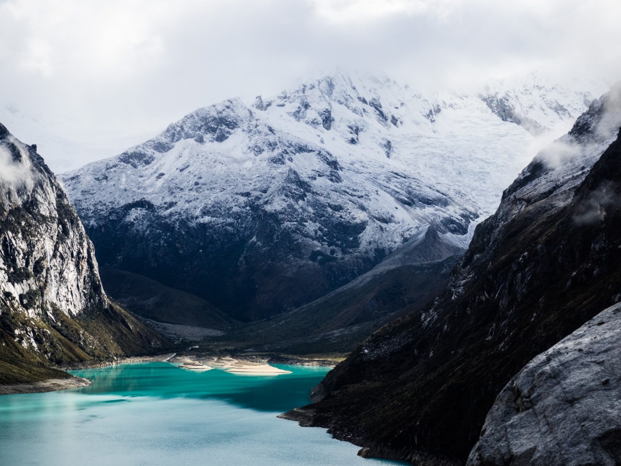
After a fitful sleep, I woke up to a mostly-clear sky and the cirque of snowy peaks surrounding the lakes revealed their majesty. Naturally, I ran outside with my camera and stood in awe of the scene as I clicked away. I hiked up to a viewpoint and laid back on a smooth rock, admiring the steep face of Mount Caraz and its reflection in the lake while waiting for the sun to climb above the peaks behind me. We lingered until a tour group showed up and, realizing we didn’t have much food (I had none), we made the decision to head back to town for lunch rather than going for a hike around the lake.
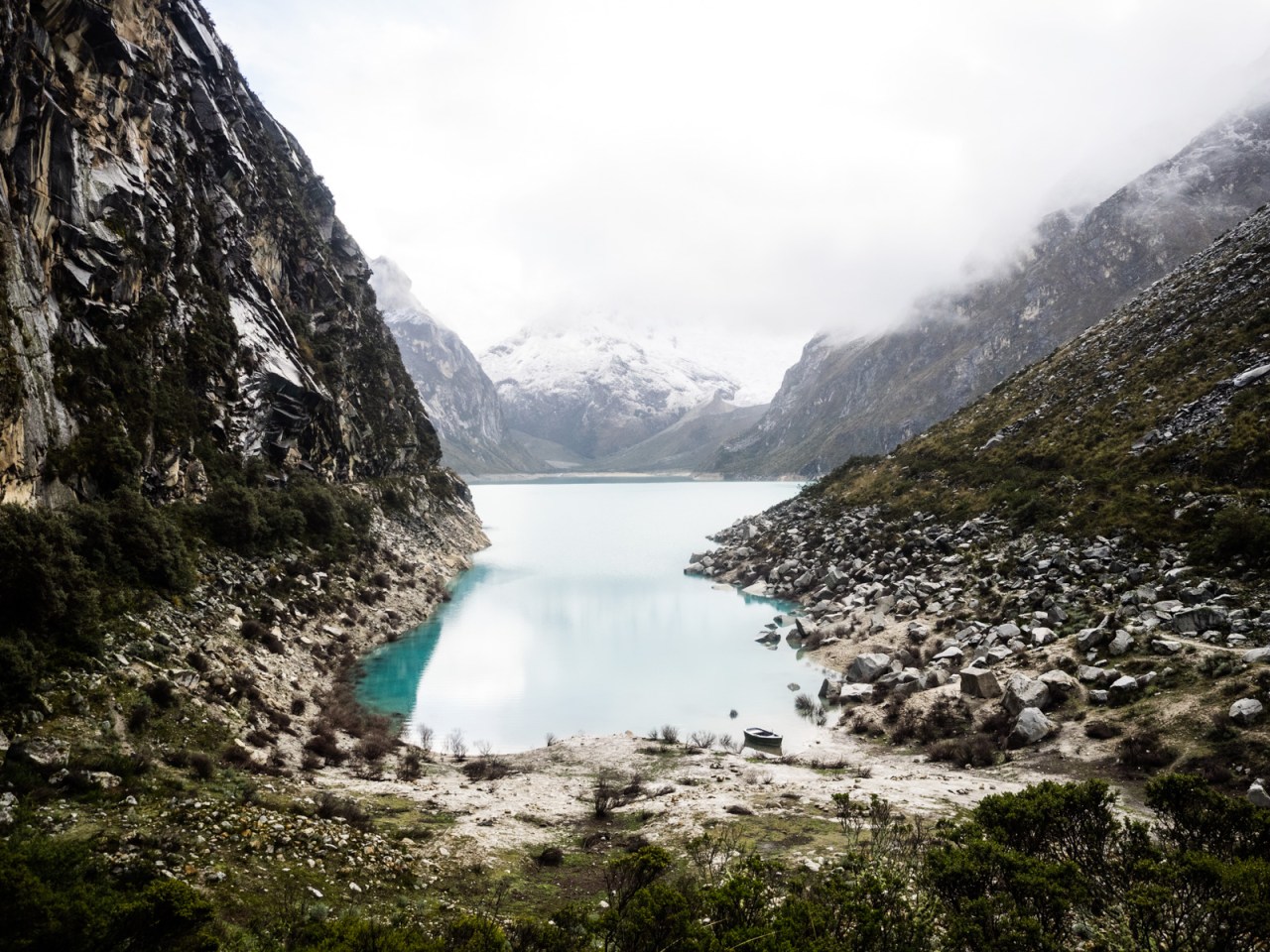
Laguna Paron in the morning.
The views were worth the poor night’s sleep.

Caraz was my favorite of the mountains surrounding the lake. I wonder if anyone’s ever skied it.


Iohan goes for a spin by the lake.

A few abandoned buildings near the lake.
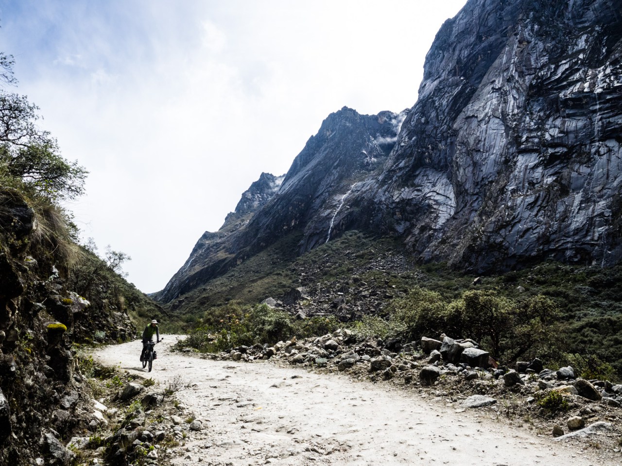
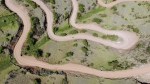
Riding down the canyon.
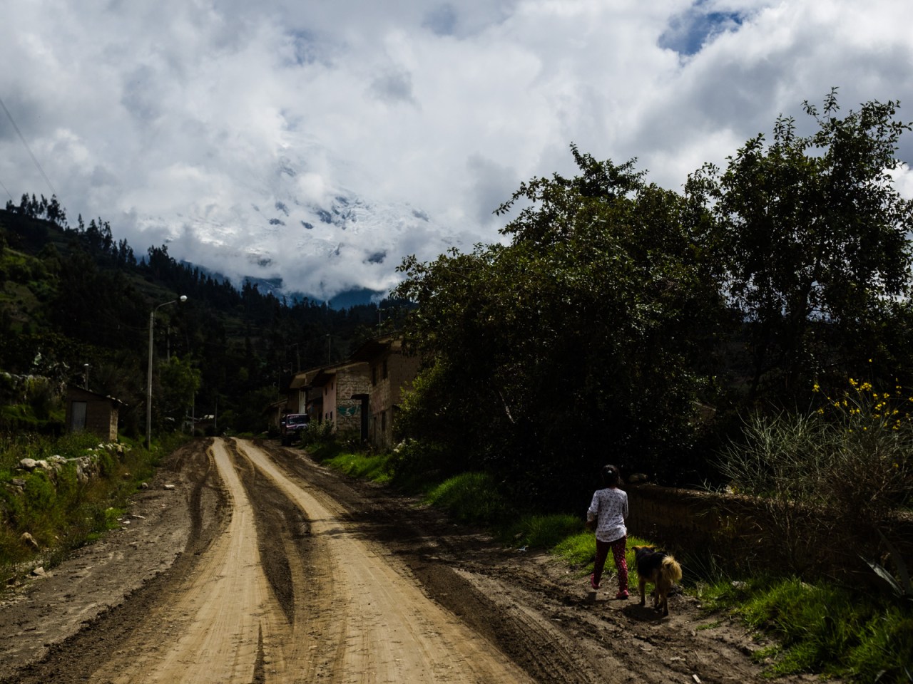
The next day we set off across the Cordillera Blanca via the Portachuelo Llanganuco, aka the Dirt Pass (one of four through the range). We rode up through more farmland, getting our first glimpses of Nevado Huascaran, Peru’s highest mountain, on the way up. A glimpse is the best we would as once again the rains set in by the time we reached the park entrance. We were charged the Gringo rate (65 soles/$25 CDN) to enter, which was made up for slightly by the fact we were allowed to camp under a spacious shelter that kept our gear dry in the while it rained most of the night.

A flower market was taking place as we left town.

Iohan never passes up an opportunity to make a canine friend,
Huascaran makes an appearance.
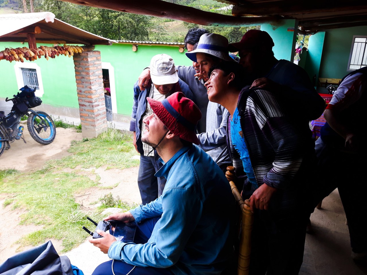
Iohan attracts a crowd while playing with his drone at lunch.

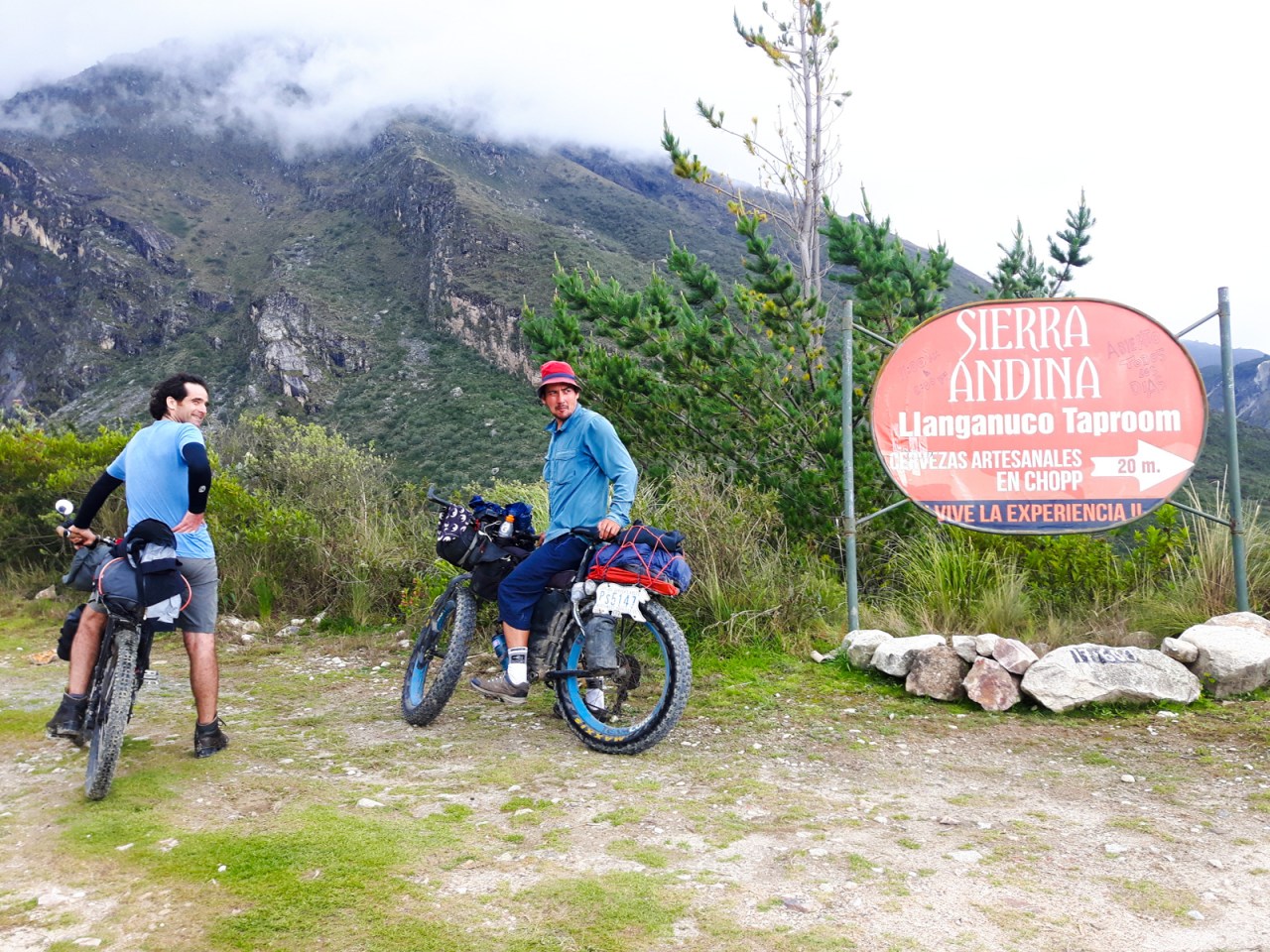
Beer?

Yes please!

Cheers!

Iohan rides into the national park.

The view from our campsite.

Mountains in the clouds.
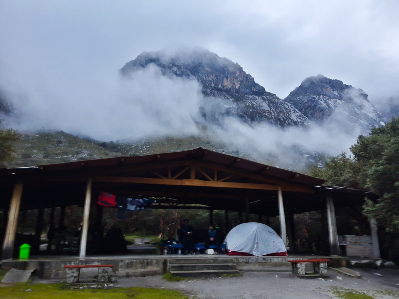
Our great campsite for the night.
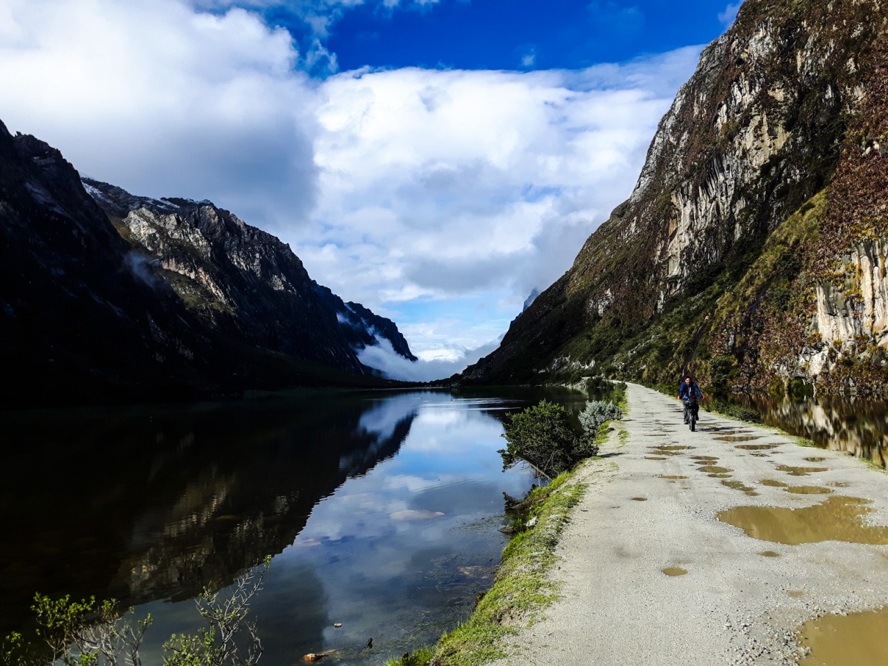
The next morning we enjoyed a flat ride alongside the Lagunas Llanganuco before beginning the climb to the 4,750-metre high pass lost in the clouds above us. Traffic was minimal but the road was muddy, making for a tough ride. Iohan and Sylvain seemed content in pushing most of the way, but I, ever the masochist, pedaled as much as I could, only getting off for a couple of the muddiest switchbacks. It was the highest I’d ever been on a bicycle but I felt pretty good on the way up, other than the general discomfort of riding with soaking wet feet all day.


We enjoyed some blue sky in the morning.
Cows in the national park. Photo by Iohan.
Me heading up to the pass. Photo by Iohan.
Looking back at the Lagunas Llanganuco.
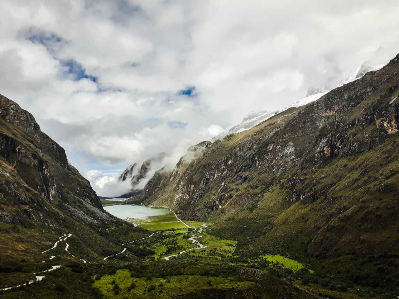
The views on the way up were stunning despite (or because of) the moody weather. The surrounding glaciers made an occasional appearance and we had consistent views of the blue and green valley below. On the other side of the pass the road snaked around several small lakes before disappearing into a distant valley. Iohan lead the charge downhill on his fat bike all the way to Yanama, where we debated keeping going but chose not to when we found a cheap place to sleep.
Sylvain slowly makes his way upward.

Nearing the top of the pass.

Me, almost at the top.

If you google this pass, you’ll see this picture.

Iohan at the pass.
Sylvain at the pass.
Iohan and Sylvain head down.
Iohan on the way down.

A church mural in Yanama.

Our neighbour in Yanama.

Actually, our neighbour was the church.
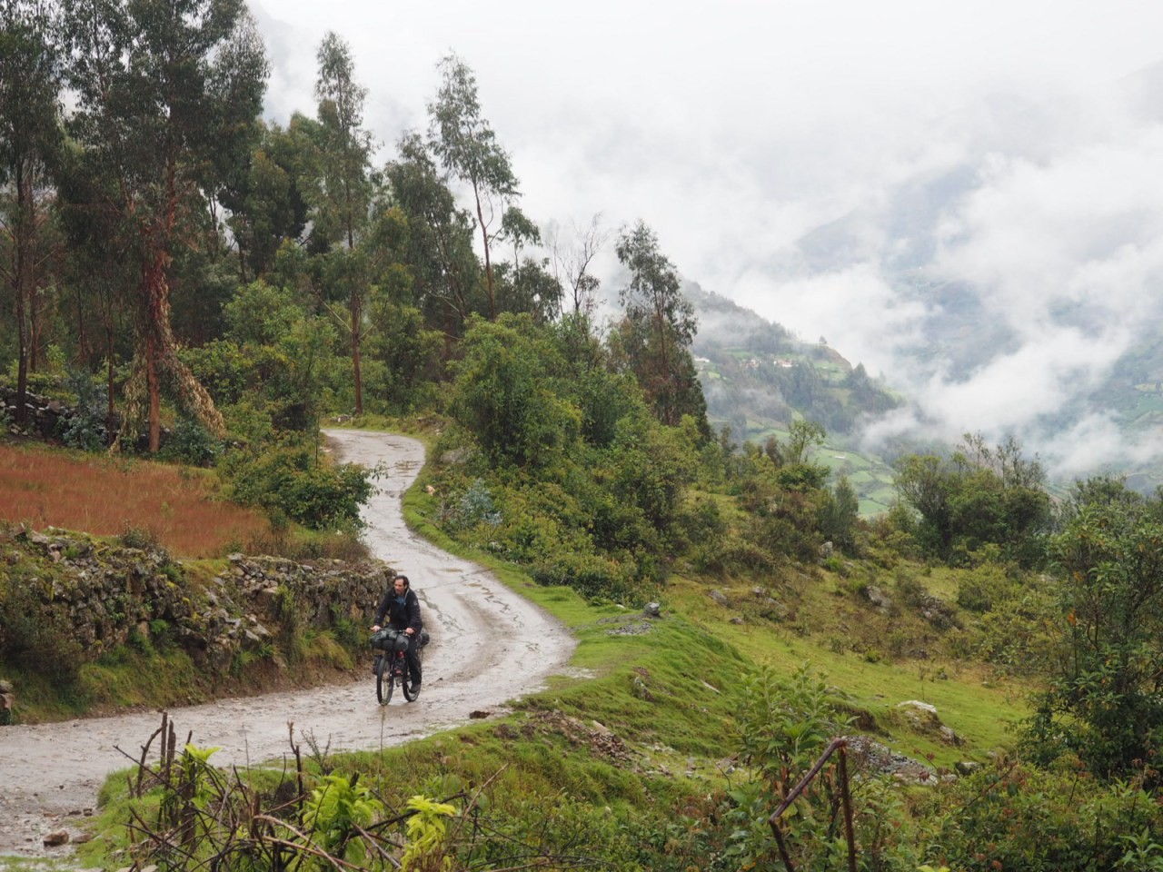
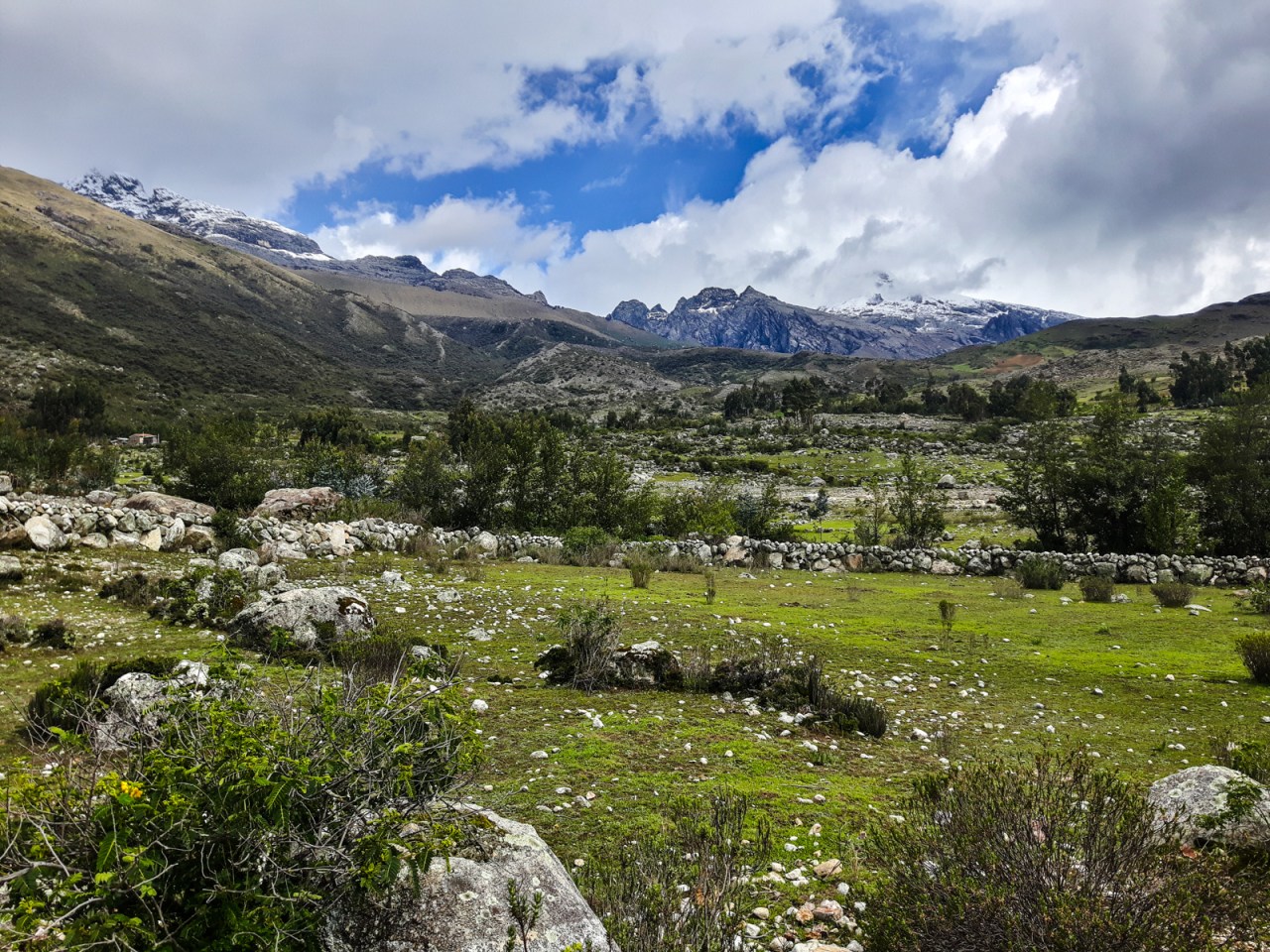
The next day started with a steep push out of town followed by a uneventful climb back up to 4,000 metres. At the top we were greeted with the view of a dazzling green valley interspersed with small creeks, farm houses, and tiny villages – idyllic even by Andean standards. It rained on and off all morning but fortunately the skies cleared when we stopped in Sapcha for lunch. The weather continued to hold for the most part until we arrived in Chacas, at the start of the climb back over the Cordillera Blanca.

The climb out of Yanama started with a steep push.
Then it was a long, gentle climb. Photo by Iohan.

The view from the top was alright.

Iohan was first down from the top.

Sylvain rides through the valley. Photo by Iohan.

The locals wear bright colours around here.
Lunch with friends in Sapcha.

Fred and a kid playing a flute on a donkey.
It was only 4 p.m. when we reached Chacas and I was keen to keep riding until we found a place to camp. My companions felt otherwise and no sooner did we walk into a hotel to find out the price, a torrential downpour began. Rooms were 30 soles, so we took it easy and had an early end to the day.

Descending down to 2,800 metres.

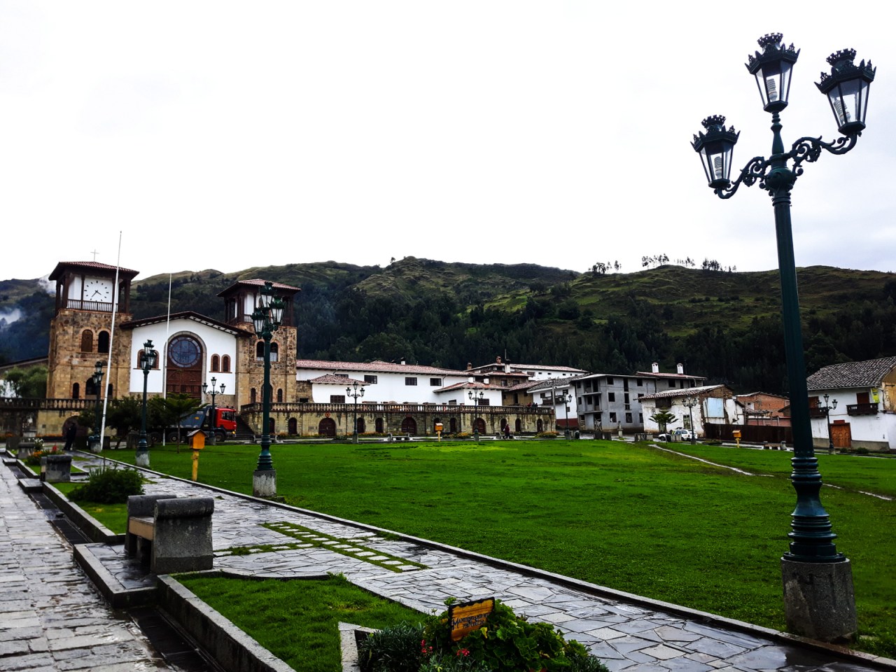
Chacas has some beautiful buildings, but one of the least interesting central plazas I’ve seen.

They also have a book exchange.
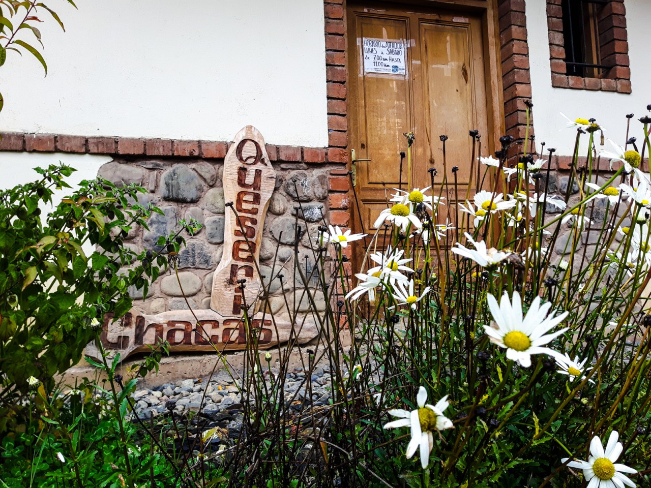
And a cheese factory.

And pretty amazing views.
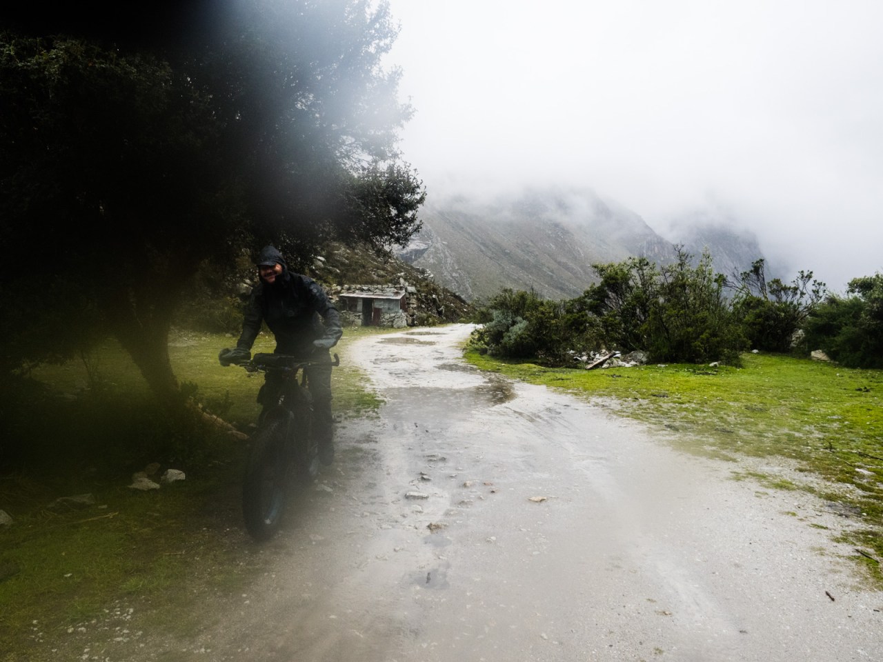
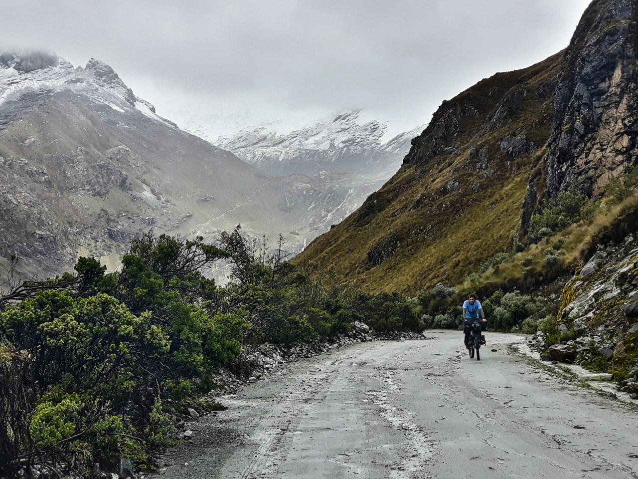
That night I had serious doubts about the next stage of our journey. Our plan was to ride up and over the Portachuelo Honda – a route over a 4,700 metre pass that’s described as 90 per cent rideable on Bikepacking.com, but all the blogs make it seem far more difficult. Considering my last hike-a-bike experience, I wasn’t all that keen to push my bike that high. Not to mention that after several days of riding in the mud, rain and snow, I was seriously tempted to take the easy way and ride the paved highway over 4,900-metre high Punta Olimpica. It would still mean a huge effort, but it would be way easier than the Honda route.
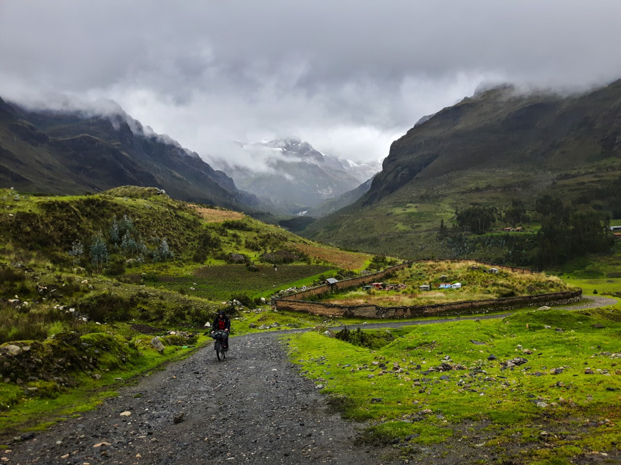
While that thoughts did cross my mind, I knew all along I’d be going for the sufferfest. Day four of our trip began with about 10 kilometres of easy highway riding before we turned off onto the road into the Juytush valley and the start of our push up to Portachuelo Honda. After a few switchbacks, the valley revealed itself and right away I was happy with my choice. Huge mountains towered on either side and a massive glacier beckoned us. We followed a gentle dirt road through pastures divided by stone walls until we reached a locked gate at the entrance to the Vaqueria Juytush. We climbed over the gate and rode on a barely-used road that was at times covered in grass and at other spots rough and rocky. As we neared the end of the valley, the road switchbacked twice, then ended at a landslide.
And that’s where the fun ended. And the rain began.
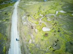
Peruvian highway traffic
The Juytush Valley.

Crossing the Rubicon….

… into the Vacaria Juytush.

The ride up the valley was stunning.
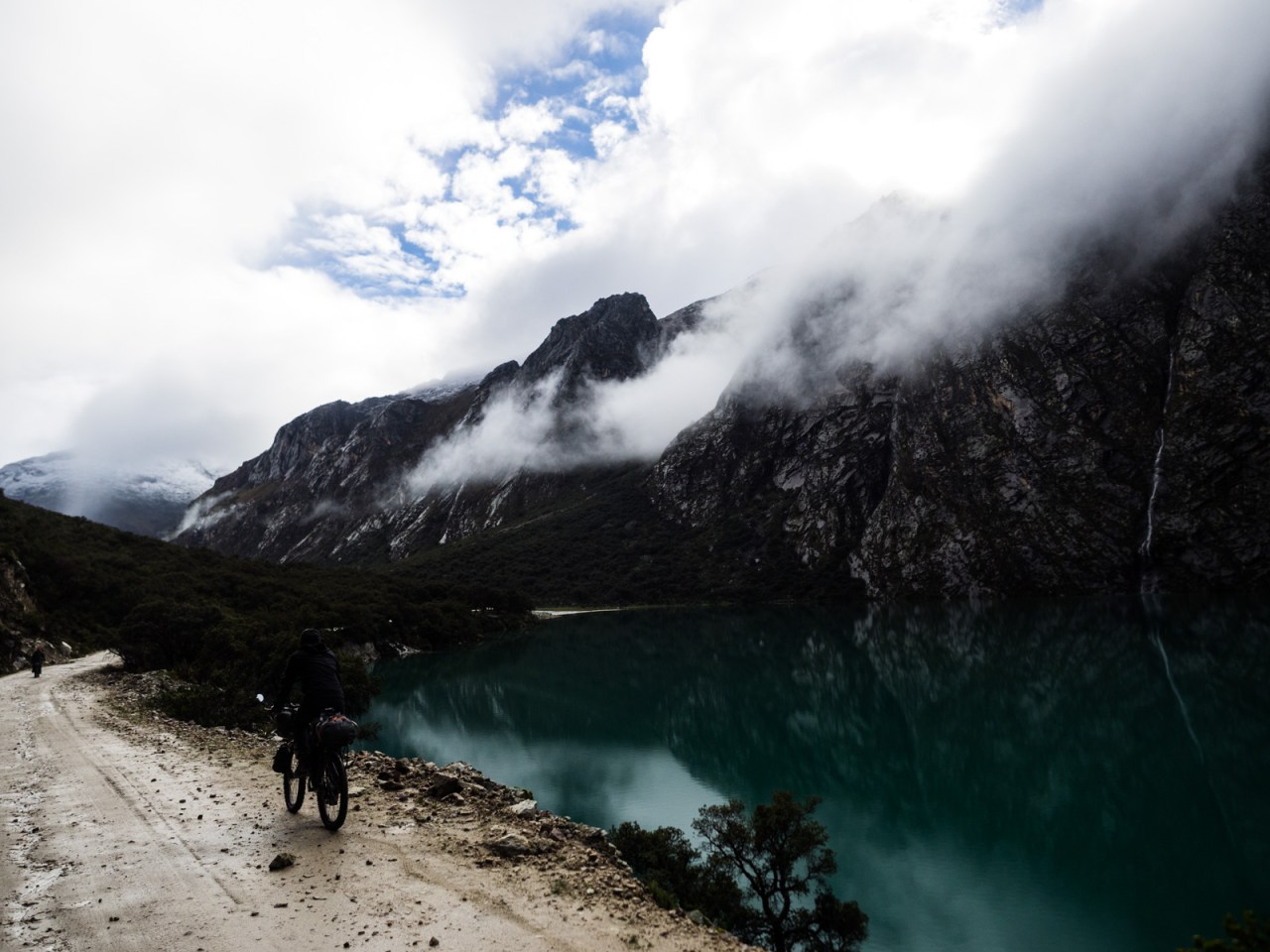
The trail from this point was a mixed bag, ranging from rocky to marshy to flooded. On a mountain bike it would have been fun, but with a loaded touring bike it meant it was time to start pushing. Iohan led the way while I, with my overloaded panniers, took up the rear. We crossed creeks and pushed our bikes through sections where rainfall flooded the trail. I resigned myself to permanently cold wet feet. Clouds hid the tops of the mountains while waterfalls cascaded all around us.

What this picture doesn’t show is the sketchy creek crossing to the left of the frame.
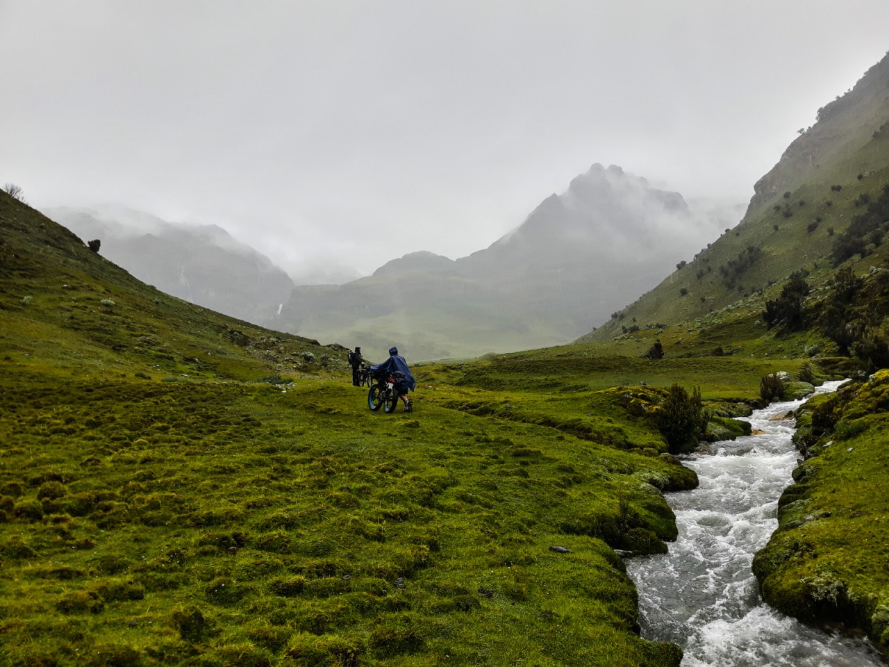
Sylvain and Iohan push through the meadows.
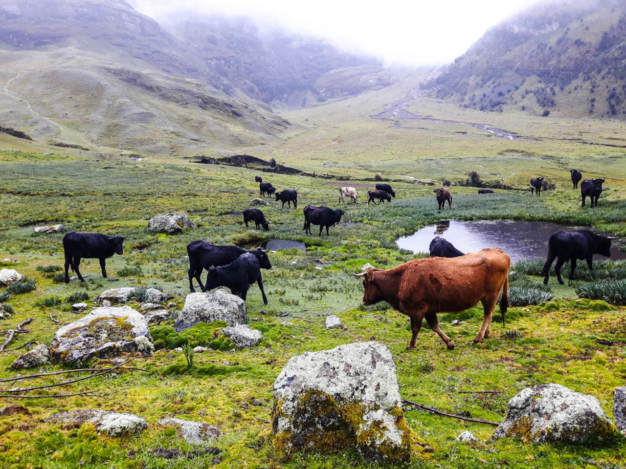
Curious cows approach during my lunch break.


Pushing into a land of waterfalls…

… and into the clouds.
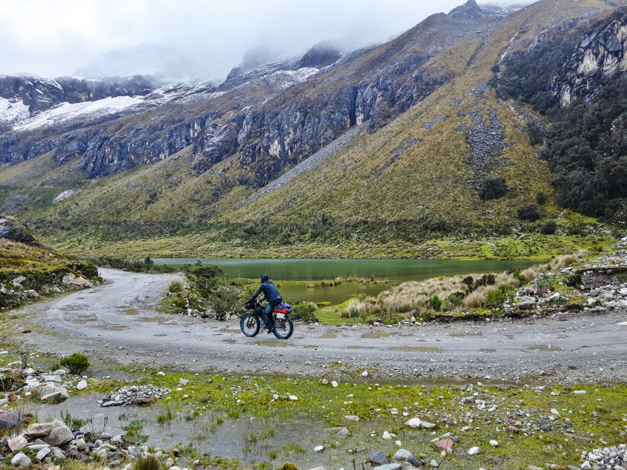
It was around 4:30 and we’d reached 4,400 metres when we spotted a promising place to camp that wasn’t too wet and was reasonably flat. I had to get to Huaraz the next day so I could have time to deal with boring stuff like laundry before meeting my parents in Lima, and I was a little concerned about leaving too much to go. Once again I was outvoted and we opted to camp. The rain let up for about 10 minutes and in that time we were able to pitch our tents before the next downpour began. We huddled inside our respective tents, cooking with the flies zipped up, until the rain finally relented and we could emerge and get a good look at our surroundings. They were pretty incredible – a dusting of snow topping craggy peaks that descended into grassy meadows divided by waterfalls and raging creeks. This would be my highest campsite of the trip.
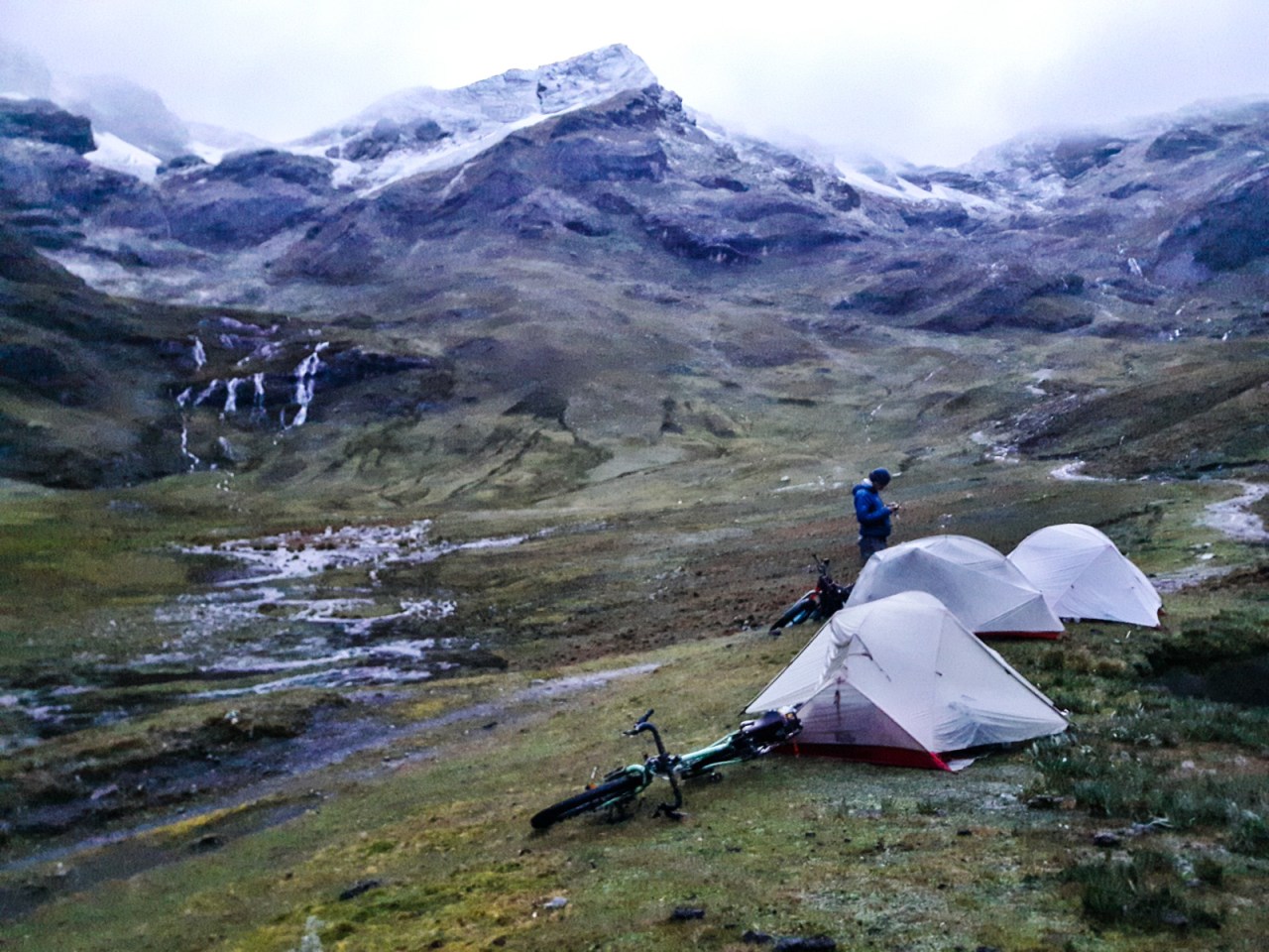
Our campsite at 4,400 metres.
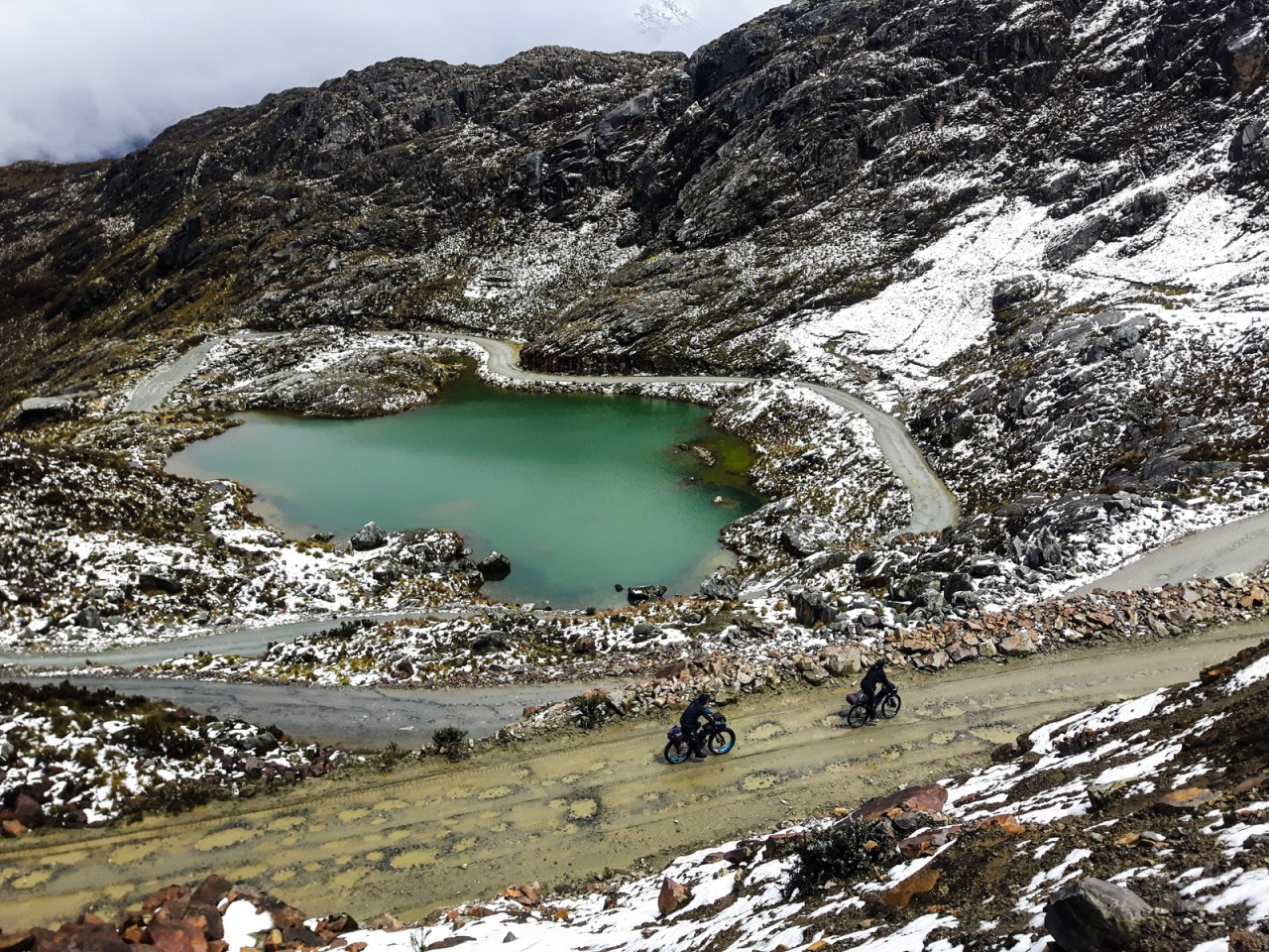
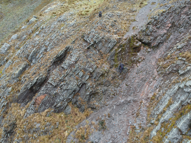
It was still raining the next morning when we packed up camp and resumed pushing our bikes. The GPS track we were following went straight up, while the trail zig-zagged up the mountain. Iohan and Sylvain followed the GPS and I followed the trail – it just looked so much gentler, but it was by no means easy. At this elevation my pace was sluggish and I set a goal of at least 30 steps at a time. Iohan, meanwhile, scrambled up their incredibly sketchy direct route like the mountain goat he is and Sylvain struggled behind him. We reconvened where the two paths converged and confirmed I took the easier way.
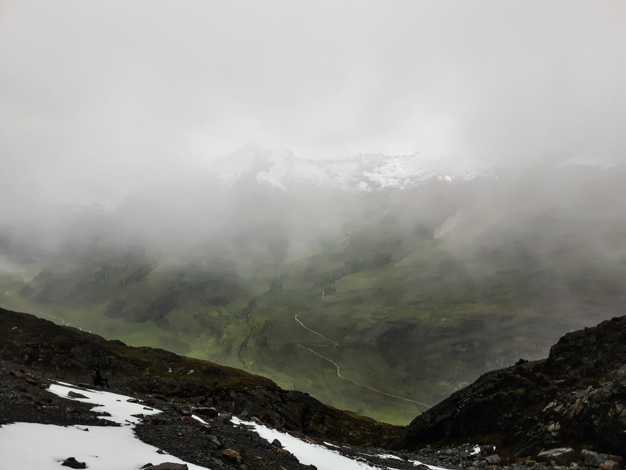
After that adventure the pass wasn’t far off. Iohan reached it well ahead of Sylvain and myself. I moved slowly, counting my steps; at one point I slipped and simply sat down in exhaustion before summoning the energy to proceed. Finally, I could see the top and one last push later I was there. I laid my bike against the rocks and found a place to sit, rest and snack. There was about five centimetres of snow on the ground where we were and more was coming down.
Sylvain and Iohan’s route. Photo by Iohan.

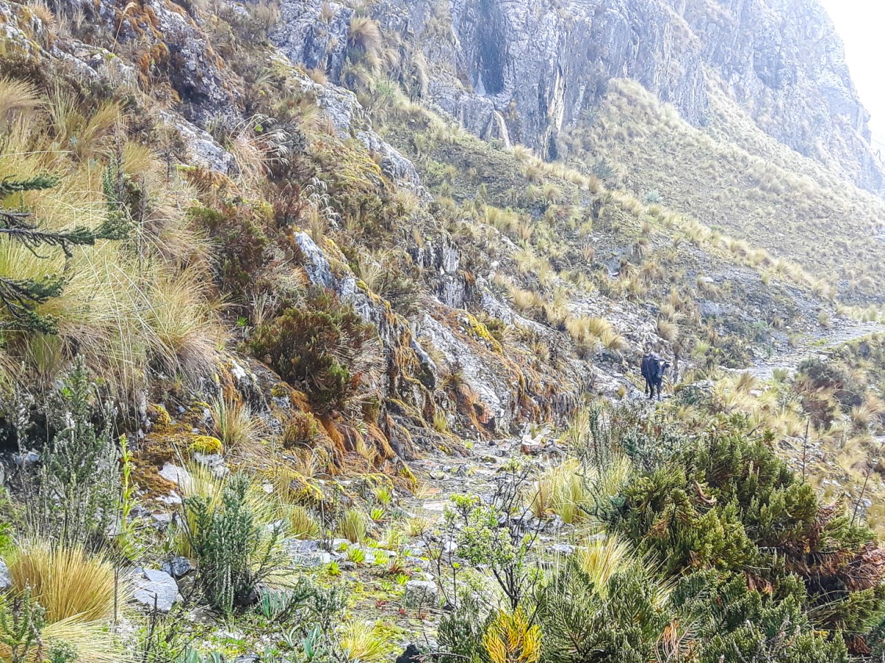
It’s surprising to see cows at 4,400 metres, but not all of the make it.

Sylvain struggles to the top.


A selfie at the pass.
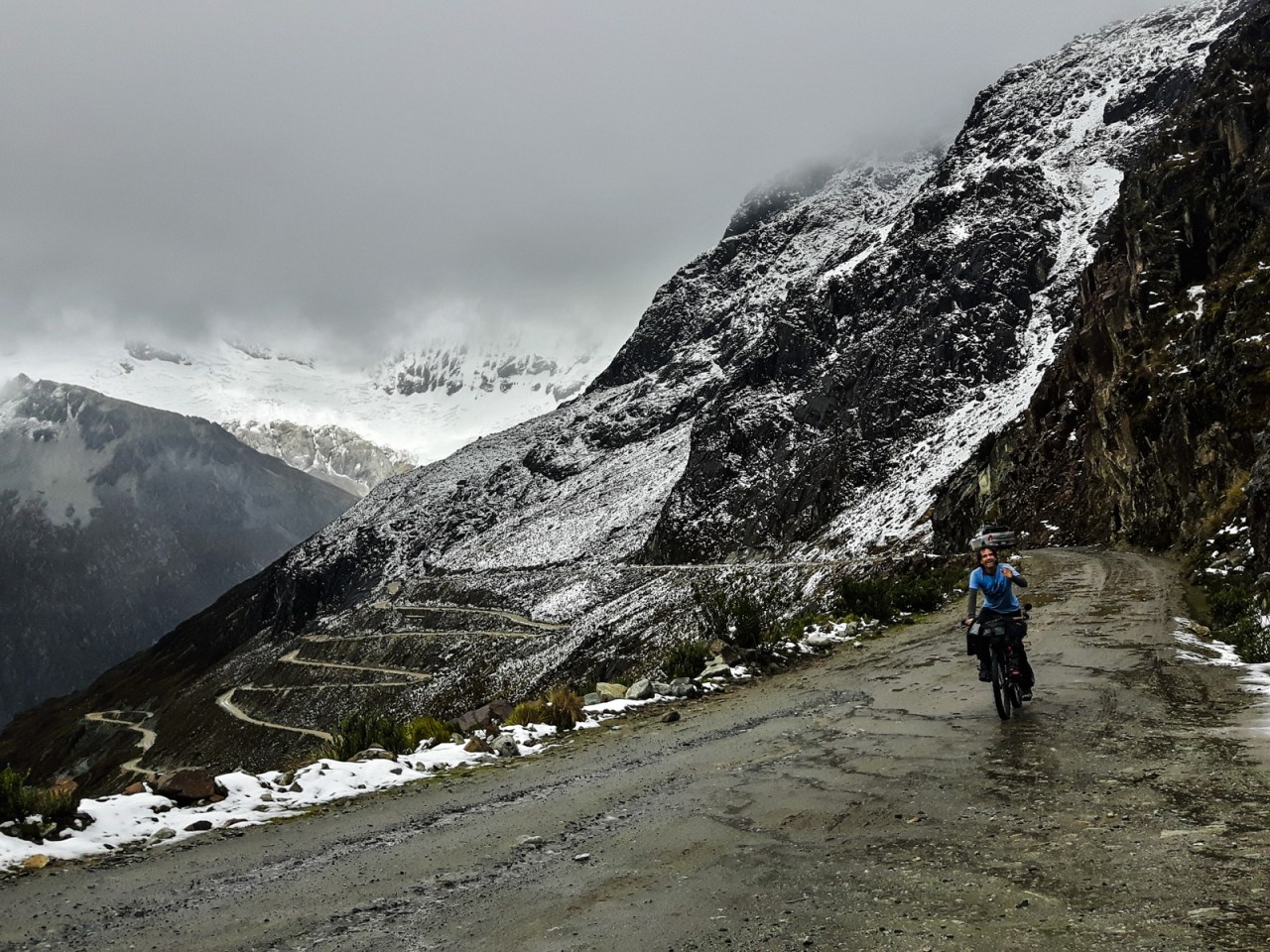
We didn’t linger too long before starting down. The trail was covered in snow at the top and was a mix of slick rocks and brush lower down. Iohan rode as much as he could, while Sylvain and I were content to walk our bikes down into the Quebrada Honda valley some 700 metres below. It wasn’t too bad of a push, especially compared to my last one, but I did manage to mangle my rain pants on my crank on the way down. Fortunately, it stopped raining and the sun came out as we reached the valley. Once again, the views were incredible as we were surrounded by more huge glacier-capped mountains. The only scar was the rumble of trucks from an illegal yet sizeable mine located in the national park.

Iohan leads the way down on his fat bike.


Backcountry obstacles in Peru.

Trucks head down from an illegal mine.
I reached the valley floor just before one and pulled up the route to Huaraz. I had five hours to go 50ish kilometres. Iohan and Sylvain had no deadline, so they went to the far end of the valley to find a place to camp, while I bombed down the road back to civilization. It was a beautiful ride through colourful farmland back to the highway and I made it to Huaraz with time to spare. I got myself a private room at the Casa Blanca Backpackers Hostel and spent the next day doing laundry and drying out my camping gear. And then it was off to Lima to meet my parents for an extended break from the ride.

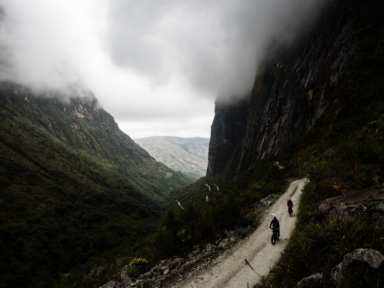
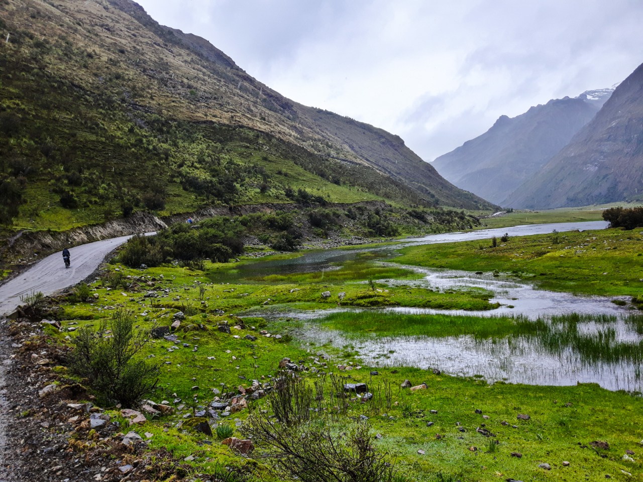
The Quebrada Honda valley. Was it worth the struggle? Probably.


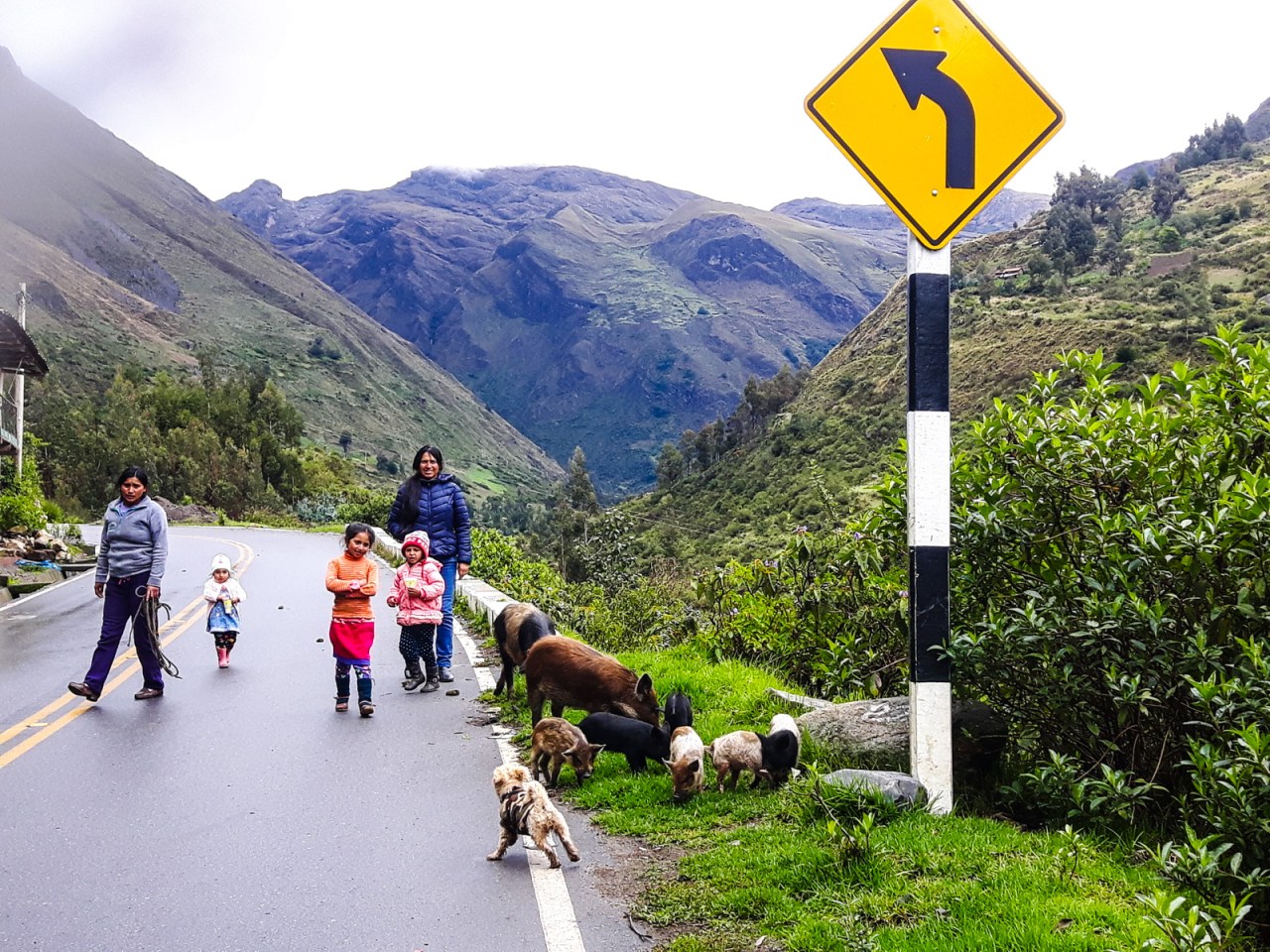
A family and their flock.

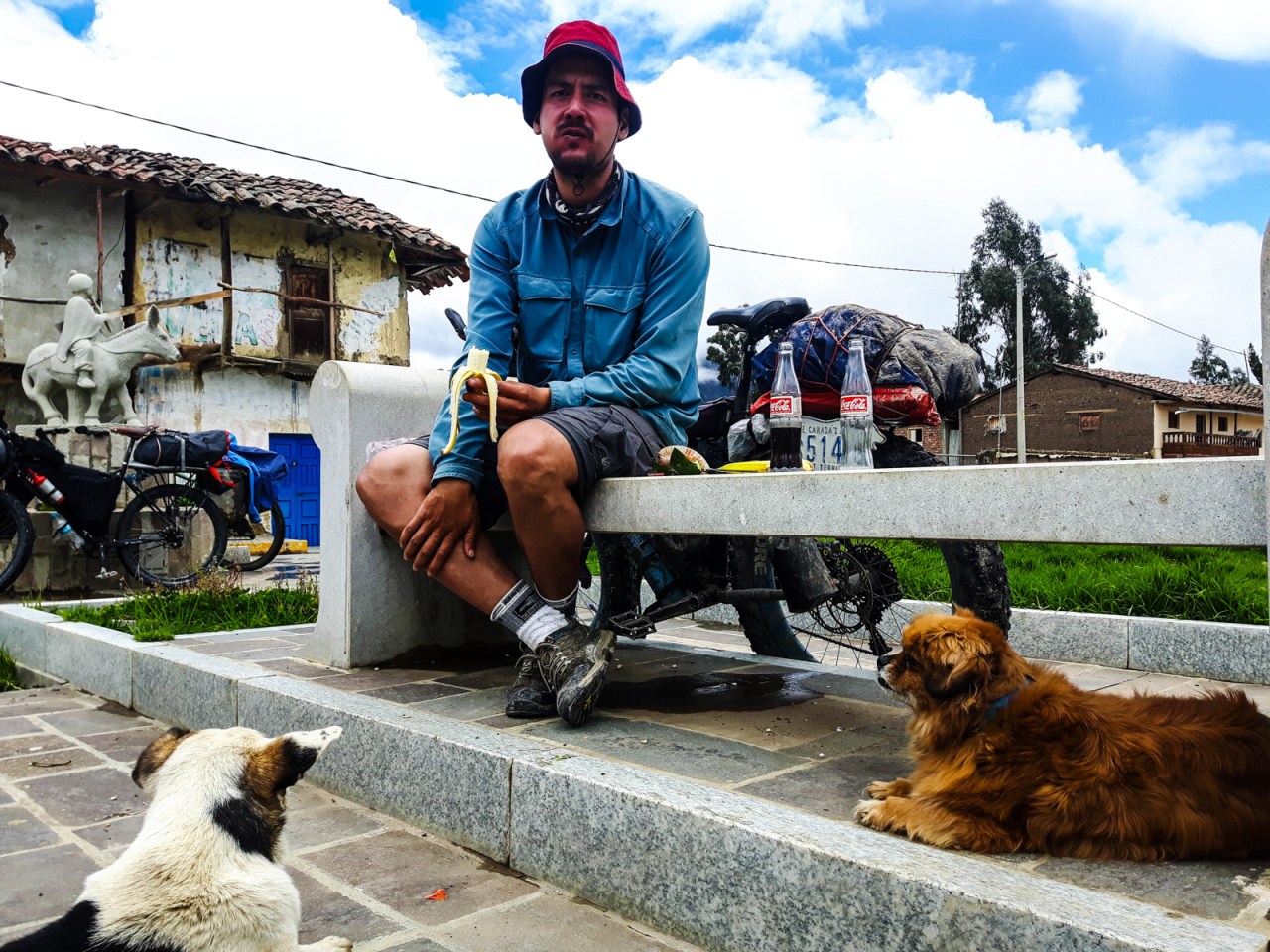
I’m not sure who this guy is.
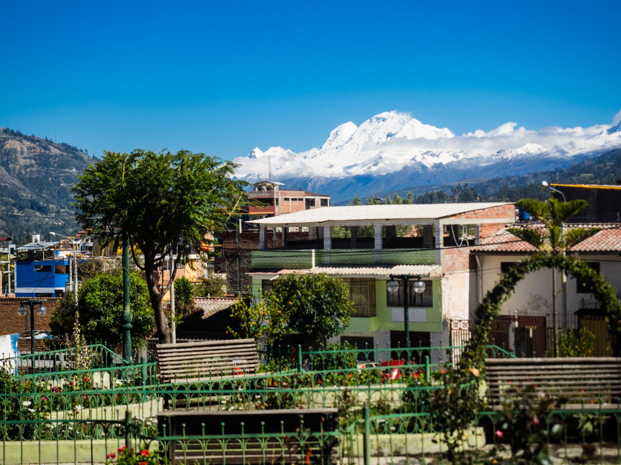
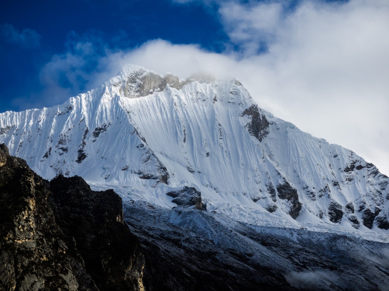
Nevado Huascaran, on the sunny morning when I head down to the coast.


Leave a comment