
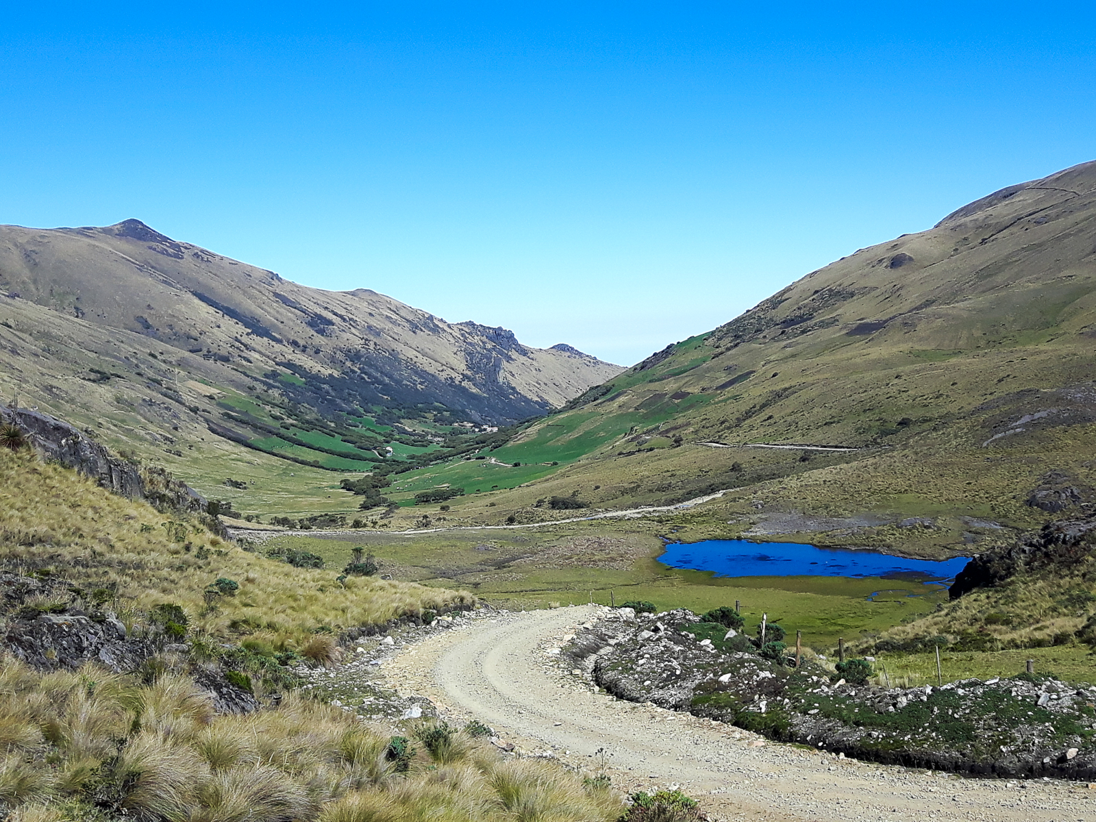
If there’s one thing I loved most about riding in Ecuador, it was the wide open spaces. Colombia featured lots of ups and downs through mountainous farmland, but I experienced little in the way of open mountain landscapes.
Entering Ecuador, I witnessed that right away as I climbed into El Angel Ecological Reserve. That continued through Cotopaxi National Park and the Quilotoa region, and there may have been more of that, but unfortunately I got stuck in an endless fog for a few days riding beyond Quilotoa and past Chimborazo. That stretch had me fleeing for the jungle lowlands, but a five hour bus ride had me back in the Andes, in the beautiful colonial city of Cuenca.

Cuenca provided a great repose and a chance to bring my bike into the shop for a full tuneup. I arrived there on a Friday evening and after a quick bit of research at the bus station, I ended up checking into the Mi Casa Hostel. It turned out to be a great choice to make home for the next four days while I waited to get my bike back.
Cuenca is a lovely city, with a preserved historic centre, a wide variety of restaurants and quick access to Cajas National Park. I spent three of my four days there wandering around the city, visiting museums and eating, and the other day going for a hike in Cajas. I was lucky to have some great company. Harry, who I’d met in Banos arrived in Cuenca the same night as me, while Anne, who I’d met on the Quilotoa loop, showed up at my hostel a day after me.


While I enjoyed my days exploring the city, and eating pho and Indian food, the real highlight was the trip to Cajas National Park. I think it was Monday when four of us – Anne, Harry, ???? and I – hopped on the 8 a.m. bus and were whisked up to almost 4,000 metres for a nice little stroll. The ride there was impressive enough as we climbed through a verdant valley before entering the lake-filled paramo. The hike was even more impressive, as we scrambled to the top of a ridge for 360-degree views of the surrounding area, before climbing back down and meandering our way around lakes and streams until we exited the park and got the bus back to town. The views were constantly incredible, and we only saw a small fraction of the park on our 15 kilometre hike.
The unfortunate part is my camera started it’s slow death partway through; it would give up the ghost for good a few days of inconsistent use later. The memory card also seemed to have died with it, but fortunately I had just transferred most of photos off it the day before, and did get a few pictures of the hike from it too.


The next day we (sans Harry, but plus Tom, another Dutchman) went for Indian food, visited a local museum, and then I went to get my bike back – something that took three tries. The upside was it was almost as good as new and ready for the road the next day. I was excited about the next stretch because I had plotted out what looked to be a very scenic dirt road route that would take me all the way to Loja with minimal highway time.


As usual, getting out of the city was a bit of an ordeal, as my GPS sent me down all sorts of strange roads. Eventually I found myself climbing through the suburb of Banos (due to its hot springs) and out into the countryside, where the paved road turned to dirt and followed a small river that flowed through beautiful valley covered in small farms. The dirt and the grade were perfect as I climbed to the hamlet of Soldados, which sits at the southern edge of Cajas National Park. I had lunch there, entered the park, then turned off to the south, where the real adventure would begin.


I couldn’t find any information online about this road I was going to take, and all I could tell beforehand is that it climbed to almost 4,000 metres and then stayed there for a while before plummeting backdown to civilization. This is exactly the type of riding I love, and I hoped my online scouting played out in real life.
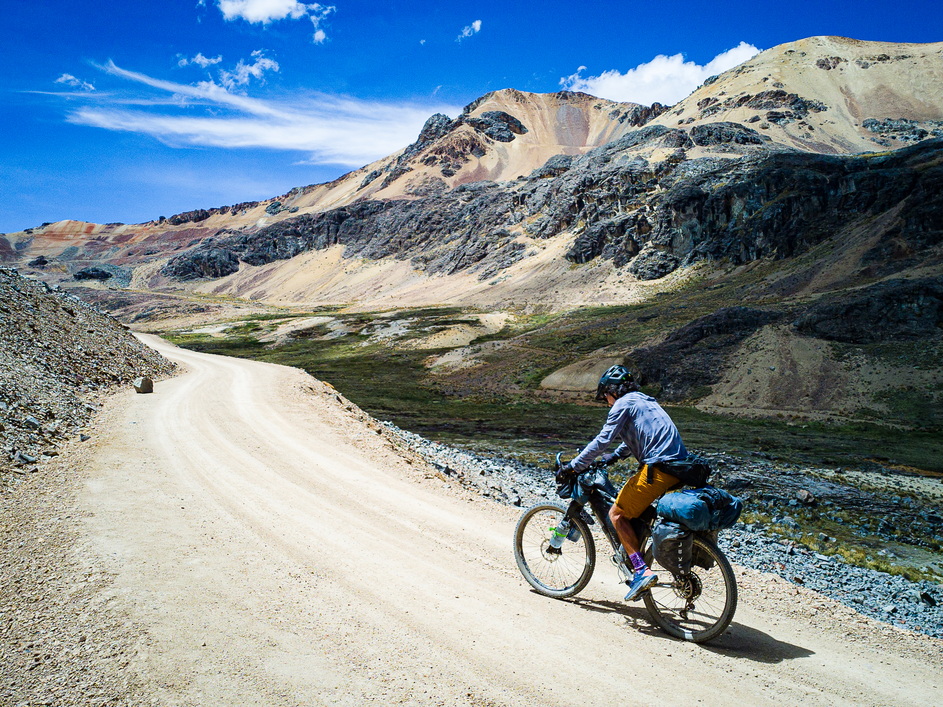
Boy did it ever. After a steep climb, I found myself in a wide open alpine landscape devoid of almost all signs of civilization. There was some cows and horses grazing and the occasional farmhouse, but I saw very few people and almost no vehicles. The road stretched out in front of me as it rose and fell through the paramo. Other than one painfully steep climb out of the hamlet of Gal Gal, it was fairly mellow riding as I pedaled into the late afternoon and the sunset hour approached. I started looking for campsites, but I also wanted to reach the top of the last climb so I could watch the sunset. That meant passing up a perfectly good spot, but it was worth it.


As I crested the final hill, I was able to look down on a sea of clouds that stretched west to the Pacific Ocean. The sun lowered in the sky, casting a golden glow and the endless grassy fields. I got off my bike to soak in the views, knowing I still needed a place to sleep. Unfortunately, the ground was very uneven and most of the roadside was fenced. I scouted out a few empty-looking buildings, only to find they were locked. As it got later, the skies illuminated. I could see a few homes off in the distance, so I made my way there, hoping someone would let me camp outside their home. Fortunately, the first place I came to was so gracious, and I was able to set up camp high in the mountains after one of the best days of my trip. I didn’t know it would only get better.
The next morning I was up early. I was able to fill up my water bottles from the home I camped at and hit the road. I had two 500-metre climbs ahead of me, and some 3,500 metres of descending to look forward to. On a trip full of scenic wonders, this may have been the most beautiful section of road I’d experienced. It did’t hurt that it was a beautiful sunny day, but the mix of wide open paramo and scenic valleys also helped.


It was one of those days that despite hoping to put in some big kilometres, I kept stopping to take photos and soak in the atmosphere. Near the top of the first of two big climbs, I found a nice rock to lean back on to admire what I’d just come up. And then when I actually crested the pass, I was once again blown away. And after more descending and a second big climb, I entered into more vast paramo terrain, this time dotted with numerous dark blue lakes. And then I got a wild, 1,000-metre descent to the town of San Fernando on a really fun dirt road. It really doesn’t get better than this.


From San Fernando, the scenery wasn’t as amazing, but the ride was just as fun as I continued to descend down to Highway E59. I followed my GPS track onto an old grassy farm track, which turned into fun single track, which turned into downhill hike-a-bike, though the trail would have been a blast unloaded. Eventually I was back on the road and I finally hit the highway at a lowly 1,400 metres. The town of Santa Isabel wasn’t far away, so I decided to head there to find a place to sleep for the night. I thought about the rest of the route I had planned, which included a 2,000 metre climb back into the mountains. I also thought about going to Mancora in northern Peru for some beach time.
Then, as I grunted up a short hill, I saw another bike tourer at the side of the highway. He was with two friends and they were going to Mancora. After spending most of the past three months riding by myself, I figured it was time for some company.
To the coast it was.
You can view the GPS track for this route here: https://ridewithgps.com/routes/26717095



Leave a Reply