“Is it worth it?”
It’s a familiar question I ask myself often. Is riding close up to glaciers it worth it, even if it means riding through snow and rain and wind and cold afterward?
Is pushing my loaded bike up and over multiple passes more than 4,500-metres in altitude worth it for the expansive views and the hot springs that await?
Why are these views worth suffering for? Why put in the extra effort for the solitude and silence of the mountains? There are easier routes to take and in Peru they’re often spectacular as well. So why do it?

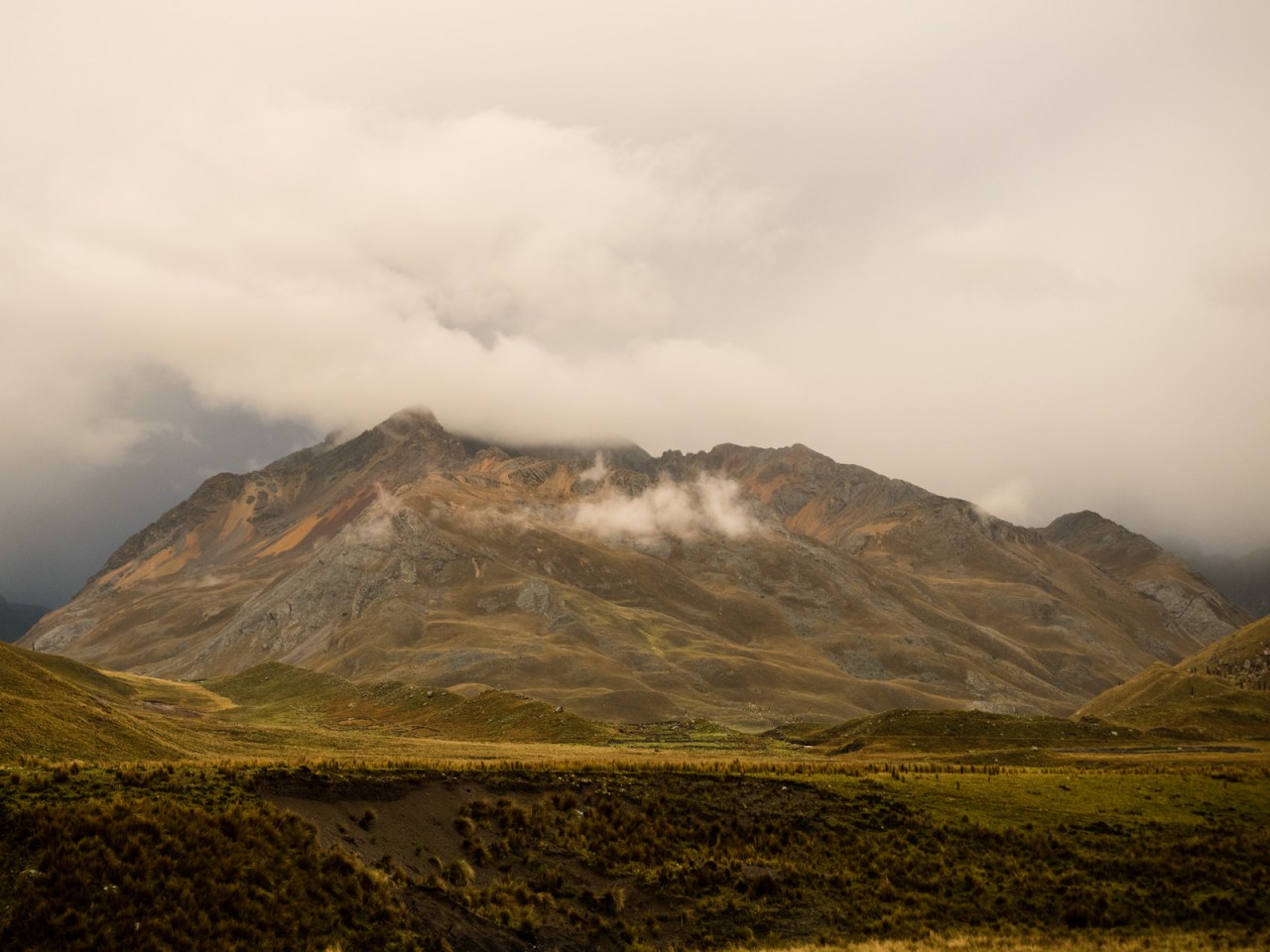
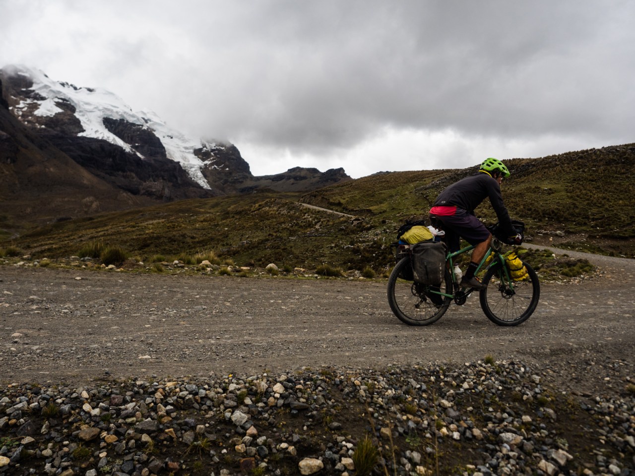
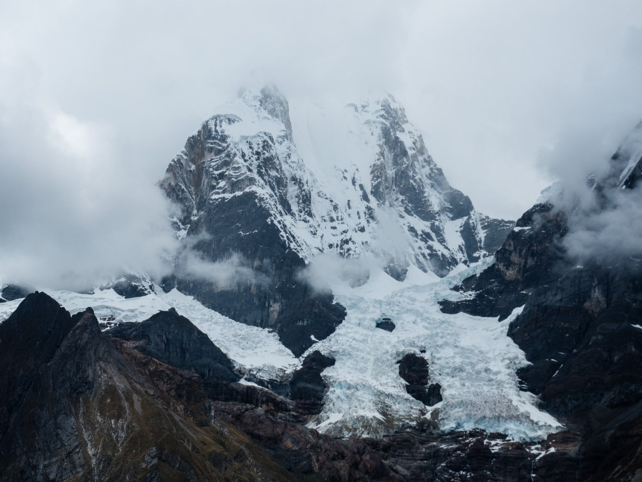
I ponder this after one of the toughest, yet most incredible stretches of my trip so far. I rode my bike past the incredible Pastoruri Glacier near the southern end of the Cordillera Blanca, then pushed it through the Cordillera Huayhuash – a trekking circuit considered one of the best of the world. Through both areas I was met with adversity. The two days along the Pastouri route saw me cycling through heavy rain and snow and into one of the coldest descents of my trip. On the Huayhuash, I often found myself cursing myself as I maneuvered my bike over a series of passes, each higher than the next, with the final one approaching 4,800 metres in elevation. Fortunately, I had help to get me through the worst of it. And there was some pretty amazing rewards.
It all started in Huaraz, which I returned to after a very relaxing 10 days traveling around southern Peru with my parents. I slept on comfy beds in nice hotels and ate amazing food at great restaurants. It was a very nice change of pace from the previous 4.5 months of travel, eating mostly the basic local food, which is generally decent but almost never great; and sleeping in a tent or in a cheap hotel with old mattresses and peeling walls.
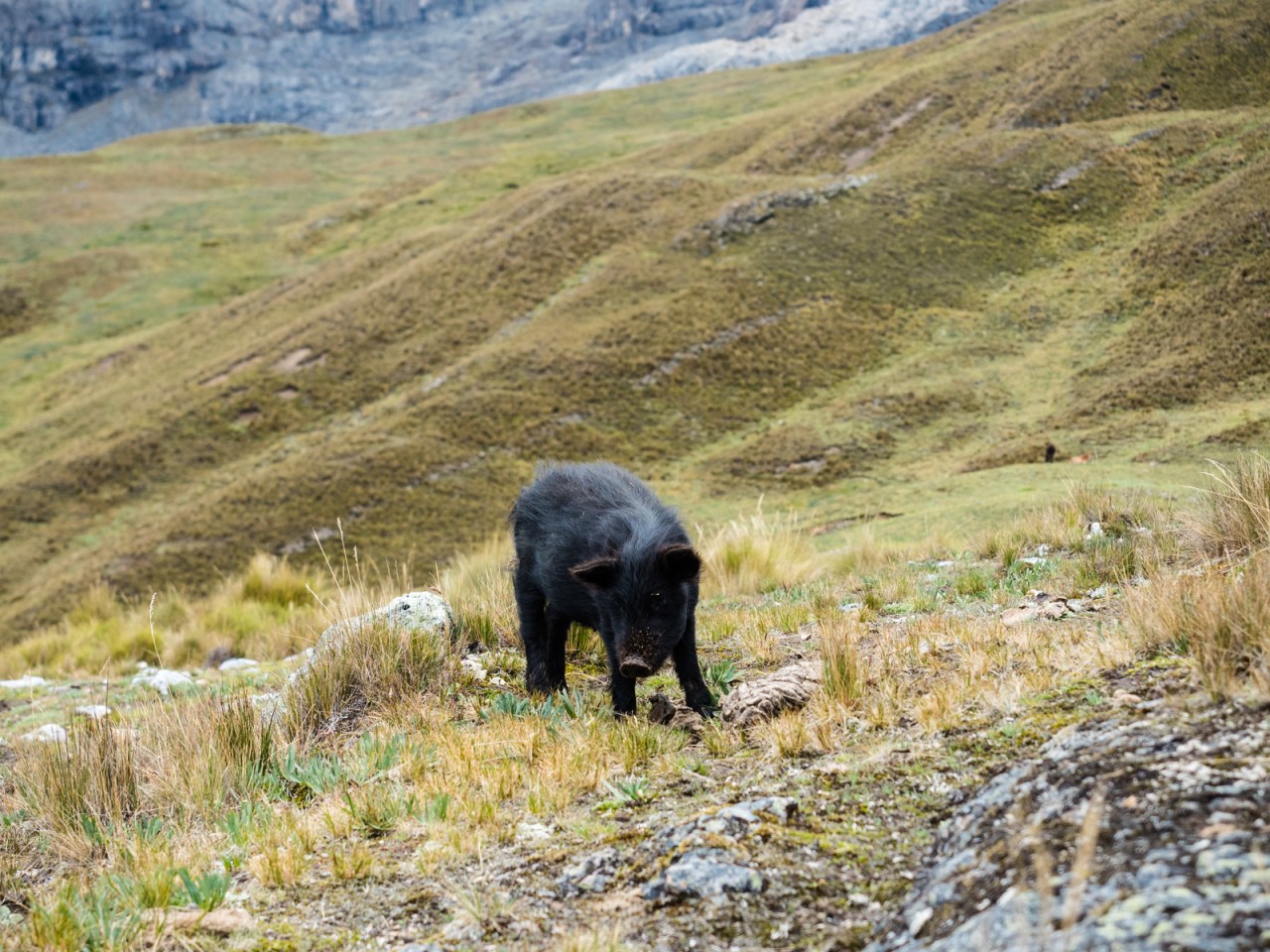
It took me two days to leave Huaraz and resume my journey south. I left a little later than planned, some last minute bike maintenance delaying my departure another morning. Still, with a relatively easy day planned, I wasn’t too worried. I rode south on the 3N highway, cruising uphill slowly to get my legs back after two weeks off the bike. It was a dull, gradual climb through the usual farmland and small towns until I reached the turnoff to the Pastoruri Glacier. No sooner than I did, it started raining – and raining hard.


I reached the entrance to Huascaran National Park a little after 5 p.m. and the wardens let me camper under the awning of the visitor centre, saving me from setting up my tent in the rain. I found a little nook that was the exact length as my sleeping pad and settled in for the night, cooking up a meal of veggies and quinoa.

The next morning I set off towards the glacier and the 4,800 metre pass that awaited. A bright sun slowly burned off the clouds, revealing the yellow fields and snow-capped mountains above them. I rode past fields of puya raimondii – huge bromeliads that are relatives of the pineapple (but many times bigger) and only found at high elevations in the Andes. The ascent was gradual and I reached the visitor centre for the glacier in a few hours.


The Pastoruri Glacier is held up as a symbol of climate change, with the trail to it lined with reminders of how far its shrunk in the past decades. Back in the day, locals would drive up and go skiing and snowboarding on it. Now, they expect the glacier to disappear within a few years. The trail loops up and down past a small lake and you can walk right to the face of the glacier. I, on the other hand, was not feeling it, and I turned around half way, knowing I still had a long way to bike today. I was heading back down the trail as the hordes of day trippers from Huaraz were heading up.


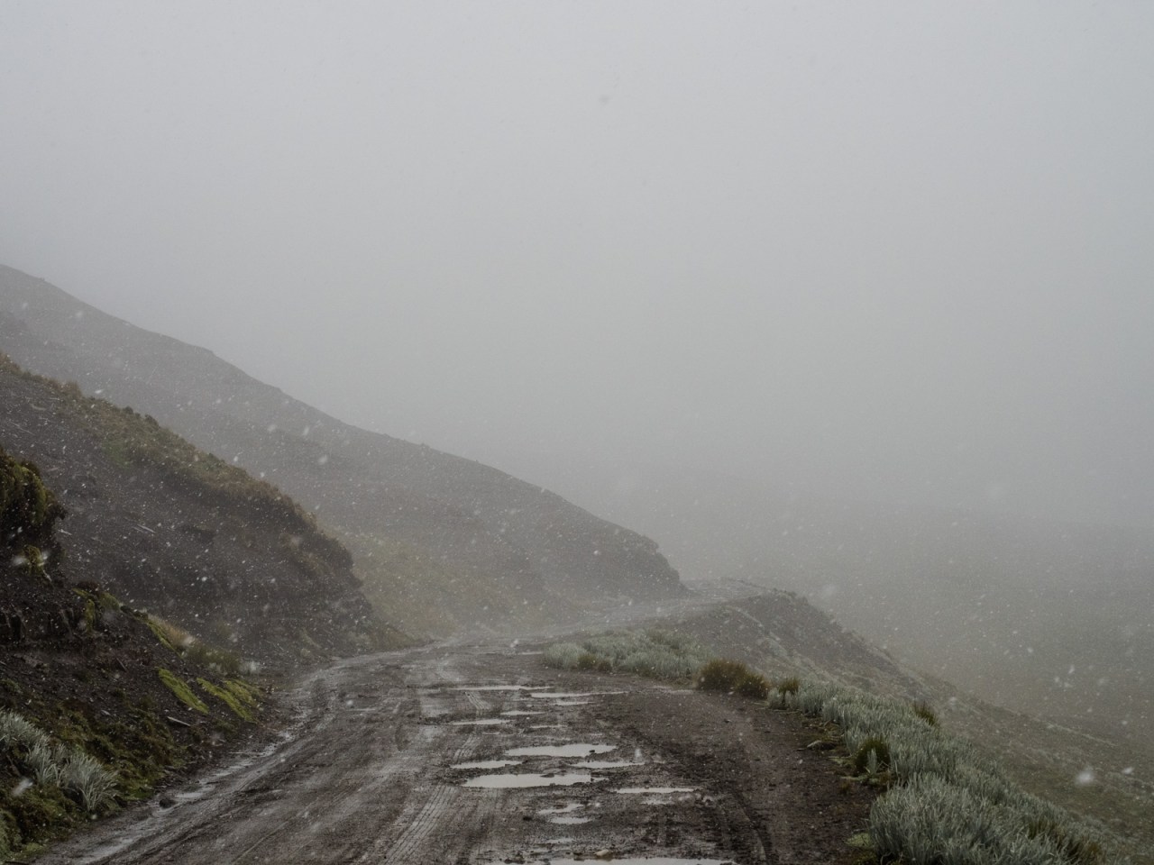
A light drizzle started as I left the visitor centre. I put on my rain gear as a precaution, even though it wasn’t really needed at that moment. Thank God I did, because the rain intensified quickly and didn’t relent the rest of the day. I reached the pass, descended a bit, then climbed to another 4,800 metre pass, where it started to snow. My glasses were covered in water and I could barely see as I started the long descent to Huallanca. My gloves, which had done such a great job of keeping my hands dry to this point, failed and by the time I hit the pavement, I was freezing. I could barely feel my brakes and I limped into the Casa Vieja hotel, grateful for a cup of hot tea and a true hot shower.


I felt a lot better the next day when I left to cycle the east side of the Huayhuash circuit. The Huayhuash is regarded as one of the premier alpine treks in the world and months ago, while plotting out my trip back in Revelstoke, I scouted out a route through the eastern portion on Google Earth that looked fairly rideable. I then found a GPS track by Dan and Gina of Fatcycling.com, who had actually ridden the route I laid out several years ago, so I knew it was doable. This was long before I realized how hard it was (read: impossible) to ride a loaded touring bike on rough single track above 4,000 metres.
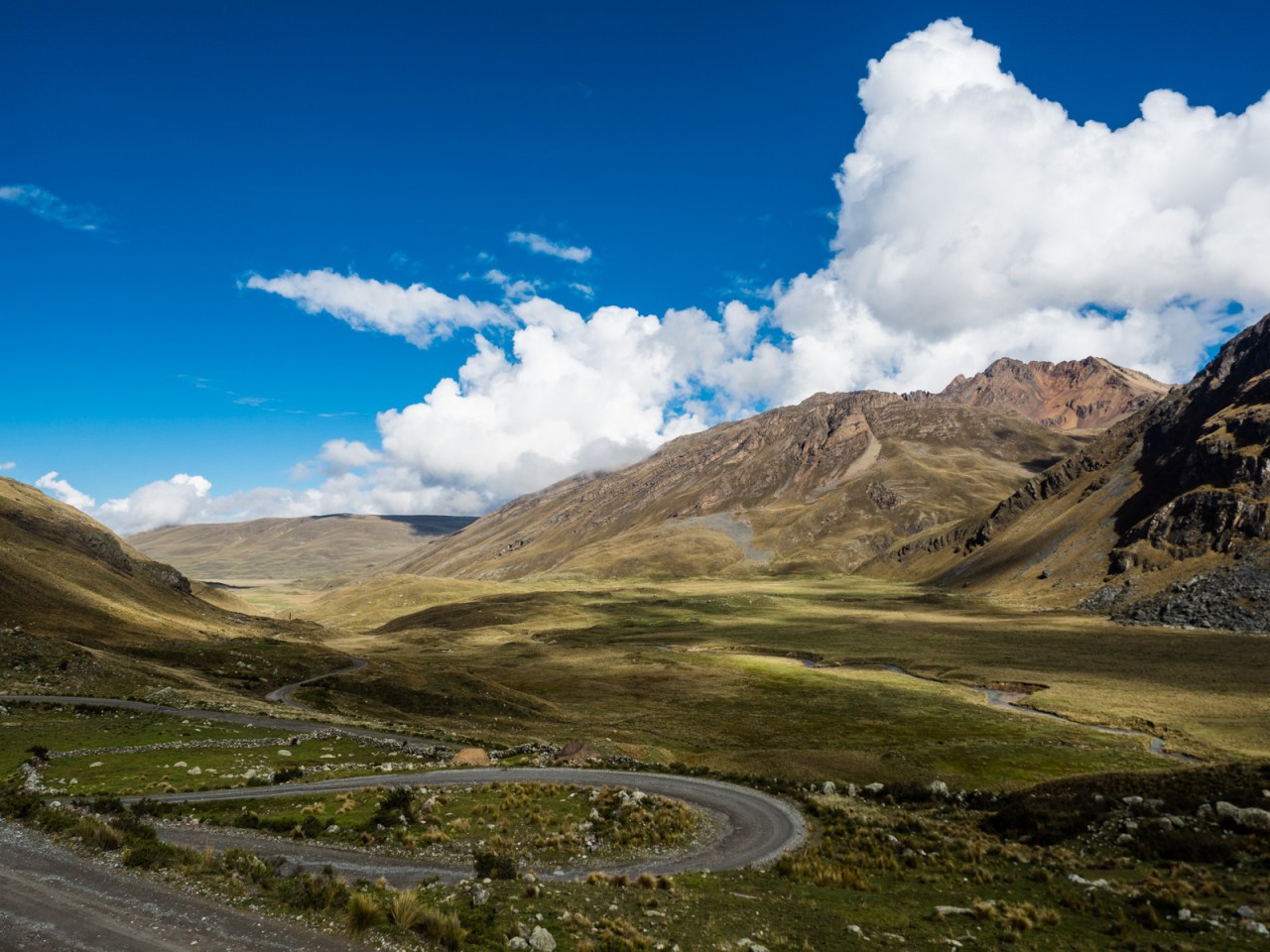
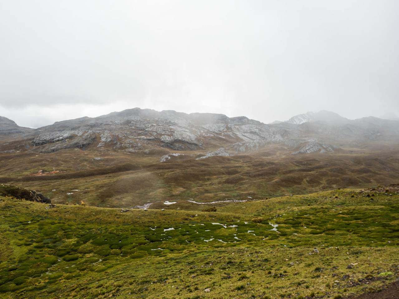
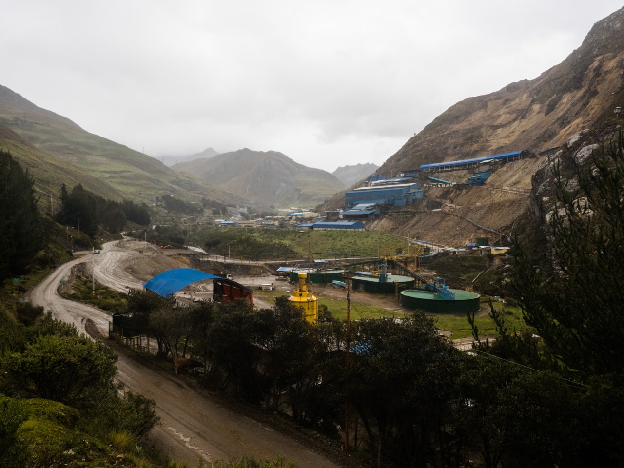
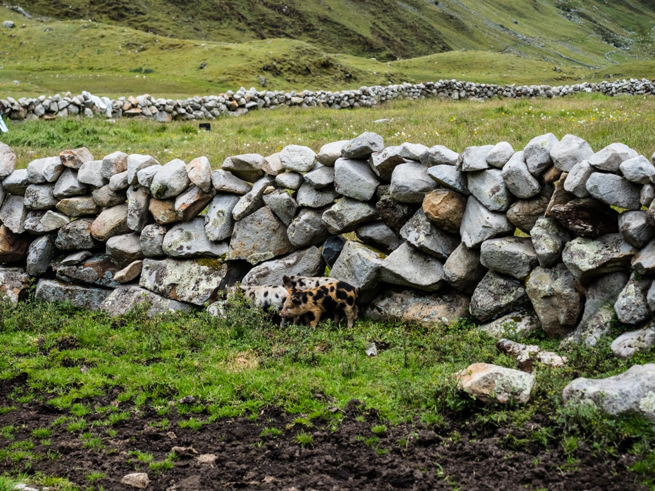
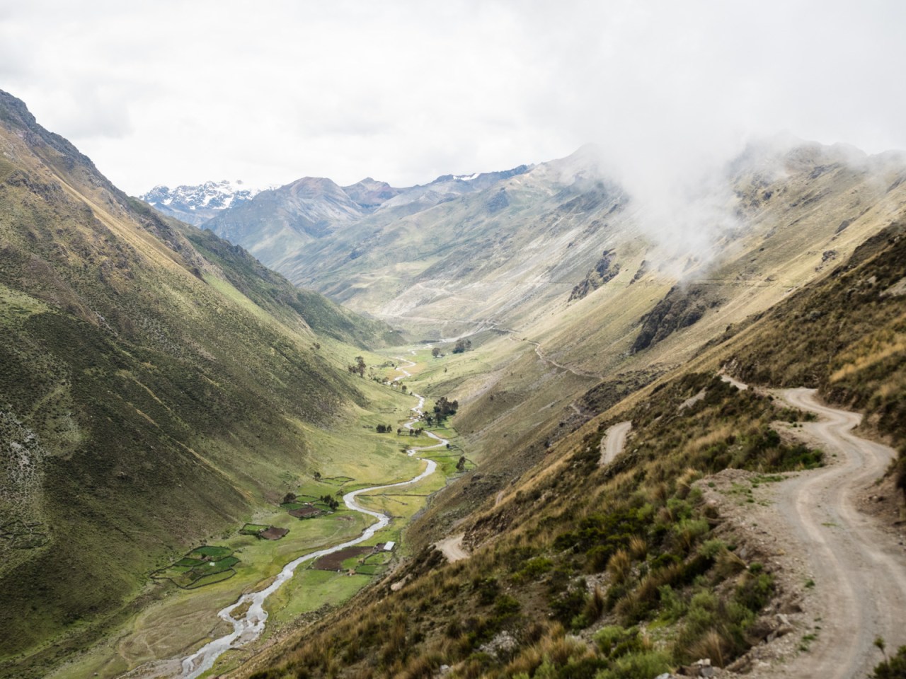
The ride started out with a couple of steep switchbacks before the road mellowed out and followed a meandering river into the Huayhuash. It was a perfect dirt road where the only traffic was a cluster of mining trucks that passed me going the other way early on. Otherwise, I had it to myself as I rode past the isolated ranches that cover this part of Peru.


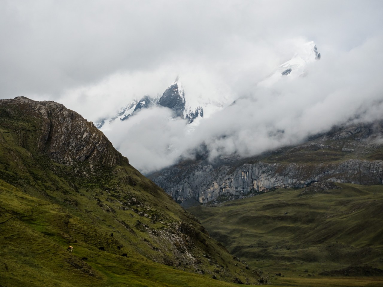
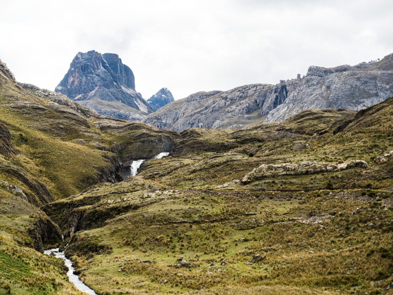
Eventually I reached the turnoff to the Huayhuash and I got off my bike and pushed it up a rocky track and around a hillside into another valley. From there, it was some difficult pushing along a steep slope, so I gave up and descended to the valley, where there was less brush and I could push and ride my bike easily over this green vegetation that looked a little like moss, but was solid and supportive of my bike. Still, it wasn’t that easy, and it took me a few hours to connect with the next bit of road road that would bring me over the pass and into the next valley. I also had a scary encounter with a pack of dogs that circled me and got closer and closer until I finally scared them off with a few well placed rock tosses. I set up camp at the edge of the road, with a perfect view of a huge mountain right in front of me. It was almost dark and I told myself I’d take a picture in the morning as the snowy peaked glowed in the early light.


When I woke up, it was calm but cloudy and that incredible mountain scene was hidden from site. I broke camp and rode down into the valley, then turned off the road and across some fields to connect with the Huayhuash trail. The next pass was a mixed bag that I could have ridden with some effort, but found it easier to push. It took me less time than expected to reach the 4,500-metre pass ahead of me and when I did, I was greeted with a wonderful bit of single track to ride down. I flew down as much as I could, but had to walk quite a bit when the terrain got too rough. On the way, a couple of kids hit me up for a 10 soles ($4 CDN) trail fee. They initially demanded 50 soles, which was absurd, and they still ran away gleefully with my “donation.”


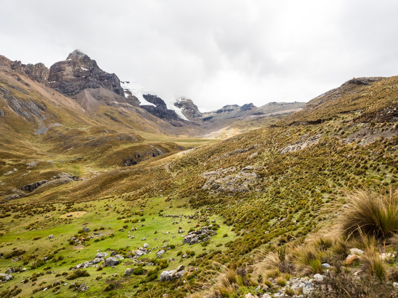
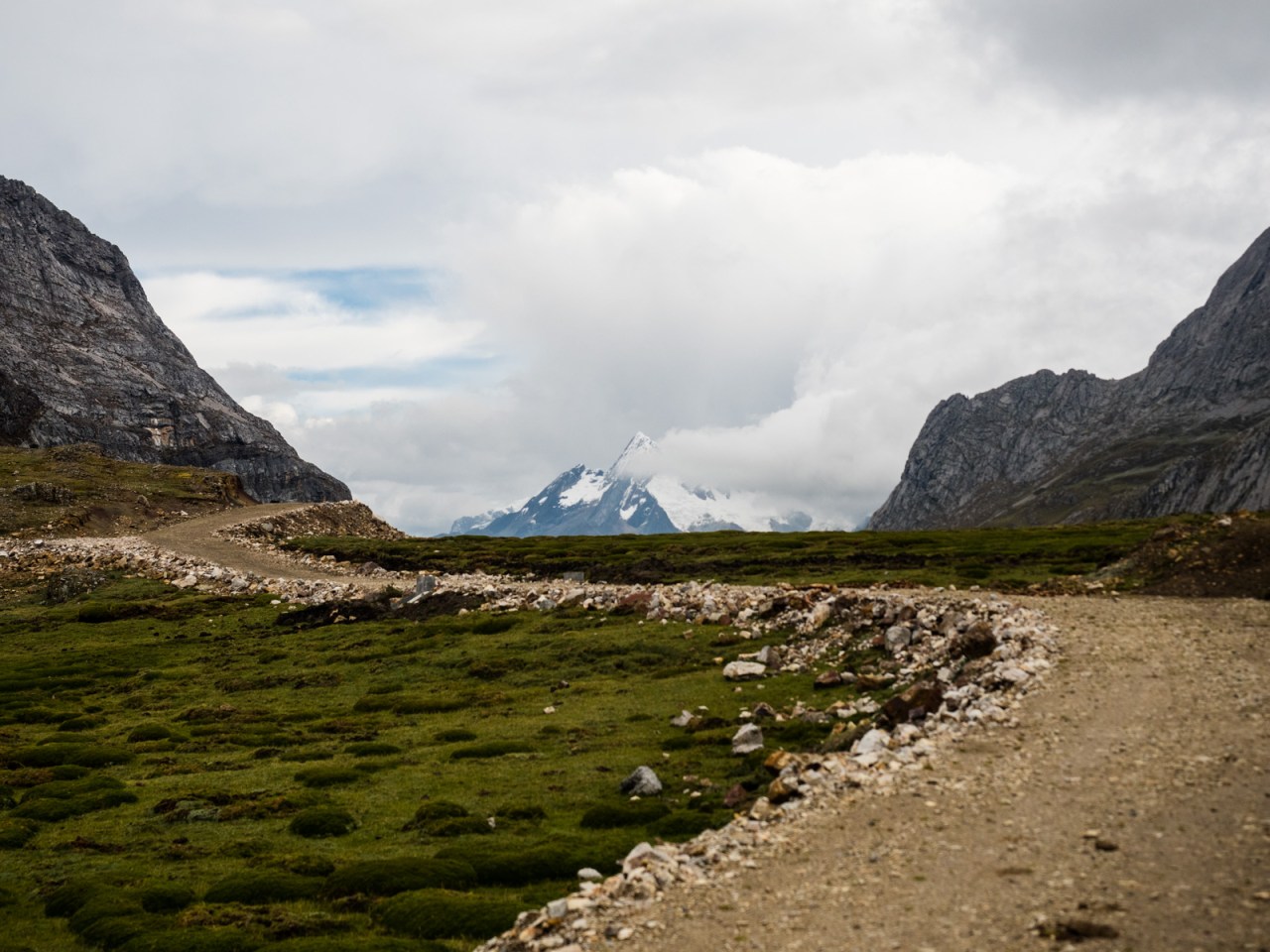
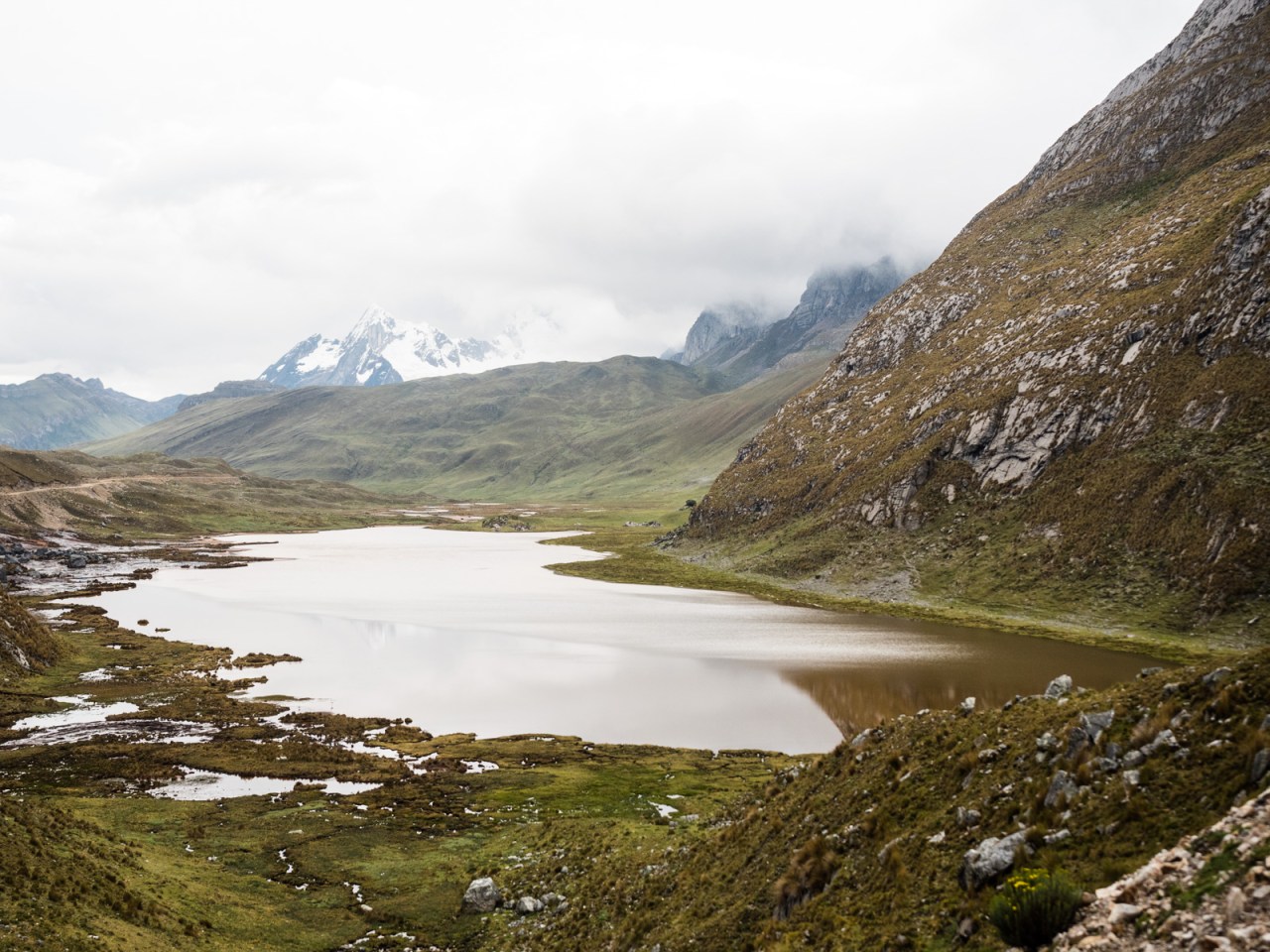
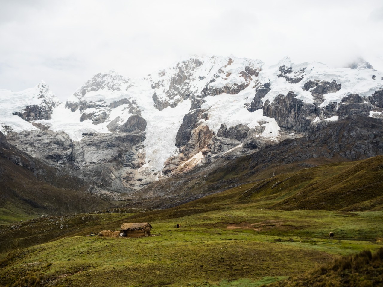
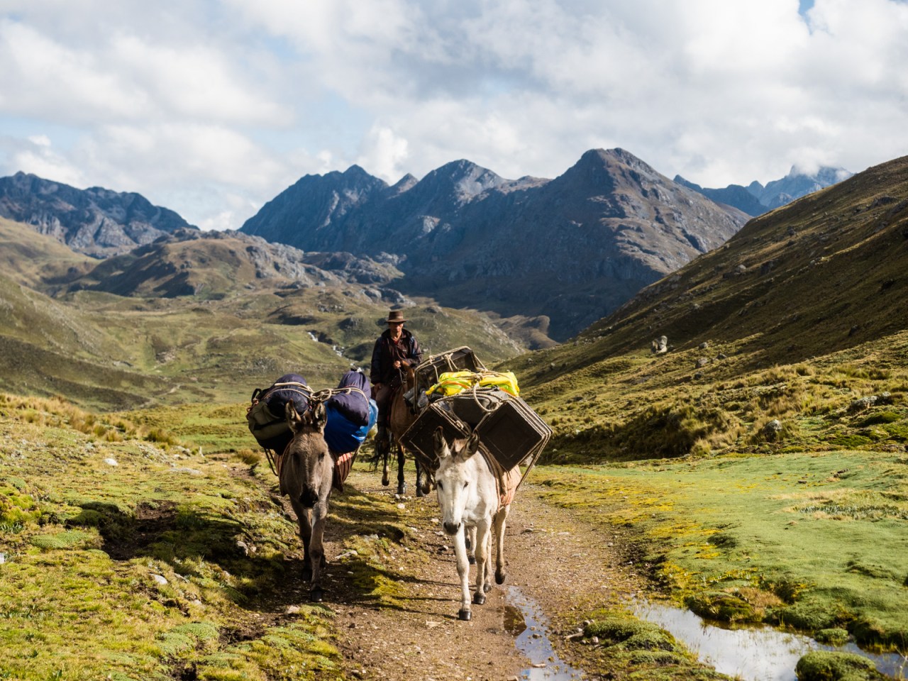
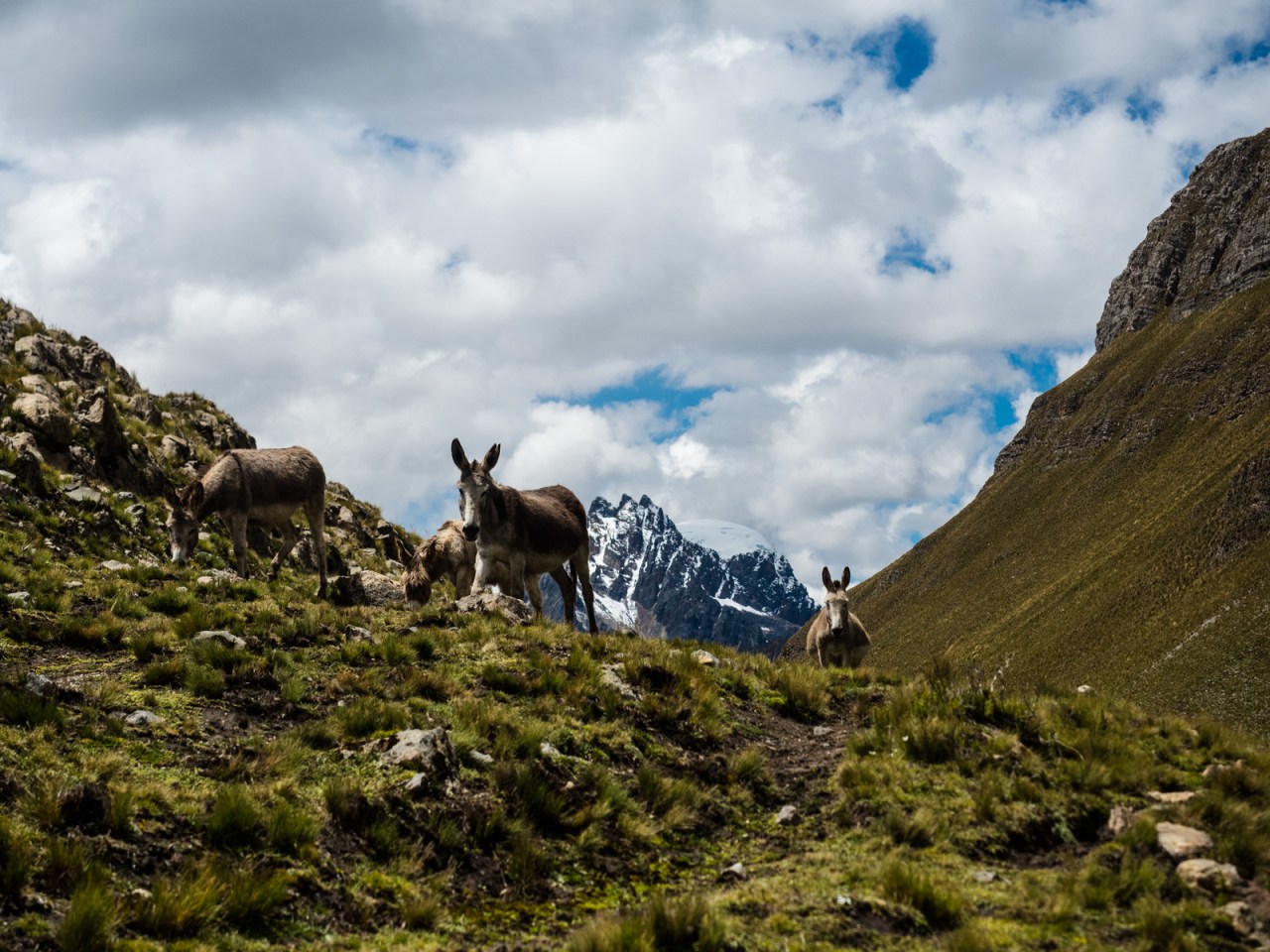
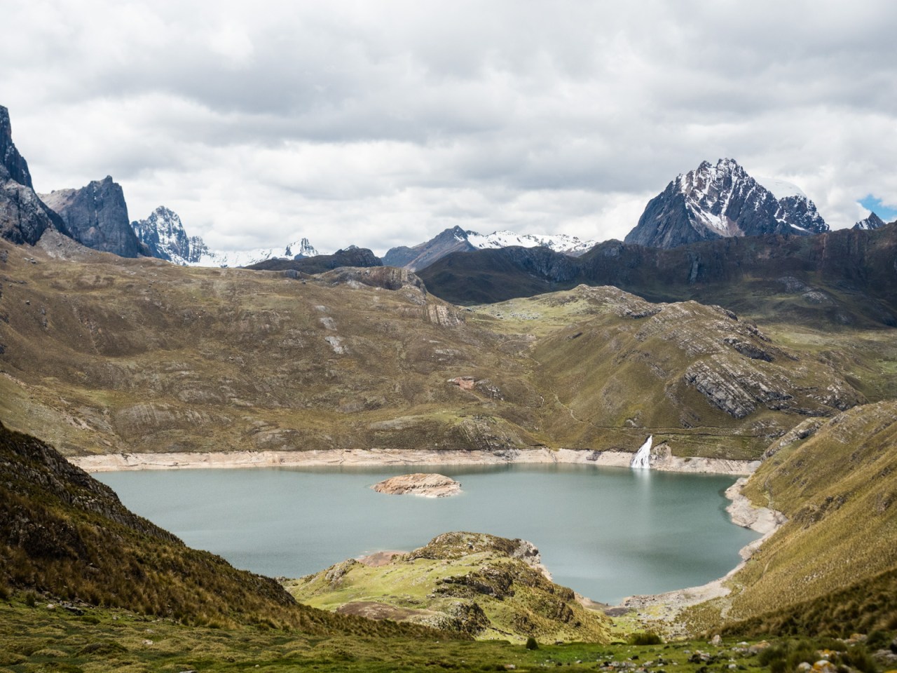
I stopped for lunch on a ridge overlooking Laguna Carhuacoach, with Yerapuja – Peru’s second highest mountain – towering above, it’s glacier plunging down towards the lake below. I spoke to Juan, a local arriero (donkey driver), about the two possible routes to the next camp site. The trekking route, he said, wasn’t possible with a donkey, let alone a bike. Instead, he pointed me to the route the donkeys use to transport gear for guided groups, while the clients go the more scenic way past the Tres Lagunas. This route looked incredibly steep as well but I trusted him. He also got me to pay him 20 soles ($8 CAD) for the privilege of passing through the area – a fee I’ve heard mixed things about, but didn’t hesitate to pay.

After a lunch break, I finished the ride into the valley and after avoiding some dogs and fording a river, I started the steep push to the next pass. Juan must have known I wasn’t going to enjoy it because he rode up behind me and asked how I was doing. “Cansado,” I replied. “Cuanto cuesta por tomar mis cosas con tu caballo al arriba?” I asked in terrible Spanish. (“I’m tired. How much will it cost for you take my stuff to the top with your horse?” We negotiated a fee and he strapped my panniers to his horse and led it up the trail.
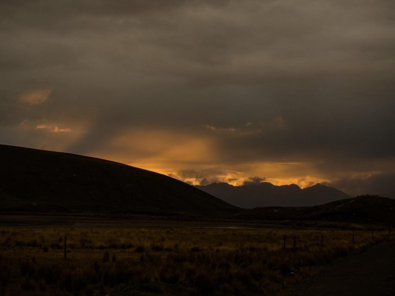
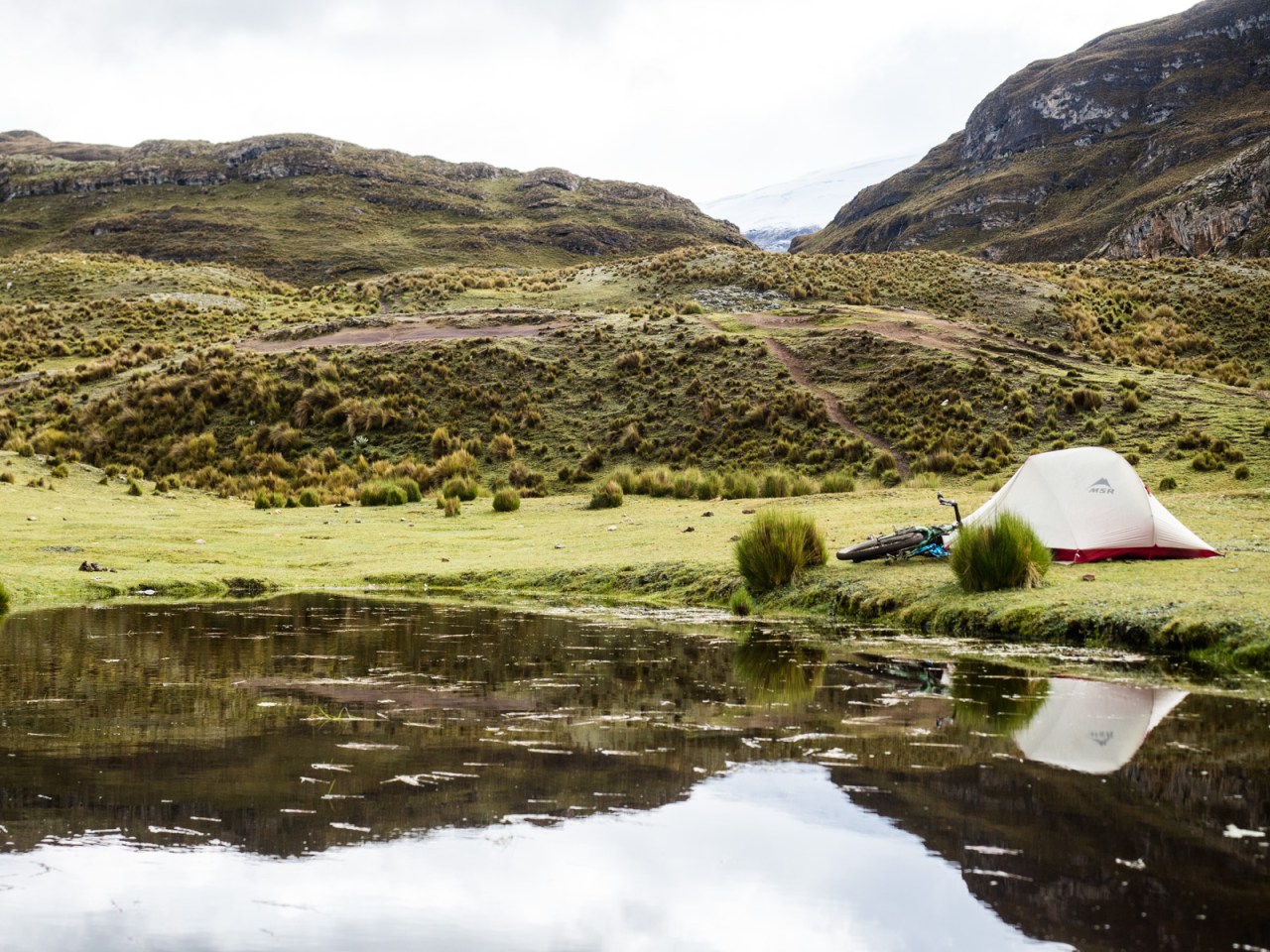
Even without my panniers, the push up the next section was tough. The trail was steep, narrow and filled with loose rock, making for rough going. Juan easily led his horse to the top while I struggled behind. I eventually caught up to him at the top, where he was laying on the grass, and paid him for his services. I continued to towards the next pass, looking for a good place to camp, passing up a few choice spots before finally settling on a slightly lumpy bit of ground when it started to rain. I pitched my tent quickly and hunkered down as the storm came in.


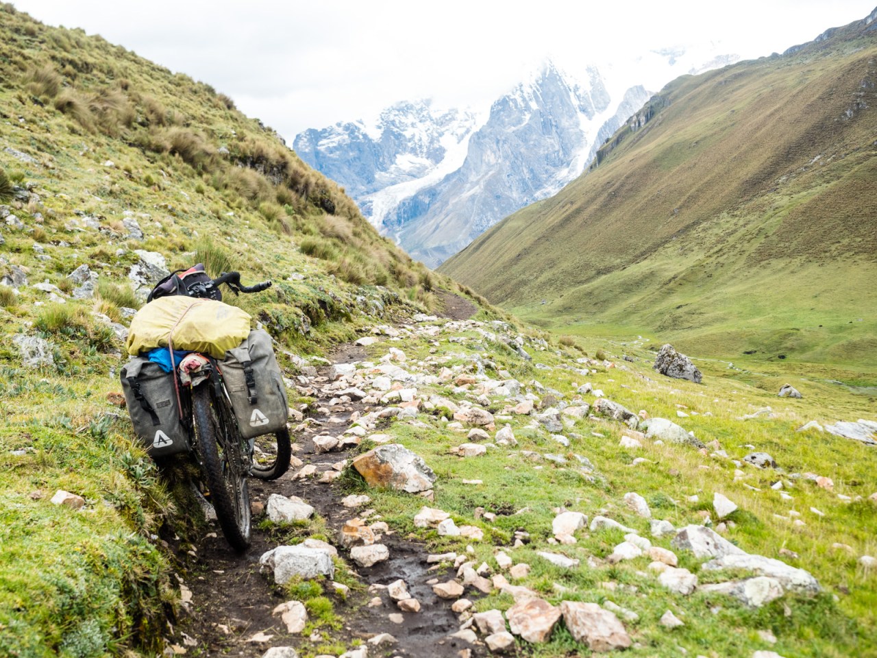
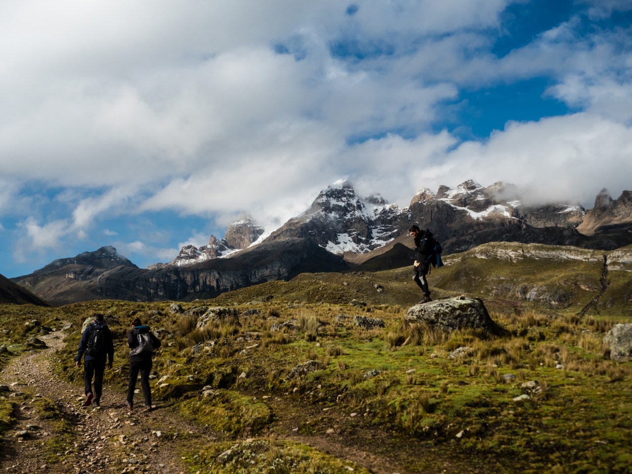
I woke up to more beautiful weather on day three of my trek. I pushed to upwards to the pass, where another arriero passed me near me the top; he was carrying gear for a trio of French that were trekking the entire circuit. The push to the top was tougher than expected and I thought I’d reached the pass, only to find there was still another kilometre of steep ups and downs ahead of me. The trail was rocky and not rideable on my bike. That didn’t stop me from trying – a choice I would regret later on.


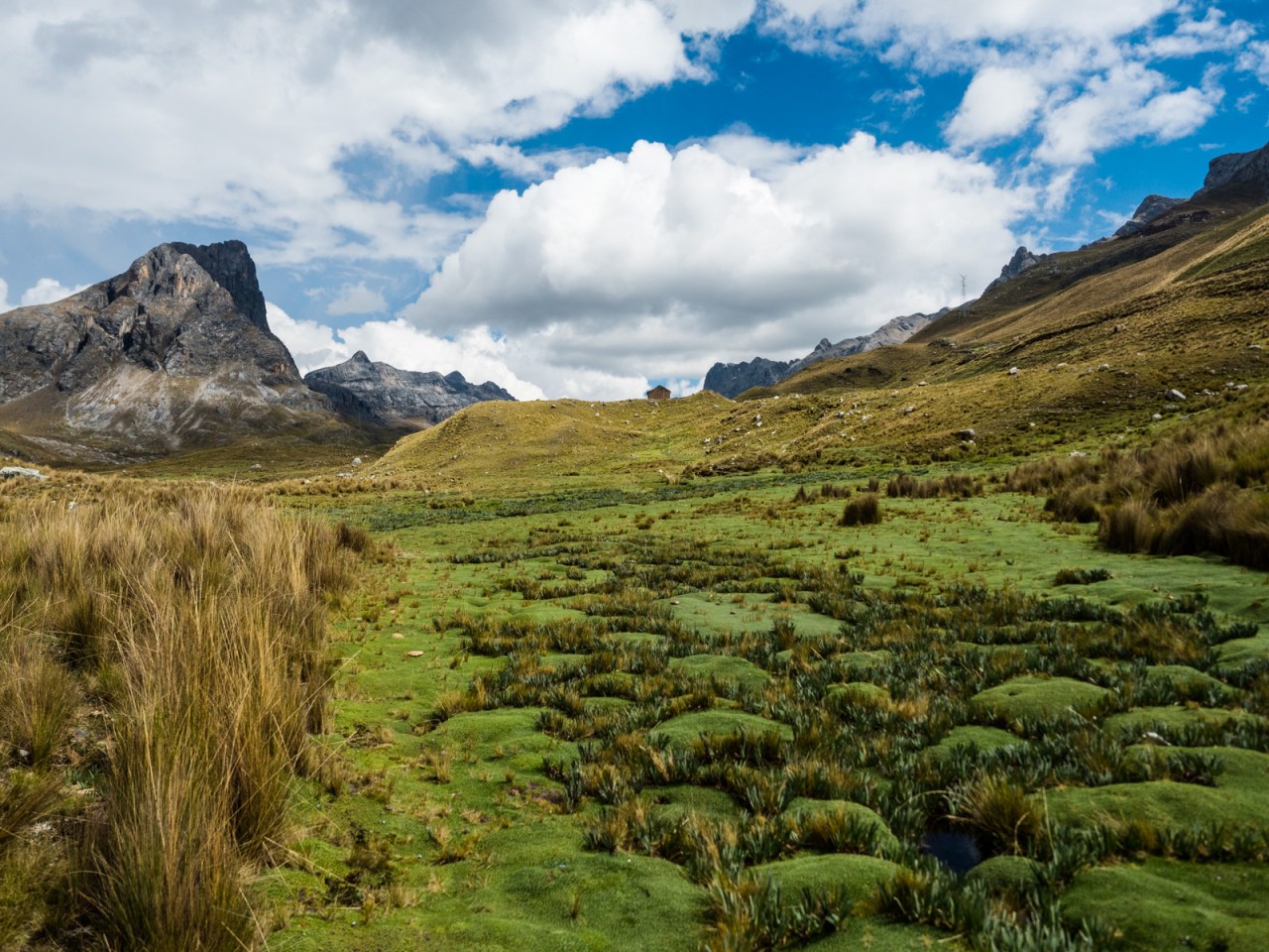
I pushed and walked the descent to the Huayhuash campground. My initial plan for the day was to try to make it past the campground and all the way to the hot springs beyond the next pass, before riding out to Oyon on day four. As I was descending amongst this incredible landscape of mountains, glaciers, lakes and pastures, I remembered I packed enough food for five days, so why rush? I decided I could stop early today, then have an easy day the next day and relax at the hot springs before riding out.
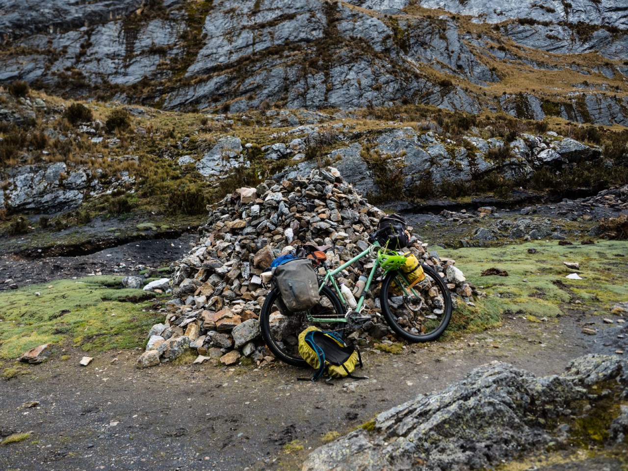
As I was descending, I could see the three trekkers and their guide looking up at me below. I was walking my bike downhill at this point and, wanting to put on a show, I got on and rode a section. It was pretty hairy, but way more fun than walking, so I kept going, easing around tight switchbacks and over loose rocks. I was almost in the valley when I heard two loud pops in succession. Two rear spokes, both on the same wheel, blew out, cracking the rim in two spots in the process. I limped into the campground, so grateful there was a team of donkeys there going the same way I was.

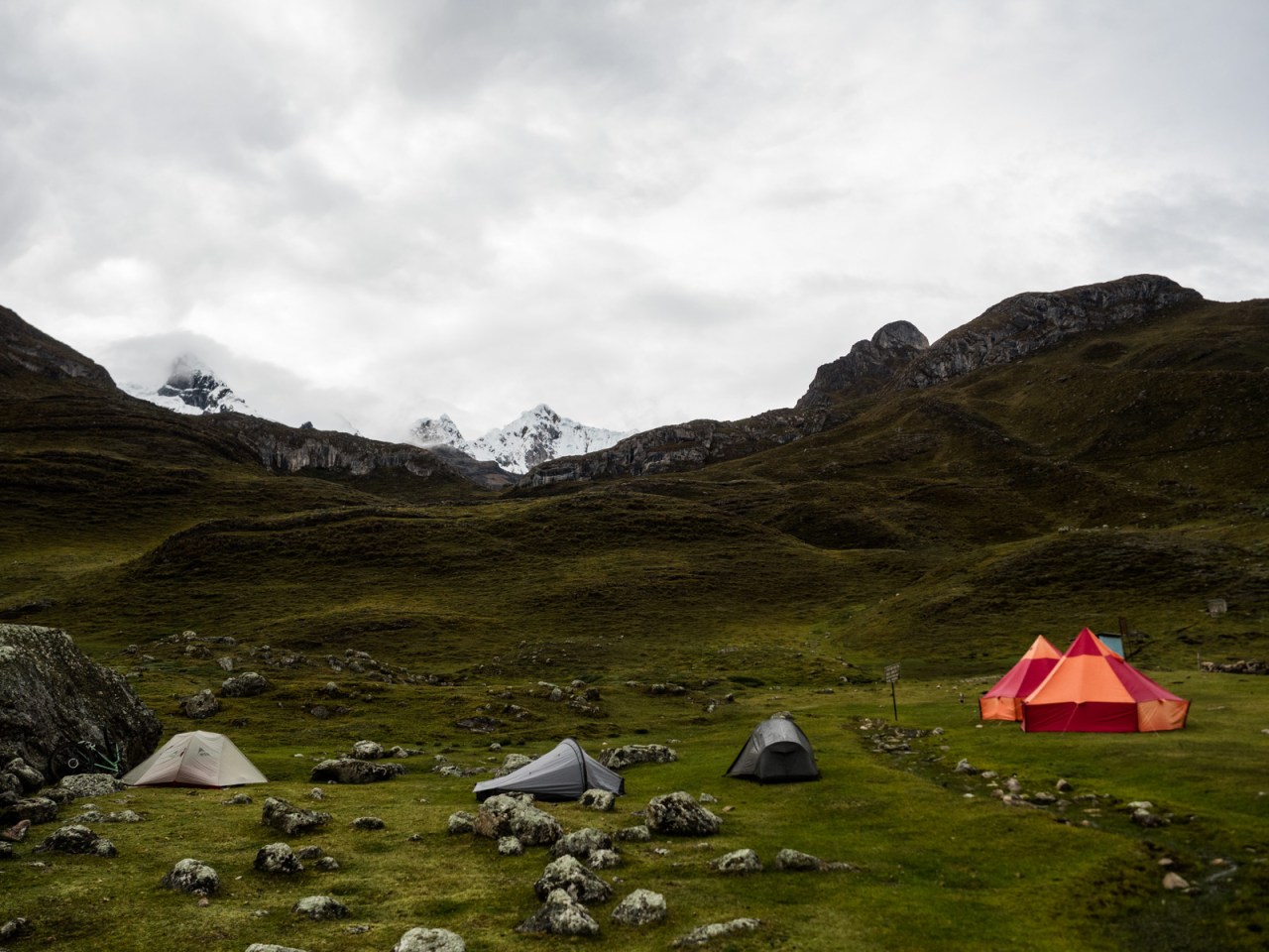
Knowing it wouldn’t be a good idea to ride my bike fully loaded in the state it was, I asked if the arriero if he could take my gear to the hot springs, and I could push my bike unloaded. “No hay problema,” he replied. It rained the rest of the day, so I was even more grateful that I decided to stop early. I also joined the French in a game of Yahtzee before fatigue overtook me.
I asked at the top of this post if the effort was worth it. Well, day four through the Huayhuash definitely made everything worth it. Unburdened of my panniers, I was able to enjoy an easy walk to the next pass, pushing my unloaded bike up a gentle trail under blue skies, surrounded by the biggest mountains I’d ever seen. I had company this time, though I lost them when my rain jacket fell off my bike and I had to backtrack a ways to find it. After that, I took it slow, soaking in the scenery and basking in the amazing weather.


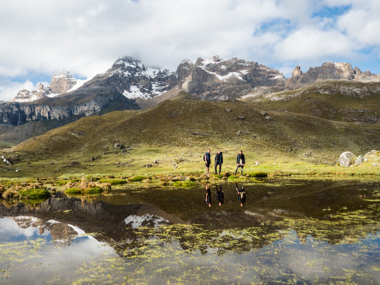
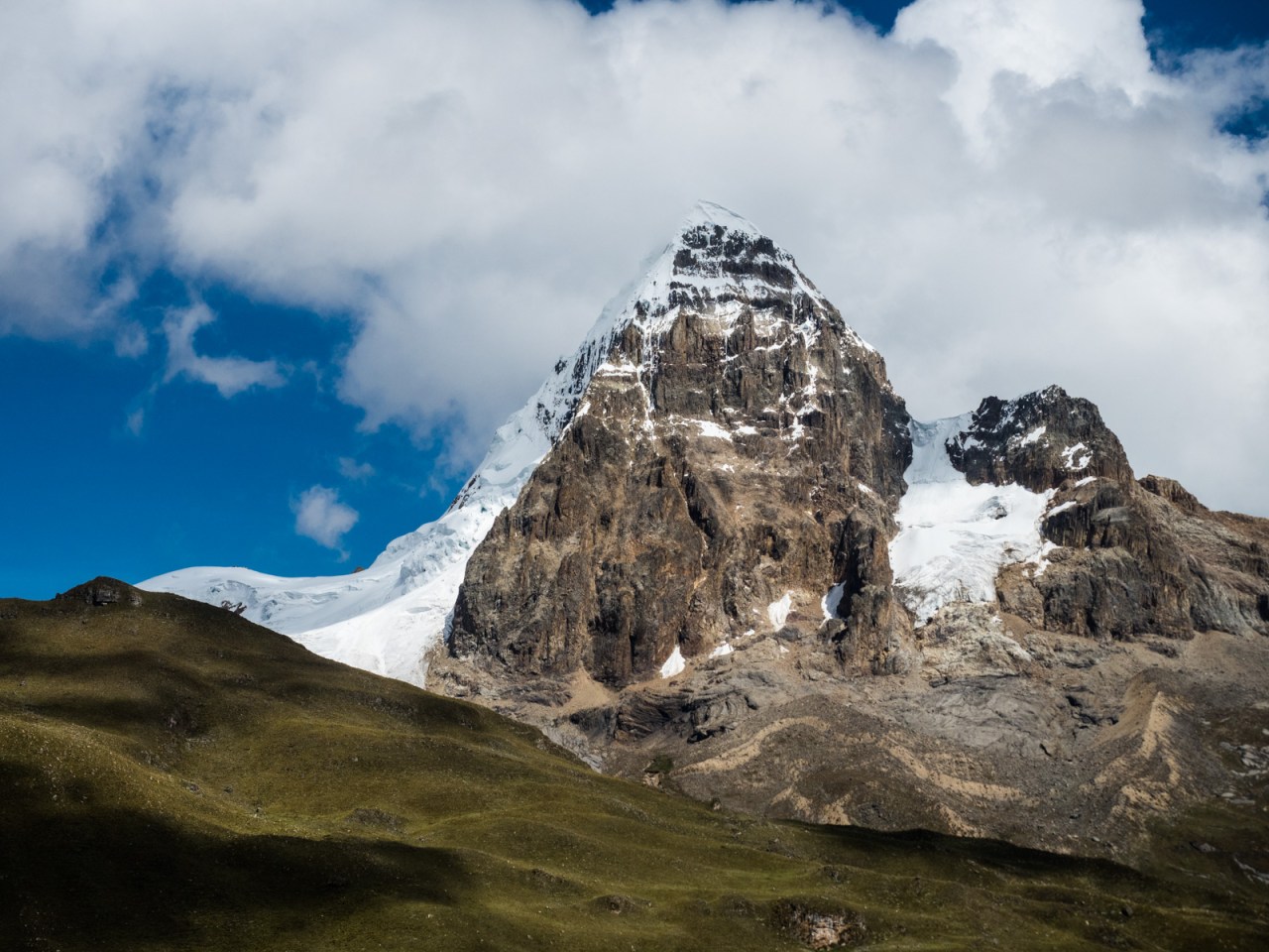
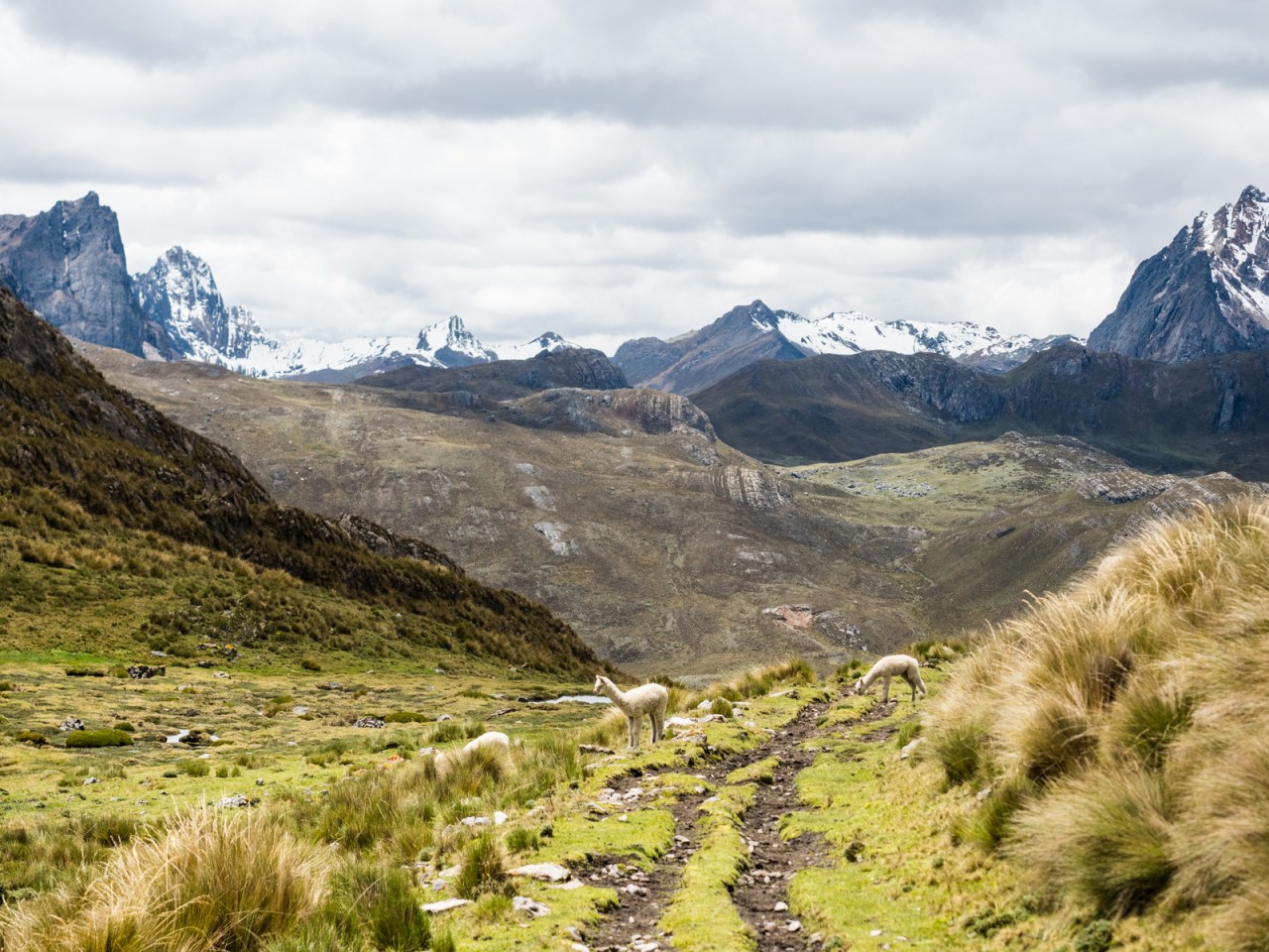
I reached the top of the pass and the trail down looked very rideable. Despite the questionable state of my bike, I jumped on and cruised down some amazing single track, past herds of alpaca and towards a beautiful alpine reservoir, with a waterfall tumbling into one end and a glacier looming over the other. One more short push, followed by a technical descent that I had to walk most of had me at the most scenic hot springs in the world, where the rest of the group was waiting. I pitched my tent and then we spent most of the afternoon soaking in the pools, which were a perfect temperature for relaxing.


It took a while to pry myself from the water, but eventually I got out and made it back to my tent to do some reading. We played a few games of Yahtzee and as I retired to my tent to cook dinner, the rain came. I ate, then stayed huddled up in the comfort of my sleeping bag until dozing off.
The next morning the trekking group took off to hike the west side of the Huayhuash while I went for another soak in the hot springs. I pondered my options for the day. Either I could embark on a very tough hike-a-bike over another 4,800 metre pass, then find an old road to Oyon; or I could take an even older road from the hot springs to the village of Cajatambo. The former would mean a shorter bus trip to Lima to get a new wheel, but a much tougher push. The latter would mean an easy, mostly downhill ride, but a longer bus ride to Lima, and a tough ride later on to get to Oyon. Looking at my bike and remembering how brutal it was pushing it up a few other passes, I opted for the easy ride to Cajatambo.

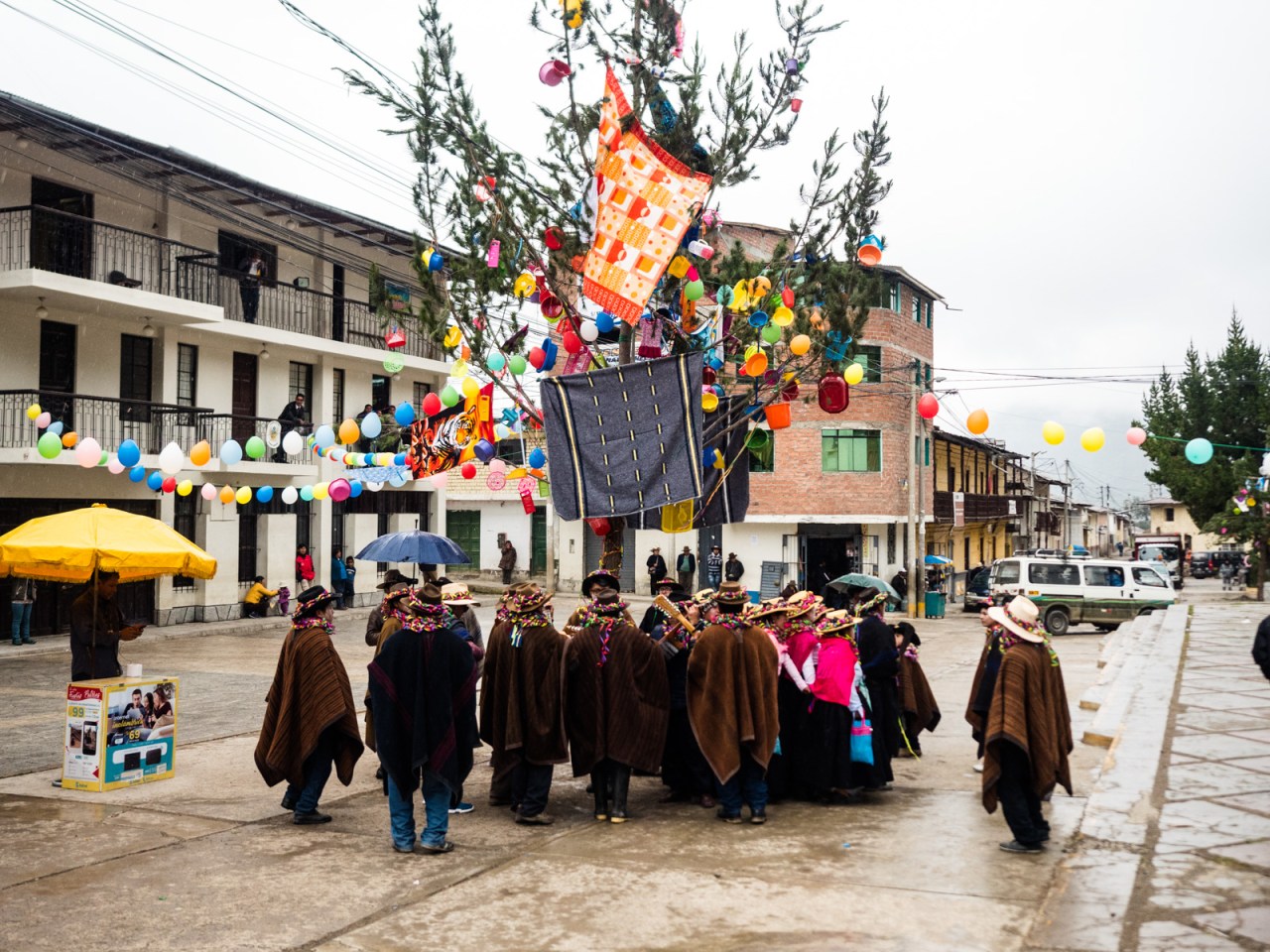
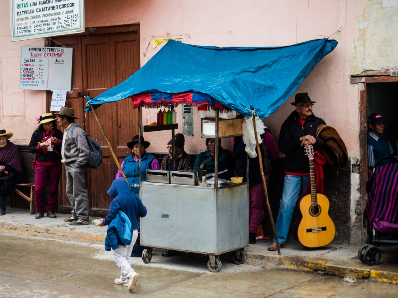
I arrived in town to see them setting up to celebrate the town’s 197th birthday. I checked into the Hotel Inka del Tambo, got some lunch, then lazed away the afternoon. As I was lying in bed, I heard music coming from the street. I went outside, and several groups were outside, playing and singing and dancing to the same song. Each consisted of group of guitarists, surrounded by singers and dancers wearing traditional clothes, their faces painted white. They went up and down the main street, stopping at different intersections to perform. They repeated the same song over and over, but it was really beautiful and uplifting to hear, and one of those amazing cultural moments that I feel lucky to have experienced. Unfortunately, due to the fact I was tired and had a 5 a.m. bus to catch, I went back to my hotel room while the celebration continued.
I was woken up several times during the night as they passed under my hotel room window celebrating. The next morning, as I walked to the bus stop, I saw several trees that had been chopped down around the main square. I should have stuck with the party.


Click here for a GPS track of this route.


Was it easy to arrange a bus from Cajatambo to Lima? And how long or difficult was the bus ride? Thank you. Enjoyed your write up!
LikeLike
There’s two buses a week from Cajatambo to Lima (and back again), but I forget which days they run. There’s a shop on the main square that sells tickets. I have to warn you that the ride was pretty terrifying. The first six hours are along a one-lane dirt road carved into the side of the cliff until you finally reach the coast. If you’re biking like me, I think you’d be better off making the trip from Oyon.
LikeLike
Thank you for the 411. I think the drive from Cajatambo will be too much for me. Appreciate the beta.
LikeLike